


 LOY CANYON TRAIL
Red Rock Secret Mountain Wilderness
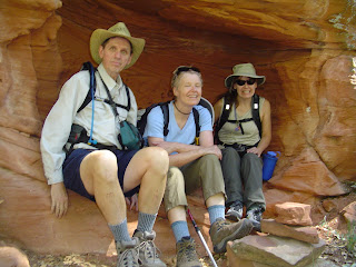
The cattle are gone, but the dirt track that was constructed in the 1890s to move them to the cooler Mogollon Rim to escape the summer heat, remains. August is the best month to hike the Loy Canyon Trail because that’s when creek-side wild grapes and raspberries lace the surrounding high desert terrain with a smattering of violet accents. Most of the soft, sandy trail is shaded by cottonwoods, pines and thickets of red-barked manzanilla. Elevation gains gradually over the first four miles where brilliant wild flowers and sweet-smelling grasses attract swarms of hummingbirds and butterflies. After that, though, the going gets rough, as the trail climbs up a sandstone ridge to the top of a beautiful knoll that overlooks the old cattle haunts a thousand feet below.
LENGTH: 9 miles round-trip
RATING: Moderate
ELEVATION GAIN: 1,700 feet
GETTING THERE:
From Phoenix, drive north on Interstate 17 to the State Route 179 exit 298. Follow SR 179 to the SR179/89 traffic circle in Sedona. Veer left (toward Cottonwood) and continue for 9.6 miles on SR89A to Red Canyon Road (Forest Road 525). Turn right and go 3.7 miles to the trailhead. FEE: A Red Rock Pass in NOT required at this trailhead.
LOY CANYON TRAIL
Red Rock Secret Mountain Wilderness
The cattle are gone, but the dirt track that was constructed in the 1890s to move them to the cooler Mogollon Rim to escape the summer heat, remains. August is the best month to hike the Loy Canyon Trail because that’s when creek-side wild grapes and raspberries lace the surrounding high desert terrain with a smattering of violet accents. Most of the soft, sandy trail is shaded by cottonwoods, pines and thickets of red-barked manzanilla. Elevation gains gradually over the first four miles where brilliant wild flowers and sweet-smelling grasses attract swarms of hummingbirds and butterflies. After that, though, the going gets rough, as the trail climbs up a sandstone ridge to the top of a beautiful knoll that overlooks the old cattle haunts a thousand feet below.
LENGTH: 9 miles round-trip
RATING: Moderate
ELEVATION GAIN: 1,700 feet
GETTING THERE:
From Phoenix, drive north on Interstate 17 to the State Route 179 exit 298. Follow SR 179 to the SR179/89 traffic circle in Sedona. Veer left (toward Cottonwood) and continue for 9.6 miles on SR89A to Red Canyon Road (Forest Road 525). Turn right and go 3.7 miles to the trailhead. FEE: A Red Rock Pass in NOT required at this trailhead.INFO: https://www.fs.usda.gov/recarea/coconino/recarea/?recid=55348
No comments:
Post a Comment