Find A Trail. Start Your Search Here:

Showing posts with label Tortuga Trail. Show all posts

Friday, January 6, 2023

Javelina Summit Trail

JAVELINA SUMMIT TRAIL

Brittlebush colors the Tortuga Trail


One of four difficult-rated summit hikes in the Skyline Regional Park in Buckeye, the Javelina Summit doesn’t scrimp on thrills.  The 0.9-mile-long trail spools off connecting routes in the park’s far east end. 

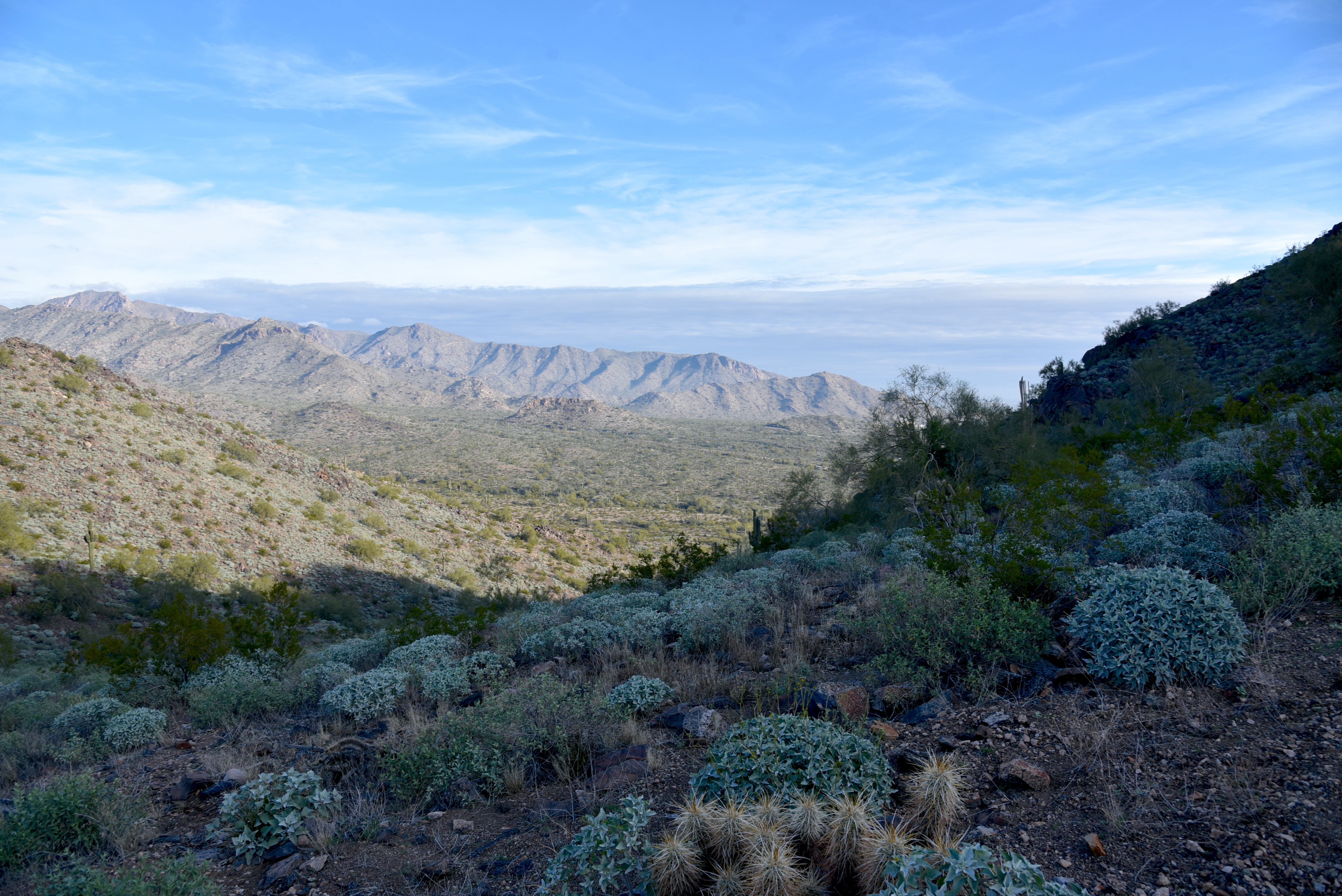
View from the Javelina Summit Trail

While it’s “just” a 745-foot climb from trail base to summit, that accounts for less than half the story.
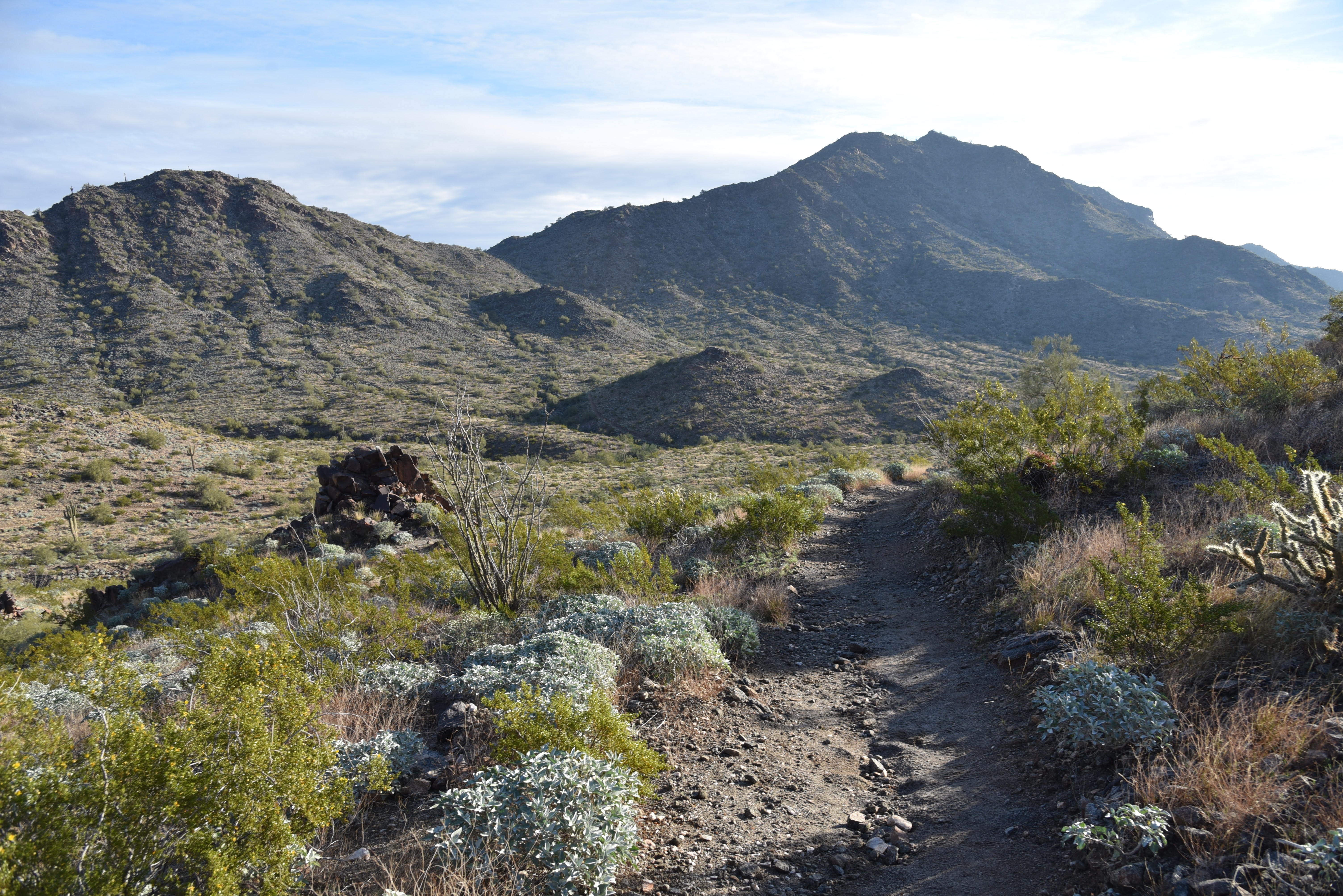
Javelina Summit (right) viewed from Tortuga Trail

Getting to the 2,200-foot mountain highpoint involves using three trails and logging over 1,700 feet of accumulated elevation change.
Hike begins on tehe Quartz Mine Trail

The rollercoaster-style trek starts from the main trailhead area with a 1.6-mile hike on the Quartz Mine Trail. About a half mile in, first peeks at the destination loom on the horizon. The prominent ridgeline rising over foothills and valleys looks imposing. And irresistible!
Beginning of the Javelina Summit Trail

The undulating path winds through washes and slopes below ragged ridges and stone outcroppings before making an ascent to a saddle where the Tortuga Trail spins off to the east.
Brittlebush are plentiful in Skyline Regional Park

The Tortuga Trail leg of the hike takes back much of the elevation gained with a smooth downhill on long lazy switchbacks. At the half-mile point, the route encounters its final segment, the 0.9-mile Javelina Summit Trail.
View of the White Tank Mountains

It's here where the real work begins. While the lower quarter mile feels just moderate and has a few level bends, the climbing becomes an unrelenting uphill haul with loose rock and a fair amount of exposure. The trail is well engineered but still very steep and precipitous as it clamors along a knife-edge sharp, rocky backbone. Persistence and careful footwork pay off on the tiny summit.

Rock outcropping on Tortuga Trail


Javelina Summit Trail is steep and edgy.

The airy pinnacle displays 360-degree vistas of the southern White Tank Mountains, the distant profile of Downtown Phoenix, the Sierra Estrella Mountains and sprawling desert plains.

LENGTH: 5.8 miles round trip (out and back hike)

RATING: difficult

ELEVATION: 1,312 – 2,200 feet (over 1,700 feet of accumulated elevation change)

GETTING THERE:

Skyline Regional Park, 2600 N. Watson Road, Buckeye.

From Interstate 10 in Buckeye, take the Watson Road exit 117 and go 2 miles north to the park. Roads are paved.

HOURS: Sunrise to sunset daily

DAY USE FEE: none

FACILITIES: restrooms, picnic ramadas, camping

INFO:

Skyline Regional Park

https://www.buckeyeaz.gov/community/skyline-regional-park

Friday, January 14, 2022

Tortuga-Spur Cross Loop

TORTUGA-SPUR CROSS LOOP

The pachyderm profile of Elephant Mountain


A quick loop hike in Spur Cross Ranch Conservation Area north of the town of Cave Creek  yields a heart-stirring trip through canyons, saguaro-fleeced slopes and a rare desert waterway, all backed with outstanding mountain views.

Saguaros cling to slopes below the CaveCreek Mountains

 
The short, but steadily challenging hike ties together two of the Maricopa County Regional Park’s trails into one stunningly tour of Sonoran Desert diversity.

From the trailhead, begin by hiking northwest (go right and downhill) on the Spur Cross Trail which is also part of the Valley-circling Maricopa Trail.  In less than a half-mile, the trail crosses Cave Creek.

Skull Mesa viewed from the Tortuga Trail

 
Fed by storms and snowmelt, water runs sporadically through the rocky channel and is usually at its height during the winter and spring months.  A few yards past the creek crossing, continue north on Spur Cross from the Metate trail junction keeping an eye out for the foundations of the defunct Spur Cross dude ranch crumbling among cholla and creosote shrubs.
Sun-lit saguaros glow on the Tortuga trail

Over the next 0.6-mile, the route climbs easily, opening views of the creek gorge below and the flat-topped tableland of Skull Mesa and Sugarloaf Mountain to the northeast. One mile in, pick up the Tortuga Trail  which signals the beginning of a steady ascent on a degraded dirt track that hangs on the cusp of a ravine flush with acres of saguaros, prickly pear, ocotillo and cholla that glow in thorny halos when backlight by the sun.

A crossing of Cave Creek comes early in the hike

The 1.1-mile uphill section is heralded by a sign warning of primitive conditions ahead. 
The as-advertised primitive trail

While the route is indeed rough, it’s not too difficult to follow. Soon, more vistas open to the south. 
Benches for viewing at the top of the loop

Look for Cave Creek classic, Black Mountain, the Cave Creek Mountains, the long profile of the McDowell Mountains and singular Pinnacle Peak on the horizon.
Sugarloaf Mountain (left) seen from Tortuga trail

 
This hike uses the Spur Cross & Tortuga trails

The circuit tops out at the Elephant Mountain trail junction where the best glimpses of the 3,926-foot massif’s pachyderm profile command attention.  A couple of benches overlooking the mark the spot where the Tortuga trail begins a 0.6-mile downhill trek toward the leafy cut of the Jewel of the Creek Preserve. 
Tortuga trail is rough but not hard to follow

To finish up this loop hike, head left at the Dragonfly trail junction and follow the Spur Cross trail as it switchbacks through a deep gully on its way back to the trailhead.

LENGTH: 5.3 miles

RATING: moderate

ELEVATION:  2,340 -2,615 feet

GETTING THERE:

44000 N. Spur Cross Road, Cave Creek

From Loop 101 in Phoenix, take Cave Creek Road north to Spur Cross Road (on the left just as you enter the downtown area) and go 4.5 miles north to the parking area. 

FEE: $3 per person daily fee. Bring exact change.

INFO:

https://www.maricopacountyparks.net/park-locator/spur-cross-ranch-conservation-area/


Sunday, December 28, 2014

TORTUGA-SPUR CROSS LOOP


TORTUGA-SPUR CROSS LOOP
Spur Cross Ranch Conservation Area

Spur Cross Ranch Conservation Area is a pristine swath of preserve snuggling up to Cave Creek. It's got everything you'd expect of a Sonoran Desert hiking destination with some unexpected extras to boot. Complementing a community of gigantic saguaros, skulking coyotes, mesquite bosques and  fragrant creosote are a smattering of Native American archeological sites and ruins of mining operations that are best explored via regularly scheduled guided hikes.  With so much to see and do within the Ranch, it can be difficult to decide where to start.  That's where the popular Tortuga-Spur Cross Loop hike comes in handy. Along its 3.6-mile circuit, the trail samples both the rough terrain round the base of Elephant Mountain and the slinky, fresh-cut tread of Spur Cross Trail. A moderate uphill slog on an old 4x4 road leads to a crest overlooking water-scoured gorges, cacti-cluttered cliffs and the riparian wonders of the Jewel of the Creek Preserve. From here, a barely discernable maze of trails braided through surrounding hills and valleys belie a bevy of connecting routes that link the park with adjacent suburbs and the wilds of Tonto National Forest. 
LENGTH:  3.6 miles
RATING: moderate
ELEVATION:  2,200' - 2,800'
FEE: $3 daily fee per person.  Exact change is required for the self-pay station
GETTING THERE:
From Loop 101 in Phoenix, take Cave Creek Road north to Spur Cross Road (on the left just as you enter the downtown area) and go 4.5 miles to the parking area.
INFO: Maricopa County Parks & Recreation
MAP: