Find A Trail. Start Your Search Here:

Showing posts with label Kaibab National Forest. Show all posts

Wednesday, June 22, 2022

Keyhole Sink

KEYHOLE SINK

Keyhole Sink surrounds a moist seep area

Not too far off Old Route 66 a few miles east of the town of Williams, a cloistered box canyon with vertical stone walls encircles a depression where water sometimes cascades over the cliffs and pool at the base of the pine-shaded oasis. 

The woodsy approach to Keyhole Sink

The sounds of tree frogs, birds, and scampering squirrels bite through a soundtrack of wind rustling through aspen canopies.  The moist, cool place vibrates with a life essence that transcends the moment.  It’s like walking through a sort of time capsule set on perennial-fill mode.
A petroglyph panel at Keyhole Sink

The Kaibab National Forest site’s ample forage grasses, water and quiet isolation made this a perfect spot for wildlife to congregate, feed, drink, and--oh yeah--be stalked.  

Aspen saplings on the Keyhole Sink Interpretive trail

From roughly 1,000 years ago, ancestral Native American hunters documented their experiences at this enchanting hideaway by pecking images of deer, bear and other local wildlife into the folds and panels of cliff faces that are the weathered remains of ancient lava flows.   Today, hundreds of the images are visible on the volcanic escarpments.
Keyhole Sink is a wildlife oasis

Dense galleries depict a vibrant, and resource-rich environment.  While the meaning and utility of the petroglyphs is best known to the makers, present day viewers may immerse in the pure beauty of the etchings and extrapolate the notes of celebrations, observations, and maybe just the plein air sketches they may have depicted.  Regardless, it’s clear that Keyhole Sink remains a living, breathing microcosm of life in the forest. 
Visitors must be front-line protectors of this heritage site

A short, interpretive trail and a descriptive brochure available online, guide visitors through the woodsy outdoor classroom.

Sadly, there’s a history of vandals defacing the rock art. Restoration involves hundreds of volunteer hours, thousands of dollars, and years of work with no guarantees of fully rehabilitating the artfacts.  Why this happens in a place that is sacred to modern Native American tribes is beyond comprehension. The place is not a “ruin”, it’s an ancestral homeland.

Although Keyhole Sink is monitored by Arizona site stewards, visitors must be the front-line protectors. As with all heritage sites, respect the irreplaceable artifacts. Do not touch or otherwise alter the rock art, stay on designated trails, pack out all trash, and leave what you find so that future generations may appreciate this Arizona point-of-pride.

LENGTH: 2 miles round-trip

RATING: easy

ELEVATION: 7,100 – 7,000 feet

GETTIGN THERE: From Flagstaff, go 16 miles west on Interstate 40 to the Parks exit 178. Connect with Historic Route 66 and go 4 miles west (left) to the Oak Hill Snow Play Area on the left. The trailhead is located across the road from the parking lot at a signed gate.

INFO:

Kaibab National Forest

https://www.fs.usda.gov/recarea/kaibab/recarea/?recid=11678


Monday, August 16, 2021

Stone to Steel Dam Trail

STONE TO STEEL DAM TRAIL

Ash Fork-Bainbridge Steel Dam

Between the sleek lanes of Interstate 40 that connect the City of Williams and the town of Ash Fork, and the fading tracks of the Atchison Topeka and Santa Fe Railroad to the north, the space from hot pavement to rusty iron tracks is separated by sprawling grasslands, pinyon-juniper woodlands and about a hundred years.  Leaving the freeway in this airy divide is like slipping into a Twilight Zone of fringy places where defunct travel corridors live on in repurposed relevance.

Ash Fork Stone Dam

Long before the interstate highway system transformed tedious Point A-to-Point B hauls into a national obsession with recreational road tripping, travel in western states was all about railroads and the iconic Mother Road, Route 66.  

The Stone to Steel Dam Trail traces Johnson Canyon

The strip of land just a mile north of the I-40 Welch exit is unique in that all three transportation corridors are stacked and packed into a hike-bike-drive exploratory opportunity that culminates with a short trail that visits two historic dams.  Getting to the Stone to Steel Dam Trail is half the fun and sets the mood for a trip back in time.
Masonry Number Two Reservoir

The adventure begins with a two-mile cruise on Historic Route 66, which parallels the interstate.

View from Lookout Point spur trail

The decommissioned byway which now serves as a recreational route for motorized vehicles and bikes, snakes its way through hilly backcountry of the Kaibab National Forest on the Colorado Plateau.  The crumbling Mother Road is a potholed sequence of concrete, asphalt and futile patch jobs of random this-and-thats.  
Historic Steel Dam was built in 1895

Alternately dipping into weedy drainages and ascending to tree-speckled high crests, the road drive unpacks a mix of heart-thumping vistas and a taste of the isolation and unnerving hazards that early-to-mid 20th century travelers would have encountered.  The surreal atmosphere is so pervasive that modern visitors would hardly flinch if Tom Joad, the protagonist in John Steinbeck’s 1939 novel The Grapes of Wrath came chugging by in a make-shift truck.
Stone to Steel Dam Trail was dedicated in 2015

Just past a rickety cattle guard, a degraded dirt Jeep road descends a half-mile to Ash Fork Stone Dam and Masonry Number Two Reservoir.  The 600-foot-wide sandstone structure that spans Johnson Canyon was constructed in 1911 by the Atchison Topeka and Santa Fe Railroad to create a backup water supply for steam-powered locomotives.  The lake behind the dam is a popular fishing spot that’s open to the public and is a stocked with trout and bass by the Arizona Game & Fish Department.

View of Bill Williams Mountain from Historic Route 66


To find the hiking trail from the parking apron and kiosk above the water, follow the designated access route to the water and follow the shore to the dam.

Atchison Topeka & Santa Fe Railroad pulled water from the reservoirs

A few yards west of the dam along a dirt road, a sign and bench mark the trailhead for the Stone to Steel Dam Trail.  Dedicated in 2015, the 0.87-mile single track, non-motorized path that tethers Ash Fork-Bainbridge Steel Dam with Stone Dam was constructed through the joint efforts of Kaibab National Forest, Ash Fork Development Association and local volunteers.  The trail traces the edge of Johnson Canyon, showcasing a green riparian zone and tiny pools within the stony corridor.  A few yards in, a short Lookout Point spur trail leads to a scenic ledge with great views of the dam and distant mountains.  The mostly level trail jogs among junipers and cacti before ending at a kiosk overlooking the steel dam.  The impressive 184-foot rusted metal wall contains Steel Dam Reservoir. 
According to the forest service, the dam was built in 1895 (some sources say 1897 and 1898) and is one of only three steel dams ever built in the U.S. 

The back side of Steel Dam shows ingenious construction

The other two are located in Montana and Michigan, so this is truly an Arizona treasure.  Like the Stone Dam, this one was constructed to provide a water source for steam locomotives and the town of Ash Fork.
Stone Dam is 600 feet wide

Goodding's verbena is a common plant along the trail

The dams, the road and myriad hazy tales of coal-fueled cross-county trips and Dust Bowl migrations are relics of an era when the first tentacles of infrastructure opened up the West for settlers, adventurers, dreamers and the first generation of automobile culture.

LENGTH: 2.4 miles round trip as described here

RATING: easy

ELEVATION: 5,641 to 5,400 feet

GETTING THERE:

From Williams, go 11 miles west on Interstate 40 to the Welch exit 151.  Drive a few yards north from the offramp on a dirt access road and make a hard right onto Forest Road 6.  Follow this dirt two track for a half mile to a “T” intersection and turn left onto Historic Route 66 which is signed as Forest Road 6E.  Continue 2 miles to an easy-to-miss turn off for Ash Fork Stone Dam.  This is located 0.2-mile past a cattle guard and there’s a sign posted a few yards in from the turn off.  The dam access road is rough dirt and requires at least a high-clearance vehicle.  The road is reasonably passable to the 0.2-mile point where there’s a parking apron for fishing access.  The trailhead is another 0.3-mile downhill but the road gets steep and dicey so it’s best to park at the apron and follow the designated access route to the dam.

FACILITIES: portable restroom

INFO:

Kaibab National Forest

https://www.fs.usda.gov/recarea/kaibab/recarea/?recid=82006

Saturday, September 7, 2019

SYCAMORE POINT TRAIL

SYCAMORE POINT TRAIL 
Sycamore Point sits above Sycamore Canyon Wilderness 
Roughly 23 miles southeast of Williams, Arizona’s second largest canyon splits the landscape at the juncture of three national forests and two wilderness areas.
High-desert grasslands: one of several eco-zones on the hike
Anchoring a 55,937-acre wilderness, Sycamore Canyon is one of the most remote and primitive gorges in the state. Unlike the Grand Canyon--which claims the number one spot in terms of canyon size-- there are no maintained roads, amenities or reliable water sources within Sycamore Canyon.
A sheer drop off marks the rim of Sycamore Canyon  
Except for a few easy-access, well-travelled trails like Parsons Spring near Cottonwood and the Sycamore Rim Trail south of Williams, exploring in and around this wilderness is not for the casual visitor. Those who venture into its deepest corners best be prepared to navigate miles of tire-eating, confusing back roads to get to trailheads, hike on strenuous paths and carry enough water for the entire trip. Despite the fact that maps show Sycamore Creek meandering through the canyon, water is a rare find.
AZ's second largest canyon is raw and untamed.
Meadows define the mid-section of the hike
The trail is open to hikers, bikes and motorized vehicles
Although a multi-day backpacking trip is the optimum way to experience the multifarious features of this unforgiving backcountry, there’s an easier way to get an overview of the canyon’s scale and diversity. A hike or bike ride on the Sycamore Point Trail #131 culminates at a breathtaking overlook that rivals those along the south rim of the Grand Canyon, but without the crowds and concession stands. This ersatz Ooh Aah Point sits near the intersection of the Prescott, Kaibab and Coconino National Forests, where the Red Rock Secret Mountain and Sycamore Canyon Wilderness areas collide 1000 feet below. There are no guard rails to stall a fall, so use extreme caution when approaching the edge. 
Domestic cattle graze in the forests around the trail 
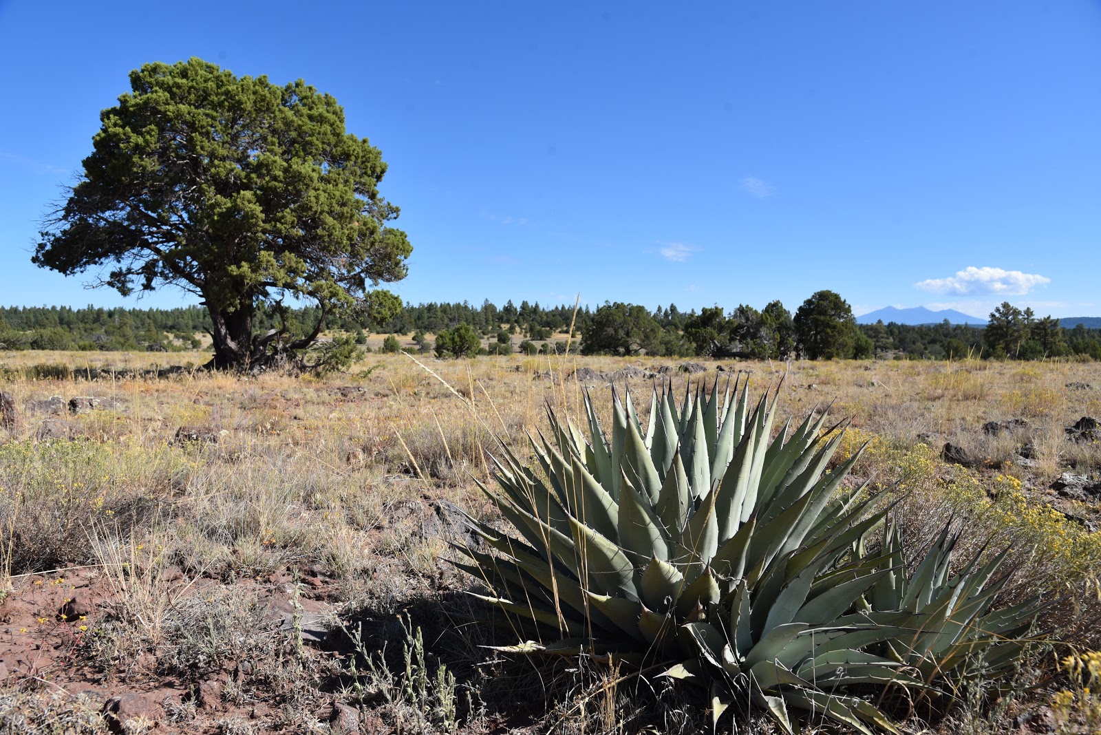
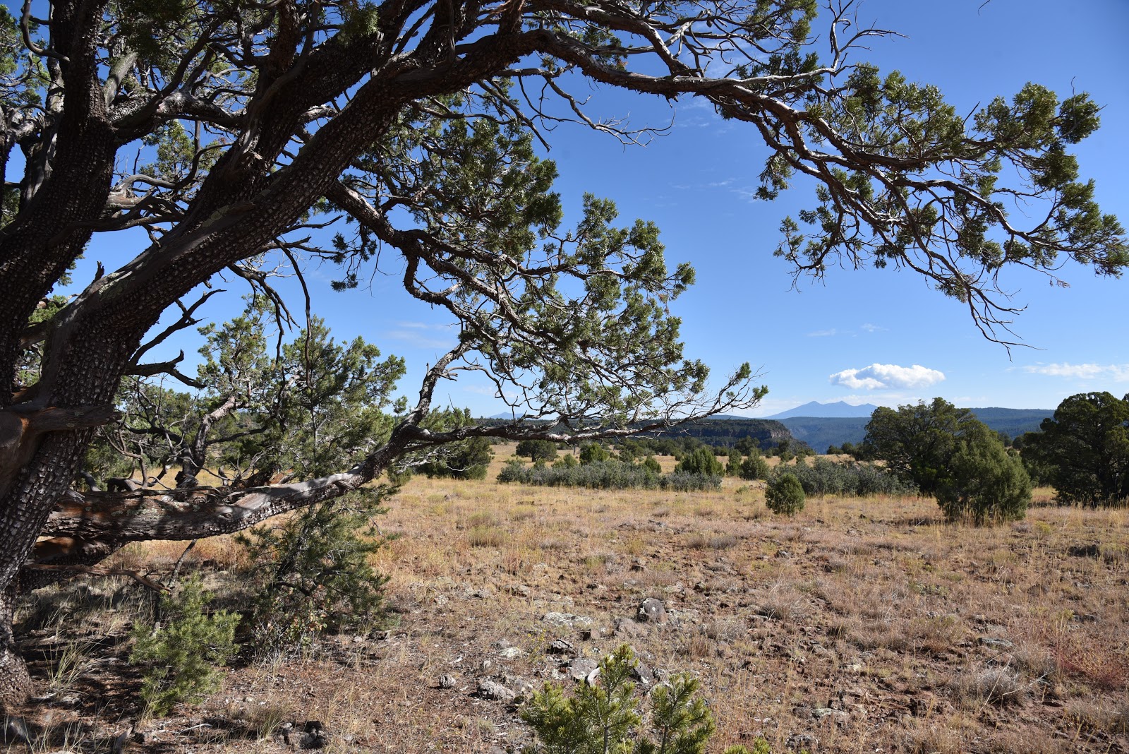
The 10-mile out-and-back trek follows the graveled, rough tail-end of Forest Road 110 that has been designated as multi-use recreational trail.  From the trailhead near JD Dam Lake, the hike begins by heading southeast on a dirt track through shady pine-oak forests. Watch for tiny bike trail signs placed at junctions to stay on track. Near the 2.5-mile point, the environment changes from thick woodlands to open meadows before gradually emerging on a grand plateau with sweeping, high-desert grasslands dotted with pinion pines, agave and Alligator junipers. Soon thereafter, first glimpses of the canyon rim appear on the eastern horizon backed by hazy views of Kendrick Peak and the San Francisco Peaks near Flagstaff. 
Distant San Francisco Peaks seen from Sycamore Point
A twisted Alligator juniper survives on an open prairie.
Where the road ends, a wide gravel roundabout makes a swing around the edge of the canyon. Ringed by junipers, shrubs and an understory of yucca and cacti, views of the 20+-mile-long chasm are dominated by russet-stained buttes and chiseled limestone pillars.
Spent agaves frame Bill Williams Mtn on center horizon
At the brim, a sheer drop off unsettles the nerves while expansive views of the of the wild canyon assault the senses like a rogue tidal wave.  From the precipitous perch, layer upon layer of complex geological features and eco-zones roll out below.
Beautiful rangeland near the canyon's rim.
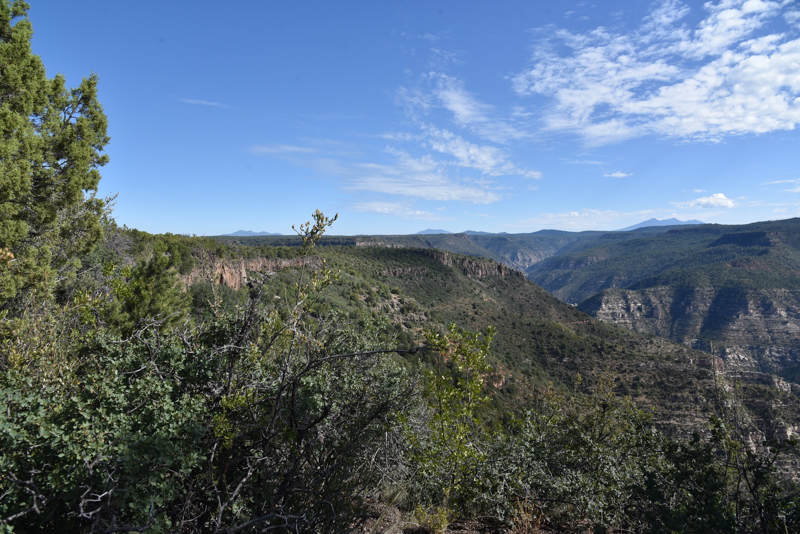
The point juts out from the edge of the Colorado Plateau to showcase a rare mix of mountain peaks, coniferous woodlands, high deserts and faint strips of riparian trees and shrubs that sink roots into seasonal water pools around Sycamore Creek and feeder streams that drain into the Verde River.
High-desert scrubland near trail's end
Directly under the overlook, the impossible to spot Winter Cabin and Taylor Cabin trails wind among buff-and-vermillion-colored cliffs and water-sculpted ravines while the tree-covered mesas above Sedona’s Oak Creek Canyon bolster the eastern horizon. 
The isolated, exposed and utterly raw beauty visible from this rim-top platform might inspire you to start training and preparing for an expedition into the wilds beneath it. But, an extended dive into Sycamore Canyon requires skill and a healthy dose of humility.
Mountains of Prescott NF on the southwest horizon
Pine forests shade the first 2 miles of the hike.
Follow the bike signs to stay on course. 
It’s easy to succumb to the come-hither call of the canyon, but surviving its clutch is a whole other matter.
Pinion pine are common along the trail
LENGTH: 10 miles out-and-back
RATING: moderate
ELEVATION: 6583 – 6296 feet
GETTING THERE:
From Interstate 40 in Williams, take the Garland Prairie exit 167, go left at the off ramp and drive south on the access road. Just over the railroad tracks, make a sharp left onto Forest Road 141 and continue 7.9 miles to Forest Road 109. Turn right on FR 109 and continue 5.6 miles south to Forest Road 12, veer left and continue 4.9 miles to the signed trailhead at FR 110. There’s a parking turnout a few yards to the left of the sign. Access roads are gravel/dirt with some washboard sections that are suitable for passenger vehicles.
INFO: Kaibab National Forest


Monday, July 1, 2019

Perkins Tank and JD Dam Lake


Two Tank Trek: Perkins Tank and JD Dam Lake

Kaibab National Forest
Perkins Tank attracts myriad wildlife.
Southeast of Williams, a string of fishing holes hiding on the north rim of Sycamore Canyon Wilderness attract anglers, wildlife watchers, birders, runners and day hikers in search of atypical forest treks. 
Alfalfa blooms around Perkins Tank
Watch for dragonflies darting among reeds at Perkins Tank.
Clustered among pine forests and sunny prairies along scenic backwoods roads 20 miles south of town, Perkins Tank and JD Dam Lake comprise a water-centric tour of the Kaibab National Forest’s southern sector.
A hiker photographs birds at JD Dam Lake.
Although both ponds are stocked occasionally with rainbow trout, neither is a very productive fishery. Light visitation along with their locations off main roads make these secluded alcoves excellent places to view the myriad critters that come to their shores to drink and wallow. This two-stop circuit combines short walks around waterholes with a sweet scenic drive for a day of easy exploring. We begin at the northern most site and work our way south.
A 0.25-mile trail flanks Perkins Tank.
Trees and lush aquatic vegetation in JD Dam lake.
Perkins Tank is a 3.5-acre catch-and-release trout fishery that averages 10 feet in depth. Sitting at a summer-comfortable 6800 feet in elevation, the tiny pond has been adopted by the Northern Arizona Flycasters (http://nazflycasters.com/naf-history/), a non-profit organization dedicated to the conservation of fisheries in the Flagstaff and Williams areas.
Acres of water smartweed cover JD Dam Lake
The organization worked with land management agencies on projects to remove destructive sediments and install structures that both improved wildlife habitats and fishing access.  Although the tank can be reached by way of a rough dirt road, a better option for hikers is to park along the main artery access road and walk 1.4 miles to the trailhead. Because the lakes are located just far enough away from major recreation sites (White Horse Lake and Sycamore Canyon Rim Trail) and heavily travelled roads to offer wildlife sanctuary, you’re almost guaranteed to spot elk splashing about in the reeds if you arrive early in the morning. One of the first things you’ll notice here is a cacophony of singing bullfrogs and squawking birds. The ubiquitous croaking and screeching of the amphibious chorus makes an apt soundtrack for the clouds of dragonflies that dance among shoreline vegetation.
Bullfrogs (center) serenade at both lakes.
 
Perkins Tank dam makes for a great viewing platform.
Penstemon and other wildflowers bloom near the ponds.
A quarter-mile, out-and-back trail traces the tank’s north shore and crosses the earthen dam that contains the water.  Find a secluded spot camouflaged by a tree or rushes, sit awhile and be amazed at the dozens of species of local fauna whizzing past.
A dragonfly darts among reeds at JD Dam lake
The marshy backwaters of JD Dam Lake.

Hikers spot a group of elk wallowing at Perkins Tank.
Two walk-able peninsulas jut into JD Dam Lake.
A few miles down the road, JD Dam Lake is roughly twice the size of Perkins Tank.  The six-acre trout pond features two walk-able peninsulas that jut into the lake’s weedy waters. Whereas Perkins Tank is surrounded mostly by pine-oak woodlands, this pond swells with willows and aquatic plants including acres of water smartweed and emerald green marshes.  Because of its drive-up access, this little gem is a popular stop-off for fishing, floating a pontoon, wildlife watching and enjoying a picnic lunch.  Pack a pair of binoculars to view the waterfowl, frogs and wild turkeys that thrive in the marshy perimeters where shoreline footpaths are sometimes obliterated by flattened reeds, soggy backwaters and hip-high grasses. Explore with care and steer clear of anglers casting lines and gaggles of marauding geese.
A beautifully stripped dragonfly at Perkins Tank.

LENGTH:
Perkins Tank:  4 miles out-and-back
J.D. Dam: 1.2 miles out-and-back
RATING: easy
ELEVATION: 
Perkins Tank: 6925 - 6815 feet
JD Dam Lake: 6458 feet
GETTING THERE:
Perkins Tank:
From Williams, go 8.2 miles south on 4th Street (County Road 73/ Perkinsville Road) to Forest Road 110 (White Horse Lake Road). Turn left (east) and go 4.6 miles to Forest Road 3281 on the right. Park along the road and hike the road to the lake. Those with high-clearance vehicles may opt to drive the narrow, bumpy road 1.4 miles to the lake. There’s a restroom at the trailhead.
JD Dam Lake:
From Perkins Tank, return to Forest Road 110, turn right and continue to Forest Road 109 (signed for White Horse Lake and JD Dam). Turn left and go 2 miles to Forest Road 12 then follow the signs 5 miles to JD Dam.  There’s a restroom at the trailhead.
INFO:
-->

Monday, June 3, 2019

DAVENPORT HILL

DAVENPORT HILL: Kaibab National Forest
Dogtown Lake & Bill Williams Mtn from Davenport Trl
Situated in the far southwest corner of the San Francisco Volcanic Field--a swath of impressive igneous features that arcs from the northern Arizona town of Williams to Flagstaff-- Davenport Hill is an anthill among giants.
Pines frame views of Kaibab National Forest
The 7805-foot mesa-like mound near Dogtown Lake 8 miles southeast of Williams barely registers a blip on hiker radar and recedes when compared to nearby lava domes and composite volcanoes like Bill Williams Mountain (8,800 feet), San Francisco Peaks (12,633 feet) and Kendrick Peak (10,418 feet).  Like its contemporary mounts, Davenport Hill sports a scenic trail that leads to its summit. For a less physically-demanding but rewarding summit trek, a hike up this little hill delivers the goods without the pain.
Summit of 7805-foot Davenport Hill
Lupines thrive in oak woodlands on Davenport Hill
Deeply wooded for its entire length, the trail twists up the hill’s north face through several vegetation zones, terrain types and vista orientations for a continually-changing sensory experience.   
Small-leaf pussytoes bloom May - August
The trek begins on the Ponderosa Trail, a 1-mile interpretive loop that passes through pine forests at the edge of green wetlands behind the Dogtown Lake dam. The moist swale that bisects this easy loop is a magnet for mountain bluebirds, robins, Steller’s jays, waterfowl, elk, bears and furry critters. In summer the moist drainage area fosters Rocky Mountain irises and dozens of other high-elevation wildflowers that add color to the forest floor. At the 0.3-mile point, turn right at the Davenport Hill trail sign where the route passes a gate before taking on the mountain in a leisurely mix of short, steep climbs and lingering inclines. Although the trail ascends 755 feet, flowing switchbacks take most of the sweat and toil out of the climb. The first mile is an effortless stroll through woodlands of Gambel oak, Ponderosa pines and sunny clearings. The uphill trudge begins where the trail crosses unsigned Forest Road 717 and moves onto the first of several edge-hugging switchbacks.
Wetlands on the Ponderosa Trail
Now comes the best part—breaks in the tree cover reveal views of the mountains and prairies of the Kaibab National Forest and the faint clank and hum of passing trains.
A hike around Dogtown Lake adds 1.8 miles to the hike
Look carefully in the direction of the mournful rattles and horns and you might spot a train snaking across the plains. On clear days, the bright white turbines of the Perrin Ranch Wind Energy Center can be seen dotting the plains 13 miles north of Williams.
White firs shade the upper portion of the trail
When operating at full capacity, the array of sixty-two, 262-foot-high turbines provide clean energy for more than 20,000 Arizona homes.  Farther up, the trail ducks into a sheer canyon shaded with moss-draped Douglas and white firs.  The slim path traverses the canyon walls landing hikers on the final uphill haul where picture-perfect views of Dogtown Lake and Bill Williams Mountain dominate the horizon.  Once past a second gate (with a stubborn barbed wire latch) the trail emerges on the summit ridge for a short, flat walk to the highpoint.
San Francisco Peaks seen from Davenport Hill summit
Robust stands of oak arch over the footpath that’s lined with lupine and globs of russet basalt that confirm the hill’s volcanic origins. 
Wind turbines visible in the distance
A massive rock pile made of the same reddish lava blobs (and artfully- arranged animal bones) found along the trail marks the summit proper.
Lupines color the forest floor
Beyond the super cairn, views of the San Francisco Peaks stand out on the northeast skyline. Given its position on the dubious side of hiker radar; chances are pretty good that you’ll have this quiet mountain top all to yourself.
Dense tree cover frames great views
A rustic gate marks the summit approach
Descend back to the Ponderosa Trail junction along the same path but take the opposite fork to complete the loop. If you’re still up for more, step out on the informal angler path that circles the lake for an additional, easy 1.8 miles of shoreline hiking around the high-elevation fishing hole that’s prized for its abundant trout, bass and catfish as well as for watercraft recreation.
Bill Williams Mountain looms over Kaibab NF woodlands 
View from the summit of Davenport Hill
LENGTH: 5.6 miles roundtrip (not including lake circumference hike)
RATING: moderate
ELEVATION: 7050 - 7805 feet
GETTING THERE:
In Williams, go 3.8 miles south on Fourth Street (County Road 73/Perkinsville Road) to Forest Road 140. Turn east (left) onto FR 140 and go 2.8 miles to Forest Road 132, turn north (left) onto FR 132 and go 1.2 miles to the boat ramp at Dogtown Lake campground. From the boat ramp parking area, follow the Ponderosa Trail 0.2-mile to the Davenport Hill trail junction.
There’s no fee for day-use parking and there are restrooms and picnic tables nearby. Camping is by reservation only.
INFO: Kaibab National Forest