


Friday, July 22, 2011
MOUNT BALDY TRAILS RE-OPENED TODAY
The Apache-Sitgreaves National Forest has re-opened the West Baldy, East Baldy and Crossover trails for hiking and equestrian use effective July 22, 2011. However, rangers warn users to stay alert for downed trees and other damage caused by this year's Wallow Fire.
Wednesday, July 20, 2011
MOENKOPI
MOENKOPI (a.k.a. Jack's Canyon)
Near Winslow

UPDATE JULY 2012: area is closed indefinitely due to damage from the Canyon Fire.
There’s a whole lot of nothing along AZ 87 between the dusty streets of Winslow and the edge of the Mogollon Rim. From the highway, this dismal strip of badlands and tumbleweeds appears to hold little opportunity for outdoor recreation.
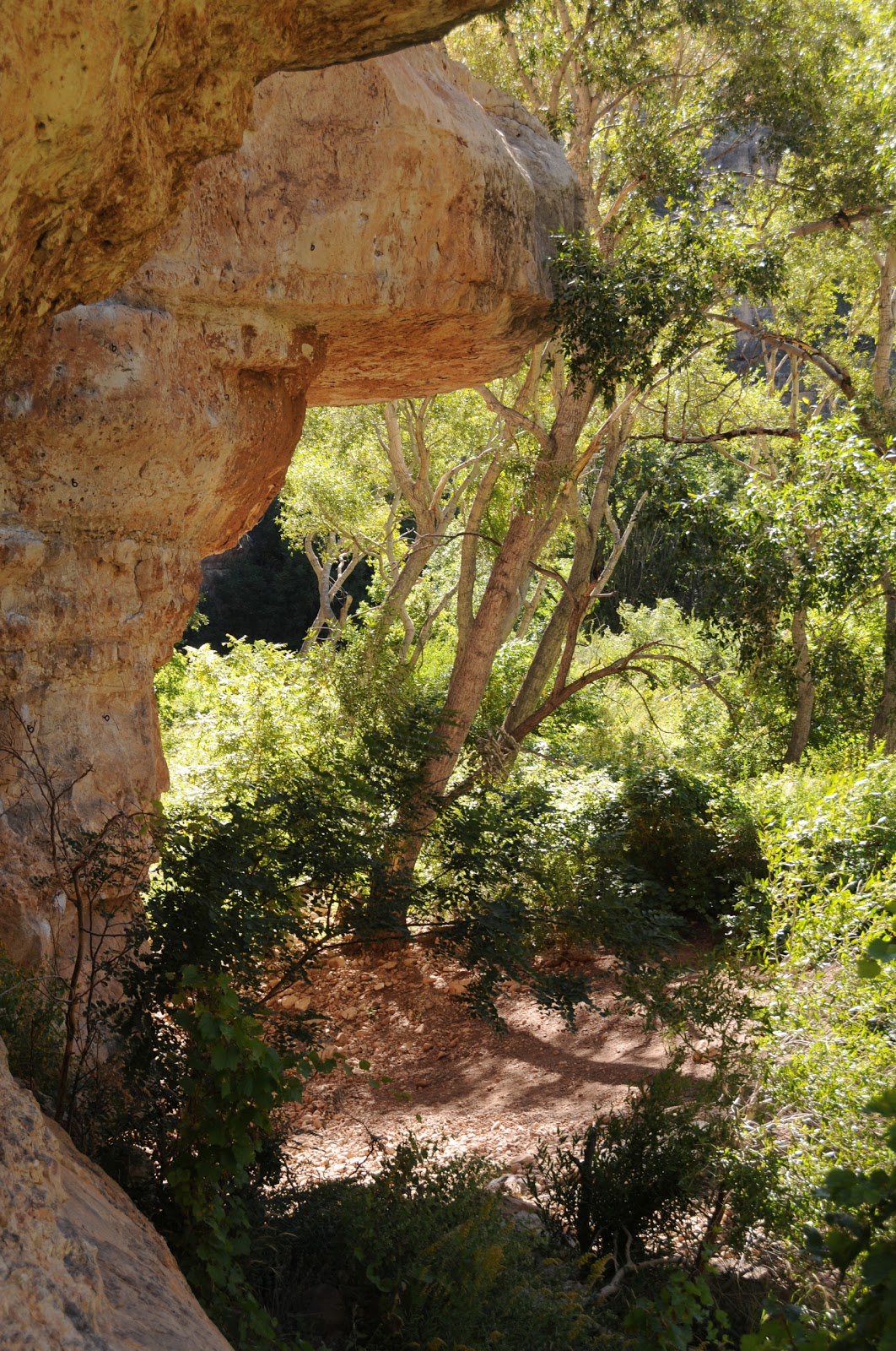
However, this grit-cloaked backyard of the boondocks holds a secret. Just a few miles beyond the pavement, a fracture in the landscape harbors a lusty green oasis and some of the best sport climbing routes and exploratory hiking paths in the state. A short spur trail heading west (go left) from the trailhead register through a grove of junipers leads to the edge of Jack’s Canyon, which is also known as Moenkopi, a Hopi word meaning “place of running water”. From here, a mildly steep trail drops from the sun-parched savanna into a grape vine-laced riparian corridor hemmed in by striated limestone walls. Myriad footpaths on the canyon floor weave among cottonwood trees, junipers and willows forming a maze of hiking options. Adventurous hikers may choose to venture beyond the beaten paths to bush whack and scramble into the remote reaches of this Garden of Eden in the middle of nowhere.


LENGTH: up to 4 miles roundtrip
ELEVATION: 6,245’ – 6,097’
RATING: moderate, exploratory
DOG RATING: fair
KID QUOTIENT: just okay
DISTANCE FROM PHOENIX: 153 miles one-way
GETTING THERE:

FACILITIES: restroom, primitive camping
INFO: Mogollon Rim Ranger District, 928-477-2255
MORE PHOTOS:
Sunday, July 17, 2011
ARIZONA TRAIL PASSAGE 34: BISMARCK LAKE TO SNOWBOWL ROAD
ARIZONA TRAIL PASSAGE 34: BISMARCK LAKE TO SNOWBOWL ROAD
Flagstaff
 |
| one of 3 aspen glens on the route |
 |
| section of trail above Hart Prairie |
One of the most scenic segments of state traversing Arizona Trail, Passage #34 (San Francisco Peaks) is 32.3 miles in length. However, day hikers in search of a shorter out-and-back excursion can sample the prettiest (in my opinion) part of this passage by trekking from Bismarck Lake to Snowbowl Road.
 |
| Bismarck Lake was just a puddle on July 16, 2011 |
From the lake trailhead, the route heads east through shady fir forests and alpine meadows, meeting the turnoff for the lake at the 1-mile point. From here, it’s 0.2 miles to the water. The lake itself is a shallow volcanic crater that fills with water during spring snowmelt and monsoon season ranging in size from a tiny mud puddle to a substantial pond---you never know what you’ll find. Once done exploring the lake, head back to the junction and continue 0.2 mile east (toward the mountains) to the Arizona Trail (AZT) junction. Go right (south) here and begin the 2.5-mile trek to Snowbowl Road. Along this segment, three hauntingly beautiful aspen glens break up wildflower-cluttered fields lined with Douglas fir and limber pines. Views of the peaks are interspersed with glimpses of Hart Prairie, Kendrick Peak and Bill Williams Mountain to the west. Near the end of the hike (you’ll know you're close when you pass the “Mexico 610 miles” sign), AZT intersects a two-track where a sign reading “Arizona Trail under construction” is visible across the road. To get to Snowbowl Road from here, veer left and follow the dirt road uphill. There’s never a dull moment on this breezy, cool, high-altitude hike.
 |
| section of trail near Snowbowl Road |
LENGTH: 8 miles roundtrip
RATING: moderate
ELEVATION: 8,800 -9,300 feet
GETTING THERE:
BISMARCK LAKE TRAILHEAD:
From Flagstaff, go north on US 180, pass milepost 225 and turn right onto FR 151 (south entrance to Hart Prairie Road). Follow FR 151 6.4 miles to FR 627 (signed for Bismarck Lake), turn right and continue 0.6 mile to the trailhead. FR 151 and 627 are maintained dirt passable by sedan.
SNOWBOWL ROAD TRAILHEAD:
From Flagstaff, go north on US 180 to milepost 223 and turn right onto Snowbowl Road (FR 516). Continue uphill on FR516 roughly 6.5 miles to the “Aspen Corner” parking area. Note: this is an unsigned pullout area on a curve in the road surrounded by wood, split rail fencing. To find the trail from here, hike into the woods following an old dirt road beginning on the west (left) side of Snowbowl Road for about 0.2 mile to the AZT intersection located just before where the road enters an open meadow. At the intersection, take a right (north) and follow the signs. Roads are 100% paved.
Subscribe to:
Posts (Atom)