Find A Trail. Start Your Search Here:

Showing posts with label vortex. Show all posts

Friday, March 9, 2012

Sedona vortex hike

COW PIES TRAIL
Sedona

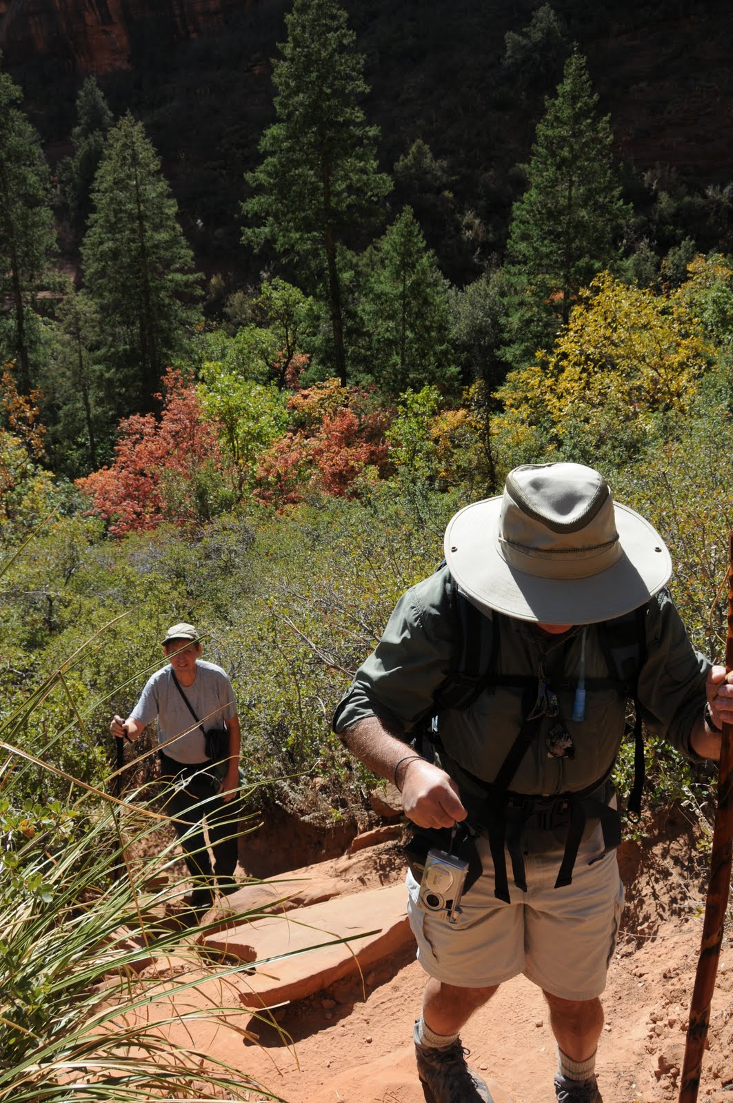
Renowned for its come-hither, otherworldly beauty, Sedona is like a quivering supernova on the Arizona landscape. The mere mention of the “S-word” sends me scrambling to assemble my gear in a heart palpitating must-go-hiking frenzy.  Alas, this is what addiction must feel like.  Thankfully the “fix” for a Sedona hiking Jones is benign (except, of course, for the whole $4 gas thing).  Obnoxious fuel costs notwithstanding, when the Sirens of Sedona call, and the weather is a perfect blend of winter nip and spring balm---what Valley resident can resist?  Although the destination choice is a relative no-brainer, selecting a hiking trail is the more complicated side of the Sedona hiking equation. Cow Pies is one of those off-the-radar vortex (a place thought to harbor energy and spiritual powers) routes popularized in Sherry & Richard Mangum’s book, Sedona Hikes.  Because of its funny name, this trail has been on my to-do list for decades so, when a friend suggested we do it, the equation tipped into balance. Because Cow Pies and most of the hundreds of other Red Rock Country trails are short, we wanted to incorporate a second path to get in enough foot time to justify the drive expense. A natural choice was the Munds Wagon Trail, which can be used to add hike mileage and/or avoid the kidney-jarring drive on Schnebly Hill Road.  However, like the adventuresome moron that I sometimes can be, I decided to brave the rutted road and drive to the Cow Pies trailhead---hey, what else are new tires and shocks for anyway, right? Driving a Toyota RAV4, with reasonably high clearance, it took us 30 minutes to go 3.5 miles.  Although I did not have to use the 4x4 and never came close to bottoming out-- I cannot help but wonder if the lurching little sedan with Nebraska plates we passed had the same success. As is turned out, the drive was the most interesting aspect of this trip.  Although it’s certainly an attractive area, the sketchy, canyon-bound route pales in comparison to other Sedona trails. Several minutes into the hike, it becomes clear how this path got its name.  Clusters of smooth-tiered russet rock mounds resemble bovine splatter wads—except, they are huge, actually FUN to step on and some cast colorful images onto shallow reflecting pools at their bases.  Rock cairns mark the out-and-back journey while obvious paths-of-use lead to scenic overlooks and a ledge traversing Mitten Ridge.  With our hiking Jones sated for the day, we headed uptown to service our truly pathological addictions---locally–roasted coffee and 44 oz jugs of Diet Coke.

LENGTH: 8 miles roundtrip
Cow Pies: 1.5 miles one-way
Mitten Ridge: 2.5 miles one-way
Munds Wagon Trail: 2 miles to Cow Pies or 4.5 miles/1000 feet gain, one-way for entire route
ELEVATION: 5,000' – 5,300' (Munds-Cow Pies)
RATING: easy (some loose footing & bare rock)
FEE:  $5 Red Rock Pass required
FACILITIES: restrooms at Huckaby-Munds Wagon trailhead
DISTANCE FROM PHOENIX: 129 miles one way
GETTING THERE:
From Phoenix, travel north on I17 to exit 298 for AZ 179/Sedona-Oak Creek. Go west (left) on AZ 179 to the traffic circle just before entering downtown Sedona.  Veer right into the circle and then take an immediate right onto Schnebly Hill Road (FR 153). Then....
Huckaby-Munds Wagon trailhead: continue 1 mile to the lot on the left. From here, hike 2 miles north on Munds Wagon, take the spur path up to Schnebly Hill Road and hike up to the Cow Pies trailhead.
Cow Pies trailhead: Continue 2.5 miles (road will turn to dirt) beyond the Huckaby-Munds Wagon trailhead to the Cow Pies trailhead on the left. The “official” parking lot is on the right across from the trailhead—but good luck getting over the massive ruts.  We parked along the road instead.
INFO:
Red Rock Ranger District, Coconino National Forest, 928-203-7500
This hike is not featured on the FS web site, however, for an overview of the area, see:

MORE PHOTOS:

Monday, December 13, 2010

BOYNTON CANYON VISTA TRAIL

BOYNTON CANYON VISTA Red Rock Secret Canyon Wilderness, Sedona Judging from the crowds, this has got to be the most popular vortex site(places on earth known for their high energy/spiritual powers) in Sedona. That’s probably because it’s easy to get to, not too tough to hike and offers the best views. Although vortex aficionados often disagree about the exact physical locations of these hot spots, there seems to be some consensus that the Boynton Canyon vortex lives on the saddle between two rock formations known as Kachina Woman and Boynton Spire. Guess where the Vista trail leads---yup, the saddle. Whether you regard the power of vortexes as a profoundly spiritual thing or a crock of baloney, it’s impossible to hike to the saddle and not appreciate the breathtaking beauty that unfolds on the way up. For a longer hike in the area, descend from the Vista Trail and continue up the Boynton Canyon Trail (see separate blog entry) for an unforgettable venture into a slim red rock gorge that slowly converges on the trail until the surrounding cliffs appear to collide in a massive wall of stone. LENGTH: 0.75 mile one-way RATING: easy ELEVATION: 4,500 – 4,800 feet BEST SEASONS: September - May FACILITIES: restroom, informational signage FEES: a Red Rock Pass (or equivalent) is required. $5 daily fee. Passes are available at the oak Creek ranger station and most local convenience stores. http://www.redrockcountry.org/passes-and-permits/index.shtml, (928) 282-4119 GETTING THERE: From Phoenix, go north on I-17 to exit 298 (Sedona/ Oak Creek). Veer left (west) and follow SR 179 through the town of Oak Creek to the junction of 179 and Highway 89A in Sedona. Go through the traffic circle, head west (left toward Cottonwood) and continue 3.2 miles to Dry Creek Road. Turn right and follow Dry Creek Road 3 miles to the Long Canyon Road intersection. Go left to stay on FR 152C and continue 1.5 miles to a “T” intersection turn right and go a short distance to the trailhead on the right. INFORMATION: Red Rock Ranger District: (928) 282-4119

BELL ROCK TRAIL

BELL ROCK TRAIL Sedona/Oak Creek Located on the north side of Red Rock Country’s most prominent geological landmark, Bell Rock Trail is comprised of two trails – lower and upper--that climb the lower ledges of the massive, bell-shaped red sandstone heap. Bell Rock is also one of Sedona’s vortex sites—places where earth energies are highly concentrated. This means different things to different people---so, I’ll refrain from trying to explain it. Good signs and basket cairns (big wire drums full of rocks) spaced among the cypress and juniper trees mark the routes. One potentially confusing aspect of keeping on track is the naming of the trails in the area. Note that there’s a Bell Rock TRAIL and a Bell Rock PATHWAY. The “pathway” is NOT the route described here. Also, the Upper Trail is signed “U Bell Rock Trail”. A mild climb leads to several exposed sandstone platforms for unobstructed views of the Oak Creek area. For even better views, take the Upper trail, but only if you’re sure-footed and don’t mind a bit of scrambling. As for those “other” unofficial paths that deface the Bell---please respect the fragile terrain and do not venture out on them. They destroy vegetation, erode the rocks and make for a great way to get injured. Be nice and stay on designated routes only. LENGTH: Lower trail: 0.5 mile one-way, Upper trail: 0.2 mile one-way RATING: moderate ELEVATION: 4,350-4,450 (4,500 for the upper trail) BEST SEASONS: September - May FACILITIES: restroom, informational signage FEE: a Red Rock Pass (or equivalent) is required to park and is available at the Oak Creek Ranger station and most local convenience stores. $5 for the day pass. http://www.redrockcountry.org/passes-and-permits/index.shtml, (928) 282-4119 GETTING THERE: From Phoenix, go north on I-17 to exit 298 (Sedona/Oak Creek). Veer left (west) and follow SR 179 to milepost 308. The trailhead will be on the right just past the milepost. INFORMATION: Red Rock Ranger District: (928) 282-4119

BELL ROCK PATHWAY

BELL ROCK PATHWAY Coconino National Forest, near Sedona For a casual stroll among Sedona’s gorgeous red rock formations that never strays far from civilization, try this wide, sunny trail. Although most of the trail is within earshot of busy Highway 179, a very scenic segment bends away from the commotion and skirts the edge of Munds Mountain Wilderness for peaceful vistas and up-close views of Courthouse Butte and the world-famous Frank Lloyd-Wright masterpiece, Chapel of the Holy Cross. LENGTH: 3.7 miles one-way RATING: easy ELEVATION: 4,050 – 4,370 feet BEST SEASONS: September - May FEE: a Red Rock Pass (or equivalent) is required to park and is available at the Oak Creek Ranger station and most local convenience stores. $5 for the day pass. http://www.redrockcountry.org/passes-and-permits/index.shtml, (928) 282-4119 GETTING THERE: NORTH TRAILHEAD: From Phoenix, go north on I-17 to exit 298 (Sedona/Oak Creek). Veer left (west) and follow SR 179 to just before milepost 310 and turn right into the parking area. This is the “Little Horse” Trailhead. Follow the signs that lead to the trail heading south. SOUTH TRAILHEAD: From Phoenix, go north on I-17 to exit 298 (Sedona/Oak Creek). Veer left (west) and follow SR 179 to just past milepost 307 and turn right into the parking area. INFORMATION: http://www.fs.fed.us/r3/coconino/recreation/red_rock/bell-rock-pathway.shtml (928) 282-4119

Saturday, September 18, 2010

BOYNTON CANYON TRAIL

BOYNTON CANYON #47 Red Rock Secret Canyon Wilderness, Sedona One of Sedona’s most popular hiking destinations, the Boynton Canyon Trail weaves through a yawning gorge flanked by rusty-red and buff-colored ramparts. The route begins in a sandy gateway of mangled manzanita, agaves and yucca climbing gently uphill. Midway through the hike, the chaparral is swallowed up in forests of pine, oak, golden Arizona ash, box elder, Arizona walnut, Velvet ash, Common hop trees and syrupy-red Bigtooth maples. Here, the cliffs close in on the trail and robust canyon winds whip fallen leaves into a frenzy of color---mimicking the rustle and roar of a confetti addled street festival. Near the high point of the route, look for a steep spur path marked by rock cairns hidden in a tangle of brush. Experienced hikers can climb this earthen staircase to a scenic box canyon with sky-high red walls on all sides. BEST TIME FOR FALL COLOR: mid-October. For weekly reports, call the Forest Service Fall Color Hotline, 1-800-354-4595 or visit.fs.fed.us/r3/recreation/fall-colors/fall.shtml LENGTH: 3.7 miles one way RATING: moderate ELEVATION: 4,500- 5,050 feet BEST SEASONS: September - May BEST TIME FOR FALL COLOR: mid-to-late October DISTANCE FROM PHOENIX: 135 miles one way GETTING THERE: From the "Y" intersection of AZ 179 and AZ89A in Sedona go left (toward Cottonwood) and continue 3 miles to Dry Creek Road. Turn right onto Dry Creek Road (Forest Road 152C) go 3 miles to Boynton Canyon Road, turn left and proceed another 0.3 miles to the parking lot on the right. Roads are paved. FEE: Red Rock Pass--$5 per vehicle is required INFO: Coconino National Forest, Red Rock District 928-203-2900 http://www.fs.fed.us/r3/coconino/recreation/red_rock/boynton-tr.shtml Red Rock Pass: http://www.redrockcountry.org/passes-and-permits/index.shtml MAP: http://www.redrockcountry.org/maps/map-graphics/red-rock-map-9-05.pdf

Friday, January 16, 2009

BOYNTON CANYON

BOYNTON CANYON Secret Canyon Wilderness, Sedona To New Age devotes, the metaphysical merit of Sedona’s vortex sites ranks right up there with Machu Pichu, the Egyptian Pyramids and Mount Everest. Along the Boynton Canyon trail, Sedona’s most popular vortex, peace symbols made of pine cones and hundreds of stone cairns mark special places discovered by droves of spiritual pilgrims and extraterrestrial zealots. It’s not unusual to hear the sounds of didgeridoos and flutes emanating from the cliffs. The trail begins on a sandy, desert path overlooking the Enchantment Resort and culminates in a box canyon shaded by oaks and pines. Once at the head of the canyon, venture out onto the sandstone ledge and peer around the corner for breath taking views of the area’s monolithic red and beige sandstone formations. Although it’s easy to see why spirits and little green men would feel right at home in Boynton Canyon, abductions are rare. LENGTH: 3.7 miles one way RATING: Moderate ELEVATION: 4,500' - 5,050' GETTING THERE: From the Sedona "Y" intersection, turn left onto highway 89A (toward Cottonwood) and continue 3 miles to Dry Creek Road. Turn right onto Dry Creek Road (FR 152C) and go 3 miles to the intersection for Boynton Canyon Road and turn left. Proceed another .3 mile to the parking lot on the right. A Red Rock Pass is REQUIRED to park. The passes are available for purchase at the ranger station in Oak Creek and at a sub station along Dry Creek Road.