MARICOPA TRAIL: Bartlett
Dam Road to McDowell Sonoran Preserve
 |
| Maricopa Trail pass through Tonto National Forest |
The 300+-mile
course of the Maricopa Trail takes many forms. Sometimes it’s a single track, canal bank, road
or suburban pathway. All the segments are beautiful and useful in their own
ways and yet, some of the most memorable are within the Tonto National Forest.
 |
| Desert greenery flanks suburbia. |
The 20.5-mile Bronco to Granite Mountain segment
northeast of Scottsdale stays within the forest boundary passing by Camp Creek,
Blue Wash, Rackensack Canyon and hilly desert back country. The north-south running route is bisected by
Bartlett Dam Road making it easy to tackle as a car shuttle hike.
 |
| Four Peaks on the eastern horizon. |
North of the
road, the route is a rugged trek through mountainous terrain, washes and rough
drainages while to the south, the hike is a milder adventure with lots of
variety. Both halves share space with a
power line that is visible to the west intermittently throughout the hike. Beginning
at Bartlett Dam Road, heading south, the trail rolls out in “chapter” format. Each mile of the
3.4-mile trek has its own character beginning with “ATV Heaven”. Much of Tonto
National is open for shared-use activities including motorized travel and
hunting. Although the Maricopa Trail corridor is designated as non-motorized,
surrounding roads are open to all and you will likely encounter dirt bikes,
4x4s and trucks where the trail crosses several dirt tracks. Once past the
boulder knoll of Wildcat Hill, the motorized traffic is much less profound.
 |
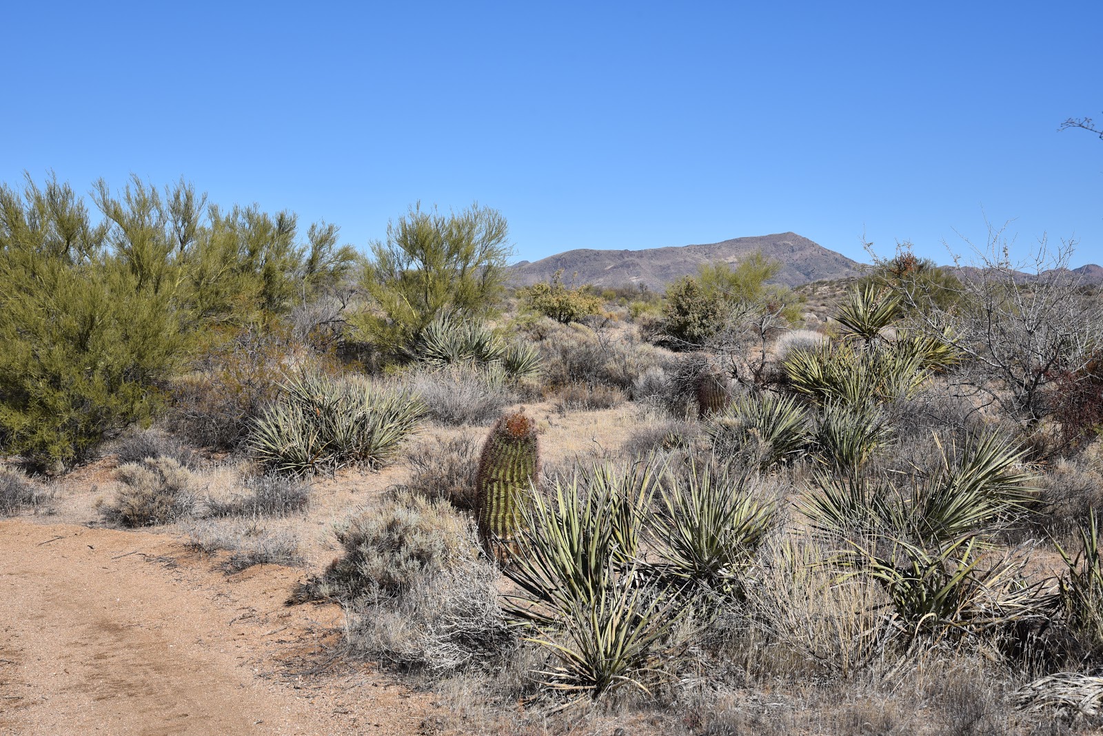
| Sonoran Desert plant life and Cave Creek Mountains. |
The
rollicking road ruckus is replaced by a quieter chapter of “Wilderness Vistas”. To the east, a panorama of mountain peaks dominates
the horizon. Look for Weavers Needle and
Flatiron in the Superstition Wilderness, Four Peaks and the Sierra Ancha
Mountains and the Cave Creek Mountains. Nearer to the trail are outcroppings of
quartz, pink granite and some of the biggest barrel cacti anywhere. Clear days
yield amazing depth of vision and ahhh-inspiring photo opportunities. Soon, the
trail begins heading downhill toward the northern boundary of the McDowell
Sonoran Preserve. This “Edge of
Suburbia” chapter skirts tony neighborhoods where lush forests of Palo Verde,
mesquite, ironwood cholla and yucca muffle the sounds of civilization.
 |
| Northern boundary of McDowell Sonoran Preserve. |
For
added entertainment, watch for vociferous phainopeplas—black, crested birds that
resemble cardinals—feasting on mistletoe.
The final
chapter is “Forest-Preserve Interface” where the trail passes a cattle gate
then continues to the north boundary of the McDowell Sonoran Preserve. Here, the trail ascends to metal gates and barbed
wire fences for sweeping views of the familiar profiles of Granite, Browns,
Cholla and Cone Mountains within the preserve.
 |
| Superstition Wilderness peaks in distance. |
To the south, Pinnacle Peak stands out over still fainter silhouettes of
the Phoenix Mountains Preserve and Downtown Phoenix. This segment of the Maricopa Trail continues
6.4 miles south to the Granite Mountain trailhead, but if you're satisfied with
the story thus far, this is your turnaround point.
 |
| A Palo Verde tree frames view of Black Mountain. |
LENGTH: 6.8
miles roundtrip
RATING: easy
ELEVATION: 2845
– 3220 feet
 |
| A female phainopepla |
GETTING THERE:
Bartlett Dam
Road Trailhead.
From Loop 101 in Scottsdale, take the Pima/Princess Drive
exit 36 and go 13 miles north on Pima and turn right on Cave Creek Road. Continue 4.1 miles to Bartlett Dam Road, turn
right and go 0.4 mile to where a dirt road crosses at a “no target shooting”
sign 0.1 mile past the Tonto National Forest ranger station. Turn right and park along the dirt turn outs.
This area is heavily used by ATVs, so don’t block roads. This segment may also be accessed via a
0.2-mile connector path from a trailhead at the ranger station-- when it’s
open.
 |
| Engelmann hedgehog cacti bloom March-April |
INFO & MAPS: