Find A Trail. Start Your Search Here:

Showing posts with label Tonto Recreation Alliance. Show all posts

Monday, April 11, 2022

Forest Road 502 to East Verde River

FOREST ROAD 502 to EAST VERDE RIVER

A calm bend in the East Verde River near Payson

From sweeping mountain vistas, to rolling, juniper-dotted rangeland and a leafy river canyon, a walk along Forest Road 502 delivers a packed agenda over its short, hilly course. 

View of North Peak from FR 502

Adopted by the Tonto Recreation Alliance, a non-profit, volunteer partner of Tonto National Forest that works to keep hundreds of miles of forest trails open and maintained for motorized off-road use, the dirt two-track a few miles west of downtown Payson offers a quick, lightly trafficked route to the East Verde River.
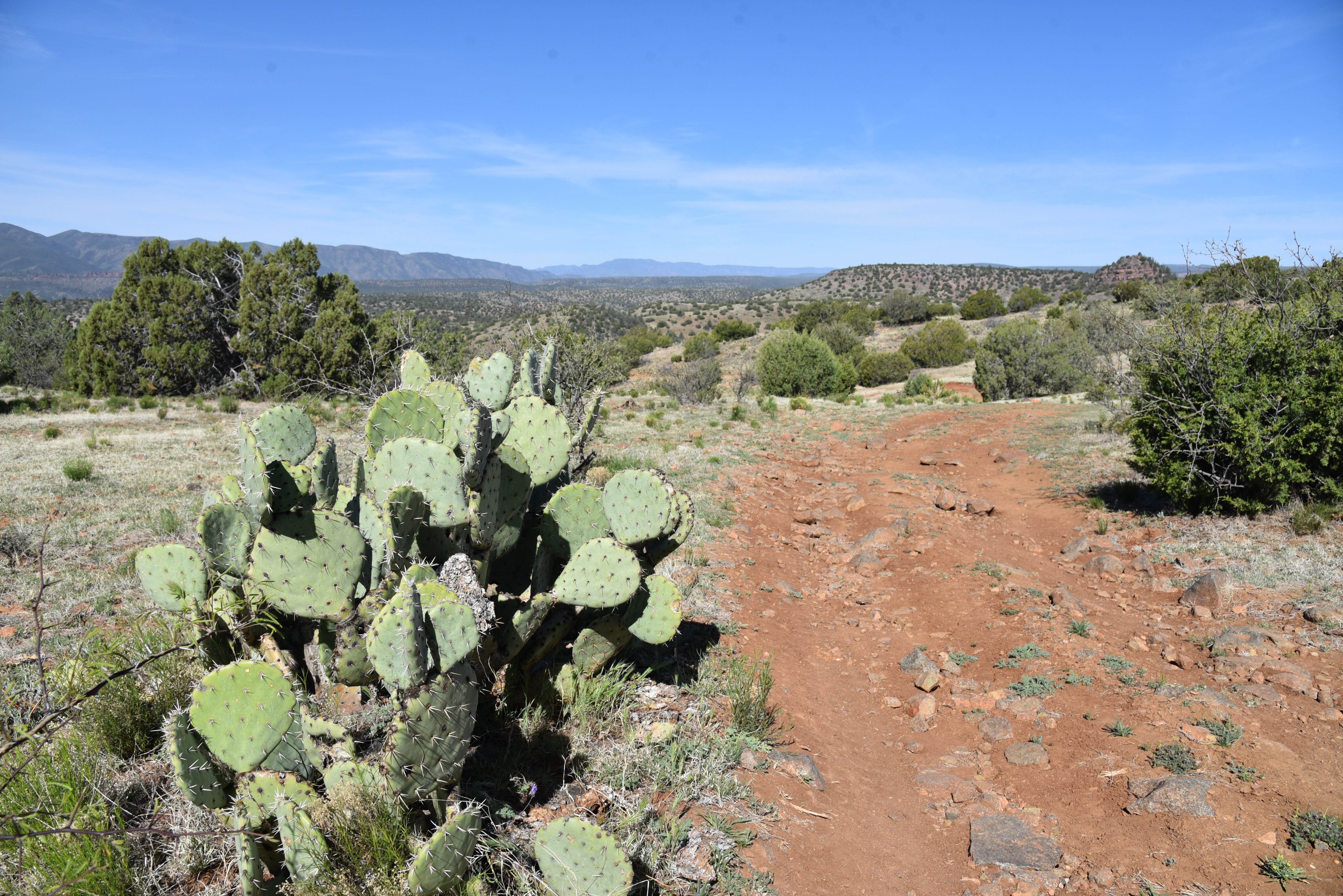
High desert valley vistas abound on FR 502

Sego lilies bloom Apr - July

Located a few miles south of Tonto Natural Bridge State Park east of Pine Creek, the road, which is open to hikers, equestrians and OHV use is a sweet find for those who appreciate a simple trek peppered with many points of visual interest.
You might encounter livestock on FR 502


From a dirt pull out along Doll Baby Ranch Road, the hike begins by passing through a barbed wire gate (close it behind you) where visitors are immediately smacked with breathtaking views of  Mazatzal Wilderness peaks including 7,449-foot North Peak, the northernmost  prominent peak in the Mazatzal Range.

Goodding's verbena blooms Feb - Oct

Barberry shrubs bloom Feb- May

The road veers left at an unsigned fork at the 0.1-mile point. After that, all junctions are signed “502”.  As the road makes an easy push through sunny juniper-pinon open range, views of a landscape rife with landforms with imagination-stoking names like Polles Mesa, Whiterock Mesa, White Hills, Horsethief Bench, Limestone Hills and Pilot Knob roll out in all directions.
Milkvetch is a common spring bloomer

Majestic land forms all around.

The largely unshaded route is flanked by a fringe of flowering shrubs, yucca and a colorful understory of classic high-desert wildflowers including delicate sego lilies, purple Goodding’s verbena, milkvetch, Blackfoot daisies and flame-red paintbrush. 

Velvet ash trees huddle around East Verde River

At just over the one-mile point, the road begins a series of gradual ups-and-downs that land hikers at the East Verde River. The final,  descent into the river canyon is somewhat rocky and steeper, but not too difficult.
Paintbrush bloom Mar - Sep

The road meets the water at 1.8 miles where hikers may explore along the rocky banks and spindly velvet ash trees to spy trout swimming in deep pools.
Trailhead on Doll Baby Ranch Road

Road ups and downs total over 780 feet in elevation change

While the river makes for a good turnaround point, hikers may consult the Tonto Recreation Alliance downloadable maps to extend the trip by way of several connecting roads.
Blackfoot daisies bloom Mar- Dec


LENGTH: 3.6 miles roundtrip (to the river and back)

RATING: moderate

ELEVATION: 3,717 – 4,058 feet (781 feet of accumulated elevation change)

GETTING THERE:

From State Route 87 in downtown Payson, go 6.3 miles west (go left at the light) on Main Street which will turn into Country Club Road and then Doll Baby Ranch Road (FR 406) to the trailhead on the right.  Park in the dirt turn outs by the gate and the “502” sign.

INFO & MAPS:

Tonto Recreation Alliance

tralaz.org


Tuesday, November 3, 2020

Deer Flat

DEER FLAT

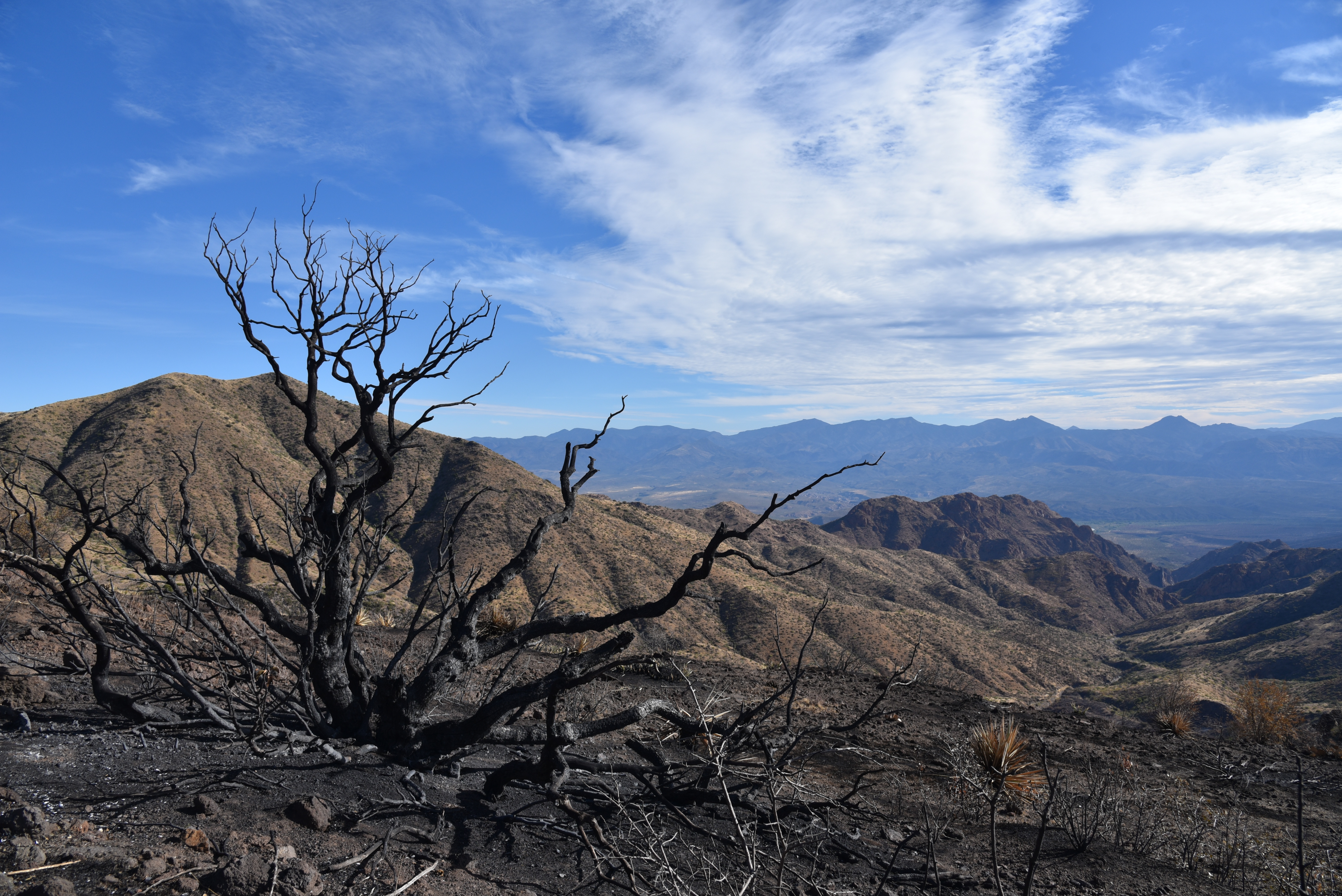
A tree burnt by the Sears Fire teeters above Buck Basin

It’s been a rough year for Deer Flat.  Pressure from an extended drought and the

Sears Fire in the back country north of Cave Creek has altered the terrain on the breezy, mountain-bound rangeland.  But the place has grit and “good bones” so it wears the effects of these most recent punches like just another pair of black eyes that will heal. 

A calming scene near the top of Deer Flat

Deer Flat sits at the top of a rise among the prominent peaks of Humboldt Mountain (5,204 feet and easily spotted by the big white ball FAA station on top), Willow Spring Mountain (4,914 feet)  and Maverick Butte (4,870 feet)—the enduring bone structure that defines the area.  Forest Road 1099, a rough OHV route that’s been adopted by the Tonto Recreation Alliance, a non-profit volunteer group that works with Tonto National Forest to educate the public about responsible off-highway vehicle use and resource conservation, provides access through the rugged desert space.

Milkweed pods dry in the sun on Deer Flat

Humboldt Mountain (center horizon) soars above Deer Flat

The hike begins with an easy walk through grassy foothills just outside of the scar of the Sears Fire which burned more than 14,000 acres of Tonto National Forest this past October.

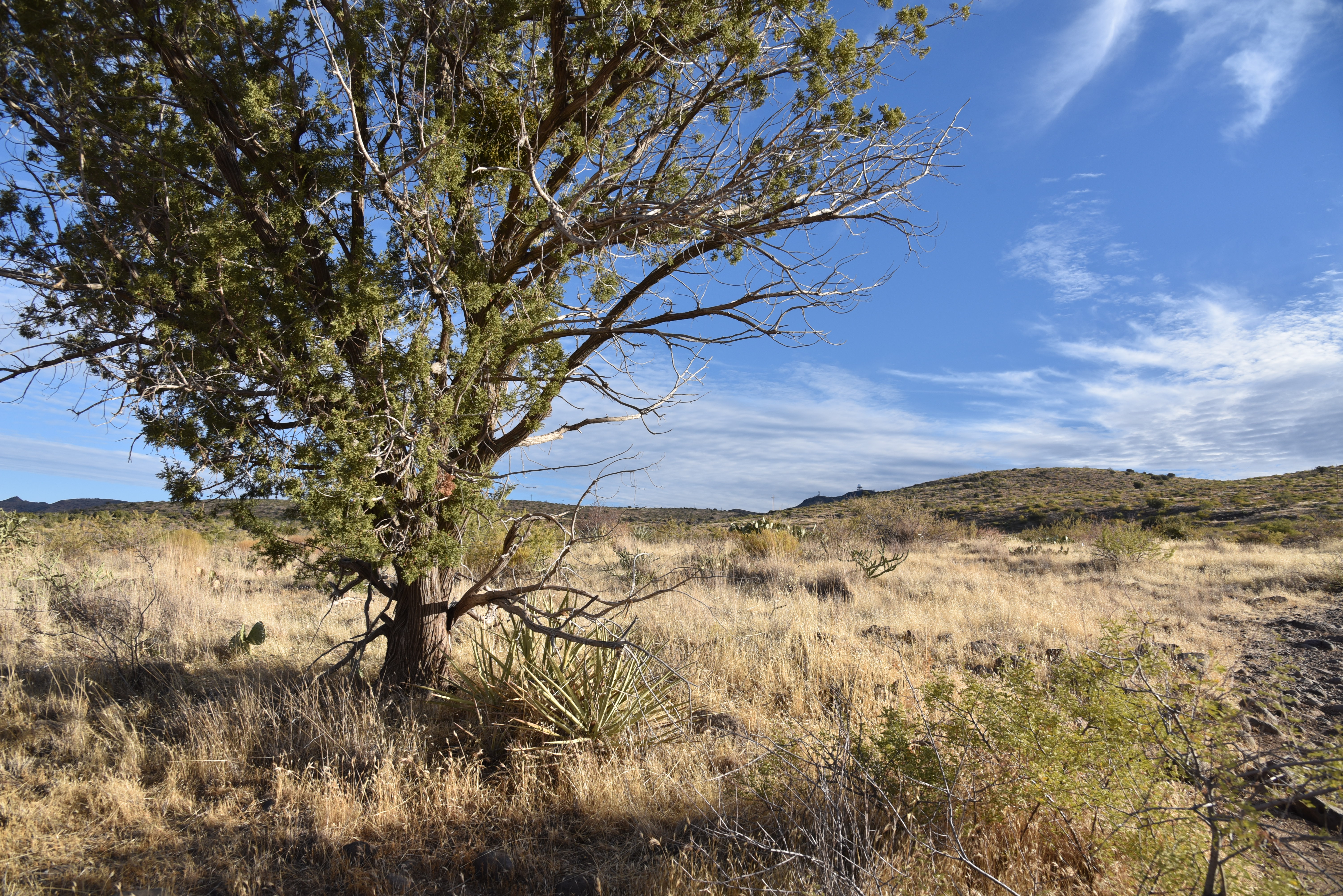
Open grasslands and junipers define Deer Flat

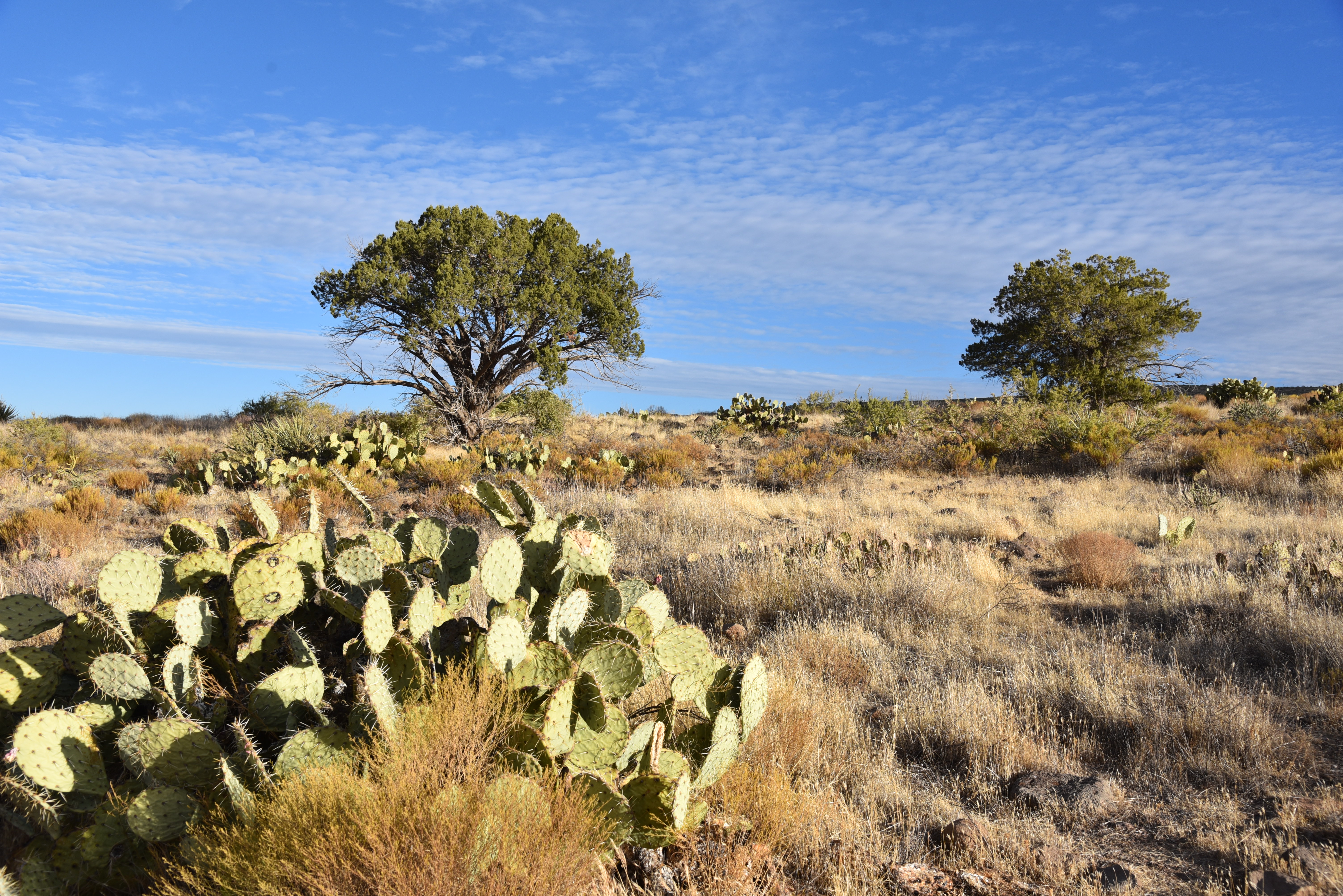
Cacti and scrub line FR 1099

A hiker gazes back at the New River Mountains from Deer Flat

As the road makes a gradual but constant ascent on a rocky, wobbly track, amazing views of the New River Mountains to the west and peeks at Scottsdale’s Pinnacle Peak to the south get bigger and better with each foot of elevation gained.  At near the two-mile point where a drought-dry stock tank sits off to the right, evidence of the fire begins to creep up. 
Pinnacle Peak visible in distance from the road up to Deer Flat

Evidently, the road served as a fire break that spared a scenic expanse of junipers and scrub oak north of its rough-cut route  where glimpses of hazy peaks jutting above the horizon hint at the combination of destruction and resilience that lies ahead.  The final slog to the hike’s high point culminates at the edge of Buck Basin with jaw-dropping views of the Verde River Valley more than 2,000 feet below.  The road curves sharply southward on a ledge above the precipice where the blaze took a heavy toll.  At this writing, the cause of the blaze is still under investigation but its path of blackened stubble and acres of ash bear witness to its intensity. Skeletal, charred trees and cacti fried to a crisp teeter creepily over scorched earth backed by distant views of the familiar profiles of Weavers Needle in the Superstition Wilderness and Four Peaks in the Mazatzal Mountains. 
Catclaw acacia grows abundantly on Deer Flat

From this dizzying, desolate platform, the vivid green corridor of the Verde River can be seen winding unscathed at the bottom of the gaping basin as it flows south between Horseshoe Reservoir and Bartlett Reservoir.  The road continues for a half-mile to South Deer Flat Tank, another parched water hole tucked into a ravine that makes for a good turnaround spot. 
The area around So. Deer Flat Tank is now prone to flooding

Fire damage around the tank is severe and its location in the folds of mountain foothills puts it at risk for flooding. Avoid hiking here during or immediately following storms because without deluge-mitigating vegetation water will run in torrents and you could be trapped, injured or swept away.
The hike follows Forest Road 1099

Much of Deer Flat escaped the Sears Fire


Despite the aftermath of fire and ongoing drought, a hike up to Deer Flat remains a stunning adventure.  Bemoaning memories of “what was” while hiking through a burn scar like this one might offer cathartic release, but it’s a buzz kill and also misses the big picture. 

The Sears Fire scar meets FR 1099

When viewed through the lens of geological time, human memories are short, fickle and finite.

Cycles of drought, fire, flooding and climate change may abruptly alter vegetation and surface characteristics in relatable time frames of days, months, years or centuries. This is the stuff we remember. But the underlying bone of resilient geological land forms hold steady.

Morning light in Tonto National Forest

Beautiful desert vistas abound on Deer Flat

Their appearance evolves over eons of seismic jolts and erosion. Observing these gradual transformations requires imperceptible timelines and more memory than we have. So, just enjoy the moment.
Maverick Butte (right) stands tall over Buck Basin

LENGTH: 5.7 miles round trip

RATING: moderate

ELEVATION: 3,585 – 4,493 feet

GETTING THERE:

From Loop 101 in North Scottsdale, take the Pima/Princess Road exit and go 13 miles north on Pima Road to Cave Creek Road.  Turn right (east) and continue on Cave Creek Road (a.k.a. FR 24, Seven Springs Road) to Forest Road 1099 located between MCDOT mile markers 9 and 10.  The road is signed but is easy to miss—it’s on the right.  There’s a dirt parking circle a few yards in.  Roads are maintained dirt suitable for all vehicles.

INFO:

Tonto Recreation Alliance

https://www.tralaz.org/