

 WEST WEBBER CREEK
Tonto National Forest
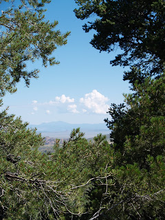
Located in the backwoods near Boy Scout Camp Geronimo beneath the Mogollon Rim, the West Webber Trail gets little publicity and few visitors. The reason for this becomes quite clear in the last two miles of the route. This hike involves connecting three trails. The circuit starts on Highline trail #31 across the road from the trailhead on the west side of Forest Road 440. After hopping shallow Webber Creek near a cluster of evergreen myrtle, follow trail #31 (marked by white diamond tree blazes) for roughly a third-of-a-mile to the junction with Geronimo trail #240 (follow the blue diamond tree blazes). From here, go right onto trail #240 and continue for 3 miles to the Turkey Springs trail junction where there’s a (usually dry) water trough and spigot. From the spring, take the left spur road and hike uphill to the signed junction for West Webber trail #228. It’s here where the hike becomes an adventure. The first half-mile hops a soggy spring seep area and is relatively easy to follow. After that, though, the path degrades into a train wreck of fallen trees, missing signposts and eroded slopes. Good route-finding skills and plenty of stamina are required to negotiate the final two-mile segment to the top of Milk Ranch Point—a promontory on top of the Rim. Those who survive the final haul to the top are rewarded with expansive vista views and hard-won bragging rights.
Highlights: Seldom-seen views of the Mogollon Rim open up for those who venture onto this rugged, steep trail in the pines.
LENGTH: 10.5 miles round-trip
RATING: moderate (difficult in the last 2 miles)
ELEVATION: 5,780’ – 7,300’
BEST SEASONS: March - November
DISTANCE FROM PHOENIX: 115 miles one-way
GETTING THERE:
From Payson, go north on Highway 87 to Forest Road 64 (Control Road). Go right (east) on FR 64 and continue for 6 miles to Forest Road 440 (Webber Creek Road). Go left (north) on FR 440 and continue 2 miles to the Geronimo trailhead on the right.
Information: (602) 225-5200 or fs.fed.us/r3/tonto


 RANCH TRAIL
Prescott National Forest
Cavernous ravines, high-desert washes and rolling ridgelines combine for a captivating hike in the foothills of the Bradshaw mountains. Closed to motorized vehicles, the Ranch Trail #62 offers a quieter hiking experience than other shared-use routes in the district. The track rambles from ridge-to-ridge in a gently undulating rhythm through a maze of pinon pines, agaves and weather-worn boulders. The gritty earth underfoot shimmers with minerals exposed by the decaying granite that defines the area’s geology. Hovering around 6,000 feet in elevation, the trail is situated high enough above the Prescott valley to showcase fabulous views of Granite Mountain floating above the green glens that ring the town a thousand feet below.
LENGTH: 6.4 miles round-trip
RATING: moderate
ELEVATION: 5,600 – 6,500 feet
FEE: $2 daily fee per vehicle.
BEST SEASONS: April - October
GETTING THERE:
From Phoenix, travel north on I-17 for the Cordes Junction interchange. Go west on Highway 69 toward Prescott. Just before entering town, turn left (south) onto Walker Road (Country Road 57) and continue for a half-mile to the “62” trailhead on the right. Roads are paved all the way and there’s a restroom at the trailhead.
Information: fs.fed.us/r3/Prescott (928) 771-4700


