


 Posts
Posts


ESCUDILLA NATIONAL RECREATION TRAIL
Apache Sitgreaves National Forest
 |
| Escudilla Mountain seen from U.S. 191/180 |
In a world replete with competition and obsessions about number-ones, nobody remembers who or what came in third. Same goes for hikers seeking to bag all of Arizona’s loftiest peaks. Hardly a hiker in the state isn’t familiar with the number one spot, Humphreys Peak, the highest point on San Francisco Mountain (the USGS official summit benchmark says “Frisco” not Humphreys), an extinct stratovolcano north of Flagstaff.
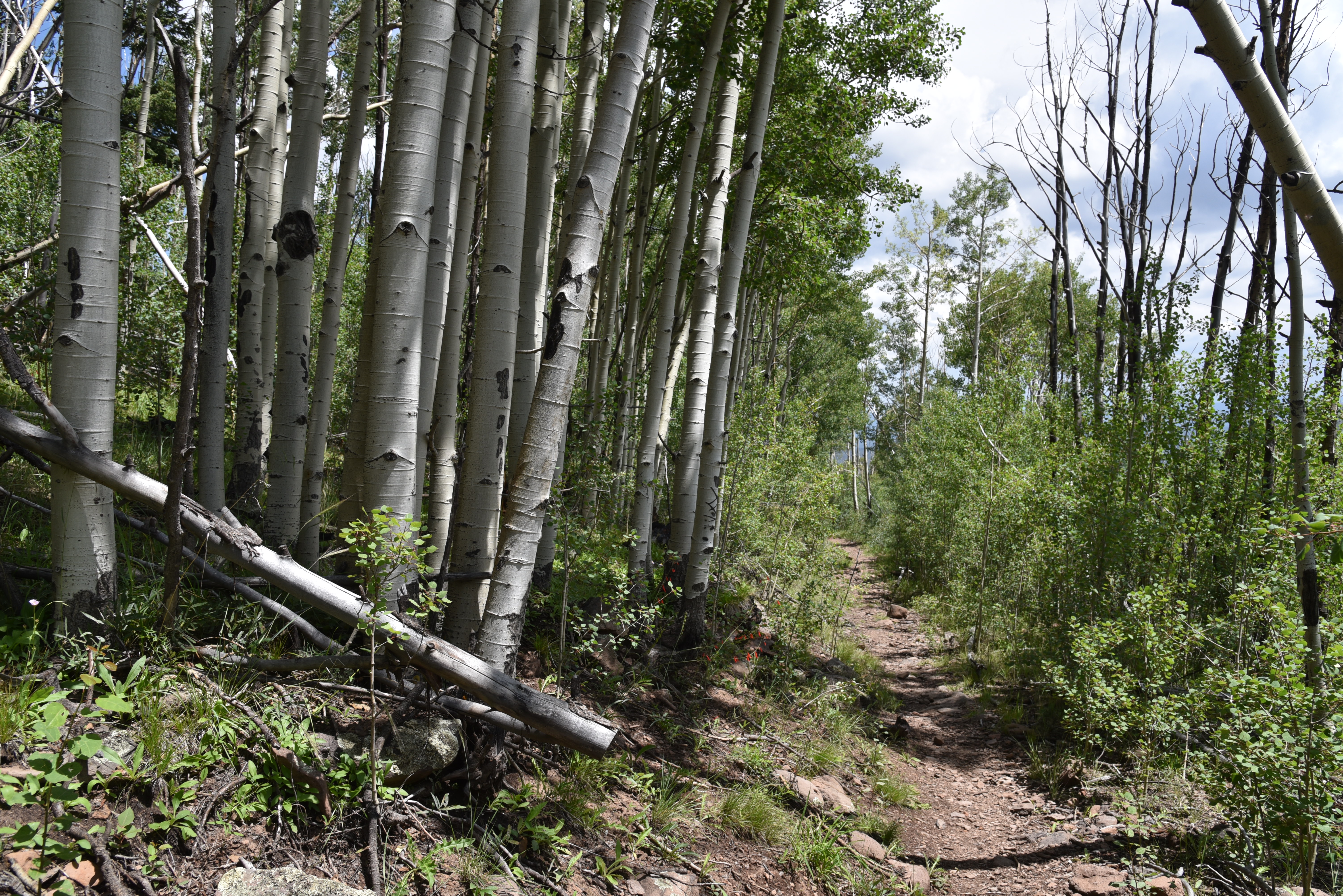 |
| Much of the lower trail escaped the Wallow Fire |
One sure way to start an argument among hikers is to breech the topic of which Arizona mountains are the highest. So we don’t trip over semantics, it’s important to distinguish between a mountain and a peak.
 |
| Aspens line the trail near the head of Toolbox Draw |
San Francisco Mountain has seven of the state’s highest peaks—Humphreys, Agassiz, Abineau, Doyle, Fremont, Rees and Schultz- but they are peaks on the same mountain.
 |
| Fireweed blooms July - Sept on Escudilla Mtn. |
So, it’s a collective number one. Here are the state’s top five highest mountains, all of which have trails to their summits.
 |
| Escudilla lookout stands above fire damaged slopes |
Humphreys Peak 12,633 feet, Mount Baldy 11,420 feet, Escudilla Mountain 10,912 feet, Mount Graham 10,720 feet and Kendrick Mountain 10,418 feet.
For Arizona “peak-baggers”, the rush to the top inevitably begins with an elbow-to-elbow slog up Humphreys Peak for bragging rights and the requisite Instagram moment.
 |
| Big sky and green valley views on Escudilla Mtn |
 |
| Lush woodlands near the trailhead |
But, in this hiker’s opinion, it’s the mountain that lags in third place that delivers the gold-medal alpine experience.
Brushing the clouds at 10,912 feet in elevation, Escudilla Mountain located off U.S. 191 in Eastern Arizona’s White Mountains is a much less congested route with a pronounced “out-there” ambiance.
 |
| Final aspen glen before fire damage dominates |
The isolated, dome-shaped massif sits just over three miles from the New Mexico state line in Apache County and cuts a distinctive profile that’s visible for miles.
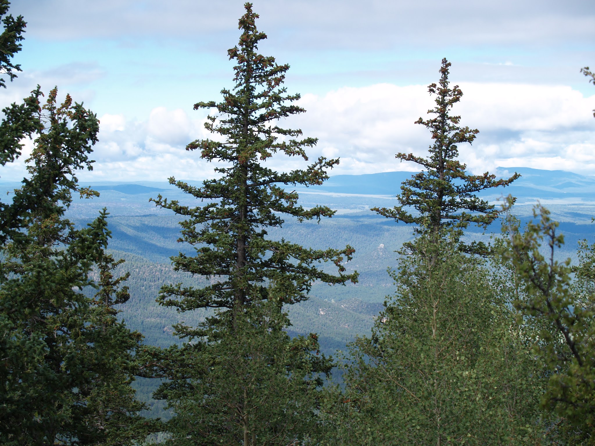 |
| Summit view in 2006 |
The Escudilla National Recreation Trail No. 308 lies almost entirely within the Escudilla Wilderness Area where only foot and equestrian travel is allowed.
The mountain was touched by another type of first--the unenviable kind- when the largest wildfire in Arizona history roared up its slopes. The 2011 Wallow Fire charred more than a half-million acres around the communities of Alpine, Nutrioso and Greer.
 |
| Shrubs & flowers grow among downed trees |
Even though Escudilla Mountain sat at the eastern edge of the fire’s reach, much of the terrain escaped severe damage.
 |
| Harebells are classic alpine wildflowers |
But some areas were devastated.
While the Wallow Fire certainly changed the mountain’s look, miraculously, much of the aspen and mixed conifer woodlands on the lower part of the trail are intact.
 |
| Summit view in 2006 |
 |
| Summit view looking east toward New Mexico |
The first half-mile of the hike was largely untouched and remains thick with white-barked aspen glens. The ravages of the blaze become apparent at the 1.1-mile point where the trail exits pristine forests and emerges on a crest at the head of Toolbox Draw. The previously fir-and-spruce draped passage is now an environment of bald rolling hills punctuated with a few stalwart Douglas firs.
 |
| How the severely damaged area looked in 2006 |
 |
| Damaged summit fire tower is closed to the public |
The upside is newly exposed mountain vistas. The trail hangs close to the edge of draws and ravines, passing through patches of survivor trees, fruit-laden shrubs and fields of colorful wildflowers.
 |
| Summer-ripening orange gooseberries |
One last aspen passage at the 1.7-mile point heralds the entrance into the severely burned side of the mountain.
 |
| Looking southwest from the summit |
The fire took no prisoners here. Ten years removed from the fire, the landscape is one of toppled tree skeletons and torched snags.
 |
| Survivor fir & spruce trees on the upper slopes |
Above it all, the battered metal frame of the former summit fire lookout stands on a scorched knob that denotes the destination. Among the downed trees, an under story of blooming shrubs, saplings, and alpine flowers hint at resurgence. Over the final mile to the summit, the trail dodges among deadfall and woodchips left from when the trail was cleared of obstacles.
 |
| Denuded flanks of Escudilla Mountain |
Spindly, head-high aspens fill spaces formerly occupied by enormous old-growth conifers on the last leg of the trek that ends at the fire tower on the 10,877-foot pinnacle.
 |
| Richardson's geranium grow among pine needles |
 |
| Trail condition on the summit ridge |
The wooden cabin that once stood below the lookout is gone and the tower is fenced off for safety. Gone too is the fringe of trees that limited views so it’s now easy to see all the way into New Mexico and the green valleys of the Blue Range Primitive Area. The 10,912-foot true summit resides a half-mile off-trail beyond the lookout, for those to whom 35 feet matters in the quest for a memorable third-place victory.
LENGTH: 6.3 miles roundtrip
RATING: moderate
ELEVATION: 9,560 – 10,877 feet
GETTING THERE:
From Springerville, go south on U.S. 191/180 for about 20 miles to Forest Road 8056 on the left between mileposts 420 and 421which is signed for Hulsey Lake and Terry Flat. Follow FR 8056 4.5 miles to the trailhead. FR 8056 is maintained gravel suitable for most vehicles. Several hairpin turns and steep drops off may not be suitable for RVs.
INFO:
https://www.fs.usda.gov/recarea/asnf/recreation/hiking/recarea/?recid=45293&actid=50


