Find A Trail. Start Your Search Here:

Showing posts with label Tucson Mountains. Show all posts

Thursday, March 17, 2022

Tumamoc Hill

TUMAMOC HILL

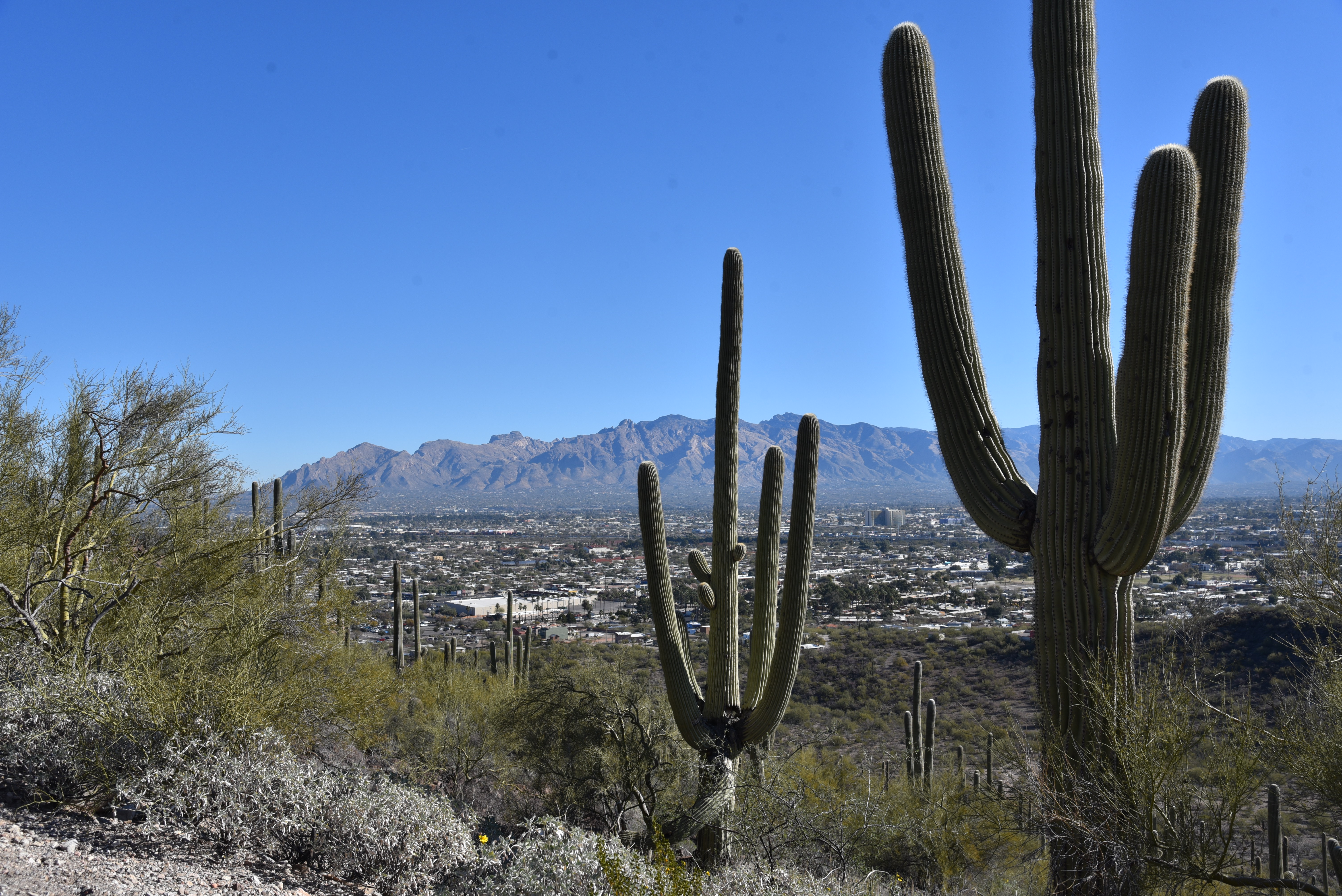
View of Santa Catalina Mountains from Tumamoc Hill

Just about everybody putting one foot in front of the other on Tumamoc Hill does so with a goal in mind, and the volcanic mesa just off Interstate 10 in Tucson holds enough interest to satisfy the physical and mental aims of its assorted visitors. Among the thousands who trudge up the distinctive  3,107-foot mound each year are casual walkers, spandex-clad runners, sightseers and families pushing strollers.  

See-forever views on Tumamoc Hill summit

In terms of popularity, the road/trail within the  860-acre University of Arizona ecological preserve rivals the likes of iconic Phoenix trails like Camelback Mountain and Piestewa Peak in visitation.
Tumamoc Hill is a wildlife sanctuary

The hill’s magnetic quality can be attributed to numerous factors. It’s close to town, easy to access and the approachable paved trail offers a moderate workout packed with educational opportunities.

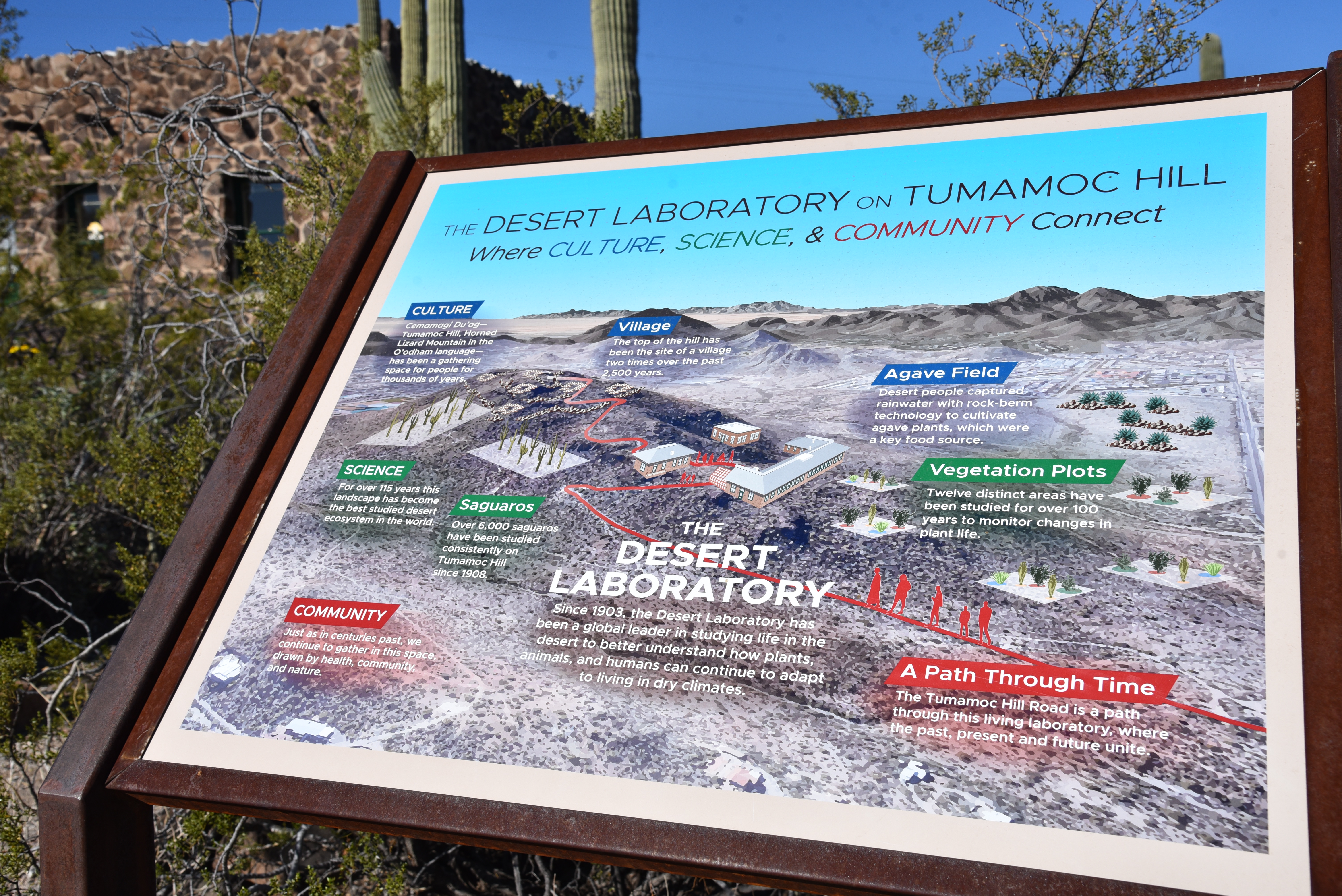
Designated a National Historic Landmark in 1975, the U of A Desert Laboratory which sits on a saddle halfway up the hill, is dedicated to ecological preservation and is a center of research, education and finding science-based solutions to challenges faced in the Sonoran Desert.
Tumamoc Hill is home to U of A Desert Laboratory

Visitors interested in augmenting their hike can download the Tumamoc Tour app. It’s an hour-long audio-video companion for smart devices that serves as a virtual docent that expounds upon on the history, ecology, archeology and native wildlife and plants encountered along the way up the hill.  

Colorful brittlebush color the hill's volcanic slopes

Even without the app, strategically-placed interpretive signs illustrate key points of interest such as the Agave Heritage Garden and an overview of the Desert Laboratory complex. 
Tumamoc Hill is an outdoor classroom

One sign explains that the name Tumamoc Hill derives from the Tohono O’odham language and means “Horned Lizard Mountain”.  Specifically, the eponymous reptile is the Regal Horned Lizard, which is the only species that lives on the hill, is an apt ambassador for the dozens of animals that thrive within the sanctuary.
The second half of the hike is steep

The 1.5-mile serpentine road hike that ascends the hill’s north face begins its 700+-foot climb on an easy grade.

An app and signs provide teaching moments

  The going gets demonstrably steeper beyond the Desert Laboratory site where  hikers can refill water bottles, take a break at benches placed at scenic overlooks or make use of the portable restrooms.  Beyond the laboratory, the road turns upward on a series of switchbacks that get more vertical at each turn and reveal vistas of the Santa Catalina Mountains to the north and nearby Sentinel Peak (2,897 feet) that’s better know as “A Mountain”. 
Saguaros line the road up Tumamoc Hill

Distant glimpses of Picacho Peak and Mount Wrightson peer out above the urban grid of downtown Tucson and surrounding suburbs topping out with a see-forever summit panorama.
Mountain vistas abound on Tumamoc Hill

Restored greenhouse at the Desert Laboratory

LENGTH: 3 miles roundtrip

RATING: moderate

ELEVATION:  2,339 – 3,098 feet

GETTING THERE:

From Interstate 10 in Tucson, take the Speedway Blvd./St. Mary’s Road  exit 257. Follow the frontage road south and turn right onto St. Mary’s Road. Continue 0.93 mile to Silverbell Road, turn left and go 0.2-mile to Anklam Road. Turn right on Anklam and go 0.15-mile to the trailhead at Tumamoc Hill Road across from St Mary’s Hospital. Park along the street, not in the medical facilities parking lots.

HOURS: 4 a.m. – 10 p.m. daily

RULES: Pets, bikes and skate boards are not allowed. Hikers must stay on the paved road.

INFO:

https://tumamoc.arizona.edu/tumamoc-hill/overview


Monday, January 6, 2020

PANTHER PEAK WASH


PANTHER PEAK WASH
Saguaro National Park, Tucson Mountain District.
Panther Peak (center distance) looms over Panther Peak Wash
Situated in an airy wilderness in the northwest sector of Saguaro National Park, Panther Peak Wash trail delves into an unusual niche of the park’s varied eco-zones.
Panther Peak (L) and Safford Peak (R) from Cam-Boh trail
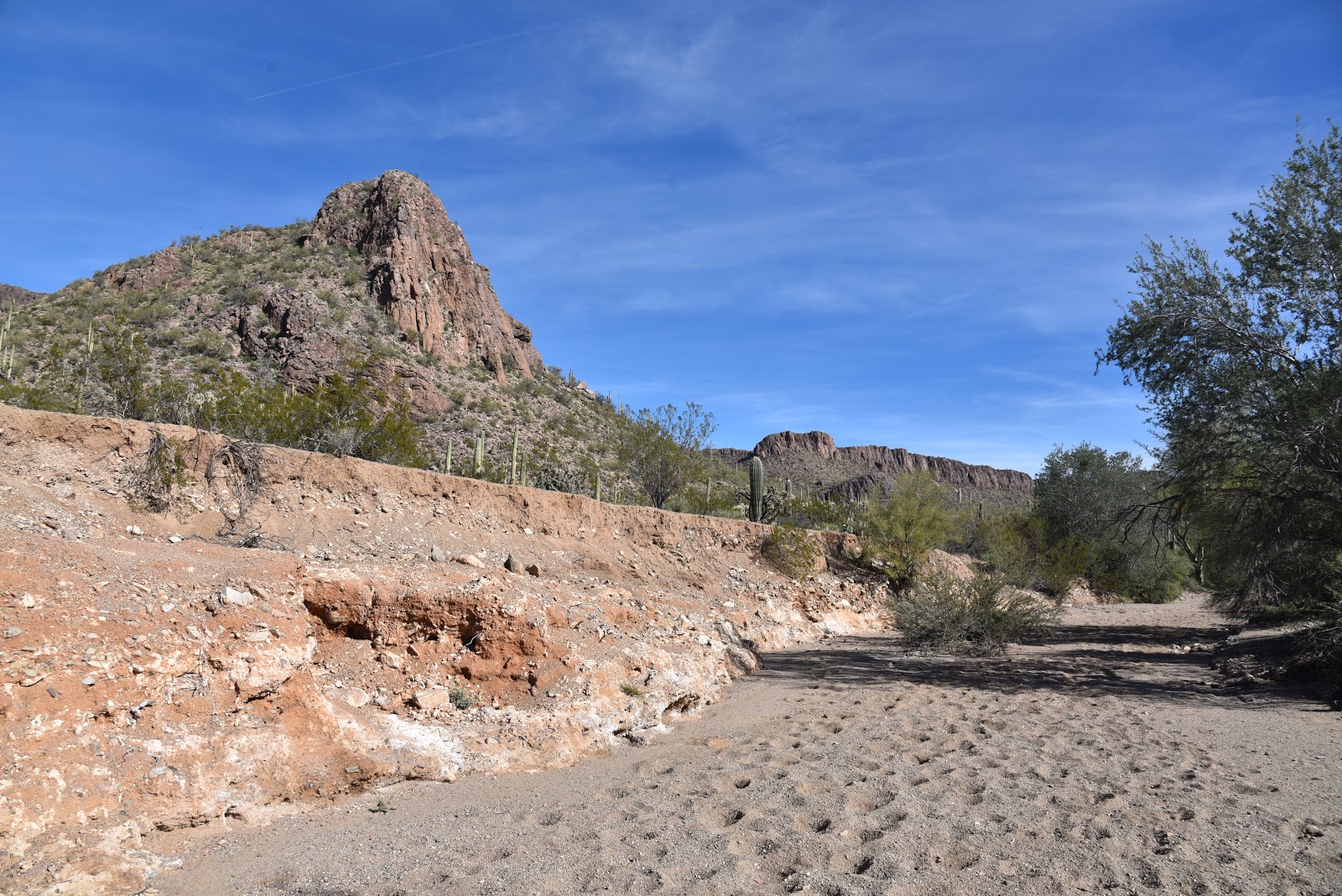
The trail sits at the base of a ragged ridgeline dominated by Safford Peak (3,563 feet) and Panther Peak (3,435 feet) and follows the sandy course of a desert drainage that funnels runoff from the surrounding Tucson Mountains. 
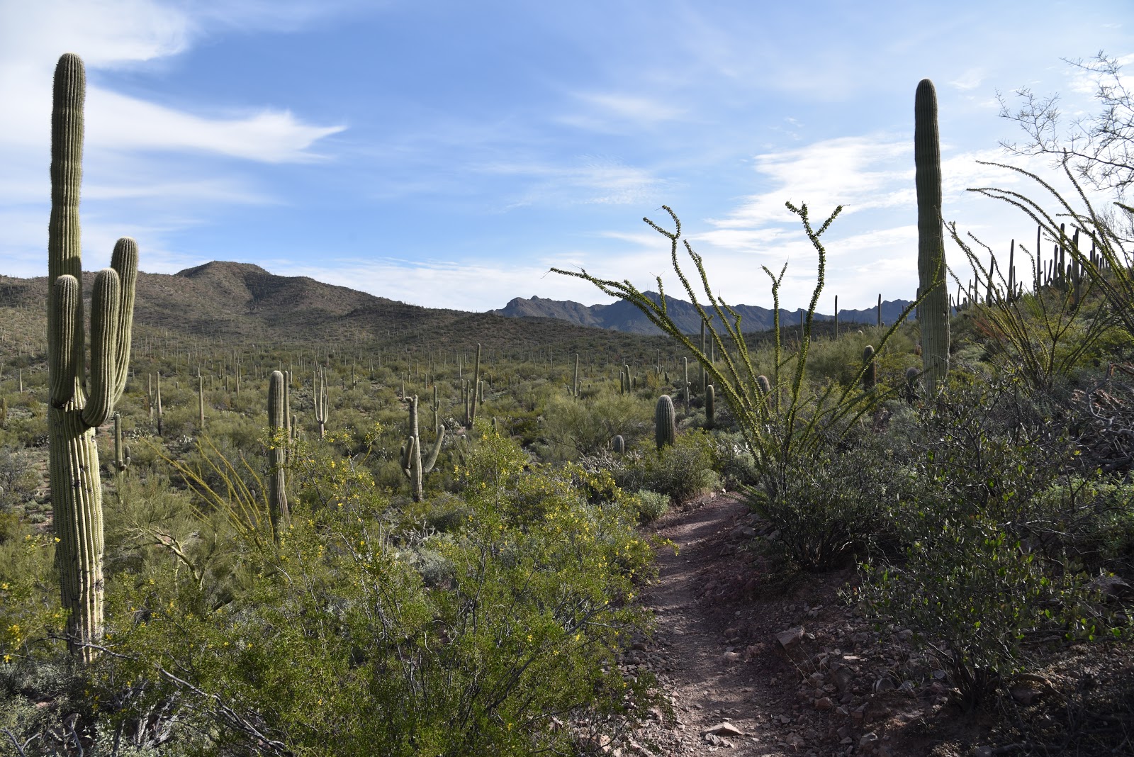
Saguaros grow above the sandy course of Panther Peak Wash
A bobcat footprint in Panther Peak Wash
A popular way to approach this hike is to make a loop by tying in the Cam-Boh and Roadrunner trails.
Santa Catalina Mtns seen from Panther Peak Wash trail
From the parking lot at the Cam-Boh picnic area, start at the west end of the lot where a map kiosk shows an overview of the route and key topographic features.  
The first leg of the hike follows the Cam-Boh trail 1.3 miles through open desert with clear views of the peaks and the Santa Catalina Mountains to the east. Massive chain fruit cholla, ocotillo and (of course) saguaros grow profusely on the sunny desert plains. The route hops over Prophecy Wash and crosses Picture Rocks Road before connecting with the Panther Peak Wash trail. After a short traipse through more flat desert on a slender single track, the route enters the wash proper. Here, the trail becomes a broad, sandy corridor that weaves among loose rock bluffs, jagged bends, shallow caves and narrow mesquite-shaded passages.
Junction for the Roadrunner trail is easy to miss
Water-scoured banks of Panther Peak Wash
Distant Picacho Peak seen from Roadrunner trail
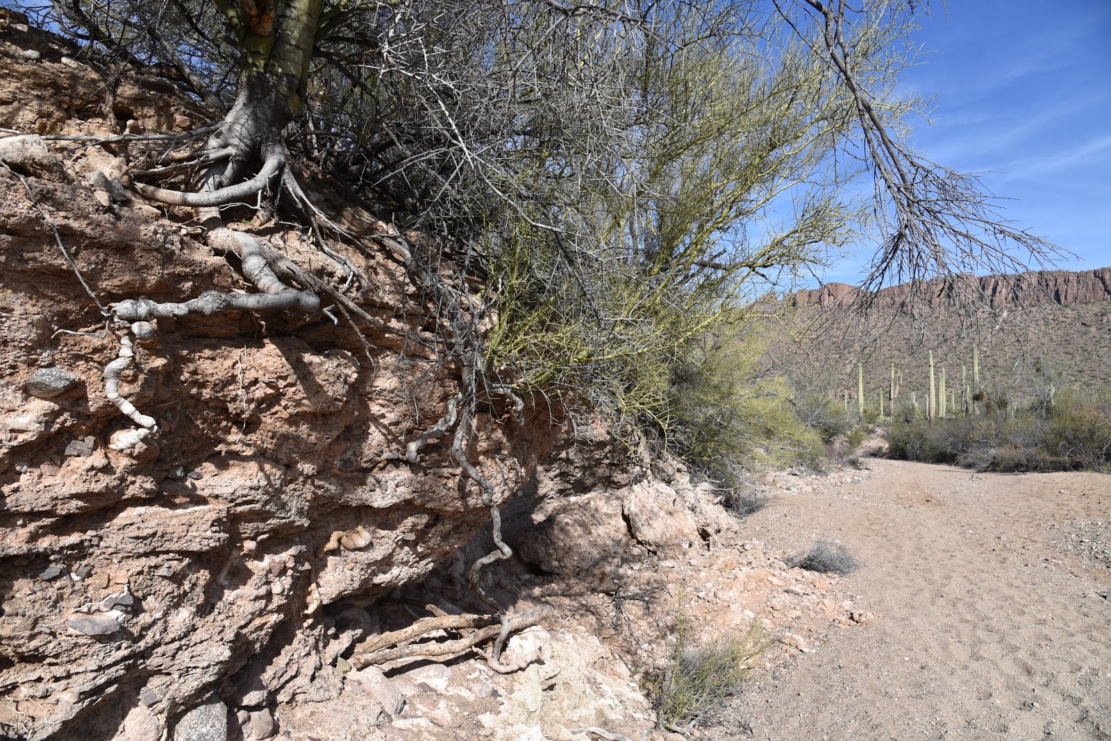
Flood waters expose tree roots in Panther Peak Wash
Mesquite trees shade a bend in Panther Peak Wash
Environment-shaping power of water is evident on the route
Scoured escarpments, jostled boulders, and piles of twisted plants torn from the roots and smashed into heaps at the base of resilient ironwoods are evidence of the environment-shaping power of running water. This is not a hike to do during or shortly following rain storms as you could be injured or swept away.
Throughout the wash leg of the route, the soaring russet form of Panther Peak stands out to the north while a wall of smaller but equally striking pinnacles hover over the trail. 
Striking geological features are plentiful along the loop hike
Between ogling the mountains and curious rock deposits, keep an eye out for the easy-to-miss turnoff for the Roadrunner trail on the left. A small metal sign set roughly 10 feet beyond the bank of the wash marks the start of the 1.4-mile return leg. Standout elements of the final mile that parallels a quiet community of ranch homes are glimpses of Picacho Peak to the northwest and views of a dense saguaro forest blanketing a craggy ridgeline.  
Cholla cacti line the Cam-Boh trail
LENGTH: 4.5 mile loop
RATING: easy
ELEVATION: 2,278 – 2,530 feet
FEE: $15 - $25 for a 7-day pass. Interagency annual passes also accepted.
There’s a scannable QR code at the trailhead kiosk to pay by mobile devise.
Fee free days for 2020: MLK Day Jan 20, April 18, August 25, Sept. 26, Nov. 11
GETTING THERE:
From Interstate 10 in Tucson, take the Ina Road exit 248 and go 2.7 miles west to Wade Road.
Continue 0.6 mile on Wade Road, turn right onto Picture Rocks Road and go 3.5 miles to the Cam-Boh picnic area on the left.  There’s a restroom at the trailhead.
INFO:

Wednesday, November 21, 2018

BROWN MOUNTAIN

BROWN MOUNTAIN
Browns Mountain Trail surprises with sweet vistas.
When compared to the soaring peaks and jagged ridges that surround it, Brown Mountain reads more like a molehill. But don’t be too quick to shrug off hiking the hill that anchors the west end of Tucson Mountain Park in Pinal County. Its wallflower appearance belies a memorable hike replete with rich Sonoran Desert vegetation and far-reaching vistas.
Ascending the flanks of Browns Mountain.
Although a hike on the moderate-rated Brown Mountain Trail is a less intimidating trek than say, adjacent King Canyon Trail to Wasson Peak, the little adventure still packs a respectable punch with some edgy exposure and steep slopes.
Overlooking the Tohono O'Odham reservation.
Seeds of a Slender Janusia vine cling to a shrub.
C.B. Brown is considered the founder of Tucson Mtn. Park.
Accessible by way of several picnic areas within the park, the hike begins with an initial descent and wash crossing before taking on the switchbacks that climb to the mountain’s crest.
Except for a few places where the trail clings to cliffs with vertical drop offs and some areas of loose rock, the climb requires only moderate effort. 
Fruits on Anderson's Thornbush.
Twisting skyward among impressive stands of saguaros, cholla, mesquite and blooming shrubs entwined with wild vines, the trail dodges stony crags stained in the colors of wine and rust.  It doesn’t take long for the ascent sweat to start paying dividends. As the trail loops up and over the mountain, it delivers a carousel-like experience of ever-changing scenery.
A rugged wash cuts into the base of the mountain.
Distant peaks on horizon.
The lower leg of the loop features views of the Tuscon Mtns.
Colorful rock outcroppings line the route.
Atop the mountain’s hogback ridgeline, an unobscured panorama of sprawling valleys and layers of mountain ranges takes center stage. To the north and east, the Tucson Mountains form a ragged wall of imposing pinnacles. To the south and west, expansive flatlands of the Tohono O’Odham reservation and the Aguirre Valley melt into the hazy silhouettes of Kitt Peak, the Santa Rosa Mountains, Mount Wrightson and the singular form of Baboquivari Peak. 
Directly north, the muted green scrub and grasslands of Saguaro National Park remind that this is one of most dense and diverse desert plant and wildlife environments in Arizona.  The return leg of the hike traces the mountain’s lower north flank capping off a short but rewarding outing.  Because this hike won’t take very long to complete, plan on extending your visit by exploring nearby Arizona-Sonora Desert Museum, Old Tucson Studios or the many attractions at Saguaro National Park.
Arizona-Sonora Desert Museum seen from the trail.
LENGTH: 3.7-mile loop
RATING: moderate
ELEVATION: 2650- 3100 feet
GETTING THERE:
From Interstate 10 in Tucson, take the Speedway Blvd. exit 257, head west and continue 9.4 miles on Speedway (turns into Gates Pass Road at 4.6 miles) to Kinney Road. Turn right on Kinney Road and continue to either of the two main access points along the road. It’s 0.8-mile to the Brown Mountain picnic area or 2.2 miles to the Juan Santa Cruz picnic area.  At the Brown Mountain site, the trail begins at the picnic area near the C.B. Brown sign. At the Juan Santa Cruz site, the trail begins just past the fenced-off ramada near a grill and picnic table.
INFO & MAPS:
Tucson Mountain Park

Monday, December 19, 2016

DAVID YETMAN TRAIL

DAVID YETMAN TRAIL

Tucson Mountain Park
View of the Tucson Mountain on David Yetman Trail
How exactly do people get a trail named for them? Well, there’s probably no one formula, but it certainly helps if you’ve made considerable contributions in the fields of conservation, outdoor recreational planning or the sweat and grind of construction and fund raising for Arizona trails. Or, maybe you become a celebrity scientist who stokes curiosity in desert biomes. David Yetman Ph.D., is that kind of guy. As a scientist, author, photographer and host of The Desert Speaks series on PBS, he’s been educating the masses for decades.  
The "stone house" is made from local rocks.
The eponymous trail is a roundup of all things desert-y offering a rich trip among Sonoran desert plants, animals and homesteading history wrapped up in the ragged peaks and jumbled washes of the Tucson Mountains.  One of the most popular attractions along the trail is the Bowen Homestead which is also known as the “stone house”. The still-standing walls and foundations of the 1930s-era ranch house can be found 1.1 miles from the Camino de Oeste trailhead. Built of native stone that mingles quietly with its surroundings, the structure appears more grown than built.
The trail is rich in desert plants and animals.
Large picture windows that lost their glass years ago, frame sharp-edged escarpments and softly rounded, saguaro-dusted slopes while the footprints of living areas hint at a life far removed from 21st-century excess. An interpretive sign at the site describes the homestead floorplan and gives some background about the Bowen family and their impact on the surrounding territory.
Bowen Homestead
The 5.9-mile one way hike is the longest route within Tucson Mountain Park’s 62-mile trail system. Because it’s anchored by two trailheads and linked to several other trails, it’s easy to customize a long out-and-back or shorter loop trips.
Mesquite trees flourish near washes that flank the trail.
LENGTH: 5.9 miles one-way
RATING: easy
ELEVATION: 2600’ – 3000’
GETTING THERE:
Camino de Oeste Trailhead:
From Interstate 10 in Tucson, take the Speedway Blvd. exit 257. Go 4.5 miles west on Speedway, veer left at the Speedway/ Gates Pass Road fork then make an immediate left onto Camino de Oeste. Continue 0.6-mile along a narrow, dirt road that’s passable by sedan to the trailhead. Roads are 100% paved.
David Yetman West Trailhead:
From Interstate 10 in Tucson, take the Speedway Blvd. exit 257. Follow Speedway/Gates Pass Road roughly 9 miles (mind the narrow, mountain curves) to the trailhead/scenic lookout on the left.
INFO:
Tucson Mountain Park
About David Yetman:
Arizona Public Media (PBS)

Monday, November 7, 2016

SWEETWATER PRESERVE

SWEETWATER PRESERVE: TUCSON
Saguaro Vista Trail

Protecting a critical wildlife corridor between the Tucson Mountains and the Santa Cruz River, Sweetwater Preserve also complements a trail-rich area of west Tucson that includes Saguaro National Park and Tucson Mountain Park. Within the 880-acre property, 16 interconnected trails combine for over 12 miles of non-motorized-use routes. For a smallish site, the trails are surprisingly varied. Based on conversations I had with local hikers and riders in the parking lot, the Saguaro Vista Trail is the best place to start exploring. Turns out, that was great advise as this cactus-cluttered pathway gets you into the good stuff quickly. Within a few minutes of mild uphill hiking, views of the Santa Catalina Mountains rising over downtown Tucson and a wildly contorted crested saguaro provide ample photo opportunities.
Santa Catalina Mountains viewed from Black Rock Loop
The trail then swings northwest where the graceful arms of chain fruit cholla and Palo verde trees frame the mounds of Wasson and Amole Peaks. Although Saguaro Vista lives up to its popularity hype, the fun doesn't end there. Each trail junction within the preserve is marked with excellent map signs that make finding your way around a cinch. The signs show a mind-boggling menu of trails that might leave you wondering which way to go. No worries though, there are no bad choices. For instance, Black Rock Loop shirts the preserve's far north sector for expansive views and a walk among jumbled basalt outcroppings. Lost Arrow Trail contours foothills above the gorge of Sweetwater Wash while The Spine traces a decommissioned road atop a sunny ridgeline. Take your pick, each trail has it's own flavor and scenic qualities making for a perfect way to spend an hour or a day in the desert.
View of Tucson Mountains from Saguaro Vista Trail
The Spine
LENGTH: 12.93 miles total
RATING: easy-moderate
ELEVATION: 2466' - 2680'
HOURS: dawn to dusk daily
Dogs must be on leash and owners must pick up and pack out waste.
GETTING THERE:
Wildflower Ridge
Sweetwater Trailhead: 4001 N. Tortolita Road Tucson.
From Interstate 10 in Tucson, take the El Camino Del Cerro/Ruthrauff Road exit 252. At the bottom of the off ramp, head right (west), go 2.6 miles to N. Tortolita Rd, turn left and continue
1 mile to the trailhead.
INFO & MAP: Pima County Parks & Recreation