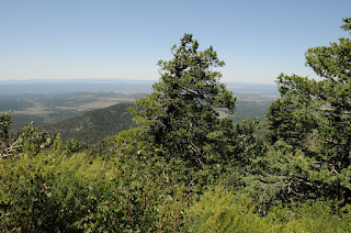
Sign up to participate in one of the many National Trails Day events scheduled for this Saturday, June 2, 2012.
There are hikes, maintenance projects and ranger-led educational opportunities being offered statewide. Check out this link to find an Arizona event near you:
http://www.americanhiking.org/NTDSearchResult.aspx?sId=3
Thursday, May 31, 2012
Tuesday, May 29, 2012
Kaibab National Forest seeks volunteers for trail work
JUNE 16-17: ARIZONA TRAIL MAINTENANCE VOLUNTEERS NEEDED
 |
| Kaibab National Forest |
FROM: Jacqueline Banks, Public Affairs Officer, Kaibab National Forest
TUSAYAN,
Ariz. – The Kaibab National Forest and the Arizona Trail Association
are seeking volunteers to assist with maintenance of the Arizona
National Scenic Trail
on the Tusayan Ranger District June 16 and 17.
Volunteers
will conduct trail maintenance on the Coconino Rim section of the trail
between Russell Tank and Grandview Lookout. Work will include clearing
fallen
trees, trimming tree limbs, cleaning water drainage features, and
removing rock, pines needles and other debris from the trail.
Any
person interested in volunteering is welcome. Those under age 18
should be accompanied by an adult. Trail work will take place all day
June 16 and until noon
on June 17. Volunteers are invited to camp on the Tusayan Ranger
District at the junction of forest roads 310 and 302 on the nights of
June 15 and 16, if they so choose.
The
Kaibab National Forest and Arizona Trail Association will provide tools
and hard hats. A large water tank will be available at the campsite.
Volunteers should
bring food, snacks, day pack, and appropriate clothing. Leather boots
are encouraged, but closed-toe shoes are required. Pants and
long-sleeved shirts are recommended.
The
Arizona National Scenic Trail is a continuous, 800+ mile diverse and
scenic trail across Arizona from Mexico to Utah. The Arizona Trail
Association’s mission
is to build, maintain, promote, protect and sustain the trail as a
unique encounter with the land.
Individuals
interested in volunteering should contact Joe Welke, Tusayan Ranger
District, at (928) 635-8219, or Tom Coulson, Arizona Trail Association,
at (480)
326-0459.
Sunday, May 27, 2012
Hiking among aspens on the Arizona Trail
Bismarck Lake to Geyler Tank
Arizona Trail Passage #34
 |
| Bismarck Lake May 26, 2012 |
Although it's fun to hike previously untried trails, there
are a few that have commandeered my soul---keeping me coming back again and
again. Bismarck Lake is one of
those trails. A breathtaking, thin air trek beneath the San Francisco Peaks,
the trail cuts through damp forests of Limber pines, aspens and Douglas firs
with intermittent meadows splattered in manic wildflower colors. Just before encountering the lake, the
trail emerges abruptly from the woodlands onto an expansive prairie with views
of the peaks soaring 3000 feet into the clouds. Here, mountain-borne breezes muddled with crisp, coniferous
perfumes rage over knee-high grasses prompting countless hat-holding photo
moments. I could stand here for hours,
soaking up what is--for me--a perfect place. Within a few yards after entering the prairie, a sign points
to a short spur path leading to the lake. As with most volcanic
lakes---Bismarck is an eroded cinder cone crater---this one vacillates from a medium-size
pond to muddy puddle, and yesterday, it was virtually non-existent. Still, the side trip pays off with
patches of water-loving blooms and animal footprints including elk, deer,
raccoons and bear. To extend the
hike, head back to the sign and continue 0.2 mile east to the Arizona Trail
junction. On past trips, we've
headed right (south) and hiked through an aspen wonderland to Snowbowl Road, so
this time, we headed left with the objective of hiking out-and-back to Geyler
Tank. We did this on May 26, 2012, an unseasonably cool, very windy day. Temperatures for the day were 37-50
degrees with 40 mph wind gusts---heaven!
Here’s what we did:
From the trailhead, hike 1 mile to Bismarck Lake
junction. A short spur trail heads
to the water, but we skipped the trip because there was no water in the
lake. From the lake, follow the
trail east another 0.2 mile to the AZT junction. Turn left (north) and continue 4 miles to FR418, cross the
road and hike less than a mile to a large meadow west (left) of the trail at
the base of an old volcano (Walker Lake is inside). Geyler Tank is located 0.2
miles west of the trail.
LENGTH: 12.2 miles roundtrip
RATING:
easy
ELEVATION: 8,500' - 8900'
GETTING THERE:
From Phoenix, go north on I17 to Flagstaff. Connect with US180 and travel 10.2
miles north to milepost 225 and turn right onto Hart Prairie Road (FR151). Follow FR 151 6.4 miles (passing by the
Nature Conservancy) to FR 627.
Turn right and continue 0.6 mile to the trailhead. FR 151 and FR 627 are
dirt and usually passable by sedan.
INFO: http://www.aztrail.org/passages/pass_34.html
INFO: http://www.aztrail.org/passages/pass_34.html
MORE PHOTOS:
Subscribe to:
Comments (Atom)


