Find A Trail. Start Your Search Here:

Showing posts with label Sunset Crater Volcano national Monument. Show all posts

Monday, June 22, 2020

Brandis Trail

BRANDIS TRAIL
Survivor pines near the Deer Hill Trail junction

Ten years ago this month, the Schultz Fire was ravaging the eastern slopes of Flagstaff’s San Francisco Peaks.
Trailhead gate on the Brandis Trail
The human-caused blaze, ignited from an abandoned camp fire on June 20, 2010, went on to burn more than 15,000 acres of Coconino National Forest before being contained 10 days later. The fire was followed by one of the wettest monsoon seasons on record which lead to devastating flooding. Without trees and other vegetation to stabilize and absorb runoff, heavy rains created rivers of debris that further eroded the landscape leaving behind a charred moonscape of sludge and an eerie wilderness of torched tree trunks and ashen gullies.


Evidence of the 2010 Shultz Fire come early in the hike
Extend the hike on the Deer Hill Trail
Mountain gromwell sprout tiny white flower heads
Sunset Crater (left horizon) seen from Brandis Trail
Pollinators swarm around Rocky Mountain beeplants
Pine sprouts grow among casualties of the Schultz Fire
O'Leary Peak (right horizon) viewed from Brandis Trail
Schultz Fire scar on eastern slopes of San Francisco Peaks
Frothy Apache plume shrubs color the trail.

Borne of volcanism that began shaping the area millions of years ago, this mountainous parcel in Northern Arizona is no stranger to fire. Whether brought on naturally by lighting or lava or by human carelessness, fire drives uneasy cycles of destruction and resurgence that’s aren’t going away anytime soon.
Brandis Trail access point 
Ten years removed from the blaze, the area is in recovery mode, transitioning from what had been a place of thick coniferous woodlands, alpine meadows and forested foothills into a much different, starkly beautiful destination. The blaze damaged several popular hiking trails including the Little Elden, Little Bear, Sunset, Heart and parts of the Arizona Trail. But two outlier routes that suffered the kind of odd, patchy damage to vegetation that melds islands of old growth survivors with resurgent sprouts provide enlightening walking tours of an emerging landscape.
Skunk bush--one of many blooming shrubs on the trail
Even before the fire, the Brandis and Deer Hill trails weren’t big-name attractions but instead offered less crowded, easy treks at the base of San Francisco Mountain with no difficult climbs or confusing junctions. The Brandis Trail, located at the edge of a residential area less than a mile from U.S. 89 north of Flagstaff, wanders through the fire scar and is a good path to follow to see how the forest is regenerating.
The 1.4-mile, straight-shot route heads due west toward the peaks beginning with a short hike among unscathed pines. Within a quarter mile, though, views of charred tree trunks that hover precariously over acres toppled logs deliver a gut-punch to those who recall the woodsy pre-fire environment.  The upside is that the near treeless terrain is now replete with unobstructed views of nearby O’Leary Peak, a 8,916-foot  lava dome volcano and Sunset Crater a young, 8,042-foot cinder cone and focal point of Sunset Crater Volcano National Monument. Interestingly, the now dormant volcano turned tourist attraction was the source of a curtain of fire that disrupted life here about 1,000 years ago.
Brandis trail roughly traces a drainage gorge where resurgent shrubs, wildflowers and saplings are encouraging signs of life regaining its hold. Healthy swaths of silvery rabbitbrush, mountain gromwell, penstemons, Rocky Mountain beeplant and Apache plume add color and sink stabilizing roots into the fragile soils while intermittent stands of survivor pines, oaks and junipers stand in testimony to the sometimes bizarre movements of wildfires.  The trail gets a little sketchy where it crosses the winding drainage several times. To stay on track, know that at the crossings, the trail picks up directly on the other side, not down the wash as random footprints might suggest.
At the 1.3-mile point, a livestock gate stands near one of the few shady areas on the trail. Pass through (close it behind you) and continue on to the turnaround point at the Deer Hill trail junction. For an optional, longer hike, the left leg heads 4 miles south to connect with the Little Elden and Arizona Trail while the right leg goes 1.5 miles north to its terminus at Schultz Pass Road.
The trail traces a scoured drainage 
A Yellow salsify flower gone to seed
Yellow salsify is a common bloomer along the route
LENGTH:  3 miles roundtrip (Brandis Trail only)
RATING: easy
ELEVATION:  6,840 – 7,212 feet
GETTING THERE:
From the Interstate 17/40 interchange in Flagstaff, go east on I-40 to exit 201 for U.S. 89 north.
Continue 8.2 miles north on U.S. 89, turn left on Brandis Way and go 0.8-mile to a parking apron at the corner of Brandis Way and Ostrich Lane.  The trailhead is located at the end of a fenced easement at the end of Brandis Way. Please respect private property in the area by not blocking driveways or attempting to drive on the easement.
INFO:

Monday, June 4, 2018

LAVA’S EDGE TRAIL

LAVA’S EDGE TRAIL

Sunset Crater Volcano National Monument.
Sunset Crater seen from Lava's Edge Trail
Volcanoes are one of earth’s most powerful and mesmerizing geological features.  Simultaneously beautiful and terrifying, they can hibernate for years before rumbling back to life spewing fiery ash clouds and fountains of molten rock that create indescribable paths of destruction.  Recent eruptions of Hawaii’s Kilauea and Guatemala’s Fuego volcanoes remind us of the landscape-altering forces inherent in these natural phenomena.
O'Leary Peak lava dome towers over the Bonito Lava Flow
Although Arizona is more commonly associated with saguaro-studded deserts, gaping chasms and red rock formations, much of the state’s landscape is a product of volcanism.  The San Francisco Volcanic Field north of Flagstaff is home to more than 600 extinct volcanoes that sprawl over the edge of the Colorado Plateau from Williams to the Little Colorado River.  Many familiar hiking trails climb to the summits of these ancient and eroded snuffed smokers.  Humphreys Peak, Kendrick Peak, Benham and O’Leary Peak are just a few examples. 
San Francisco Mountain is an extinct stratovolcano
Views from the tops of these classic trails showcase a landscape dotted with cinder cones, lava domes and expansive lava flows that melt into the colorful flatlands of the Painted Desert and the edge of the Grand Canyon.  To complement the impressive highpoint overviews and get a close look at the inner workings of a young volcano, take a hike on the Lava’s Edge Trail.  The 3.4-mile roundtrip trail is one of several within Sunset Crater Volcano National Monument that explore ground-level volcanic features.  The moderate-rated route shoveled out of crunchy cinders and soft black sand traces a ragged hem of a petrified magma skirt.  Geologists date the eruptive phase of Sunset Crater to between the years 1040 and 1100 which means the volcano’s birth was undoubtedly witnessed by the Hopi and Zuni people who lived nearby.
Aspens sprout from creases in the inky basalt
 The 1000-foot cinder cone blew ash and debris for miles around before liquid rock oozed from its western base forming the Bonito Lava Flow.  Lava’s Edge Trail wanders through the hardened remains of the flow.  The free-flowing aa—jagged basaltic lava—cooled into bizarre razor-edged slabs, contorted pillars, splatter cones, crusty walls and arched squeeze ups.  The acres of raw, blocky basalt look as fresh as the flows shown spilling from Kilauea on the nightly news. 
The hike is on rough cinders and black sand
Over the past 900 years, plant life has struggled to take hold in the steely ground.  Still, a stronghold of hearty Ponderosa pines, pinions, skunk bush and aspens have taken root in crevasses where water and organic materials provide hospitable conditions along the route.  In addition to the other worldly lava field and its parent 8039-foot cinder cone, the trail is flanked by two other types of volcanoes.  To the north of the trail, the double-humped form of O’Leary Peak (a lava dome volcano) soars to 8,916 feet while to the west, the bald peaks of San Francisco Mountain (a stratovolcano) top out at 12,633 feet.  
A Ponderosa pine frames the San Francisco Peaks 
To better understand the science behind the trail’s many points of interest, stop by the visitor center to view informative videos and displays or take part in a ranger talk.  As quiet and peaceful as the dormant volcanic highlands might appear; don’t be fooled.
Pines shade the black sand path
The fireworks aren’t over yet.  
The San Francisco Volcanic Field is still considered to be active, with the next event predicted to happen to the east of Sunset Crater.  Whether the earth resumes its fire show in the coming minutes or not for a million years, recent events in Hawaii have given us a vivid preview of what it might look like.
Rough aa lava cooled into bizarre sculptures
LENGTH: 3.4 miles roundtrip
RATING: moderate
ELEVATION: 6920 - 6960 feet
GETTING THERE:
From the Interstate17/40 junction in Flagstaff go east on I-40 east to the U.S. 89 north exit.  Continue north on US89 to the turn off for Sunset Crater (FR545), located just past milepost 430.  Turn right and follow the signs 2 miles to the park entrance.  From the fee station, continue 1.3 miles to the signed trailhead on the left.  
Sunset Crater and the Bonito Lava Flow
FEE: Park entry fee is good for 7 days of exploring within both Sunset Crater Volcano and Wupatki National Monuments. See website for fee schedule, free days and accepted passes.
INFO & MAPS:

Sunday, May 26, 2013

Marginalized mountain gets some love


O'LEARY PEAK
Flagstaff
Destination: O'Leary Peak in background

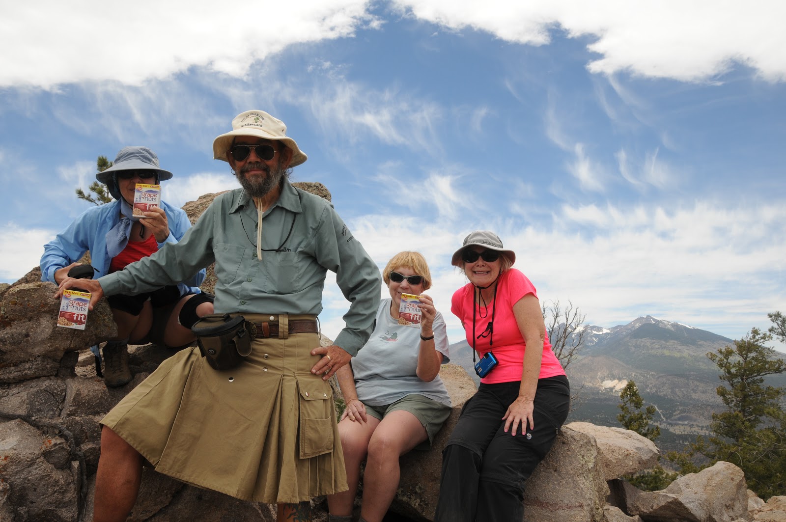
Hiding in plain sight between Sunset Crater National Monument and Arizona's loftiest mountain is O'Leary Peak--- a dormant lava dome volcano with a character unlike its geological neighbors.  Normally, this trail sees only little-to-moderate hiking traffic, but this week was different.  First, the annual Arizona Highways Summer Hiking Guide hit newsstands and features O'Leary as one of its favorite destinations (nice pick, Robert!). And, I selected this trail for my contribution to the Grape-Nuts Summit Sampler event.  So, good  'ol O'Leary is suddenly getting the recognition it deserves. What turns hikers off about this route is that it's on a closed gravel road (no, you cannot drive to the summit unless you're with the forest service) all the way to the top.  However, it's a big mistake to discount this hike because of that.  In fact, because this no-route-finding-no-worries trail eliminates the need for maps and GPS, hikers are freed up for unrestricted gawking at the surrounding San Francisco Volcanic Field.  It’s helpful to dust off your Geology 101 textbook prior to hitting this trail.  That's because you'll be treated to a mélange of volcanic formations included lava flows, cinder cones, a strato volcano (San Francisco Mountain/Humphreys Peak) and of course O'Leary itself which is comprised of mostly an igneous rock called dacite. The climb is an unmitigated haul up the mountain's south face.  Switchbacks transition from wide and gradual to short and abrupt near the summit.  The effort pays off though with birds eye views of Sunset Crater National Monument that could otherwise only be seen by helicopter.  As the trail reaches its high point, there are terrific views of the Painted Desert, Grand Canyon and the more than 600 volcanoes that populate the southern edge of the Colorado Plateau. On the summit, an official elevation sign beneath a fire tower makes for the perfect way to commemorate the climb with photos.  The tower is not ordinarily open to visitors, however on our visit, the forest service worker invited us up--and we, of course, handed her some Grape-Nuts Fit samples!
Taking a break on the summit


LENGTH: 10 miles roundtrip
RATING: difficult
ELEVATION: 6956' - 8916'
GETTING THERE:
From Phoenix, go north on I-17 to the junction with I-40 just south of Flagstaff.
Head east (right) on I-40 and continue to the junction for AZ89 NORTH at exit 201.
Follow AZ89 north to the entrance for Sunset Crater at milepost 430.3.
Turn right onto Sunset Crater Road (FR545) and go 1.7 miles to FR545A, which is signed for O’Leary Group Campground. Turn left on FR545A and go 0.25 mile to the parking area on the right near the gate for O’Leary Lookout.

View of San Francisco Peaks from the trail

INFO: Flagstaff Ranger District, Coconino National Forest, 928-526-0866

MORE PHOTOS:

Monday, August 13, 2012

Walking Wupatki: Part 6

LENOX CRATER
Sunset Crater Volcano National Monument
Summit of Lenox Crater

View from the trail
Woe to Lenox Crater. Crushed, pummeled, bullied and ultimately overshadowed by its younger, more aggressive volcanic neighbors, this humble cinder cone is older than the tumultuous lava flows and red-tinged peaks that have nearly obliterated its rounded and relaxed profile. Unlike the park’s star attraction---Sunset Crater---it's okay to climb Lenox. It's not a difficult hike, however, pea-to-pebble-sized black cinders underfoot create a mildly hazardous carpet of sandpapered marbles.  Ponderosa pines and Gambel oaks shade the trail on its way up to the summit. On top, there's no discernable "crater”, but an impressive cinder-ash flow sliding down the south face is evidence the hill's explosive past.  Take a moment to scoop up a handful of cinders and examine the structure and lightness. Pumice like this can sometimes float on water and has been used to smooth and file rough skin. Each of these pebbles began life as a molten projectile spit from the crater like terrestrial meteorites.  To the north, the mounds of O’Leary Peak and Strawberry Crater stand out above the Bonita Lava Flow.  Both of these volcanoes---located outside of the monument boundaries---are climbable and although, Lenox Crater concludes the Walking Wupatki series of hikes---guess where I'm going next? 

LENGTH:  1 mile roundtrip
RATING: moderate (loose footing)
ELEVATION: 6,940' - 7,240
PETS: are not allowed on any park trails in buildings.  
Please do not leave pets in cars---heat can be fatal.
FACILITIES: restroom, visitor center, vending machines
GETTING THERE:
From Flagstaff, travel north on US 180 to milepost 444.5.  Turn right and continue 30 miles to the turn off on the left. Roads are 100% paved. Alternate access: enter the park from US 180 at milepost 430 and go 5 miles to the trailhead.
INFO: National Park Service, 928-679-2365
MORE PHOTOS:

Thursday, August 9, 2012

Walking Wupatki: Part 5


LAVA FLOW TRAIL
Sunset Crater Volcano National Monument

Moving south ---and about 2000 feet uphill-- from Wupatki National  Monument,  scenic "volcanoes and ruins" loop road enters the tortured terrain of Sunset Crater National Monument.  Complementing a bevy of  scenic view roadside pullouts  for casual sightseers; two hiking trails delve deeper into the otherworldly landscape.  First up: the Lava Flow Trail.  This hike-by-numbers trek uses a guide booklet available in a box at the trailhead or the visitor center down the road to describe various volcanic features along the route. The trail has a .25-mile section that's paved and barrier-free, but the remainder of the trail requires sturdy (closed toe) footwear as it moves over some rough-around-the-edges lava.  Just under a mile in length, the trail manages to get hikers into the guts of a massive lava flow that issued from the base of Sunset Crater some 900 years ago.   In terms of geological time, this is newborn rock. Unfettered by the ravages of time, the molten crust that  squeezed, belched, oozed and sprayed from the belly of the earth retains its wild, "fresh from the smelter" veneer.  All around the trail, a placid sea of black cinders peppered with hardy tree sprouts laping  at the base of Sunset Crater Volcano belies  a history of fire raining from the sky.

LENGTH:  1 mile loop
RATING:  easy (some loose rock and steps)
ELEVATION: 7,000' - 7,050'
PETS: are not allowed on any park trails in buildings.  
Please do not leave pets in cars---heat can be fatal.
FACILITIES: restooms,  vending machines and water  at the visitor center
GETTING THERE:
From Flagstaff, travel north on US 180 to milepost 444.5.  Turn right and continue 29.5 miles to the  turn off on the left. Roads are 100% paved. Alternate access: enter the park from US 180 at milepost 430 and go 5.5 miles to the trailhead.
INFO: National Park Service, 928-679-2365
MORE PHOTOS:

Tuesday, September 20, 2011

LENOX CRATER & LAVA FLOW TRAIL

LENOX CRATER & LAVA FLOW TRAIL
Sunset Crater Volcano National Monument
San Francisco Peaks from Lava Flow Trail

Stranded at the trailhead.  That was me last Saturday when ALL of my hiking pals opted out on a planned hike in a remote area north of Flagstaff.  As we all know, it's not a real good idea to hike alone in seldom-traveled territory (see the movie 127 Hours) so, given that I still wanted to hike up north, I decided to alter my plans and solo hike a couple of the little touristy trails festering on my “some day” list.  That way, if I broke a leg or something, there would be several dozen people milling around ready to assist (or gawk).
O'Leary Peak from Lava Flow Trail
The new destination became Sunset Crater Volcano National Monument and two easy lava-themed trails within the park. First up, Lenox Crater.  This short, up-and-back scenic trail climbs on crumbly volcanic ejecta to the top of an eroded cinder cone. The summit vent of this extinct fire spitter has long since worn way, but nice views of the eastern slopes of the San Francisco Peaks make up for the loss.  From this 7,000-foot vantage point, damage from the 2010 Schultz Fire appears as a massive swath of ash-brown stubble across the foothills.  At the trailhead, there's a fenced viewing area overlooking the rough-hewn geology of the Bonito Lava Flow—a fractured sea of basalt issuing from the base of Sunset Crater. It's a popular stop for people taking car tours of the park---so beware of rubbernecking drivers!  In terms of geological time, this volcanic event is very young, so the inky-black lava retains the sharp-edged rawness of new-borne rock.   Just up the road is the Lava Flow Trail.  This turned out to be much more enjoyable hike than I had anticipated.  The stark volcanic terrain is a mesmerizing maze of jagged Aa flows, acres of eerily fused pyroclasts and taffy-like rivers of Pahoehoe.  In addition, there's an ice cave, a splatter cone “mini volcano” and sweet glimpses of nearby 8,916-foot O'Leary Peak (a lava dome volcano).   Booklets available at the trailhead coordinate with numbered points-of-interest along the trail, providing a substantial dose of learnin' about the local geology, flora fauna and human history. Sadly, the day's (whopping) two miles of hiking went by in a flash--I was done by noon.    That provided the perfect excuse to squander the afternoon buying candles and coffee in historic downtown Flagstaff.
Lenox Crater Trail

LENGTH: Lenox Crater: 1 mile roundtrip
Lava Flow Trail: 1 mile loop and a 0.25 barrier-free interpretive trail
RATING: easy-moderate (uneven footing and loose rock)
ELEVATION: Lenox Crater: 6,940'-7,240'. Lava Flow: 7,000'-7,050'
DISTANCE FROM PHOENIX:  166 miles one way
BEST SEASON: year round (may be snow in winter)
GETTING THERE:
Summit of Lenox Crater
From Phoenix, go north on I-17 to the I-40 junction in Flagstaff.  Follow I-40 east to the US89 north exit.  Continue north on US89 to the turn off for Sunset Crater (FR545), located  just past milepost 430.  Turn right onto FR 545 and follow the signs 2 miles to the park entrance.  From the fee station, continue 1.3 miles to the signed Lenox trailhead.  The Lava Flow trail is another 0.5 miles farther up the road--can't miss it. 

FEES: $5 fee per vehicle.  Pass is good for 7 days.
FACILITIES: restrooms, water, visitor center
INFO: http://www.nps.gov/sucr/index.htm, Visitor Center phone: (928) 526-0502
MORE PHOTOS: Lava Flow Trail:

MORE PHOTOS: Lenox Trail: