Find A Trail. Start Your Search Here:

Showing posts with label Greer. Show all posts

Monday, August 19, 2019

GREENS PEAK: Hike to the High Point of the Springerville Volcanic Field

GREENS PEAK
The beastly profile of Greens Peak near Greer.
From a distance, the lopsided hump of Greens Peak with its sparsely vegetated south face and top fringe of conifers resembles the shaggy profile of an African wildebeest.
Escudilla Mountain (horizon on right) seen from Greens Pk.
The funny-looking hill sits a few miles north of State Route 260 near the town of Greer, between the lofty peaks of eastern Arizona’s White Mountains and the colorful badlands of the Petrified Forest National Park and offers a unique vantage point in the ecoregion between alpine forests and high-desert plains.
Looking toward Springerville from Greens Peak
Mima mounds dot the meadows around Greens Peak
The hike climbs to the top of a cinder cone volcano
Fleabane grow in dense clumps along the route
Aspens thrive on the north face of Greens Peak
The 10,134-foot extinct cinder cone volcano is the highest point of the Springerville Volcanic Field-- a swath of hundreds of diverse geological wonders that runs roughly between the towns of McNary and Alpine. Surrounded by miles of open rangeland, meandering creeks and sweet-smelling fir-spruce woodlands, the area is also home to dozens of easy-to-explore volcanic elements and glacial imprints. For an in-depth but approachable read about this fascinating corner of Arizona, check out A Guide to the Geology of the White Mountains and the Springerville Volcanic Field, Arizona by John V. Bezy and Arthur S. Trevena. It’s available as a free download on the Arizona Geological Survey website. 
Hundreds of geological features are visible from Greens Pk
The book describes several field trips to some of the area’s most interesting peculiarities. The keynote trip is a hike up to Greens Peak.  
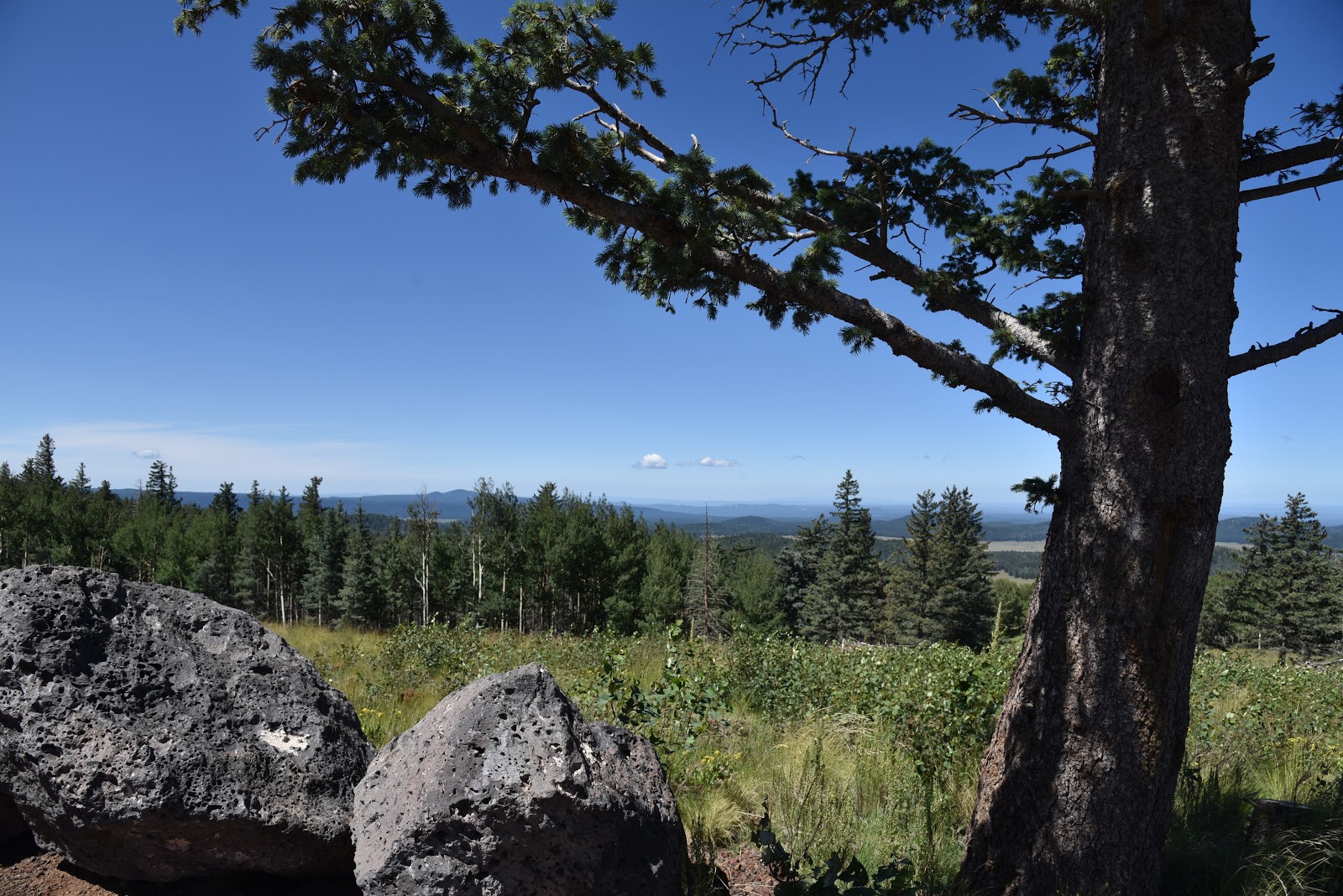
Summit of Greens Peak has great views in all directions
With its beastly appearance and half bald, half forested slopes, the mountain is a natural draw for curious visitors in search of an off-the-radar summit hike with primo views. Although it’s short in length and ascends on a gradual, undulating grade, the trek is not for the faint-of-heart. It begins at over 9,000 feet in elevation where thin air will tax the lungs of unacclimated Valley dwellers. If you’re not up to the 600-foot haul to the summit, there are plenty of curiosities to explore around the mountain’s base including the mima (pronounced may-muh) mounds.
Sunrise ski area and Fence Tank seen from Greens Peak
One of the enduring mysteries of White Mountain geology, is the origin of the mounds.
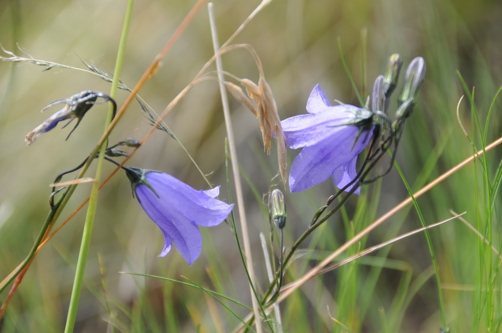
Harebells bloom in alpine meadows through September
Rodents, imbedded root systems and creatures from outer space all have been credited with making these roundish, lumps of gravel that average 2 feet high in the breezy meadows below the peak.
Summit marker on 10,134-foot Greens Peak
The prevailing theory is that these odd lumps are remnants of a glacial ice field that receded some 25,000 years ago leaving behind a landscape that smacks more of Iceland than Arizona.   
A pollinator alights on a Western yarrow plant.
Don’t be intimidated by the hill’s steep, stark appearance. Following an edge-hugging road that makes a 180-degree swing along the mountain’s west and south flanks, the steady uphill slog is easier than it looks.  Along the lung-pumping climb, vista points appear around every kink in the road.
North view from the summit of Greens Peak
Look for surrounding hike hubs like Pole Knoll, Mount Baldy (11,420 feet) and the trails around Big Lake. Near the top, the distinctive profile of Escudilla Mountain (10,912 feet) that sits near the New Mexico border shows a frenzy of aspen resurgence in the scar of the 2011Wallow Fire.  On the summit, a fire lookout and communication towers rise above the coniferous woodlands that cover the mountain’s northeast flanks.
Greens Peak seen from nearby Fence Tank corral.
To the south, the web-like patterns of ski runs at Sunrise Park Resort near Greer stand out above a landscape of misshapen volcanic bluffs, mounds and eroded cones.
Cattle graze in meadows at the base of the mountain.
The mountain’s breezy high-elevation edges are also ideal for birdwatching or spotting herds of pronghorn, elk and ubiquitous cattle roaming among lumpy grasslands and watering holes below.
A fire lookout and communication towers on the summit
LENGTH: 2 or 4 miles roundtrip
RATING: moderate
ELEVATION: 9,520 – 10,134 feet
GETTING THERE:
From Pinetop-Lakeside, travel east on State Route 260 (toward McNary).  Continue to roughly 3 miles past State Route 273 to Forest Road 117 near milepost 380 on the left (about a mile past the Railroad Grade trailhead).  Follow FR117 north for 3 miles to a "Y" junction at Forest Road 61 where a sign reads “Greens Peak 2 miles”. You can park here for a 4-mile roundtrip hike or veer left and drive another mile to the next “Y” intersection at FR61/61C
for a 2-mile hike.  Roads are maintained dirt and cinder and passable by sedan.
INFO: Arizona Geological Survey
Arizona Wildlife Trails:

Monday, August 21, 2017

INDIAN SPRINGS TRAIL # 627

INDIAN SPRINGS TRAIL # 627
Indian Springs Trail
Late summer in Arizona’s White Mountains is prime time for wildflower viewing. Cooler evenings take the edge off daytime heat and mornings break in a crisp dewy dampness that hints of autumn and nurtures a colorful spectacle of blooming plants. Fields of sunflowers dress roadside pastures making the annual bloom frenzy accessible to anybody willing to take a drive and pull off onto a random dirt road.
Apache Lobelia
But if you want deeper access to high altitude botanical treasures, lace up your hiking boots, strap on a backpack and hit the Indian Springs Trail near Big Lake.
Paintbrush and ferns
The 2011Wallow Fire roared across this classic trail of fir-spruce woodlands taking out some segments while leaving others mostly intact.
Richardson's Geranium
The upside to the loss of coniferous canopies is a sunlight-generated surge in wildflower proliferation. The best part about loop trails like this one is its mix of sun, shade, hydrology and micro climates that produce a wide variety of flowering plants.
The blossom bonanza begins right from the get go in a bud-dotted meadow. Here, sun-loving fleabane and harebells bob in mountain breezes. Beyond the trailhead, the path moves into a section of survivor pines and the filtered light domain of species like Richardson’s Geranium, Pleated Gentian and brilliant orange Paintbrush.
Indian Spring suffered damage from the 2011 Wallow Fire
A passage of wild red raspberries and ferns culminates at the junction for the optional half-mile spur trail that leads to Big Lake Lookout. Although the fire tower that stood on this rocky knob succumbed to the blaze, there’s an upside. Lake views are now easier to see through toasted stumps and resurgent shrubs.
Wild Raspberry shrubs and ferns
The next section of the hike passes through an old growth forest of fir, spruce and mature aspens. This darker, wetter space favors Canada violets, mushrooms and  Blue-eyed grass. At the 1-mile point, the reliable trickle of Spillman Spring creates a water garden of clovers and Seep Monkey Flowers that grow in bright clumps in and around the rustic wooden troughs set up to catch the flow. Fire damage is much more visible throughout the remainder of the hike. Thickets of aspen saplings account for much of the regrowth.
Seep Monkey Flowers
In these areas, look for Common mullein, Apache lobelia and Spurred Gentian.
Indian Spring appears as a mucky pond at the 2.5-mile point.
Red Raspberry
The swamp’s fringe of Rocky Mountain irises that bloom May thru June, are  long past prime by mid-summer.
Harebells
Beyond the loop’s halfway mark, marshy areas define the trail’s lowest elevation.  Runoff collects in soggy bogs and funnels into streamlets that feed the tributaries of the Black River. These swales are the habitat of False Hellebore, horse mint, New Mexican checker mallow, lupine and penstemones. At 5-miles there’s an option to add on the 6-mile round trip West Fork of the Black River Trail #628 before the route curves back to the start point. 
False Hellebore
Water Hemlock

LENGTH: 7.5-mile loop (8.5 miles with lookout side trip)
RATING: moderate
ELEVATION:  8600’ - 9415'
Pleated Gentian
GETTING THERE:
From the Hon-Dah casino in Pinetop-Lakeside go 19.6 miles east on State Route 260 to State Route 273, just past milepost 377 and signed for Sunrise Ski Area. Go 19.2 miles south on SR 273 (turns into Forest Road 249 past the Big Lake turnoff) to Forest Road 249E, turn right and continue 0.4 mile to the trailhead on the left. Roads are paved up to FR 249E which is good gravel.
INFO & MAP: Apache-Sitgreaves National Forest
https://www.fs.usda.gov/recarea/asnf/recreation/recarea/?recid=45143&actid=24

Monday, June 5, 2017

THOMPSON TRAIL #629

THOMPSON TRAIL #629
Apache-Sitgreaves National Forest
Parts of Thompson Trail survived the Wallow Fire
Trails with good bones have a way of reinventing themselves after a major wildfire. When the 2011 Wallow Fire---the largest in Arizona history-- roared through the woodlands around Mount Baldy and Big Lake, the nearby Thompson Trail #629 suffered heavy damage that will change its character as it recovers. Because of its good bones, the classic White Mountains route that follows the West Fork of the Black River still embodies everything great about high country trails—a creek with native fish, moss-laced trees, clump grass meadows and shadowy forests teeming with wildlife.
West Fork of the Black River flows along the trail
But the blaze altered its feel. The fire impacted the trail in patchwork style leaving some sections intact and others charred beyond recognition. The most noticeable change is the loss of shade-casting fir and spruce trees that had covered the canyon walls surrounding the stream. Where the fire burned hardest, the trail is now sunnier than its former self, allowing for the emergence of aspen trees that had been smothered by the conifers. Colonies of white-bark aspen sprouts are quickly claiming the space beneath blackened trunks and will eventually mature to replace the former darkly imposing canopy with a mottled sunshade.
Marsh marigold
In the six years since the fire, most of the ash and smoky residues have washed away revealing a scared but healing landscape.

The hike begins at the mouth of a gorge where the river meanders in oxbow curls. Within the first half-mile, two dams built as barriers to protect the native Apache trout population form still ponds and roaring waterfalls. Never straying far from the river’s edge, the trail passes through survivor forests and moist cienegas where rock piles and stepping stones mark the way through abundant shrubs, forbs and wetland wildflowers like marsh marigolds and prairie smoke. Interesting geology is another key feature of the hike---watch for an impressive volcanic dike on the west cliffs and tufts of red columbine growing from pock holes on basalt boulders. The trail ends where the 2.5-mile West Fork of the Black River Trail #628 begins with a knee-deep creek crossing. However, if you’d like to keep your feet dry, just turn back here and enjoy the trek in reverse.
Prairie Smoke
LENGTH: 6.5 miles roundtrip
RATING: moderate
ELEVATION: 8600’ – 8840’
GETTING THERE:
From Show Low, go 35 miles east on State Route 260 to State Route 273, just past milepost 377 and signed for Sunrise Ski Area.Turn right and continue 14 miles to Forest Road 116 (signed for Reservation Lake), turn right and go 4 miles to the trailhead on the right. Roads are paved except for Forest Road 116 which is sedan-friendly gravel.
INFO: Apache-Sitgreaves National Forest


Monday, August 22, 2016

EAST FORK TRAIL #95

EAST FORK TRAIL #95
Pasture at the base of Mount Baldy
If you drive down State Route 373/Main Street, through the town of Greer to near road's end, you'll find yourself at the banks of the West Fork of the Little Colorado River and the trailhead for the East Fork Trail #95.
Yup, the East Fork Trail begins at the West Fork and this woodsy stream side spot is the most popular place to begin the hike that rambles through alpine meadows sprawled out between two creeks that originate on the slopes of Mount Baldy. Although the drive through town is scenic, it's often crowded and parking can sometimes be a challenge. Couple that with the fact that accessing trail #95 here requires an immediate creek crossing that might cause unprepared hikers to turn back before even starting.
Mooooont Baldy cows. 
There's a work around, though. If you start the hike from the Gabaldon Horse Campground at the edge of Mount Baldy Wilderness, you'll avoid the traffic and parking headaches.
East Fork Trailhead in Greer on the West Fork of the LCR

The southern terminus of Trail #95 shares space with Railroad Grade Trail, a 21-mile route that follows the repurposed track of the defunct Apache Railroad. This first section follows a raised cinder bed through a canopy of spruce and aspens that gradually spills into an open alpine meadow with see-forever views. From June through September, abundant moisture and dappled sunshine provide perfect conditions for wildflowers.
East Fork of the Little Colorado River near Colter Reservoir
Take time to appreciate the delicate lavender harebells and dainty clustered blooms of Autumn Dwarf Gentian that pop up among swaying forbs and shrubby cinquefoil. At the 1.5-mile point, the trail encounters Colter Reservoir. More like a giant stock pond than lake, the trapped water is a favorite bovine gathering place. Sometimes, the cows congregate on the trail, but when given their space, they'll usually move aside. Pass a cattle gate (leave it open or closed as found) and make an immediate right turn onto a cow-trampled single track marked by posts and carins. From here, the trail follows the twisted trickle of the East Fork of the Little Colorado River for awhile before ascending into the hills. Over the next miles, the route passes among dewy cienegas and patches of fir-spruce forest. In places, evidence of the 2011 Wallow Fire manifests in charred tree trunks that stand like fragile matchsticks doomed to succumb to the next winter storm. But the forest is renewing itself as fresh growth is springing up from the ashes. As the trail approaches Greer, take a last look at White Mountain vistas from Amberon Point before scrambling 600 feet downhill to get your feet wet crossing the West Fork.
Harebells

LENGTH: 7.5 miles one way
RATING: moderate
ELEVATION: 8200' - 9350'
East Fork Trail #95

GETTING THERE:
Gabaldon Trailhead (as described here):
From State Route 260 17 miles west of Eagar, turn onto State Route 273 that's located just past milepost 377 and signed for Sunrise Ski Area. Go 11.9 miles south to the trailhead on the right (0.4 mile past the East Baldy trailhead. Park in the turnouts before entering the campground. To get to the trailhead, hike 0.2 mile up SR 273 to Forest Road 409, turn left and make a left onto the unsigned red cinder trail just past the cattle guard. SR 273 beyond the ski area is not plowed in winter and may be closed due to snow between October and May.
Greer Trailhead:
From State Route 260 9.6 miles west of Eagar, turn onto State Route 373 (Greer) and continue 5.5 miles south to the trailhead on the left. Parking is limited to 5 cars and there's a restroom. There's an immediate crossing of the river that's easy in low water, but may require wading.
INFO: Apache-Sitgreaves National Forest

Monday, August 24, 2015

WEST BALDY TRAIL #94

WEST BALDY TRAIL #94
Mount Baldy Wilderness Area
West Fork of the Little Colorado River flanks trail #94

Arizona's second highest mountain* is an ancient stratovolcano that last erupted around 2 million years ago. The genesis of Mount Baldy began roughly 9 million years ago with multiple lava flows that gradually built up the mountain to an estimated 13,000 feet. Although this massif's initial geological history mirrors that of the Ring of Fire volcanos like those found in the Pacific and along the west coast of the Americas, its present form is due to mostly to the work of glacial ice. If you want proof that enormous ice sheets once slid
through Arizona, just take a hike on West Baldy Trail #94. The scoured mounds, gaping scoop-shaped valleys, and fields of errant boulders are actually cirques and moraines that formed during three periods of glaciation lasting hundreds of thousands of years. Today, these ice-born features form the headwater basins of the West and East Forks of the Little Colorado River that continue to shape the mountain's character and feed water all the way to the Salt River outside of Phoenix. Unlike the chiseled peaks of Flagstaff, the chain of bulbous, volcanic mounds that make up Mount Baldy present a tamer alpine experience.
Two trails ascend to near the top. West Baldy Trail #94 follows the West Fork of the Little Colorado River and is the route of choice for those looking for a green, water-themed trek. East Baldy #95 is somewhat less shaded and more exposed. In between, the 3.5-mile Mt. Baldy Crossover Trail provides a handy link to make a 17.5-mile loop hike.
West Baldy Trail #94 starts out as an easy stream side walk. Alpine meadows, thigh-high wildflowers surrounding the river and magnificent views define the hike's first 3 miles. Instead of being smacked with an abrupt vertical ascent, the arduous climbing part sort of sneaks up on you, turning serious near the 4-mile point where the trail enters a tract damaged by the 2011 Wallow Fire. Here, charred tree trunks teeter like fragile matchsticks poised to topple downhill at the behest of summer storms and winter snow. The relatively short haul through the destruction is mitigated by the promise of impending high-point vistas and a sense of accomplishment. The "summit" is actually ridge line with 3 distinct peaks. The tempting one in the middle--11,403' Baldy Peak-- is within the White Mountain Apache Tribe boundary and is open only to tribal members. Please respect this sacred area by not trespassing.
LENGTH: 14 miles roundtrip (up and back)
RATING: moderate-difficult
ELEVATION: 9,000' - 11,200'
GETTING THERE:
From Pinetop-Lakeside, travel 20 miles east on State Route 260 to State Route 273 (signed for Sunrise Ski Area just past milepost 377). Turn left and go 8.4 miles south to the West Baldy trailhead on the right at milepost 386. The East Baldy trailhead, is 2.5 miles farther south on SR 273.
INFO: Springerville Ranger District, Apache-Sitgreaves National Forest
* Agassiz, Humphreys, Fremont, Abineau, Rees and Doyle are all PEAKS on San Francisco MOUNTAIN-- AZ's highest. Just as Baldy Peak and Mount Ord (not the one on AZ87) are PEAKS on MOUNT Baldy---AZ's 2nd highest.
MORE PHOTOS:

Sunday, June 14, 2015

POLE KNOLL TRAILS

POLE KNOLL TRAILS
Apache-Sitgreaves National Forest
Trails are marked with Nordic ski symbols

Conveniently located off State Route 260 near Greer, the Pole Knoll Recreation Area is a year-round destination for outdoor sports. The site's 12 trails combine for 18 miles of both cross-country ski routes in winter and hike-bike-horse paths in summer. Nordic ski symbols mark the trails. Green circles indicate easy trails, blue squares are for moderate and black diamonds mark the most difficult. The trail system loops through a mix of alpine meadows, pine forests and aspen-fir groves. Although most of the trails here offer moderate grades and well-engineered climbs, the diminished oxygen of this high elevation site tends to slow down visitors from the lowlands who may find themselves huffing and puffing even on the easier routes. You may need to suck more air here, but persistence pays off with gorgeous mountain and lake vistas. Having to catch your breath every so often is the perfect excuse to stop and savor views of classic White Mountain peaks like 11,421' Mount Baldy and the 10,133' tower cluttered slopes of Greens Peak---the tallest cinder cone in the Springerville Volcanic Field. (And, yes, you can hike its edge-hugging summit road). Route options include the easy 6.2-mile Pole Knoll Loop that traces the meadowy base of the aspen embellished volcanic hill and the more difficult Summit (2.1 miles) and View Point (1.3 miles) trails that ascend to near the top. Although trails do not go to the actual summit, peak baggers (hikers focused on reaching mountain tops) with GPS skills can easily hike cross country to the high point prize. Whether you trek along the base or trudge high into heavenly hypoxia, this easy to access destination offers a satisfying spectrum of hiking options for all levels of experience.
LENGTH: 18 miles of interconnected loop trails
RATING: easy-difficult
ELEVATION: 8,700'-9,700'
FACILITIES: restrooms, picnic ramadas
GETTING THERE:
From the intersection of State Routes 260/73 in Pinetop-Lakeside (near the Hon-Dah Casino), continue 25 miles east on SR260 to the turn off on the right just beyond milepost 383.
INFO:
MAP:
MORE PHOTOS:

Monday, June 9, 2014

RAILROAD GRADE TRAIL #601


RAILROAD GRADE TRAIL #601
Apache Sitgreaves National Forest, near Greer
Mount Baldy on horizon

Over its 21-mile course, Railroad Grade Trail passes by five lakes, crosses three streams, and makes a creaky traverse of an old-style trestle bridge. Once used by the Apache Railroad to service bygone logging operations, the route had a brief second wind as a tourist ride before being decommissioned and repurposed into its current status as a hike/bike/horse trail. Because of its relatively flat terrain, ever-changing scenery, four  trailheads, connectivity with other popular White Mountains trails and proximity to campgrounds, hiking this historic gem is do-able  as a long day hike or a multi-day excursion. The cinder substrate trail runs north-south between Highway 260 and Big Lake through marshes and fur-spruce woodlands flanked by the volcanic massif of Mount Baldy ridge, which at 11,420' is the second highest point in Arizona that you can hike to legally.  Mid-way through the trek, the route passes through a tunnel under AZ273 emerging at Sheep Crossing, a popular fishing spot on the West Fork of the Little Colorado River.  Here, the trek makes an easy ascent up toward the West Baldy Trail and the hike's highest point where scars from the 2011 Wallow Fire paint the forest in shades of gray. Heading down toward Big Lake, views of 10,912-foot Escudilla Mountain stand out among treeless grasslands punctuated with glassy ponds that attract blue heron, eagles and swarms of waterfowl. This is also cattle country, so  herd encounters are guaranteed, especially along the last miles leading to the trail's southern terminus at Railroad Cove---a northern estuary of Big Lake.
Sheep Crossing

 
Fence near Railroad Cove
LENGTH: 21 miles one-way
RATING: easy
ELEVATION: 8950' - 9350'
GETTING THERE:
NORTH: AZ260 Trailhead:
From Show Low, go 36 miles east on AZ260 to a point 1.5 miles beyond AZ273 at milepost 379. The signed trailhead is on the right. Paved roads. Restrooms.
MID-WAY, 8 miles from AZ260: Sheep Crossing Trailhead:
From Show Low, go 35 miles east on AZ260 to AZ 273 at milepost 377.  Turn right and go 8.8 miles south to the trailhead on the right at milepost 391. Paved Roads. No facilities.
NINE-TENTHS: 18 miles from AZ260: Lightning Ridge Trailhead:
From AZ260, go 14.3 miles south on AZ 273 to FR 116, turn right and drive a few yards to the trailhead on the right. Trail begins across the road.
Expect bovine encounters along the trail.
SOUTH: Railroad Cove at Big Lake Trailhead:
From AZ260, go 14.3 miles south on AZ273 to FR 116, turn right and continue 2.8 miles to FR 249E, turn left and drive 1.8 miles to FR249G turn left and follow the road 0.3-mile to the parking area. Forest Roads 116 and 249E/G are sedan-friendly dirt. Restrooms. 
Aspen-shaded section

INFO: Apache Sitgreaves National Forest, Springerville Ranger District, 928-333-6200
MORE PHOTOS:

Thursday, July 5, 2012

SQUIRREL SPRING RECREATION AREA

PONDEROSA LOOP
Squirrel Spring Recreation Area

Fed by three gurgling mountain streams and located adjacent to several campgrounds, Squirrel Spring Recreation Area is a popular, year-round playground with ample parking, picnic tables and restrooms. With over 14 miles of multi-use trails, this destination offers easy hiking among gigantic Ponderosa pines, bramble-choked creeks and glades. A good introduction to this trail system is the Ponderosa Trail #2.
Like a walk through the mythical earthly paradise of Shangri-La, the path wanders through a grassy-green valley enveloped by rolling hillsides and abrupt, stony escarpments. The route is somewhat befuddling, so, here’s the plan: From behind the trailhead kiosk, walk a quarter-mile on the wide, old road to a large metal gate. Pass through the gate and continue uphill to a junction at roughly the 1.5 mile point. Stay on trail #2. The trickiest intersection comes at mile 1.7 where there’s a small “#2” sign posted on a tree on the left. Here’s where you’ll leave the wide road and use the blue diamond symbols as your guide to complete the loop.

HIGHLIGHTS: easy hiking with lots of greenery and nearby campgrounds
LENGTH: 3.5-mile loop
RATING: easy
ELEVATION: 8,300 – 8,700 feet
DRIVING DISTANCE FROM PHOENIX: 237 miles
GETTING THERE:
From the stoplight in Eagar, go west on AZ260 for 9.6 miles to AZ373. Go south (left) on 373 and continue 2.2 miles to the Squirrel Spring Recreation Area on the right.

Wednesday, June 6, 2012

Hiking Arizona's "everglades"


CARNERO LAKE
Apache-Sitgreaves National Forest

Carnero Lake, June 2, 2012
Even to the casual observer, it's clear that Arizona boasts  a plethora of environmental diversity.  Over the years, I've hiked through deserts, chaparral, prairies, alpine meadows, volcanic highlands, river canyons, wildly contorted mountain peaks, coniferous forests and even tundra.  Now,  "everglades" joins the list.  What? Huh? In Arizona?  Yuppers--Carnero Lake is a swamp.  Located off AZ260 between Pinetop-Lakeside and Greer, this shallow, 65-acre lake is prone to summertime weed growth.  This green quagmire may frustrate anglers hoping to nab the stocked rainbow trout, but for camera-toting hikers, it's a beautiful destination with lots of opportunities to view wildlife.  A slim footpath-- with many spurs leading to the water --circles the spruce-and-aspen fringed lake.  Thick woodlands on the south side of the lake provide good cover for photo stalking.  Waterfowl are easy to spot among the reeds and on my visit, a huge Ferruginous hawk put on an acrobatic air show above the water.  Antelope, elk, black bear, squirrels and lizards also inhabit the area.  We did this hike as a double-header with the Greens Peak trail (see separate blog entry) for a pleasant afternoon of off-the-radar trekking.

LENGTH: 1.63-mile loop
RATING: easy
ELEVATION: 9035'
BEST SEASON: May - October
KID FRIENDLY: yes
GETTING THERE:
From Show Low, travel east on AZ260 to FR 117 near milepost 380.  Turn left (north) and continue 2.5 miles on FR117 to FR117A, turn right and continue 0.5 mile to the signed turnoff for the lake. The access road is rough, but still passable by sedan.
INFO:
MORE  PHOTOS: