


ESCONDIDO TRAIL
McDowell Mountain Regional Park
 |
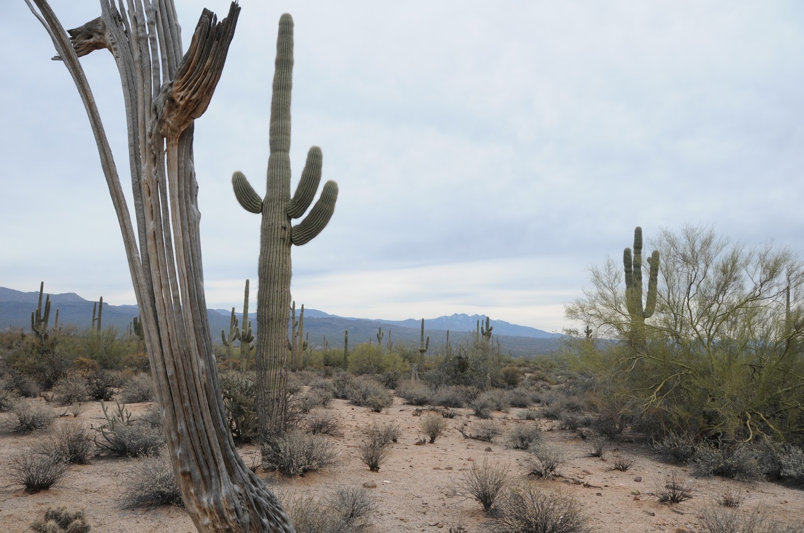
| View of Four Peaks from the Escondido Trail |
There's a cool virtual tour of the
Escondido Trail on the McDowell Mountain Regional Park website. It's
a beautiful slide show describing the route's scenic features,
elevation profiles and loop options. This is the park's first online
tour and it's great for both vicarious thrills and inspiration to
hike the trail in real life.

Constructed in late 2013, the trail can
be accessed at established trailheads or from its many connecting
routes. One option is to begin at the Lousley Hill Trailhead and hike
5.1 miles south to the Four Peaks Staging Area as either an
out-and-back or car shuttle trek.
 Because of its flowing style,
hairpin turns, graceful bends and few obstacles, the trail feels fast
underfoot. Located in the park's far east end, the mostly unshaded
trail showcases expansive mountain views, a smattering of gigantic
saguaros and a twisting walk through the quarry-like mounds and
washes around the Lousley Hills.
Because of its flowing style,
hairpin turns, graceful bends and few obstacles, the trail feels fast
underfoot. Located in the park's far east end, the mostly unshaded
trail showcases expansive mountain views, a smattering of gigantic
saguaros and a twisting walk through the quarry-like mounds and
washes around the Lousley Hills.

The trail's fast track nature makes it
a favorite among mountain bikers and runners. For hikers, the smooth
pathway is perfect for a joint-friendly, swift paced jaunt.


LENGTH: 6.2 miles one-way (10.2
out-and-back as described here)
RATING: moderate
ELEVATION: 1,620' - 1,930'
FEE: $6 daily fee per vehicle
FACILITIES: restrooms, picnic areas,
horse staging, visitor center
GETTING THERE:
Lousley Hill Trailhead:
From Loop 202 in Phoenix, take the
State Route 87 (Beeline Highway) exit 13. Go 11.5 miles north to Shea
Blvd. Follow Shea 0.5 mile to Saguaro Blvd., turn right and continue
3.7 miles to Fountain Hills Blvd. Turn right and go 4 miles to the
park entrance.
Follow McDowell Mountain Park Drive
4.8 miles to Lousley Drive South, turn right continue 0.3 mile to the
parking area
INFO & VIRTUAL TOUR:
MORE PHOTOS: