UPDATE 9-16-10:
THE VOTE ON TRAILHEAD PARKING FEES HAS BEEN MOVED TO OCTOBER 6, 2010. PLEASE CONTACT YOUR REPRESENTATIVE TO REGISTER YOUR CONCERNS: http://copwww05.phoenix.gov/mydistrict/
The latest citizen sacrifice: Hikers
UPDATE 9-16-10:
THE VOTE ON TRAILHEAD PARKING FEES HAS BEEN MOVED TO OCTOBER 6, 2010. PLEASE CONTACT YOUR REPRESENTATIVE TO REGISTER YOUR CONCERNS: http://copwww05.phoenix.gov/mydistrict/
The latest citizen sacrifice: Hikers
The city of Phoenix is getting ready to bleed yet another passionate segment of its citizenry, hitting them up for a few more dollars because they truly care about a narrow aspect of city life and are willing to pay more for it.
Then the city will turn around and give that money to its employees. There is insufficient backbone to say no.
This time it’s the hikers who will pay.
You’ve seen this movie before: Threaten to kill or severely cut some service with passionate (or desperate) supporters. Offer up a disaster scenario if more money isn’t produced. Then, after the initial wailing and public apoplexy, come up with a slightly lesser fleecing of this group to gain public compliance. Hey, it’s only a few bucks and it will keep our (fill in the blank) hiking trails, softball fields, library hours, etc. etc. etc.
The Oscar for this performance came during the budget hearings, where police, firemen, libraries and seniors centers were offered up as sacrifices to the fiscal gods if the public didn’t approve a $50 million food tax. Take a wild guess where all the public hearings were held? Libraries and senior centers, naturally.
The ugly truth is that the $100 million in new taxes and fees Phoenix has already imposed on its citizenry in the past seven months is not necessary to keep those services and protections. It’s to find enough money to pay for 14,000-plus union-represented employees who average $100,000 a year in compensation.
Yes, it was easier for Phoenix to cut after-school programs -- and send more than half of our at-risk kids back on the street, along with significant cuts to seniors -- than it was to look internally and take the significant steps to cut labor costs. By simply getting city employees to make the exact same compensation as you, the boss, we could save more than $300 million a year. Let me repeat this: If we can get public workers to make exactly what you make, we save hundreds of millions of dollars a year. Read on.
That average compensation for all employees has gone up $17,000 during the past five years, which means that while you were struggling to survive the worst recession in most of our lifetimes, Phoenix employees got $17,000 in raises. Did you get that? I hope so, because you’re paying for theirs. And you’re going to pay more – for a lower service level – unless citizens rise up and shout “ENOUGH.”
The parking fee – at trails you already pay for three ways – is a great place to start. This came about after the city drastically cut services and hours for parks, then gave the parks board the notion that if it didn’t raise money for the general fund, much more would be cut. That’s where the $5 a day parking fee came up (later reduced to $2 – hey, a comparative bargain). Then the city management promised that all the new dollars would go to parks.
First off, management can’t promise that. Even the Council can’t promise that, because it can’t commit a future Council. And because both the Council and management already have swept parks funds this year, creating this artificial crisis, you know they’re willing and capable of doing it again.
But more importantly, where’s the attention to the real drain, public employee labor costs? Everyone raised Cain when it was discovered that Bell, California, paid its top three employees hundreds of thousands of dollars. How about 14,000-plus employees averaging $100,000? (No, they don’t all make that, but the private sector compensation average for the Valley is $57,000, a difference of more than $40,000.)
Connect these dots, and Phoenix is heading for the same cliff as Los Angeles, Detroit, California, Greece and General Motors. And not only does the city not have a plan to deal with labor costs, it doesn’t even plan to have a plan, other than continuing to bleed you.
On Sept. 15, the Phoenix City Council will be asked to approve enforcing this latest rummage through your pockets. No Council approval, no new fee. I say it’s time to separate the taxing and spending addict from its drug, which is your money.
Doing so would force Phoenix to grow a backbone and restructure its operations for today’s fiscal reality. Doing so requires you citizens demanding that it be so.
Councilman Sal DiCiccio represents District 6, which includes Ahwatukee, Arcadia, Biltmore, East Camelback and North Central. He can be reached at council.district.6@phoenix.gov.
LET YOUR VOICE BE HEARD, SEND AN EMAIL TO YOUR REP:http://copwww05.phoenix.gov/mydistrict/


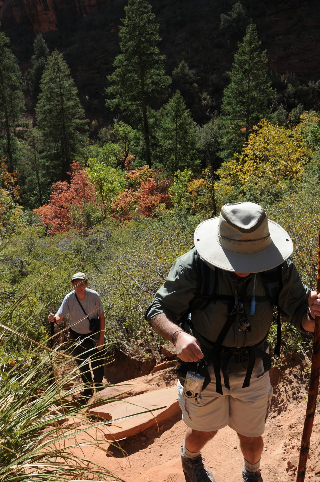
 SECRET CANYON TRAIL #121
Red Rock Secret Canyon Wilderness, Sedona
A community of pinion pines, juniper and assorted cactuses at the trailhead belie what lies ahead on Secret Canyon Trail. Epic views of Sedona’s red rock landscape dominate the first 1.75 miles of this hike before the trail makes a sharp westward swerve at the mouth of the canyon. From here, the route leaves the shade-less chaparral plunging into a streambed where torrential spring water runoff and blowing dust have carved bizarre sculptures in the sandstone escarpments flanking the path. Residual pools of water stand at the bases of moisture-hungry cottonwoods with heart-shaped, lemony leaves.
Near the 5-mile point, the trail enters “the narrows”, a series of slick-rock corridors hemmed in by a vertical fortification of sandstone with clusters of blood-red maples and rusty-orange oaks bursting from the rubble-strewn canyon floor. Beyond this point, the trail degrades into a quagmire of scree and undergrowth which is why most hikers make the narrows their turnaround point. However, those with good route-finding skills can opt to scramble, squeeze and scoot along a sketchy footpath for another half-mile.
LENGTH: 5.5 miles one-way
RATING: difficult
ELEVATION: 4,500 – 5,100 feet
DISTANCE FROM PHOENIX: 134 miles
BEST SEASONS: September - May
BEST TIME FOR FALL COLOR: mid-October, For weekly reports, call the Forest Service Fall Color Hotline, 1-800-354-4595 or visit.fs.fed.us/r3/recreation/fall-colors/fall.shtml
GETTING THERE;
From the “Y” intersection of AZ 179 and AZ 89A in Sedona, go left (toward Cottonwood) on 89A for 3.2 miles to Dry Creek Road. Turn right and go 2 miles to Vultee Arch Road (Forest Road 152). Turn right and follow FR 152 3.4 miles to the trailhead on the left. A high clearance vehicle is required on FR 152.
FEE: Red Rock Pass--$5 per vehicle is required
INFO: Coconino National Forest, Red Rock District 928-203-2900
http://www.fs.fed.us/r3/coconino/recreation/red_rock/secret-canyon-tr.shtml
MAP: http://www.redrockcountry.org/maps/map-graphics/red-rock-map-9-05.pdf
SECRET CANYON TRAIL #121
Red Rock Secret Canyon Wilderness, Sedona
A community of pinion pines, juniper and assorted cactuses at the trailhead belie what lies ahead on Secret Canyon Trail. Epic views of Sedona’s red rock landscape dominate the first 1.75 miles of this hike before the trail makes a sharp westward swerve at the mouth of the canyon. From here, the route leaves the shade-less chaparral plunging into a streambed where torrential spring water runoff and blowing dust have carved bizarre sculptures in the sandstone escarpments flanking the path. Residual pools of water stand at the bases of moisture-hungry cottonwoods with heart-shaped, lemony leaves.
Near the 5-mile point, the trail enters “the narrows”, a series of slick-rock corridors hemmed in by a vertical fortification of sandstone with clusters of blood-red maples and rusty-orange oaks bursting from the rubble-strewn canyon floor. Beyond this point, the trail degrades into a quagmire of scree and undergrowth which is why most hikers make the narrows their turnaround point. However, those with good route-finding skills can opt to scramble, squeeze and scoot along a sketchy footpath for another half-mile.
LENGTH: 5.5 miles one-way
RATING: difficult
ELEVATION: 4,500 – 5,100 feet
DISTANCE FROM PHOENIX: 134 miles
BEST SEASONS: September - May
BEST TIME FOR FALL COLOR: mid-October, For weekly reports, call the Forest Service Fall Color Hotline, 1-800-354-4595 or visit.fs.fed.us/r3/recreation/fall-colors/fall.shtml
GETTING THERE;
From the “Y” intersection of AZ 179 and AZ 89A in Sedona, go left (toward Cottonwood) on 89A for 3.2 miles to Dry Creek Road. Turn right and go 2 miles to Vultee Arch Road (Forest Road 152). Turn right and follow FR 152 3.4 miles to the trailhead on the left. A high clearance vehicle is required on FR 152.
FEE: Red Rock Pass--$5 per vehicle is required
INFO: Coconino National Forest, Red Rock District 928-203-2900
http://www.fs.fed.us/r3/coconino/recreation/red_rock/secret-canyon-tr.shtml
MAP: http://www.redrockcountry.org/maps/map-graphics/red-rock-map-9-05.pdf