Find A Trail. Start Your Search Here:

Thursday, December 30, 2010

KIWANIS TRAIL

KIWANIS TRAIL South Mountain Park, Phoenix This sweet little traipse up a desert gully, has been entertaining Phoenicians since the 1920s. The Kiwanis Trail #62 is an easy way to hike high enough in the hills to get excellent views of the Valley without breaking a sweat. Of all the trails in South Mountain Park, this is perhaps the best groomed— there’s little loose rock underfoot and even the shrubs and trees are trimmed. Stone steps and strategically placed railroad ties make the ascent effortless. In addition to the view, the trail features a healthy population of ironwood trees, which explode with pink pea-like blooms in spring. Also, keep an eye out for petroglyphs. Some are pecked into the cliffs while others embellish stones that flank the trail. The trail tops out at Summit Road where you can pick up the National Trail or hike another quarter-mile uphill to visit the Telegraph Pass lookout. LENGTH: 2.2 miles roundtrip RATING: moderate ELEVATION: 1,570' – 2,070'  BEST SEASONS: October - April
DOGS: must be on leash
KID FRIENDLY?: yes   GETTING THERE: From Phoenix, go south on Central Ave. all the way to the end to where it enters the park south of Dobbins Road. Pass the guard gate and continue straight on the main road (San Juan Road) through a second gate at the old stone park administration building---where there are restrooms. At the 4-way intersection just past the admin site, turn left and follow the signs to the Kiwanis trailhead/picnic area. INFO: City of Phoenix Parks & Recreation: http://phoenix.gov/parks/trails/locations/south/hiking/index.html

MORE PHOTOS: 
https://www.facebook.com/media/set/?set=a.1378713806624.44871.1795269672&type=1&l=911dcf38f7

Monday, December 13, 2010

BOYNTON CANYON VISTA TRAIL

BOYNTON CANYON VISTA Red Rock Secret Canyon Wilderness, Sedona Judging from the crowds, this has got to be the most popular vortex site(places on earth known for their high energy/spiritual powers) in Sedona. That’s probably because it’s easy to get to, not too tough to hike and offers the best views. Although vortex aficionados often disagree about the exact physical locations of these hot spots, there seems to be some consensus that the Boynton Canyon vortex lives on the saddle between two rock formations known as Kachina Woman and Boynton Spire. Guess where the Vista trail leads---yup, the saddle. Whether you regard the power of vortexes as a profoundly spiritual thing or a crock of baloney, it’s impossible to hike to the saddle and not appreciate the breathtaking beauty that unfolds on the way up. For a longer hike in the area, descend from the Vista Trail and continue up the Boynton Canyon Trail (see separate blog entry) for an unforgettable venture into a slim red rock gorge that slowly converges on the trail until the surrounding cliffs appear to collide in a massive wall of stone. LENGTH: 0.75 mile one-way RATING: easy ELEVATION: 4,500 – 4,800 feet BEST SEASONS: September - May FACILITIES: restroom, informational signage FEES: a Red Rock Pass (or equivalent) is required. $5 daily fee. Passes are available at the oak Creek ranger station and most local convenience stores. http://www.redrockcountry.org/passes-and-permits/index.shtml, (928) 282-4119 GETTING THERE: From Phoenix, go north on I-17 to exit 298 (Sedona/ Oak Creek). Veer left (west) and follow SR 179 through the town of Oak Creek to the junction of 179 and Highway 89A in Sedona. Go through the traffic circle, head west (left toward Cottonwood) and continue 3.2 miles to Dry Creek Road. Turn right and follow Dry Creek Road 3 miles to the Long Canyon Road intersection. Go left to stay on FR 152C and continue 1.5 miles to a “T” intersection turn right and go a short distance to the trailhead on the right. INFORMATION: Red Rock Ranger District: (928) 282-4119

BELL ROCK TRAIL

BELL ROCK TRAIL Sedona/Oak Creek Located on the north side of Red Rock Country’s most prominent geological landmark, Bell Rock Trail is comprised of two trails – lower and upper--that climb the lower ledges of the massive, bell-shaped red sandstone heap. Bell Rock is also one of Sedona’s vortex sites—places where earth energies are highly concentrated. This means different things to different people---so, I’ll refrain from trying to explain it. Good signs and basket cairns (big wire drums full of rocks) spaced among the cypress and juniper trees mark the routes. One potentially confusing aspect of keeping on track is the naming of the trails in the area. Note that there’s a Bell Rock TRAIL and a Bell Rock PATHWAY. The “pathway” is NOT the route described here. Also, the Upper Trail is signed “U Bell Rock Trail”. A mild climb leads to several exposed sandstone platforms for unobstructed views of the Oak Creek area. For even better views, take the Upper trail, but only if you’re sure-footed and don’t mind a bit of scrambling. As for those “other” unofficial paths that deface the Bell---please respect the fragile terrain and do not venture out on them. They destroy vegetation, erode the rocks and make for a great way to get injured. Be nice and stay on designated routes only. LENGTH: Lower trail: 0.5 mile one-way, Upper trail: 0.2 mile one-way RATING: moderate ELEVATION: 4,350-4,450 (4,500 for the upper trail) BEST SEASONS: September - May FACILITIES: restroom, informational signage FEE: a Red Rock Pass (or equivalent) is required to park and is available at the Oak Creek Ranger station and most local convenience stores. $5 for the day pass. http://www.redrockcountry.org/passes-and-permits/index.shtml, (928) 282-4119 GETTING THERE: From Phoenix, go north on I-17 to exit 298 (Sedona/Oak Creek). Veer left (west) and follow SR 179 to milepost 308. The trailhead will be on the right just past the milepost. INFORMATION: Red Rock Ranger District: (928) 282-4119

BELL ROCK PATHWAY

BELL ROCK PATHWAY Coconino National Forest, near Sedona For a casual stroll among Sedona’s gorgeous red rock formations that never strays far from civilization, try this wide, sunny trail. Although most of the trail is within earshot of busy Highway 179, a very scenic segment bends away from the commotion and skirts the edge of Munds Mountain Wilderness for peaceful vistas and up-close views of Courthouse Butte and the world-famous Frank Lloyd-Wright masterpiece, Chapel of the Holy Cross. LENGTH: 3.7 miles one-way RATING: easy ELEVATION: 4,050 – 4,370 feet BEST SEASONS: September - May FEE: a Red Rock Pass (or equivalent) is required to park and is available at the Oak Creek Ranger station and most local convenience stores. $5 for the day pass. http://www.redrockcountry.org/passes-and-permits/index.shtml, (928) 282-4119 GETTING THERE: NORTH TRAILHEAD: From Phoenix, go north on I-17 to exit 298 (Sedona/Oak Creek). Veer left (west) and follow SR 179 to just before milepost 310 and turn right into the parking area. This is the “Little Horse” Trailhead. Follow the signs that lead to the trail heading south. SOUTH TRAILHEAD: From Phoenix, go north on I-17 to exit 298 (Sedona/Oak Creek). Veer left (west) and follow SR 179 to just past milepost 307 and turn right into the parking area. INFORMATION: http://www.fs.fed.us/r3/coconino/recreation/red_rock/bell-rock-pathway.shtml (928) 282-4119

Friday, December 10, 2010

MEXICAN GREY WOLVES UPDATE

JUNE 2011 WALLOW FIRE & MEXICAN GREY WOLVES UPDATE LINK: http://www.fws.gov/southwest/es/mexicanwolf/pdf/MWWFU_6-13-11.pdf


Dec. 7, 2010 Arizona Game and Fish reaffirms commitment to Mexican wolf conservation   Department continues day-to-day management as it seeks to play greater role in conservation effort     PHOENIX – On Dec. 4, the Arizona Game and Fish Commission voted to support Congressional actions to delist the gray wolf from protection under the Endangered Species Act. The commission reaffirmed its strong commitment to Mexican wolf conservation, but recognized that progress on the program had been stalled since 2001 due to the current federal process that guides Mexican wolf conservation and the impact of unceasing environmental litigation. “The current Mexican wolf conservation program is in gridlock, and while we support the Endangered Species Act, we recognize that in the case of the wolf, it has helped create an impasse that could lead to the demise of the species in the wild,” says Terry Johnson, Ph.D., endangered species coordinator of the Game and Fish Department. “The discussion that led to the Game and Fish Commission’s decision recognizes that it is both unfortunate, and ironic that successful Mexican wolf conservation may hinge on removing it from the Congressional act intended to help restore it.” Through the commission’s action, they anticipate that the Game and Fish Department will become even more heavily involved in planning the future of the species and the day-to-day activities in a more affordable, efficient and effective manner “Continuous litigation on wildlife conservation efforts, including wolves, has left wildlife management decisions to the judiciary instead of with the experts – the natural resources agencies. This litigation-driven bureaucratic process also drives up the cost of conservation, making Mexican wolf conservation unaffordable for anyone,” added Johnson. The commission discussed that Congressional involvement is necessary to break the regulatory and litigious gridlock that Mexican wolf conservation has endured for many years before the demise of the species in the wild. Federal partnerships have been, and will continue to be, essential to continuing Mexican wolf conservation, and the commission invites all stakeholders to the table who are willing to participate in seeking solutions that will lead to effective, productive Mexican wolf conservation. Wolves in Arizona will continue to be protected wildlife through state statutes. Arizona’s involvement in Mexican wolf conservation began in the mid-1980s, with exploration of the feasibility of reintroducing wolves in Arizona and New Mexico. In 1996, the U.S. Fish and Wildlife Service selected the Blue Range area in east-central Arizona as the reintroduction site, and the first 11 captive-reared wolves were released there in 1998. The Blue Range Wolf Recovery Area encompasses east-central Arizona and west-central New Mexico. The Fort Apache Indian Reservation also plays an integral part in the reintroduction effort. TO LEARN MORE, VISIT: http://www.azgfd.gov/w_c/es/mexican_wolf.shtml

HACKBERRY SPRING FALL COLOR,2010

HACKBERRY SPRING 12-10-10 Superstition Wilderness Here are some shots from today's hike. The cottonwoods, willows and narrowleaf cottonwoods are nearly at peak color. I'm guessing we'll have another week or so of fine desert fall foliage. Also, there was some water in First Water Canyon, but hiking was easier than usual. SEE MY PRIOR ENTRIES For HACKBERRY SPRING FOR DRIVING DIRECTIONS AND HIKE ROUTE INFO.

Wednesday, December 8, 2010

V-BAR-V RANCH & SACRED MOUNTAIN

V-BAR-V RANCH & SACRED MOUNTAIN Coconino National Forest, near Sedona 
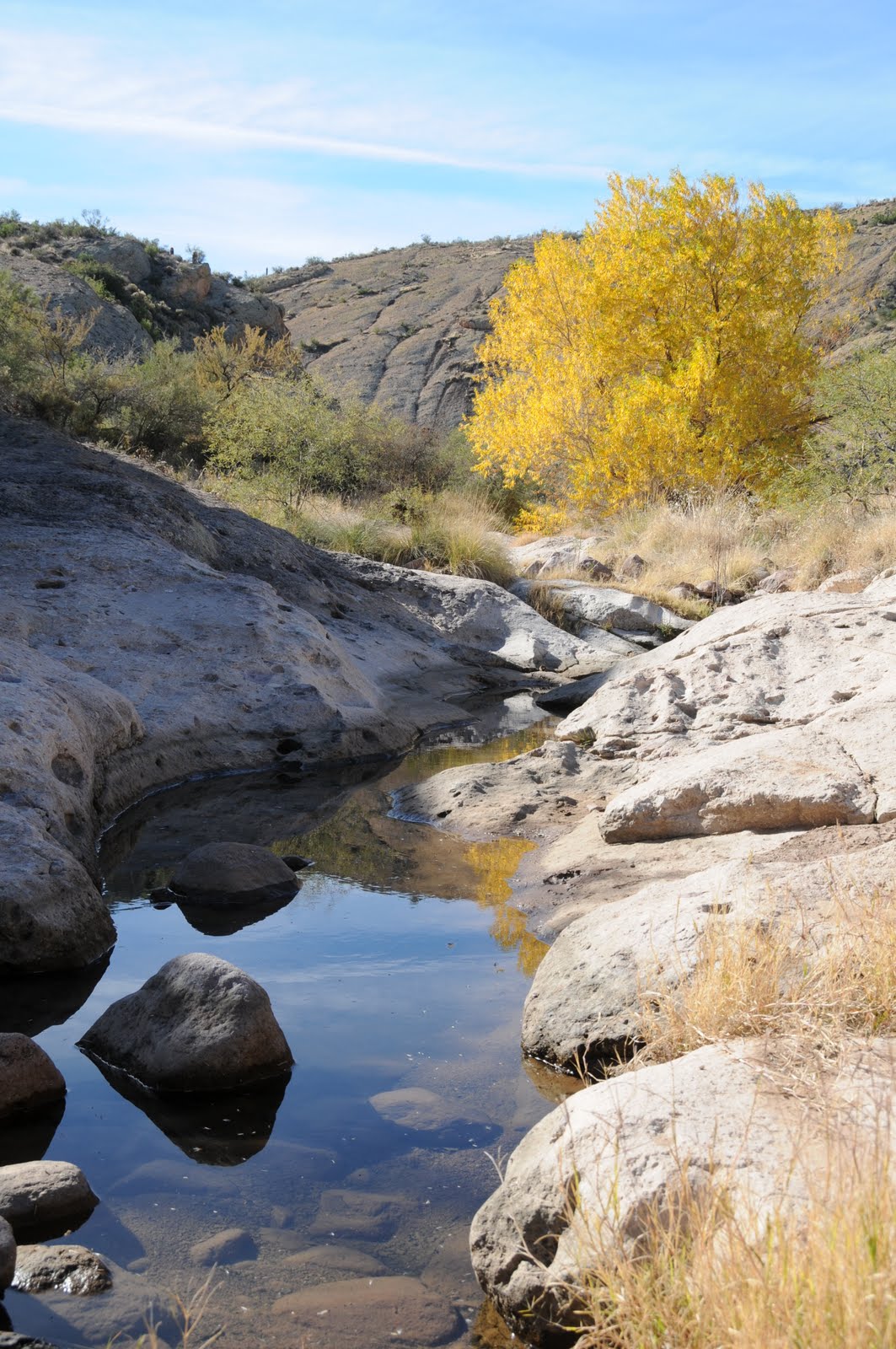
In terms of both physical presence and historical significance, Sacred Mountain really stands out. A lone white limestone massif jutting from a bowl-like basin surrounded by stark red and black cliffs makes a bold impact on the landscape and holds many secrets of Arizona’s native peoples. The focal point of what archeologists refer to as Sacred Mountain Basin, the 300-foot-high flat-topped mesa was home to a farming community of Sinagua people between the 12th and 15th centuries. The hilltop living space included dozens of rooms and a central courtyard with expansive views of what we now call Wet Beaver Creek, Montezuma Well and the Verde Valley. The ruins are highly eroded, however, the crumbling foundations hint at the footprint of the vanished community. Underfoot, pottery shards are plentiful, including some with an unusual, rich black patina. Archeologists continue to study this area and have determined that the fields below the mountain supported abundant food and fiber crops. Remains of ball courts tell a story of people who not only worked hard, but also liked to play hard. The Sinagua also used sophisticated mathematical and astronomical tools to measure time, seasons and build accurate solar calendars. Evidence of this can be seen at nearby V-Bar-V Heritage Site where panels of petroglyphs are believed to document ceremonial traditions, hunting magic and the trajectory of the sun over the horizon. The best plan for appreciating all the wonders of Sacred Mountain Basin is to begin by visiting V-Bar-V Ranch. Here, exploring the petroglyphs is by guided tour only---the site is kept under lock and key, because, as we know, some people think it’s fun to deface national treasures. Guides are very knowledgeable and can answer most questions about the rock art---remaining questions are easy to research if you purchase one or more of several (reasonably priced) books available at the site visitor center. Once you’ve learned about the petroglpyhs and a bit about the Sinagua life ways; head over to Sacred Mountain. 
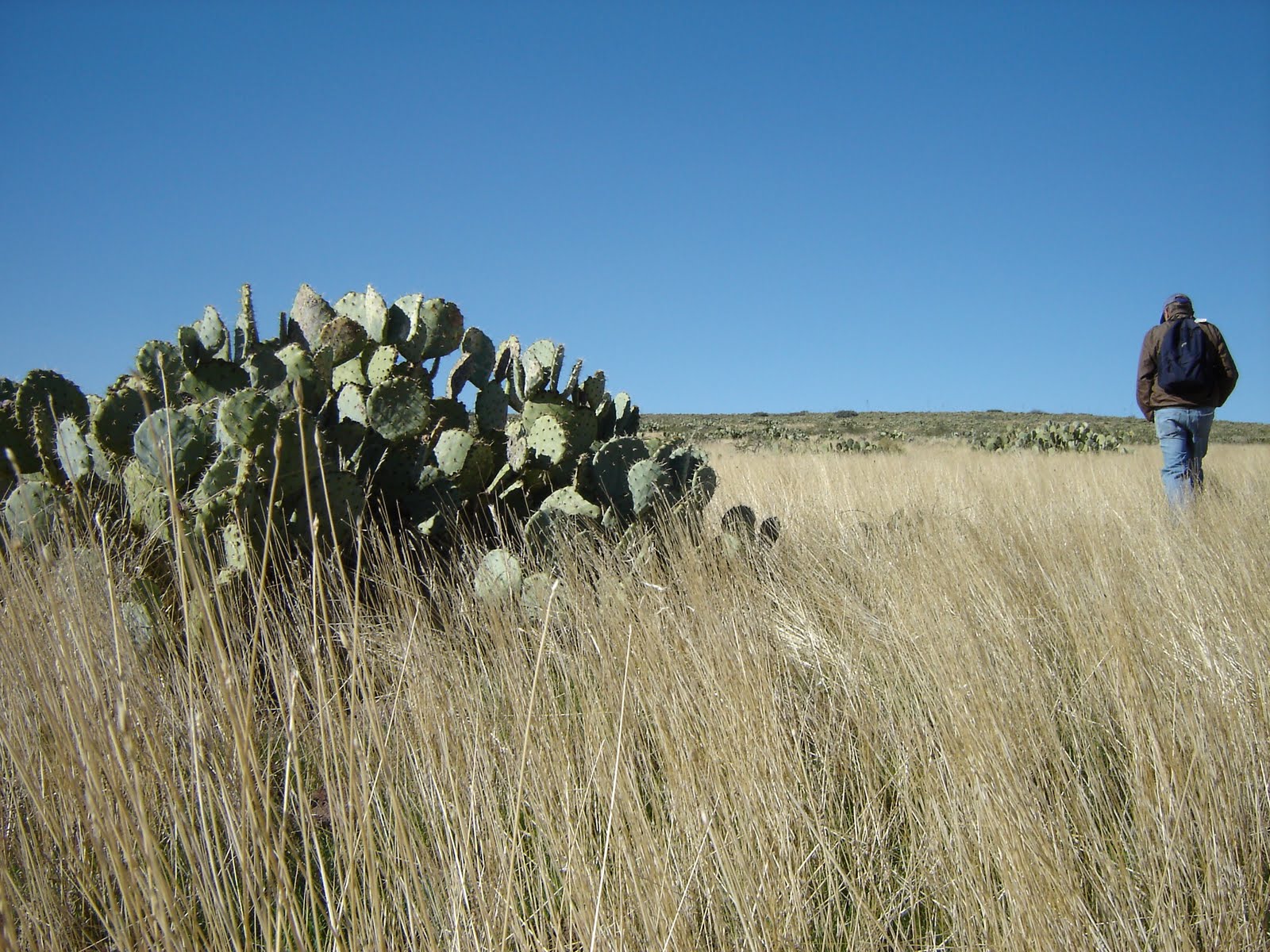
At the trailhead, pass the barbed-wire gate (close it behind you) and pick up the footpath that parallels the fence. The rest of the trail is obvious. On the summit, carefully explore at will, being careful to respect the fragile nature of this special place. AS WITH ALL ARCHEOLOGICAL SITES, IT IS ILLEGAL (not to mention, just plain ignorant & disrespectful) TO REMOVE OR ALTER ANYTHING. Leave the artifacts as you found them and don’t climb, sit on or attempt to “reconstruct” the walls. LENGTH: V-Bar-V: 1-mile roundtrip. Sacred Mtn: 1-mile roundtrip. RATING: V-Bar-V: easy. Sacred Mtn: moderate. ELEVATION: V-Bar-V: 3,800 feet (flat) Sacred Mtn: 3,800 – 4,100 feet BEST SEASON: September - May FEES: a Red Rock Pass (or equivalent) is required. http://www.fs.fed.us/r3/coconino/contact/redrock-index.shtml, (928) 282-4119 HOURS: V-Bar-V ranch is open 9:30 a.m. to 3:00 p.m. Friday, Saturday, Sunday and Monday only. Closed Thanksgiving & Christmas. GETTING TO V-BAR-V HERITAGE SITE: From Phoenix, go north on I-17 to exit 298 (Highway 179 for Sedona-Oak Creek). Go right (east) on Hwy 179 (FR 618) and continue 2.7 miles to the turn off for the site. Park in the lot above the ranch and hike down to the visitor center where you must sign in and meet your guide. GETTING TO SACRED MOUNTAIN: From the V-Bar-V Ranch, go back out onto FR618, turn right and drive 0.5 mile to FR 9201A. Turn left and follow the rutted dirt road 0.2 mile (or as far as you dare) to a barbed wire fence and gate. Park at or near the gate. INFORMATION: http://www.redrockcountry.org/recreation/cultural/v-bar-v.shtml (928) 282-3854

Monday, November 22, 2010

FALL COLOR: AGUA FRIA NATIONAL MONUMENT

The big fall foliage show may be over in northern Arizona, but its just getting under way in the lower elevations. Here are some shots from Saturday, November 20th near the Agua Fria River crossing on Bloody Basin Road. For more low-elevation fall color hikes, click on "fall color" in the trail index on this blog.

PUEBLO LA PLATA

The "fort" overlooking Silver Creek Canyon
Part of the main pueblo
The "fort" as seen from the pueblo
Sycamore and cottonwood trees in Silver Creek Canyon
The big room at the pueblo
Pottery sherds are abundant--please leave them as you found them!!
PUEBLO LA PLATA Agua Fria National Monument Also known as the Silver Creek Ruins, Pueblo La Plata is one of seven major prehistoric cities and over 450 archeological sites located on the Agua Fria National Monument. Archeologists say this site was active from the twelfth to fifteenth centuries and contained up to 160 rooms. The hike is a two-part exploratory trek. A good trail leads to the pueblo ruins, while an easy cross-country hike leads to a fort. The pueblo sits upon a rounded mound and although most of the walls are waist high or less, the footprint of the complex is easy to discern. Pottery shards are everywhere so, watch where you step. For those willing to spend time exploring, there are also grinding stones, arrowheads and piles of flint litter to be seen. To reach the fort, head roughly 0.5 mile due west from the pueblo veering toward the rim of the canyon. A low rock barricade extends from the very tip of the mesa above Silver Creek canyon. Here, views of Perry Mesa, the Agua Fria River, and the Bradshaw Mountains are breathtaking. When we visited in mid-November, the cottonwoods and sycamores in the creek where lit up in shades of gold. To extend this exploratory hike, climb down into Silver Creek Canyon. This is best achieved by following an unmarked road heading northeast from the trailhead. It will get you near the edge of the canyon where the scramble down is much less treacherous than it would be from the fort area. There are a few petroglyphs pecked into the canyon walls and a primitive road above the water makes hiking manageable. NOTE: PLEASE RESPECT THIS NATIONAL MONUMENT BY LEAVING ARTIFACTS AS YOU FOUND THEM. Do not remove or alter anything and watch your step as not to disturb or destroy anything. LENGTH: 3 miles roundtrip (longer if you climb down into the canyon) RATING: easy ELEVATION: 3,710- 3,630 BEST SEASON: October - April GETTING THERE: From Phoenix, go north on I-17, 40 miles to exit 259, Bloody Basin Road. Follow Bloody Basin Road (also signed as FR 269 and 9269) 8.3 miles to FR 9023 on the left. Continue on FR 9023 1.2 miles (go right at the first junction, left at the second and left at the third---just follow the 9023 signs and you’ll be fine) to the trailhead. There’s a cattle gate, green fence and a small sign that reads “parking area” at the trailhead. Pass the gate and follow the dirt road to the ruins. NOTE: a high clearance vehicle is required and FR 9023 is very rough. Bloody Basin Road looks pretty innocuous in the beginning, but there are some very rugged, narrow sections several miles in that should not be attempted in passenger cars. INFO: http://www.blm.gov/az/st/en/prog/blm_special_areas/natmon/afria.html (623) 580-5500

Monday, November 15, 2010

NEW RIVER NATURE PRESERVE

NEW RIVER NATURE PRESERVE New River Just north of the New River exit on I-17 in the valley off to the right is a slender band of green standing out like the odd fluorescent crayon in a box of mundane desert hues. Cluttered with a mix of fan palms, willows, mesquite, native walnuts, cottonwood, gum and sycamore trees, this tiny, Garden-of-Eden-esque strip of arboreal slendor thrives on perennial spring waters. Deeded to the Desert Foothills Land Trust in 1994, this rare 20.8-acre habitat will now be preserved for future generations and is open during daylight hours to hikers and people on bikes or horseback. Although short in length, there are plenty of opportunities for exploring. Several well-worn side paths leave the main dirt trail leading to secluded coves and rocky washes where active wildlife including hawks, coyote, rabbits, javalena, deer and countless birds populate the hillsides and treetops. Hike this oasis in spring for a fabulous display of wildflowers, or take a stroll in fall to see the arboreal canopy ablaze in shades of gold. Best time for fall color is mid-November through mid-December. LENGTH: 1-mile roundtrip (exploratory) RATING: easy ELEVATION: 2,150-2,240 feet BEST SEASON: October - April GETTING THERE: From Phoenix, go north on Interstate-17 to the New River exit (exit 232) . Go east for about  0.8- mile to the frontage road where there’s a “welcome to New River” billboard beyond the stop sign. Turn left (north) here and continue roughly 2.2 miles (the road turns to dirt after 1 mile, but it’s passable by sedan) to a 3-way junction where there’s a row of mailboxes and a street sign reading Coyote Pass/Old Stage Road. Park across from the mailboxes. There's room for about 3-4 cars. Do not block the private driveways in the area. From here, follow the dirt road straight ahead and in about 0.1 mile, there will be a New River Preserve sign and a gate. Hike down the road and explore. INFO: http://www.dflt.org/, 480-488-6131, info@dflt.org

Wednesday, November 10, 2010

SPUR CROSS-METATE-TOWHEE LOOP

SPUR CROSS-METATE-TOWHEE LOOP Spur Cross Ranch Conservation Area, Cave Creek This short loop hike makes for an excellent introduction to the diverse bio zones of Spur Cross Ranch Conservation Area. The route wanders through rare mesquite bosques, creekside riparian habitats and a forest of some of the most outrageous saguaro cactuses anywhere. Handy steppingstones make short work of crossing usually shallow Cave Creek while gentle uphill grades lead to high ledges where views of famous local geological features like Elephant Mountain, Sugarloaf and Skull Mesa soar over pristine swaths of Sonoran desert. The route is well signed and maintained. Park rangers and volunteers offer a full schedule of public programs that range from hikes to archeological sites to talks on native flora and fauna. Check out the Web site below for details. HIKE DIRECTIONS: From the permit kiosk, hike straight ahead on the wide dirt road to the first major trail junction and take the left leg (heading northwest) of the Spur Cross Trail (SX). Follow SX 0.2 mile to the Metate Trail (MT) junction, hang a right (northeast) and follow MT 0.2 mile to the Towhee Trail (TW). Veer right onto TW, which will rejoin MT in 0.2 mile. Follow MT 0.5 mile back to SX, hang a right (south) and continue 1.5 miles back to the trailhead. LENGTH: 2.8-mile loop RATING: easy ELEVATION: 2,200 – 2,300 feet BEST SEASONS: October - April GETTING THERE: Spur Cross Ranch Conservation Area is located approximately 35 miles north of central Phoenix. Interstate 17, State Route 51, and Loop 101 can all be used to reach the park. From the intersection of Carefree Highway and Cave Creek Road head north on Cave Creek Road about 2.5 miles to Spur Cross Road. Turn north for approximately 4.5 miles to the public parking area. After 3 miles the road turns to all-weather graded dirt and is passable by sedan. The last 1.5 miles can be confusing; continue north on the graded road past the green house, through the tall gateposts and on past the horse corrals to the signed public parking area on the right. FEE: $3 daily fee per person. Bring exact change for the self-serve permit kiosk. FACILITIES: port-o-potties INFORMATION & MAP: www.maricopa.gov/parks/spur_cross/Directions.aspx

Sunday, November 7, 2010

JOE'S HILL

Joe's Hill as seen from the Sunset Point rest area
JOE’S HILL Agua Fria National Monument Next time you’re traveling along I-17, make a stop at the Sunset Point rest area near Black Canyon and look east across the freeway. That low mound sitting above the Agua Fria Canyon is Joe’s Hill, a shield volcano like the ones in Hawaii. Although it’s possible to hike to the summit of this hill, you’ll need good route-finding skills, at least a high clearance vehicle and much patience to do so. For geology buffs, this volcano has a lot to explore, but for the average hiker, the big draw is getting to look down into the gorge of Agua Fria Canyon. This is of particular interest to hikers who have explored the canyon from Badger Springs Wash---this hike takes you to the edge of the cliffs above. LENGTH: 3 miles (exploratory) RATING: moderate (cross-country, bushwacking) ELEVATON: 3,600 – 4,045 feet BEST SEASONS: October - April GETTING THERE: From Phoenix, go north on I-17 to Bloody Basin Road (exit 259). Turn right and follow Bloody Basin Rd. roughly 11 miles to Forest Road 14. Go right (south) and continue to the second unmarked dirt road on the right. From here, it’s a quagmire of un-maintained dirt roads---so you’ll basically head toward the mound of Joe’s Hill as far as your vehicle will allow. We got to within a half-mile of the volcano’s base in a Jeep. Do your research, get maps and drive at least a high-clearance vehicle. From your parking spot, head toward the hill and pick your way up. GPS: N 34.18753 and W -112.06321 INFO & MAP: http://www.blm.gov/pgdata/etc/medialib/blm/az/images/afria.Par.65014.File.dat/aguafriamap.pdf