


EAST FORK TRAIL #95
 |
| Pasture at the base of Mount Baldy |
If you drive down State
Route 373/Main Street, through the town of Greer to near road's end,
you'll find yourself at the banks of the West Fork of the Little
Colorado River and the trailhead for the East Fork Trail #95.
Yup, the East Fork Trail
begins at the West Fork and this woodsy stream side spot is the most
popular place to begin the hike that rambles through alpine meadows
sprawled out between two creeks that originate on the slopes of Mount
Baldy. Although the drive through town is scenic, it's often crowded
and parking can sometimes be a challenge. Couple that with the fact
that accessing trail #95 here requires an immediate creek crossing
that might cause unprepared hikers to turn back before even starting.
There's a work around, though. If you start the hike from the
Gabaldon Horse Campground at the edge of Mount Baldy Wilderness,
you'll avoid the traffic and parking headaches.
 |
| Mooooont Baldy cows. |
 |
| East Fork Trailhead in Greer on the West Fork of the LCR |
The southern terminus of Trail
#95 shares space with Railroad Grade Trail, a 21-mile route that
follows the repurposed track of the defunct Apache Railroad. This
first section follows a raised cinder bed through a canopy of spruce
and aspens that gradually spills into an open alpine meadow with
see-forever views. From June through September, abundant moisture and
dappled sunshine provide perfect conditions for wildflowers.
 |
| East Fork of the Little Colorado River near Colter Reservoir |
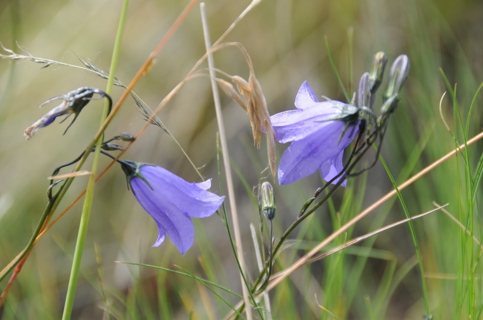 |
| Harebells |
LENGTH: 7.5 miles one way
RATING: moderate
ELEVATION: 8200' - 9350'
 |
| East Fork Trail #95 |
GETTING THERE:
Gabaldon Trailhead (as described here):
From State Route 260 17 miles west of
Eagar, turn onto State Route 273 that's located just past milepost 377 and signed
for Sunrise Ski Area. Go 11.9 miles south to the trailhead on the
right (0.4 mile past the East Baldy trailhead. Park in the turnouts
before entering the campground. To get to the trailhead, hike 0.2
mile up SR 273 to Forest Road 409, turn left and make a left onto the
unsigned red cinder trail just past the cattle guard. SR 273 beyond the ski area is not plowed in winter and may be closed due to snow between October and May.
Greer Trailhead:
From State Route 260 9.6
miles west of Eagar, turn onto State Route 373 (Greer) and continue
5.5 miles south to the trailhead on the left. Parking is limited to
5 cars and there's a restroom. There's an immediate crossing of the
river that's easy in low water, but may require wading.
INFO: Apache-Sitgreaves
National Forest