GREENS
PEAK
 |
| The beastly profile of Greens Peak near Greer. |
From a distance, the lopsided hump of Greens Peak with its sparsely
vegetated south face and top fringe of conifers resembles the shaggy profile of
an African wildebeest.
 |
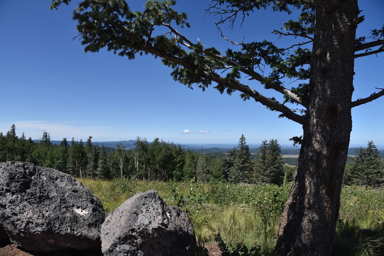
| Escudilla Mountain (horizon on right) seen from Greens Pk. |
The funny-looking hill sits a few miles north of State Route
260 near the town of Greer, between the lofty peaks of eastern Arizona’s White Mountains and the colorful
badlands of the Petrified Forest National Park and offers a unique vantage
point in the ecoregion between alpine forests and high-desert plains.
 |
| Looking toward Springerville from Greens Peak |
 |
| Mima mounds dot the meadows around Greens Peak |
 |
| The hike climbs to the top of a cinder cone volcano |
 |
| Fleabane grow in dense clumps along the route |
 |
| Aspens thrive on the north face of Greens Peak |
The 10,134-foot extinct cinder cone volcano is the highest
point of the Springerville Volcanic Field-- a swath of hundreds of diverse geological
wonders that runs roughly between the towns of McNary and Alpine. Surrounded by
miles of open rangeland, meandering creeks and sweet-smelling fir-spruce
woodlands, the area is also home to dozens of easy-to-explore volcanic elements
and glacial imprints. For an in-depth but approachable read about this
fascinating corner of Arizona, check out A
Guide to the Geology of the White Mountains and the Springerville Volcanic
Field, Arizona by John V. Bezy and Arthur S. Trevena. It’s available as a
free download on the Arizona Geological Survey website.
 |
| Hundreds of geological features are visible from Greens Pk |
The book describes several field trips to
some of the area’s most interesting peculiarities. The keynote trip is a hike
up to Greens Peak.
 |
| Summit of Greens Peak has great views in all directions |
With its beastly appearance
and half bald, half forested slopes, the mountain is a natural draw for curious
visitors in search of an off-the-radar summit hike with primo views. Although it’s
short in length and ascends on a gradual, undulating grade, the trek is not for
the faint-of-heart. It begins at over 9,000 feet in elevation where thin air
will tax the lungs of unacclimated Valley dwellers. If you’re not up to the
600-foot haul to the summit, there are plenty of curiosities to explore around
the mountain’s base including the mima (pronounced may-muh) mounds.
 |
| Sunrise ski area and Fence Tank seen from Greens Peak |
One of the enduring mysteries of White Mountain geology,
is the origin of the mounds.
 |
| Harebells bloom in alpine meadows through September |
Rodents, imbedded root systems and creatures from
outer space all have been credited with making these roundish, lumps of gravel that average 2 feet high in the breezy meadows below the peak.
 |
| Summit marker on 10,134-foot Greens Peak |
The prevailing theory is
that these odd lumps are remnants of a glacial ice field that receded some
25,000 years ago leaving behind a landscape that smacks more of Iceland than
Arizona.
 |
| A pollinator alights on a Western yarrow plant. |
Don’t be intimidated by
the hill’s steep, stark appearance. Following an edge-hugging road that makes a
180-degree swing along the mountain’s west and south flanks, the steady uphill
slog is easier than it looks. Along the
lung-pumping climb, vista points appear around every kink in the road.
 |
| North view from the summit of Greens Peak |
Look for
surrounding hike hubs like Pole Knoll, Mount Baldy (11,420 feet) and the trails
around Big Lake. Near the top, the distinctive profile of Escudilla Mountain (10,912
feet) that sits near the New Mexico border shows a frenzy of aspen resurgence
in the scar of the 2011Wallow Fire. On
the summit, a fire lookout and communication towers rise above the coniferous
woodlands that cover the mountain’s northeast flanks.
 |
| Greens Peak seen from nearby Fence Tank corral. |
To the south, the
web-like patterns of ski runs at Sunrise Park Resort near Greer stand out above
a landscape of misshapen volcanic bluffs, mounds and eroded cones.
 |
| Cattle graze in meadows at the base of the mountain. |
The
mountain’s breezy high-elevation edges are also ideal for birdwatching or
spotting herds of pronghorn, elk and ubiquitous cattle roaming among lumpy grasslands
and watering holes below.
 |
| A fire lookout and communication towers on the summit |
LENGTH: 2
or 4 miles roundtrip
RATING:
moderate
ELEVATION:
9,520 – 10,134 feet
GETTING
THERE:
From Pinetop-Lakeside, travel east on State Route 260 (toward
McNary). Continue to roughly 3 miles past State Route 273 to Forest Road
117 near milepost 380 on the left (about a mile past the Railroad Grade
trailhead). Follow FR117 north for 3 miles to a "Y" junction at
Forest Road 61 where a sign reads “Greens Peak 2 miles”. You can park here for
a 4-mile roundtrip hike or veer left and drive another mile to the next “Y”
intersection at FR61/61C
for a 2-mile hike. Roads are maintained dirt and cinder
and passable by sedan.
INFO:
Arizona Geological Survey
Arizona
Wildlife Trails: