Find A Trail. Start Your Search Here:

Showing posts with label Mount Baldy. Show all posts

Monday, June 8, 2020

Mount Baldy Crossover Trail


MOUNT BALDY CROSSOVER TRAIL

Mount Baldy Wilderness.
Mt.Baldy Crossover trails moves through forests & meadows
Tethering the West Baldy and East Baldy trails that make grueling ascents to a saddle near the 11,403-foot summit of Mount Baldy at the edge of the White Mountain Apache Indian Reservation, the Mount Baldy Crossover trail No. 96 is much more than a means to an end.
Crossover Trail is in the Mt. Baldy Wilderness
The woodsy 3.5-mile connector route is often used as part of the 16.7-mile three-trail loop that traces the slopes of the extinct stratovolcano that’s been silent for 2 million years, but it also delivers a classic White Mountains experience when done alone as an out-and-back trek. It’s a great way to get acquainted with the high country terrain and acclimate before taking on the mountain.
Although this trail trifecta isn’t especially difficult in terms of technical challenge, the thinner, high elevation air can cause huffing and puffing that slows down progress. That’s a good thing, though, because you’ll want to take this one at a leisurely pace to enjoy the variety of scenery and rich biodiversity.
Delicate prairie smoke sprout feathery plumes in summer
Brilliant magenta American vetch flowers stand out underfoot
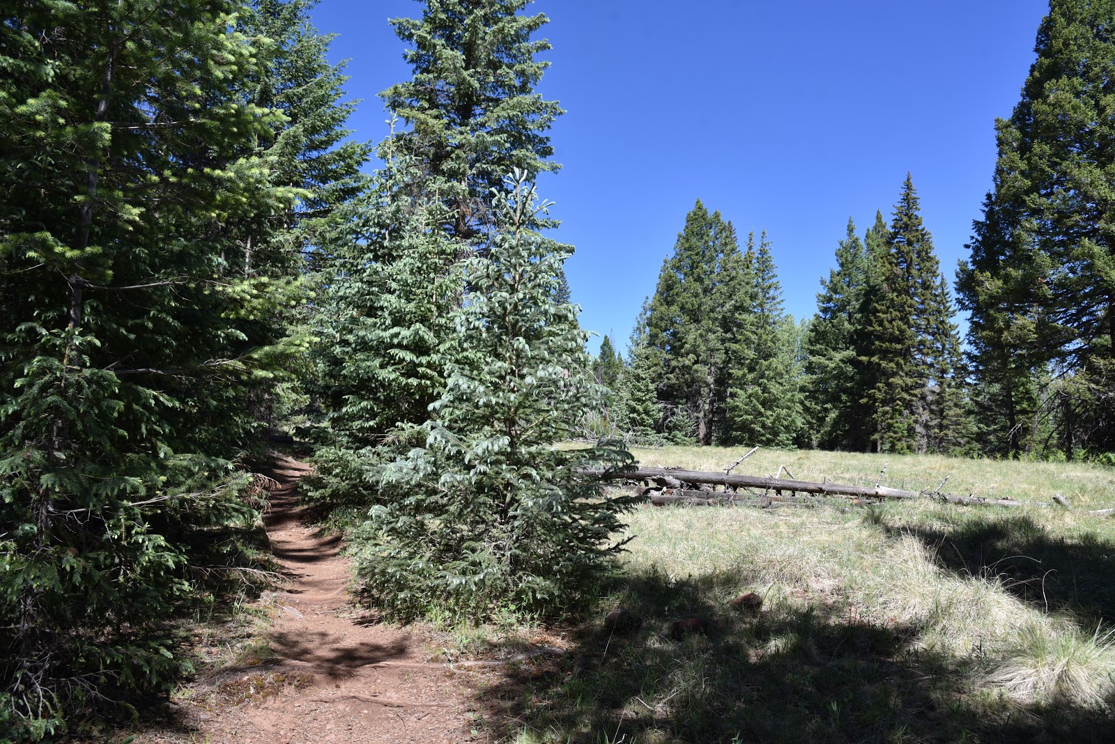
Forest and meadows collide on Crossover trail
Orange gooseberry shrubs are common on the route
Ferns grow hip-high in sunny spots
Marsh marigolds grow in moist areas on the Crossover trail
A feeder stream cuts through a meadow on Crossover trail
Many-flower stickseed is a fun find on the trail
Aspens flourish in sunny glens on the Crossover trail
False hellebore grows in wet meadows along the route
Rocky Mountain irises thrive in wet meadows
The quickest access to the Crossover trail is from the East Baldy trailhead where the route follows the East Baldy trail for 0.2-mile to a junction where it swerves north and away from the channel of nearby East Fork of the Little Colorado River.  Bouncing among various ecozones within the Mount Baldy Wilderness area in Eastern Arizona, the trail kicks off with a stroll through aspen glens with glimpses of mountain foothills. Soon, the aspens are swallowed up in mixed conifer woodlands of Douglas firs, Ponderosa pines and Engelmann and Blue Spruce. 
There's lost of scenic variety on the Crossover trail
Cloaked in a crisp atmosphere tinged with the smell of moss and damp earth, the forest is so thick in some places that sunlight barely lights the way, while in other spots, gaps in the tree cover let in enough sunshine to sustain spreads of ferns, wild strawberries, Canada violets and spotted coralroot--a complex and odd-looking ground dweller in the orchid family.  Interspersed throughout the hike are open-to-the-sky wet meadows replete with their own community of moisture-loving plants. Where the ground is mushy and damp, look for frilly bundles of false hellebore that sprout head-high flower stalks in summertime and the delicate blooms of marsh marigolds, aquatic buttercups, prairie smoke and berry-laden shrubs.
Spotted coralroot grow among pine needles on the forest floor
The route begins with a short hike on the East Baldy trail
A segment of mixed conifer woodlands  on the trail
Except for where fallen trees slumped over the trail require some mild scrambling to get over, the trail is easy to follow and, even with the diluted oxygen, not too much of a challenge. The trail ends at the junction with the West Baldy trail. Turn around here, or if you parked a shuttle vehicle at the West Baldy trailhead, head right and hike a half-mile to complete the journey.
LENGTH: 7.4 miles round trip
RATING: moderate
ELEVATION: 9,275 – 9,400 feet
GETTING THERE:
From Pinetop-Lakeside, travel 20 miles east on State Route 260 to State Route 273 which is just past mile post 377 and signed for Sunrise Ski Area. Turn left and go 11 miles south to the East Baldy trailhead on the right.
INFO:

Monday, August 22, 2016

EAST FORK TRAIL #95

EAST FORK TRAIL #95
Pasture at the base of Mount Baldy
If you drive down State Route 373/Main Street, through the town of Greer to near road's end, you'll find yourself at the banks of the West Fork of the Little Colorado River and the trailhead for the East Fork Trail #95.
Yup, the East Fork Trail begins at the West Fork and this woodsy stream side spot is the most popular place to begin the hike that rambles through alpine meadows sprawled out between two creeks that originate on the slopes of Mount Baldy. Although the drive through town is scenic, it's often crowded and parking can sometimes be a challenge. Couple that with the fact that accessing trail #95 here requires an immediate creek crossing that might cause unprepared hikers to turn back before even starting.
Mooooont Baldy cows. 
There's a work around, though. If you start the hike from the Gabaldon Horse Campground at the edge of Mount Baldy Wilderness, you'll avoid the traffic and parking headaches.
East Fork Trailhead in Greer on the West Fork of the LCR

The southern terminus of Trail #95 shares space with Railroad Grade Trail, a 21-mile route that follows the repurposed track of the defunct Apache Railroad. This first section follows a raised cinder bed through a canopy of spruce and aspens that gradually spills into an open alpine meadow with see-forever views. From June through September, abundant moisture and dappled sunshine provide perfect conditions for wildflowers.
East Fork of the Little Colorado River near Colter Reservoir
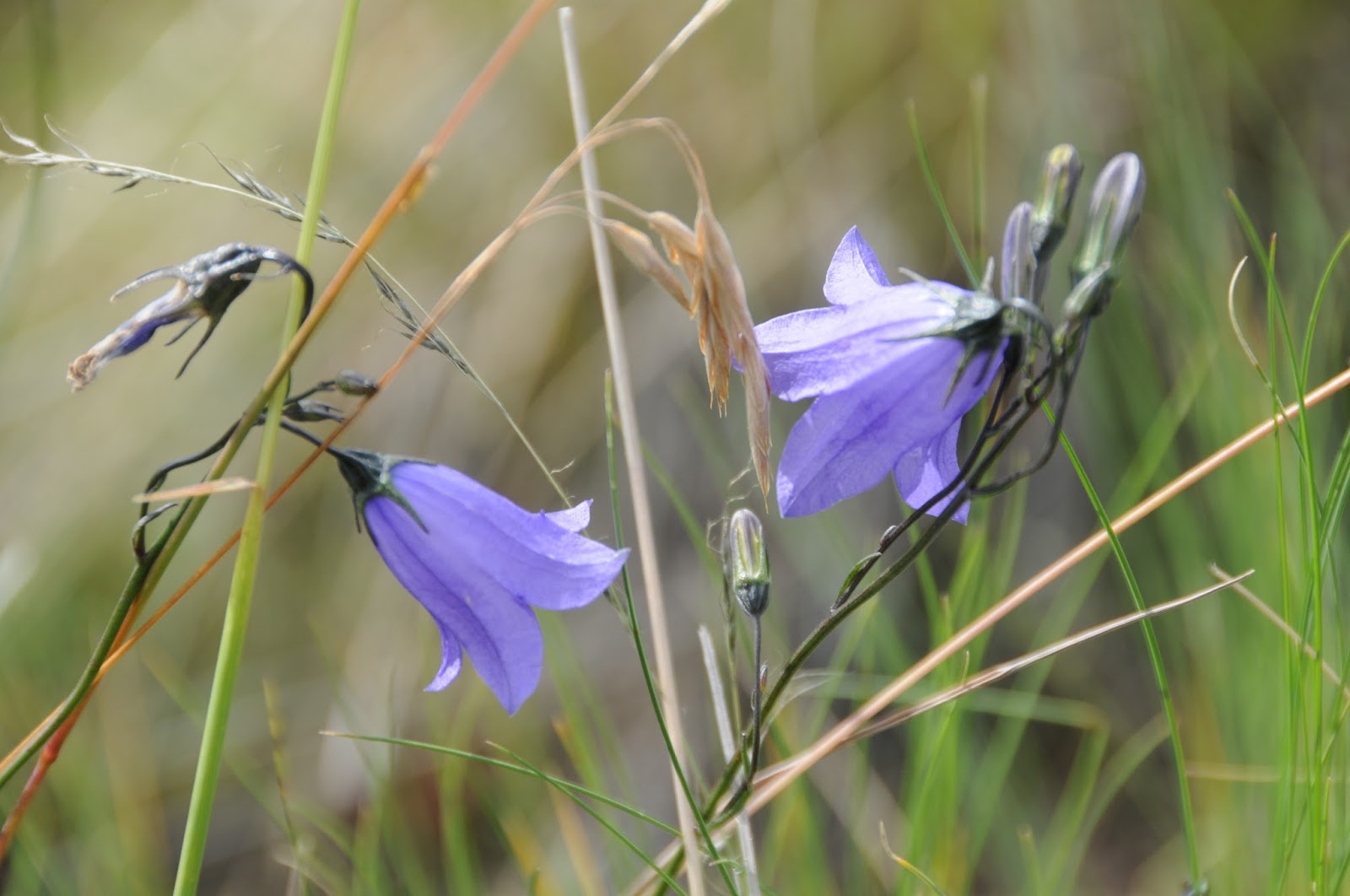
Take time to appreciate the delicate lavender harebells and dainty clustered blooms of Autumn Dwarf Gentian that pop up among swaying forbs and shrubby cinquefoil. At the 1.5-mile point, the trail encounters Colter Reservoir. More like a giant stock pond than lake, the trapped water is a favorite bovine gathering place. Sometimes, the cows congregate on the trail, but when given their space, they'll usually move aside. Pass a cattle gate (leave it open or closed as found) and make an immediate right turn onto a cow-trampled single track marked by posts and carins. From here, the trail follows the twisted trickle of the East Fork of the Little Colorado River for awhile before ascending into the hills. Over the next miles, the route passes among dewy cienegas and patches of fir-spruce forest. In places, evidence of the 2011 Wallow Fire manifests in charred tree trunks that stand like fragile matchsticks doomed to succumb to the next winter storm. But the forest is renewing itself as fresh growth is springing up from the ashes. As the trail approaches Greer, take a last look at White Mountain vistas from Amberon Point before scrambling 600 feet downhill to get your feet wet crossing the West Fork.
Harebells

LENGTH: 7.5 miles one way
RATING: moderate
ELEVATION: 8200' - 9350'
East Fork Trail #95

GETTING THERE:
Gabaldon Trailhead (as described here):
From State Route 260 17 miles west of Eagar, turn onto State Route 273 that's located just past milepost 377 and signed for Sunrise Ski Area. Go 11.9 miles south to the trailhead on the right (0.4 mile past the East Baldy trailhead. Park in the turnouts before entering the campground. To get to the trailhead, hike 0.2 mile up SR 273 to Forest Road 409, turn left and make a left onto the unsigned red cinder trail just past the cattle guard. SR 273 beyond the ski area is not plowed in winter and may be closed due to snow between October and May.
Greer Trailhead:
From State Route 260 9.6 miles west of Eagar, turn onto State Route 373 (Greer) and continue 5.5 miles south to the trailhead on the left. Parking is limited to 5 cars and there's a restroom. There's an immediate crossing of the river that's easy in low water, but may require wading.
INFO: Apache-Sitgreaves National Forest

Monday, August 24, 2015

WEST BALDY TRAIL #94

WEST BALDY TRAIL #94
Mount Baldy Wilderness Area
West Fork of the Little Colorado River flanks trail #94

Arizona's second highest mountain* is an ancient stratovolcano that last erupted around 2 million years ago. The genesis of Mount Baldy began roughly 9 million years ago with multiple lava flows that gradually built up the mountain to an estimated 13,000 feet. Although this massif's initial geological history mirrors that of the Ring of Fire volcanos like those found in the Pacific and along the west coast of the Americas, its present form is due to mostly to the work of glacial ice. If you want proof that enormous ice sheets once slid
through Arizona, just take a hike on West Baldy Trail #94. The scoured mounds, gaping scoop-shaped valleys, and fields of errant boulders are actually cirques and moraines that formed during three periods of glaciation lasting hundreds of thousands of years. Today, these ice-born features form the headwater basins of the West and East Forks of the Little Colorado River that continue to shape the mountain's character and feed water all the way to the Salt River outside of Phoenix. Unlike the chiseled peaks of Flagstaff, the chain of bulbous, volcanic mounds that make up Mount Baldy present a tamer alpine experience.
Two trails ascend to near the top. West Baldy Trail #94 follows the West Fork of the Little Colorado River and is the route of choice for those looking for a green, water-themed trek. East Baldy #95 is somewhat less shaded and more exposed. In between, the 3.5-mile Mt. Baldy Crossover Trail provides a handy link to make a 17.5-mile loop hike.
West Baldy Trail #94 starts out as an easy stream side walk. Alpine meadows, thigh-high wildflowers surrounding the river and magnificent views define the hike's first 3 miles. Instead of being smacked with an abrupt vertical ascent, the arduous climbing part sort of sneaks up on you, turning serious near the 4-mile point where the trail enters a tract damaged by the 2011 Wallow Fire. Here, charred tree trunks teeter like fragile matchsticks poised to topple downhill at the behest of summer storms and winter snow. The relatively short haul through the destruction is mitigated by the promise of impending high-point vistas and a sense of accomplishment. The "summit" is actually ridge line with 3 distinct peaks. The tempting one in the middle--11,403' Baldy Peak-- is within the White Mountain Apache Tribe boundary and is open only to tribal members. Please respect this sacred area by not trespassing.
LENGTH: 14 miles roundtrip (up and back)
RATING: moderate-difficult
ELEVATION: 9,000' - 11,200'
GETTING THERE:
From Pinetop-Lakeside, travel 20 miles east on State Route 260 to State Route 273 (signed for Sunrise Ski Area just past milepost 377). Turn left and go 8.4 miles south to the West Baldy trailhead on the right at milepost 386. The East Baldy trailhead, is 2.5 miles farther south on SR 273.
INFO: Springerville Ranger District, Apache-Sitgreaves National Forest
* Agassiz, Humphreys, Fremont, Abineau, Rees and Doyle are all PEAKS on San Francisco MOUNTAIN-- AZ's highest. Just as Baldy Peak and Mount Ord (not the one on AZ87) are PEAKS on MOUNT Baldy---AZ's 2nd highest.
MORE PHOTOS:

Friday, July 22, 2011

MOUNT BALDY TRAILS RE-OPENED TODAY

The Apache-Sitgreaves National Forest has re-opened the West Baldy, East Baldy and Crossover trails for hiking and equestrian use effective July 22, 2011. However, rangers warn users to stay alert for downed trees and other damage caused by this year's Wallow Fire.