


SADDLE MOUNTAIN VOLCANO
Flagstaff
 |
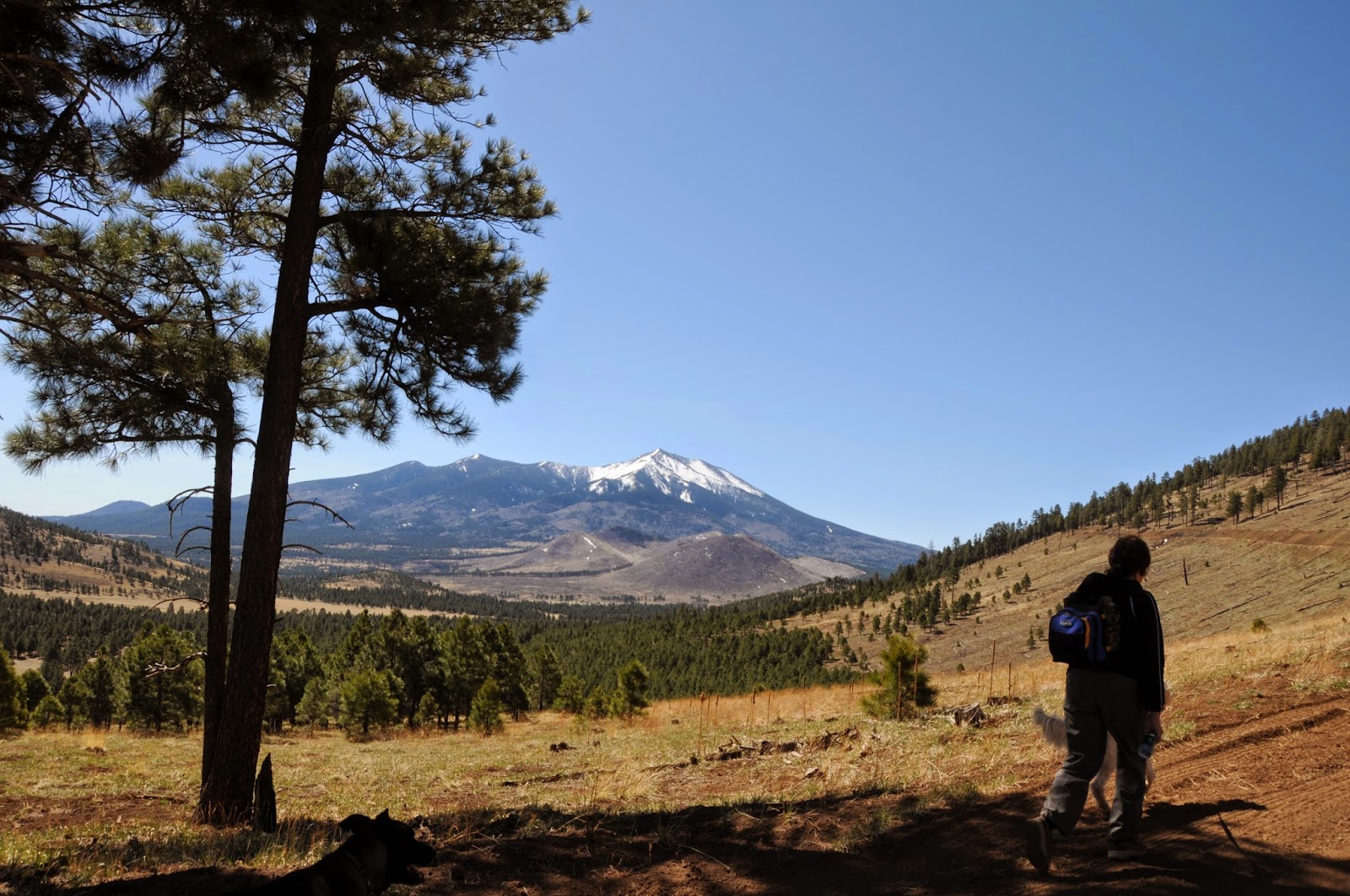
| San Francisco Peaks viewed from Saddle Mountain |
In my book, trails like this one don't get enough respect.
In the grand promised land of Flagstaff-area hiking, it's easy to understand
why a perfectly decent destination like Saddle Mountain would fall off the
radar. Visible from US 180 just north of the Kendrick wildlife viewing area,
the extinct cinder cone volcano rises 700 feet above woodlands recovering from
the 2000 Pumpkin and 1996 Hochderffer fires. In fact, several hiking books and online sources focus so
much on the wildfires when describing this trail that they have failed to acknowledge
its headliner attraction: fabulous views. Certainly, this mountain's proximity to much more ambitious climbs (Kendrick Peak, Humphreys Peak) doesn’t help visitation either. Get over it---I’m going out on a limb
to highly recommend this trail. The hike itself is a moderate trudge up a
service road which twists up the hill candy-cane-style, revealing sweeping,
360-degree landscape vistas that stretch all the way to the Grand Canyon and
Painted Desert. To the north,
geological landmarks Red Mountain and Red Butte stand out on the flat plains of
the Colorado Plateau while massive San Francisco Mountain commands the southern
flank. On the summit, a visual spectacle of eroding cinder cones can be seen in
northern Arizona’s volcanic field while communication transmitters hum in sync
with alpine breezes.
 |
| Kendrick Peak as seen from the trail |
 |
| View from the summit of Saddle Mountain |
LENGTH: 5.8
miles roundtrip
RATING: moderate
ELEVATION: 8,100' - 8,800'
GETTING THERE:
From Flagstaff, go 21 miles north on US 180 to FR 514
located at milepost 236.5. SET
YOUR ODOMETER---trust me. Turn right and travel 2.5 miles east on FR 514 (stay
straight, ignore all side roads) to FR 550, turn left (north) and drive 1.9
miles to where there’s a small loop turnaround road on the left. This is FR
550A, but it’s not signed. The
road climbing the mountain on the left is the trail. Park anywhere along the road, or, there’s also a small (one
car) dirt turn out roughly 0.2 mile up FR550A if you want to shorten the hike.
INFO:
Flagstaff Ranger District, Coconino National Forest, 928-526-0866
