Find A Trail. Start Your Search Here:

Showing posts with label Hawknest Trail. Show all posts

Tuesday, January 24, 2023

Rawhide Wash

RAWHIDE WASH

Hiking in Rawhide Wash is tougher than it looks

The sandy gap between the Axle Grease and Hawknest trails attracts a lot of horses.  The north-south running ribbon of soft stuff in Scottsdale’s McDowell Sonoran Preserve is a perfect substrate for hoofed travelers. But, for bikers and hikers, not so much.

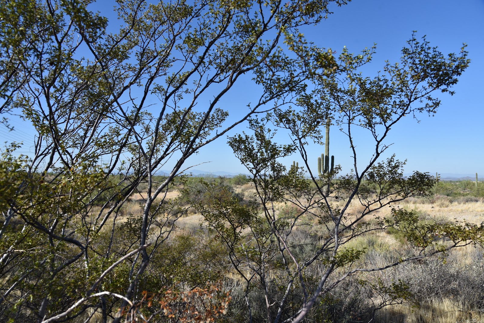
View of Cave Creek Mountains from Rawhide Wash

That is, unless the goal is to get the outdoor equivalent of a stair stepper gym workout. Even though the 4.2-mile route is mostly flat, wide, and easy to follow, its shifting grains put extra pressure on leg and foot muscles, including some that ordinarily don’t protest. 
The first mile of Rawhide Wash is on standard dirt trail

The drag of the sand slows the pace, which in this case is a good thing because there’s plenty to see along the ephemeral desert spillway.  Beginning at the Pima-Dynamite trailhead, the first mile is a normal dirt singletrack that swings among some spectacular saguaro specimens. The work begins where the trail touches a walk-in gate on Pima Road before bending east following the natural corridor of velvety grit.
Avoid desert washes during and after rain storms

The impact of sand versus compact dirt is felt right away. The rhythm of wash walking is one of shallow sinking, pulling, and wobbling that, unlike hiking regular trails, demands more attention to what's underfoot.  Flood debris, hidden stones and uprooted trees and shrubs are common encounters that douse the trail with a wild flavor.
Rawhide Wash seen from Basalt Ridge Overlook


The ragged edges are also reminders of the power of running water.
Buckwheat blooms February through June

That’s why it’s smart to avoid desert washes like this one during and immediately following rainstorms.  Lined with Palo Verde, mesquite, hackberry trees, and wolfberry shrubs the wash meanders in a northeast arch on the Preserve’s far north west edge. 
Desert Wishbone blooms March through October

Springtime brings a plethora of colorful wildflowers that thrive in the loose, disrupted soils.  Ubiquitous Mexican poppies, desert lavender, brittlebush, desert marigolds, buckwheat, and globemallows are easy to spot while the tiny blooms of Red Maids, Desert Rock Pea and Desert Wishbone are rarer sightings.

Wolfberry shrubs bear orange fruits in late spring

The wash trail ends at Browns Ranch Road below the Basalt Ridge Overlook where hikers may consult preserve maps to either backtrack or return via one of several intersecting trails that dial down the quad-burning demands on tired legs.

LENGTH: 4.2 miles one way

RATING: easy-moderate

ELEVATION: 2,310- 2,613 feet

GETTING THERE:

Pima-Dynamite Trailhead

28777 N Pima Rd. Scottsdale

INFO:

Scottsdale’s McDowell Sonoran Preserve

https://www.scottsdaleaz.gov/preserve

Monday, September 30, 2019

LATIGO-ROCK TANK- HAWKNEST LOOP

LATIGO-ROCK TANK-HAWKNEST LOOP

McDowell Sonoran Preserve
Palo verde trees shade the Latigo trail
Black Mountain seen from Rock Tank Trail
Outdoor recreation opportunities continue to expand in the McDowell Sonoran Preserve.  The permanently protected swath of Sonoran Desert in north Scottsdale that has over 220+ miles of trails that wind through more than 30,000 acres of pristine territory recently gained a new trailhead. 
WAPA power lines on Powerline Road
Located in the preserve’s northwest corner, the Pima-Dynamite trailhead that opened earlier this year, is part of the City of Scottsdale’s Phase 3 Trail Corridor Plan. The roomy access point is bordered by Pima Road and State Trust Land, Dynamite Boulevard and Stagecoach Pass and has parking for more than 200 passenger vehicles and special spots for horse trailers. While still under development, several trails in the Phase 3 project which involves 3,000 acres of land just west of the Brown’s Ranch trailhead are open for use by hikers, bikers and equestrians. Like all preserve trails, the new cluster of sustainably-designed, multi-use routes offer safe, non-motorized access while protecting native plant and wildlife habitats.
To get a quick look at the Phase 3 sector, make a loop hike on the Latigo, Rock Tank, Hawknest and Powerline Road trails. 
New trails in Scottsdale's McDowell Sonoran Preserve
A map kiosk at the trailhead shows the system layout as well as its connectivity with old-favorite preserve trails to the east.  The circuit begins with a short walk on Powerline Road to the Latigo Trail junction. The 1.1-mile Latigo leg is dominated by views of the Western Area Power Administration high voltage powerline.  Not exactly anybody’s idea of a perfect hiking visual experience, the looming spider-like metal structures have an odd, other-worldly presence.
A stony passage on the Hawknest Trail
When framed by the gangly arms of ocotillo and the gnarly branches of dead ironwood trees, the towers embody technology imitating nature. The juxtaposition of wires and wilds elicits mixed responses from trail users. Is the high-voltage canopy a necessary co-existence or an omen of doom?  It’s a dialectic best not explored when disparaging the juice conduits while pulling up trail apps on your phone. 
Bizarre granite rock forms are common site along the trails
Creosote shrubs line the Rock Tank Trail
Granite boulders on the Hawknest Trail
Wires and wilds on Latigo Trail.
Desert Senna blooms April - October
Hawknest Trail swerves around a granite rock garden
An old mesquite tree on Hawknest Trail
The hike isn’t all power lines, though.  As the route dips and bends, the wires are swallowed by big desert vistas of surrounding mountains and the distinctive forms of Cone Mountain, Pinnacle Peak and Black Mountain.  Hang a left at the Rock Tank trail junction where acres of saguaros, shrubs and hilly terrain mark the transition into a maze of mountain bike routes to the north. 
Sonoran Desert vegetation of Rock Tank Trail
The twisted paths of Dare A Sarah, Scorpion and Snake Eyes trails form a loopy challenge course in an area that, as of this writing, is signed to advise users to use caution because the area is not yet mapped. The trails are indicated on the trailhead kiosk, though. Continue on to the Hawkneck trail junction, turn left and get ready to hike though some narrow stone corridors with bizarre granite outcroppings. Although this leg of the hike also parallels the power lines, Palo verde, ironwood and mesquite trees do a good job of hiding them from view. 
Technology imitates nature on the Latigo Trail
The final miles back to the trailhead meld swerving singletrack paths with the straight-shot, bulldozed power line road that is both a backbone trail for pristine back country hikes and an access route for maintenance crews that tend the wires that send power to mobile devise charging stations.  The paradox abides.
LENGTH: 3-mile loop
RATING: easy
ELEVATION: 2,339- 2,453 feet
GETTING THERE:
Pima-Dynamite Trailhead: 28777 N. Pima Rd., Scottsdale.
From Loop 101 in Scottsdale, take the Pima/Princess exit 36, go 6.5 miles north on Pima Road to Dynamite Blvd., turn right and continue 0.1-mile to the trailhead on the left. No facilities at this time. The preserve is open daily from sunrise to sunset.
INFO: McDowell Sonoran Preserve

Monday, October 19, 2015

BUCKSHOT-HAWKNEST CIRCUIT

BUCKSHOT-HAWKNEST CIRCUIT
McDowell Sonoran Preserve, North
Buckshot Trail

I have a new favorite trail in Scottsdale's McDowell Sonoran Preserve. Again. This happens every time I overcome my penchant for hiking well-known long paths with spectacular scenery and try something different. Although it's only 0.8-mile long, Buckshot Trail wins laurels because it straddles the gap between the familiar and the untried. It shoots off from the heavily travelled Brown's Ranch site to connect with the newer Hawknest Trail that arches over the preserve's north section for nearly its entire width. On the day I discovered this desert jewel, a huge group of hikers was assembled at the trailhead preparing to trek the 7.7-mile Cholla Mountain Loop--one of the area's most scenic circuits. They invited me to join them, but the drone of "been there done that" rattling in my cerebellum won over and I plowed north toward new-to-me territory instead. As with all hikes, trying to comprehend the unique character and secrets of an unexplored trail by viewing it as a line on a map is kind of like presuming to know the traits of a wine without having tasted it. Will it be a nobel Grand cru or some pedestrian vin du pays? The essence of the Buckshot Trail falls somewhere between Night Train and a hoity toity Bordeaux--amusing yet rich. Packed with massive saguaros, blooming shrubs and yucca-framed vistas, it's just far enough off the beaten paths to offer savory solitude. Only one other hiker (a preserve steward) and a handful of mountain bikers, crossed my path. Excellent maps available online and at the trailhead show numerous ways to cobble your own circuit using Buckshot Trail. Here's the route I took: From the trailhead, hike 1.9 miles north on Brown's Ranch Road to marker CL6 and turn right onto Corral Trail (note, this is 0.6 mile beyond the first Corral Trail access point). Go 0.5 mile on Corral, turn left on the Buckshot Trail and continue 0.8 mile to Hawknest Trail. Turn right (north) at the sign and hike 1.5 mile to Broken Spoke Trail, turn left and go 0.6 mile to High Desert Trail. Turn right (south) and go 0.7 mile to Corral Trail and follow the signs back to the trailhead.
On the return leg of the trip, solitude evaporated as I encountered some of the Cholla Mountain group and dozens of other hikers funneling onto arterial Brown's Ranch Road for the final mile-long trudge back to civilization and perhaps a nice Chianti.
LENGTH: 8.8 mile loop
RATING: easy
ELEVATION: 2,610' – 2,770'
HOURS: sunrise to sunset daily
GETTING THERE:
Brown's Ranch Trailhead
30301 N. Alma School Road, Scottsdale.
From Loop 101 in Scottsdale, take the Pima/Princess exit 36, go 6.5 miles north on Pima to Dynamite, turn right and continue 2.7 miles to Alma School Road. Turn left and continue 1 mile to the trailhead. There are restrooms, water and maps at the trailhead. No fee.
INFO: McDowell Sonoran Preserve
http://www.scottsdaleaz.gov/Assets/ScottsdaleAZ/Preserve/Preserve+North+Area+Trail+Map.pdf
MORE PHOTOS: