Find A Trail. Start Your Search Here:

Showing posts with label Verde River. Show all posts

Monday, February 19, 2024

Rockin' River Ranch State Park

ROCKIN’ RIVER RANCH STATE PARK

Verde River from the White Cliffs Trail

The thickets shock the eye. Massive tangles of sycamore, cottonwoods, ash, and willows quake with the rustlings of birds making a sweet living above perennial waters at the confluence of West Clear Creek and the Verde River.

Mountain vista on the Buckaroo Trail

A small slice of this watery, woodsy paradise surrounded by mountains at the end of a narrow dirt road is now the domain of Rockin’ River Ranch State Park which opened to the public in February. 
Riparian forest along the Verde River

Located about 90 miles north of Phoenix and 7 miles southeast of Camp Verde, the 209.4-acre site includes a mile of the Verde River, one of only two Arizona waterways designated as part of the National Wild & Scenic  Rivers System (the other is Fossil Creek, learn more here: rivers.gov/arizona).  

Cottonwoods on the White Cliffs Trail

The irregularly shaped waterfront property abuts private lands and both the Coconino and Prescott National Forests.
Pastoral view on the Outlaw Trail

The rich landscape has a long history of human habitation stretching back thousands of years when indigenous hunters and farmers lived off the area’s natural resources. More recently, the property had been a private guest ranch replete with corrals, pastures, living quarters and critical historic water rights.

The new park is physically and intellectually engaging. Its appeal begins with its “out there” territorial atmosphere.  Amenities are delightfully sparse.  Simple trails, a few picnic tables, and benches placed in shady alcoves provide just enough structure for safety and comfort without sullying the wild and scenic spirit.

Winter scene on the Verde River

The day use park is open only on weekends for hiking, picnicking, and fishing. Four miles of wide, well-groomed trails loop through pastures, mesquite bosques and riverside riparian forests.

The park includes a mile of the Verde River

The park’s Central Arizona location means seasonal changes put perpetual spins on the landscape. Summer may be too hot to venture here, but the rest of the year is amazing.

Old building near the White Cliffs trailhead

The bare-branched beauty of winter exposes the arboreal bones of the place backed by snowy mountain vistas. Spring sprouts a pastel palette as cottonwoods and sycamores shower the trail in soft catkins before leafing out in thick green canopies that wind down in autumn with a showy display of golden foliage.  Whatever the season, water remains the park’s central draw and the 1.7-mile White Cliffs Trail, the longest and most diverse of the park’s 6-trail hiking menu, is the best way to explore along the Verde. Beginning near an old ranch building that now serves as a maintenance office, the trail heads straight for the Verde River and follows it for about half of its length.  The jungle-like approach to the river crackles with an avian cacophony.
Mountain vista on the Outlaw Trail

The cries of blue herons, egrets, ducks, and swarms of tiny sparrows add random top notes to the steady baseline of tumbling water. First up-close glimpses of the river come about a quarter mile in.  The ducks are generally visible, but the supporting cast of elusive river otters and beavers are rare sightings for those willing to make use of one of the strategically placed benches and a pair of binoculars.
Thickets of cottonwoods, ash and sycamores

 
The eponymous White Cliffs show up around a half-mile in.  The vertical, buff-colored walls of flood-scoured sediments contain the river’s northeast banks casting long shadows over the waterway that vacillates from raging to trickle with the seasons. 
White Cliffs on the Verde River

Beyond the cliffs, the trail enters semi-arid terrain dominated by prickly stands of catclaw and mesquite.  The White Cliffs Trail connects with most of the park’s trails for easy customization. 
Park trails are wide and mostly flat

All trails are largely flat, simple to navigate, unique in theme and replete with wildlife, mountain vistas and the kind of solitude that comes with a former ranch at the far end of a dirt road. 

LENGTH: 4 miles of trails

RATING:  easy

ELEVATION: 2,962 – 3,016 feet

GETTING THERE:

4513 S. Salt Mine Road, Camp Verde

From Interstate 17 exit 287 in Camp Verde, go 1.6 miles east (toward Payson)  on State Route 260 to Oasis Road on the right just past milepost 220. Follow Oasis around a bend to a stop sign and turn right onto S. Salt Mine Road (not signed) and continue 5 miles to the park. Roads are paved up to the park access road which is maintained dirt and passable by all vehicles.

HOURS: Day use only. 9 a.m. – 5 p.m. (last entry at 4 p.m.). Friday, Saturday, and Sunday. Holiday hours vary.

FEE:  $7 daily fee per vehicle or $3 per person for walk/bike-in

FACILITIES: Visitor center, picnic areas, restrooms, fishing. There’s no public drinking water, but water bottles are sold in the gift shop.

INFO & MAPS:

azstateparks.com/rockin-river


Tuesday, February 4, 2020

Ryal Canyon Trail

RYAL CANYON: Prescott National Forest
High desert vegetation lines the Ryal Canyon Trail 
Up until last year, gaining access to one of the most challenging hikes in the Camp Verde area was an iffy venture. Although the Ryal Canyon Trail 521 terminus is located right off Salt Mine Road just a few miles southeast of town, hikers had to cross private property to get to it.  The landowner was pretty chill about allowing people to walk the few yards between the road and the Prescott National Forest boundary where the trail begins, but the town of Camp Verde decided to do the right thing and make access to the popular multi-use trail legal.
Fractured earth and white cliffs on Ryal Canyon Trail
With a grant provided by Arizona State Parks and Trails and the Off-Highway Vehicle Recreation Fund, the city purchased a 4.4 acre buffer zone from the privately-owned Salt Mine Cattle Company. 
The hike begins at the boundary of Prescott National Forest
The purchase and subsequent development of a real trailhead are part of a larger effort to expand trail access and stoke interest in hiking in the Camp Verde area.
The roomy new trailhead has plenty of parking and provides worry-free access to trail 521. At this writing, the trailhead is open but still under construction. Trail signs and other planned amenities including a restroom and picnic ramadas have yet to be installed.  But the drive-up convenience doesn’t mean the rugged trail that’s known for its fierce workout value has been tamed. To find the route, just pass through the forest boundary gate and start hiking on the dirt two track that parallels a deeply rutted drainage area where hardy mesquite trees teeter over gaping cracks in the flat terrain.
The trail skirts the crest of Ryal Canyon
It takes about 10 minutes of walking to discover that this hike is not for the faint of heart.
Steep and rocky, the 2.5-mile path also has some sections that cling uncomfortably close to the precipitous edges.  The trail swings south, hugging the crest of Ryal Canyon via a series of aggressive vertical clambers with intermittent level sections. 
Ryal Canyon trailhead is still under construction
On the way up, the queasy track exposes views of the Verde Valley, Sedona, Flagstaff and the green course of the Verde River which get bigger and better with every few feet of elevation gained.
Mesquite trees thrive in the drainages around the trail
Throughout the hike, the landscape is dominated by sheer cliffs colorfully layered with clay, salt and gypsum. These sediments are the signatures of an ancient lake that ebbed and flowed between 10 and 2 million years ago. Long since eroded into a maze of crumbling embankments and chiseled mesas, the mineral-rich lake sediments have been mined for centuries. For a closer look at the history of these natural resources, visit the nearby Camp Verde Salt Mine which archeologists say may have been mined for over 2,000 years. It was abandoned in the 1930s and is currently being developed as an interpretive site.
Evidence of the area's salt deposits are visible on the hike
This hike also emphasizes the frustration of false summits.  Just when you think “I got this,” another brutally vertical hill tests your resolve. Relentless in its 1,650-foot upward haul and lack of climb-mitigating switchbacks, the hike is a wild workout your quads won’t soon forget.
San Francisco Peaks in Flagstaff seen in distance
Steep inclines on the trail make for a great workout.
Verde Valley views stand out throughout the hike
The trail ends at the junction with the Box T Trail 511. By referencing a forest service map, the east leg the 10.4-mile route may be used to create a loop hike. Otherwise, head back down on the Ryal Canyon trail where slippery inclines and vertical drops will have you wondering if the uphill slog was the easy part.
LENGTH: 5 miles round trip
RATING: moderate-difficult
ELEVATION: 3,110 – 4,760 feet
GETTING THERE:
From Interstate 17 in Camp Verde, take the State Route 260 exit 287.  Go 1.6 miles east on SR 260 (toward Payson) to Oasis Road, where there’s a sign for Copper Canyon Trailhead. Turn right and follow Oasis Road PAST the Copper Canyon Trailhead (Forest Road 136) to a stop sign. Turn right onto Salt Mine Road (not signed) and continue 2 miles to the large trailhead on the right. Hike begins at the national forest boundary gate. Access roads are 100% paved.
INFO: Prescott National Forest
Camp Verde Salt Mine
-->

Monday, February 4, 2019

Copper Falls Trail

Copper Falls Trail
Copper Falls cascade over stony shelves.
Chasing winter waterfalls is sort of an unofficial rite of passage for Arizona hikers.
With a few blaring exceptions (hello, Havasupai) most of our state’s waterfalls don’t flow continually.  Experienced hikers know that dark-stained cliffs and jumbled drainages visible along trails hold the potential for spectacular waterworks following episodes of rain and snow melt. Some trekkers even adjust their agendas to sync with the rhythm of the rains.
A rustic corral on the Camp Verde Trail section of the hike.
The spur trail to the falls is a bit of a scramble.
Timing is key to catch the transient desert founts at their best. Pick a day after a storm but pay attention to weather reports and road closures as torrential downpours come with a real threat of potentially deadly flooding.
The tiered flow of Copper Falls.
The fugitive waterworks aren’t hard to find.  
Copper Falls Trail traces a ridge above an ancient lake bed. 
A few famous ones like Encinoso Falls in Sedona’s Oak Creek Canyon, Massacre Falls in the Superstition Wilderness, Grand Falls north of Flagstaff, Bridal Wreath Falls in Tucson and the miles of cascades in Barnhardt Canyon flow reliably along established trails during peak conditions. Others though, reside where you’d least expect them.
One such cascade is the crux of Copper Falls Trail No. 504.  Tucked into a pocket of colorfully-layered sediments that separate the Verde River from Interstate 17, this non-motorized route is the result of grass-roots efforts driven by the residents of nearby Camp Verde.
Following years of working together with Prescott National Forest, the Copper Canyon trailhead project came to fruition with the support of donated materials and volunteer labor.  The roomy, well-outfitted recreation hub officially opened in February 2012.
The new site anchors a popular recreation area south of State Route 260 that’s known for its ATV routes and river-access for fishing and paddling.  Trail No. 504 explores above and within a bowl-like depression of an ancient lake bed where limestone and siltstone deposits disrupted by faults and other geological events have eroded into oddly-sculpted buttes, ridges and gullies.
The trailhead & Verde Valley seen from the switchbacks.
Storm clouds obscure views of Sedona to the northwest.
The 4.1-mile, moderate loop hike begins at a gate in the northwest corner of the trailhead.  Hike a few yards then veer left at a pair of generic trail signs where the route begins a mild 300-foot climb to a crest of a ridge. This scenic segment ascends through a bone-dry landscape dominated by Crucifixion-thorn bushes and acres of cacti.
Crucifixtion-thorn shrubs are common along the trail.
Views of the gaping Verde Valley and the emerald river course backed by the hills surrounding West Clear Creek Wilderness roll out to the north and east. A mile in, the trail tops out on a grassy mesa littered with chalky white stones, a fringe of yuccas and patchy forests of junipers, scrub oaks and pinion pines. 
Water from Copper Falls trickles beside the trail.
The muffled rumble of vehicles traveling on Interstate 17 and views of Sedona’s red rocks mark the beginning of an edgy traverse of the oblong mesa above a deeply furrowed basin.  The airy walk ends with a swift descent on long switchbacks that end at a drainage area where a slim footpath heads into a secluded, stonewalled gorge that hides Copper Falls.
Arizona sycamores thrive in the runoff from Copper Falls.
The 0.2-mile one-way path follows an ephemeral creek cluttered with sycamores, willows, log jams and boulders. Some minor route-finding and scrambling are needed to work your way through to the head of the dead-end canyon where tiered cascades tumble over blocky shelves into shallow drop pools.  
A sycamore leaf floats in a drop pool near Copper Falls.
This leafy oasis stands in stark contrast to the arid high desert that surrounds it.
The return leg of the loop passes through mesquite rangeland
The trailhead officially opened in Feb. 2012.
The trail then briefly traces the fall’s trickling issue before meeting the Camp Verde Trail No. 545. 
Water at the base of Copper Falls.
At the junction that’s marked with only a “504” sign, continue straight ahead passing some old native stone foundations. Soon, the terrain transitions into mesquite-covered rangeland with a rickety corral bolstered by ashen limestone embankments.  Just beyond the corral at the 3.9-mile point, another junction marks the final decision point of the hike.
A plaque at the trailhead recognizes contributors.
Head left for a slightly longer return trip to the trailhead or veer right onto the Saloon Trail No. 9833 (not signed) for a shortcut.
MacDougal's Biscuitroot bloom near the trail.
LENGTH: 4.1-mile loop
RATING: moderate
ELEVATION: 3190 – 3533 feet
GETTING THERE:
From Interstate 17 in Camp Verde, take the State Route 260 exit 287. Go 1.6 miles east (toward Payson) on SR 260 to Oasis Drive, turn right (south) and continue 0.3-mile to Forest Road 136, turn right again and go 0.8-mile to the trailhead on the right. FR 136 is washboard-rough dirt but is passable by passenger vehicles.
There are picnic ramadas with grills and a restroom at the trailhead.
The trailhead is open year round from dawn to dusk for day-use only. No fees.
INFO:
--> -->

Monday, January 23, 2017

PALO VERDE TRAIL

PALO VERDE TRAIL

Tonto National Forest, Bartlett Reservoir
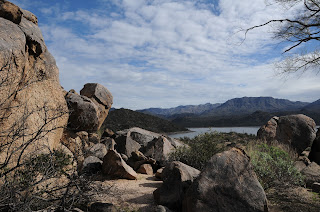
Granite boulders above Bartlett Lake
From the drive in to the trailhead to its turnaround point, this hike is packed with stunning scenery. Hedged among rough cut cliffs and desert highlands of the Verde River watershed, Bartlett Reservoir fills 12 miles of the canyon bound channel with crystalline waters teeming with bass, catfish and bluegills. Although the year-round recreation site which is located roughly 50 miles north of Phoenix is famous mostly for its boating, fishing, shaded picnic areas and camping opportunities, the Palo Verde Trail offers hikers a surprisingly challenging route with terrific mountain and water views. The trail meanders among the foothills and washes on the lake’s western banks. This is not a hike to try during or immediately after storms because rain rumbling off the foothills turns washes and gullies into raging rivers of debris.
Chollas frame Tonto National Forest mountain vistas
Don’t be fooled by the hike’s minimal amount of elevation change---the trail is a deceptively convoluted series of twists, steep climbs and slippery descents on a base of crumbling granite and sand. Overall, you will have accumulated 900+ feet of elevation gain over the 9.4-mile, out-and-back trek.  The trail wastes no time getting you up into the hills above Rattlesnake Cove for breathtaking vistas of the distant peaks of the Mazatzal Wilderness and fire tower-capped Mount Ord. Across the water, the hulking profiles of Maverick and SB Mountain in Tonto National Forest bolster the reservoir’s 33 miles of shoreline casting shadows on peninsulas and islands that morph in size with water levels. 
Rattlesnake Cove
In springtime, these hills are ablaze in wildflower glory. Look for desert lavender, chuparosa, brittlebush, Mexican gold poppies, filaree, lupines and blooming cholla and saguaro cacti.
Beyond the marina at near the 3-mile point, the trail splits. The path to the left is a spur that shaves a mile off the route. To the right, the main trail makes a hairpin loop among deep washes, quartz mounds and areas of washouts that make the route somewhat difficult to follow. Strategically-placed rock barriers and cairns mark the way. Soon, you’ll reach the beachy inlet of SB Cove. Strewn with driftwood, this cozy notch in the landscape is a favorite stomping ground for blue heron and seasonal shorebirds. The route terminates a short walk from the SB Cove Recreation Site. If you didn’t park a shuttle vehicle there, return the way you came.
Foothills of the Verde River watershed
LENGTH: 4.7 miles one way or 3.7 with shortcut
RATING: moderate
ELEVATION: 1798’ – 1882’
GETTING THERE:
Desert lavender can bloom any time of year
From Loop 101 in Scottsdale, take the Pima/Princess Drive exit 36 and go 13 miles north on Pima and turn right on Cave Creek Road.  Continue 4.1 miles to Bartlett Dam Road, turn right and go 12.6 miles to North Shore Road (Forest Road 459). Turn left continue 0.6 mile to the turn off Rattlesnake Cove Recreation Site (Forest Road 459A). Park at the last restroom at the south end of the parking loop. Walk down the stairs behind the restrooms and head right toward the trailhead sign.
FEE: A Tonto Pass is required to park.  $6 daily fee per vehicle.
INFO: Tonto National Forest

Friday, January 30, 2015

CLIFFROSE TRAILHEAD

CLIFFROSE TRAILHEAD
Cottonwood
Cliffrose Trailhead in Cottonwood

In what might be described as the "tip of the iceberg", the Cliffrose trailhead in Cottonwood represents the ongoing efforts of the Verde Valley Regional Trails Concept Plan. This grassroots effort to enhance and maintain the area's multi-use trail systems draws upon the expertise of residents from towns of Jerome and Camp Verde, and staff from the Prescott National Forest, Coconino National Forest, State Parks, City of Sedona, City of Cottonwood, Town of Clarkdale, and Yavapai County.
Together these groups are working to foster a long-range vision for Verde Valley trails and open spaces for the development of interconnected recreational travel systems.
The compact, no-frills Cliffrose trailhead sits near the Verde Valley Botanical Area and provides access to the Lime KilnTrail which in turn provides an established 15-mile travel corridor between Cottonwood and Sedona. At this writing (Jan. 2015), the trails here are unsigned but well defined. A dirt road heading east from the trailhead curves north to meet Lime Kiln in roughly 2 miles while a web of loop trails heading west trace a starkly beautiful landscape of ravines and cave riddled, jagged-edged limestone outcroppings. Beyond the chalk white sediments and high-desert scrub, sweeping vistas of Sedona's angular, vivid, rusty hued sandstone mesas and spires contrast with the hushed tones and rounded slopes of the Bradshaw Mountains. Finding your way around the roughly 3 miles of nicely maintained trails is easy. Just use the lay of the land as a natural compass. The red rocks of Sedona are in the northeast, Cottonwood and Jerome on the western frontier and the hum of Cornville Road to the south provide all the navigation tools you'll need.
LENGTH: variable, our GPS track of the loops read 3 miles
RATING: easy
ELEVATION: 3,089' – 3,353'
GETTING THERE:
From Phoenix, go north on Interstate 17 to the McGuireville exit 293 and go 12.4 miles west on Cornville Road (a.k.a. CR30, Mingus Ave.) to State Route 89A. From here, cross 89A ,continue less than a mile and turn right at the Cliffrose Trail sign.
INFO:

Tuesday, January 27, 2015

JAIL TRAIL RIVER WALK

JAIL TRAIL RIVER WALK
Cottonwood
Verde River

A trip to Old Town Cottonwood just isn't complete without a stroll under the "Gateway to the Verde River" archway that leads to a hike along the Jail Trail. Debarking from the site of a rustic old jail building, which is now home to a quaint tea house, the mile long, easy trail follows the banks of the river through River Front Park and on to Dead Horse Ranch State Park. The trail is shaded by thick tangles of willows and enormous cottonwood trees towering over the running water, cattail ringed coves and rock strewn flood plains. With reliable water and ample nesting spots, this riparian corridor is a productive birding location with hundreds of resident, seasonal and migratory species gracing the property. The hike can be enjoyed year-round as it cycles through the seasons. During the leafless winter months, the riparian corridor is as enchanting as ever with the benefit of bare branches giving clear views of roosting raptors and flocks of red-winged blackbirds. Springtime brings a flurry of chartreuse leaf shoots and fluffy catkins that mature into emerald canopies of cooling shade that last through summer. The balmy days and cool nights of late October turn the leaves into a spectacle of gold and russet. So whether you're visiting Cottonwood for a day of wine tasting, antique shopping or a scenic drive, a walk along the Verde River is de rigueur and the Jail Trail is the easiest path to the water.
LENGTH: 1 mile one-way
RATING: easy
ELEVATION: 3300' - 3290'
GETTING THERE:
From Phoenix, travel north on Interstate 17 to the Camp Verde exit 287. Head 10 miles east on State Route 260 toward Cottonwood and Jerome. When SR260 intersects with Main St./State Rt. 89A/Historic 89A, take a left. When State Rt. 89A separates at the light, stay on Main St./Historic 89A to get to Old Town. Continue through Old Town to where the road makes a sharp left turn just past Yavapai Street. Look for the “Gateway to the Verde River” archway and park in the lot on the right at 1101 N. Main Street.
INFO: Sedona Verde Valley Tourism Council
Birding info:

Monday, January 26, 2015

LIME KILN-BILL ENSIGN TRAILS

LIME KILN-BILL ENSIGN TRAILS
Cottonwood
Bill Ensign Trail

The Lime Kiln Trail is a reclaimed wagon road that was originally used from the 1890s thru the early 1900s to transport building materials and market goods between Cottonwood and Sedona. Today, the 15-mile-long route serves as a recreational trail for hikers, equestrians and mountain bikers anchored by Dead Horse Ranch State park in the west and and Red Rock State Park in the east. Named for a kiln built in the 1880s to produce mortar for the construction of several homes in Cottonwood area, the trail wanders through a landscape of limestone-layered rock formations dotted with Crucifixion thorn, juniper and beavertail cacti with impressive views of the mining town of Jerome, Mingus and Woodchute Mountains and Sedona's House Mountain volcano. Multiple access points and connecting trails provide dozens of day hike and backpack options. One to try is an out-and-back circuit using the Lime Kiln and Bill Ensign trails. Beginning from the Lagoon trailhead at DHRSP, this trip passes by the kiln site where interested hikers can take a short spur trail to the crumbling remains. At the 1.7-mile point, turn right at the Bill Ensign junction and hike 1.5 miles through high desert terrain skirting the boundary of the Verde Valley Botanical Area--a preserve established to protect the endangered Arizona Cliffrose. The trail culminates at a high point overlooking a riparian corridor of willows and cottonwoods along the Verde River.
LENGTH: 7.5 miles (as described here)
RATING: moderate
ELEVATION: 3,300' – 3,590'
FEE: $7 daily fee per vehicle
FACILITIES: restrooms, camp sites, cabins, picnic ramadas, fishing
GETTING THERE:
Dead Horse Ranch State Park
From Interstate 17 go north to State Route 260 exit 287 and head west toward Cottonwood. Continue 11 miles to Main Street in Cottonwood (Hwy 89A) and turn left. Continue through Cottonwood on Main Street, turn right on 10th Street and follow the signs to the park.
INFO:
MAPS:
Lime Kiln-Bill Ensign:
Lime Kiln:

Monday, October 27, 2008

TAVASCI MARSH

TAVASCI MARSH Dead Horse Ranch State Park Situated in the backwaters of the upper Verde River, Tavasci Marsh is a bird watcher’s paradise. Herons, egrets, finches, wrens and flycatchers flourish in the profuse vegetation and aren’t shy about spreading their wings. The hike passes through a healthy mesquite bosque—one of the most rare ecosystems in the world—ending at a wooden observation deck with a viewing bench at the edge of the wetlands. Here, river otters cut through pond water like oiled torpedoes accompanied by a boisterous avian soundtrack. LENGTH: 3 miles round-trip RATING: easy elevation gain: 50 feet ELEVATION GAIN: 3,350’ – 3,300’ GETTING THERE: From Phoenix, go north on Interstate 17 to Camp Verde (exit 287) and take Highway 260 west to Cottonwood. Turn left on Main Street (89A toward Clarksdale) and continue to 10th Street. Turn right on 10th St. and proceed over the Verde River Bridge to the park entrance. From the park entrance, follow the main road to Flycatcher Road (2nd road on the left) where there’s a “Tavasci Marsh” sign. Follow this road less than a mile to the signed parking area.