Find A Trail. Start Your Search Here:

Showing posts with label Queen Creek. Show all posts

Tuesday, March 1, 2022

Dynamite Trail

DYNAMITE TRAIL

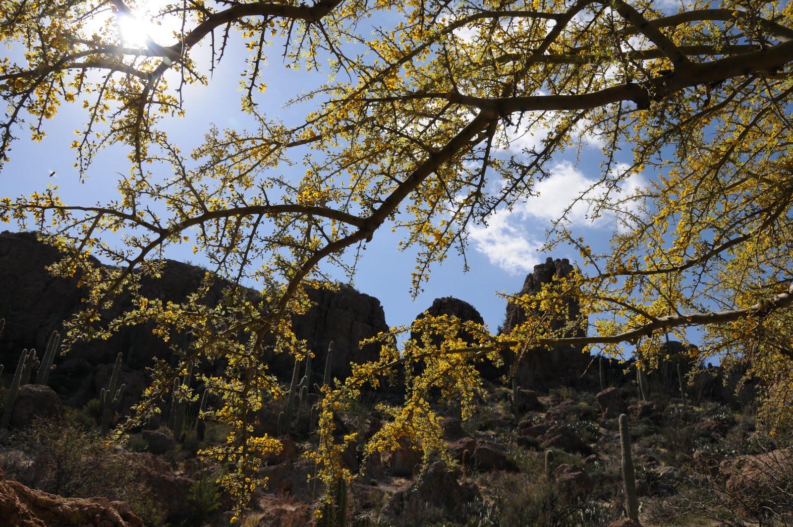
Dynamite Trail passes through a leafy desert wash

San Tan Mountain Regional Park in Queen Creek is a 10,198-acre mountain-bound property that anchors the far southeast reach of the 10 Maricopa County Regional Parks that circle the Valley.  The park’s 9 non-motorized trails plus a short interpretive loop, provide options for trail users of every level of experience. 

Big valley views on the Dynamite Trail saddle

Situated in a hilly expanse bolstered by Goldmine Mountain in the north and the Malpais Hills in the south, the park’s 20+ miles of trails wander among lush desert vegetation, scoured washes and scenic high points with excellent valley vistas. One moderate route to try uses parts of the Littleleaf, Goldmine and San Tan trails to connect with the park’s northwest classic—the Dynamite trail.

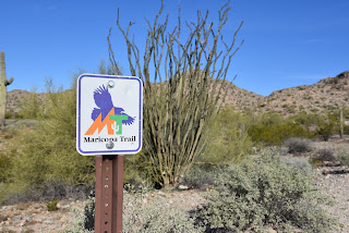
The route is part of the 315-mile Maricopa Trail

Fragrant creosote shrubs cluster around the trails

Ocotillos frame mountain views on the Dynamite Trail

All three trails are also part of the 315-mile, Valley circumnavigating Maricopa Trail.
Mountain vistas begin on the Littleleaf Trail

The 2.5-mile path may be accessed by way of connecting routes from either the main park trailhead or the Goldmine trailhead located at the park’s northwest end.  With extra amenities like real restrooms and a visitor center, the main park trailhead is a good place to start.
Mountains close in on the Dynamite Trail
Begin with an easy  0.7-mile walk on the Littleleaf trail. While it gains only 85 feet in elevation, it’s enough to serve up appetizer vistas of distant Tonto National Forest and Mazatzal Wilderness mountain peaks.  This warmup segment is followed by a 0.4-mile hike on the Goldmine trail which undulates through drainages and cholla forests before arriving at the junction with the San Tan Trail where Goldmine begins its strenuous uphill haul.  For this trip, head left on the San Tan trail and continue 0.4-mile to link up with the destination route—the Dynamite trail.  It’s along this segment where the mountainous nature of the park becomes headily apparent.  The Malpais Hills jut abruptly on the near horizon while the green valleys of the Gila River Indian Community peek out to the southwest.

Goldmine Mountain seen from the Littleleaf Trail

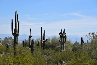
The Dynamite trail starts out by tracing the western foothills of Goldmine Mountain ducking through ironwood-cluttered washes, acres of creosote shrubs and many impressive stands of saguaros and cholla cacti.
Junctions are well signed in the park

At 2.4 miles from the trailhead, the route takes on a series of switchbacks that ease the climb to a mountain saddle.  On the breezy divide, a fresh set of views open up over sprawling east Valley suburbs that stretch into the Superstition Mountains and, on clear days, all the way to the New River Mountains to the far north. 
Dynamite Trail descends from the high saddle

Viewing benches placed at scenic overlooks throughout the route, including on the saddle, invite trail users to sit awhile and soak up the beauty.  From the saddle, the trail spirals downhill over long, lazy curves, passing by historic grave sites before reconnecting with the Goldmine trail near the Goldmine trailhead on Wagon Wheel Road.
The route crosses several sandy washes

Switchbacks ease the climb to the Dynamite saddle

Unless you parked a car-shuttle vehicle there, return the way you came. Or, for a more difficult return route, loop it up with the 2.5-mile Goldmine trail for a challenging climb to the park’s highest point and even more outstanding viewing opportunities.

LENGTH: 4.1 miles one-way or 8.2 miles round trip, as described here.

Use the Goldmine trailhead for a car shuttle hike

RATING: moderate

ELEVATION: 1,617 – 1,894 feet

GETTING THERE:

South: San Tan Mountain Regional Park main trailhead:

6533 W. Phillips Road, Queen Creek.

From U.S. 60 in Mesa, take the Ellsworth Road exit 191. Go south on Ellsworth to Hunt Highway and continue east to Thompson Road. Go south on Thompson Road to Phillips Road and follow the signs to the main park entrance. The park has restrooms, water, a visitor center, equestrian staging area and picnic tables.

North: Goldmine trailhead:

From Hunt Highway north of the main park entrance, go 1.2 miles west on Empire Blvd. to Wagon Wheel Road, turn south and follow the road 1.0 mile to the Goldmine trailhead.

If no attendant is on duty, pay the entry fee in cash to the “iron ranger” (metal kiosk with payment envelopes). Follow the Goldmine trail 0.2-mile to connect with the Dynamite trail.

There are portable restrooms at the trailhead but no other amenities.

FEE: $7 daily fee per vehicle or $2 per person walk-in/bike-in fee.

HOURS: the park is open for day use only from 6 a.m. to 8 p.m.

INFO & MAPS:

San Tan Mountain Regional Park

https://www.maricopacountyparks.net/park-locator/san-tan-mountain-regional-park/


Wednesday, February 2, 2022

Legends of Superior Trail: Queen Creek Canyon

LOST: QUEEN CREEK CANYON SEGMENT

Boulders line the upper part of the Queen Creek Canyon hike

Imagine the trip from Phoenix to the Copper Corridor towns of Globe-Miami taking all day. That was the reality back in the early 20th century before U.S. 60 replaced the old Apache Trail route. While the annual Renaissance Festival traffic might still make the trip feel like a lurching marathon, the highway shaved the 88-mile drive time down to about an hour and a half.

Inside the defunct Claypool Tunnel

The highway’s original, “million-dollar-a-mile” sinuous alignment opened in 1922.  

Ruins of mining equipment visible on the hike

Convicts were used to build parts of the route, including the Claypool Tunnel near the town of Superior, which was blasted from solid rock in the rugged cliffs above Queen Creek Canyon.
Hike follows the 1920s alignment of U.S. 60

 
The current U.S. 60 bridge spans Queen Creek

While known for its fabulous views, the narrow, edge-hugging road with hairpin turns and queasy drop-offs proved just too dangerous for modern travel needs.  So, the route was retooled in 1952 to its safer, current alignment which includes the slick (yet claustrophobic) Queen Creek Tunnel. 
The rough-blasted interior of the Claypool Tunnel

A 1920s-era bridge crosses Queen Creek

But the decommissioned U.S. 60 didn’t just disappear. Its crumbling course, which is now on Resolution Copper property, has been repurposed into a recreational trail that’s part of the Legends of Superior Trails (LOST) system.
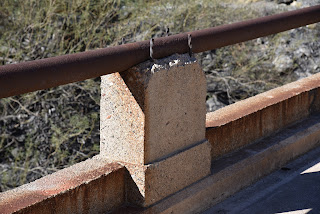
Early 20th century masonry work

Picketpost Mountain and the Superior water tank

 
Located roughly 65 miles east of Phoenix, the 11.65-mile  LOST system is divided into 5 segments open to hiking, biking and equestrian use.
Sycamores grow in the riparian zone around Queen Creek

Each segment explores a unique slice of Superior’s history and environmental diversity. There’s the stunning riparian corridor of Arnett Canyon with connectivity to the Arizona National Scenic Trail, a walk through the abandoned town of Pinal and an interpretive in-town stroll among artifacts from the area’s rich mining and ranching heritage.  But it’s the Queen Creek Canyon segment that gives a boots-on-the-ground tour of the defunct highway.
Close up of the 1952 Queen Creek Bridge


The 4.2-mile out-and-back hike begins on the outskirts of the historic downtown business district.  Following the disintegrating substrate of pavement and gravel, the old highway traces the bed of Queen Creek where bits of old mining equipment and barred-off prospects teeter over the usually dry waterway. 

The Claypool Tunnel was blasted from solid rock

Throughout the hike, a palpable push-pull of old and new defines the mood, beginning with the crossing of a 1920s-era concrete bridge that stands below the gargantuan span of its metal-riveted replacement bolted into vertical cliffs soaring above the sycamore-lined creek. Among eroding culverts, barriers and drainage systems, interpretive signs augment the trek with information on local wildlife, geology and history.  About halfway through the hike, the road swings around a water tank and begins a winding ascent through a geologically complex zone of quartzite, limestone and volcanic tuff--an amazing display 540 million years in the making.
Mineral-rich geology in Queen Creek Canyon

Interpretive signs augment the hike

On its way uphill, the trail unpacks views of 4,377-foot Picketpost Mountain and the remote, chiseled landscape of Alamo Canyon and Tonto National Forest to the southwest.

Abandoned mines are dangerous. Stay on the trail.

The crumbling foundation of old U.S. 60

The trail tops out at the old Claypool Tunnel.  It’s a short, sort of creepy, walk through the rough-blasted stone tube that lands hikers just yards beyond its replacement on the new U.S. 60.  For average-paced visitors arriving from Phoenix, the hike takes about as long as the drive to the trailhead, Fair traffic notwithstanding.

LENGTH: 4.2 miles roundtrip

RATING: moderate

ELEVATION: 2,807 – 3,485 feet

GETTING THERE:

Magma Avenue Trailhead:

From U.S. 60 in Superior, take the Kearny/Winkelman exit 227 for State Route 177. At the top of the offramp, go left and merge onto Magma Ave. (toward the business district) and continue 0.2-mile to the intersection of Magma Ave. and Heiner Dr. where there’s a dirt parking area. Hike begins at the gate at the north end of the lot.

INFO:

Legends of Superior Trails

https://superioraztrails.com/


Wednesday, December 12, 2012

Dream of wildflowers. Howl at the moon.


MOONLIGHT-STARGAZER-SAN TAN-HEDGEHOG LOOP
San Tan Mountain Regional Park

I'm keeping this one on my list to re-visit during spring wildflower season.  That's because by then, the ironwood trees lining the park's numerous washes will be laden with pink, pea-like blooms and the now-dormant strawberry hedgehog cactuses will be dressed up in fragrant, fusha-colored blossoms.  But, right now,  our cool winter weather makes hiking this open-to-the-sky (shadeless) trail system a real treat.  With a soft treadway and enough directional signage to keep even novice hikers on track, this loop is just right for a quick outing with kids or even non-hiker (our winter visitor) types.
Also--as their names suggest--the Moonlight and Stargazer trails offer front row quality night sky viewing. 
DIRECTIONS FOR LOOP DESCRIBED HERE:
In case you don't get a free map from the visitor center or trailhead kiosk: From the main trailhead, begin on Moonlight Trail (ML), hike 1.2 miles to the San Tan Trail (SA).  Turn left (south and hike 1.5 miles to the Hedgehog Trail (HG).  Turn left (north) and continue 1 mile to SA, turn left and go 0.3 mile to Stargazer Trail.  Turn left hike 0.8 mile to ML, turn right and hike 0.7 mile back to teh trailhead.

LENGTH:  5.5 mile loop
RATING:  moderate
ELEVATION:  1400'-1600'
FEE: $6 daily fee per vehicle
PARK HOURS: Sunday- Thursday: 6 a.m. - 8 p.m. , Friday-Saturday: 6 a.m. - 10 p.m.
PETS: leashed pets allowed
FACILITIES: restrooms, water, visitor center, wildlife exhibit, tortoise habitat, ranger-led activities

GETTING THERE:
From Phoenix, travel east on US 60 to Ellsworth Road exit 191.  Follow  Ellsworth 13.6 miles south (Ellsworth turns into Hunt Highway at about the 12 mile point) to  Thompson Road (traffic light), turn right (south)  and go 2.1 miles to Phillips Road. Turn right and continue 1 mile to the park entrance.
INFO: Maricopa County Parks & Recreation: San Tan Mountain Regional Park, 480-655-5554

MORE PHOTOS:

Saturday, December 8, 2012

Desert beaches and a “hang five” saguaro


SAN TAN TRAIL
San Tan Mountain Regional Park, Queen Creek
Rock Peak and the Malpais Hills

the "hang five" crested saguaro
Part of the fun of visiting this desert park on the southeastern fringe of Maricopa County is the drive down Ellsworth Road through Queen Creek.  It’s a 13-mile stretch of cow pastures, cotton farms and horse corrals tossed together with acres of stucco and strip malls.  At the base of this suburban-rural interface is San Tan Mountain Regional Park—10,200 acres of pristine Sonoran Desert with 20 miles of shared-used trails ranging in difficulty from easy to strenuous. All of the park's nine trails are well-signed and laid out so users can easily cobble custom treks, but when the park ranger told me there was a rare crested saguaro and a petroglyph site on the San Tan Trail (SA) , choosing a route was a no-brainer for me.  Using the park map available for free at the visitor center, I planned my hike around those two features.  Except for a few places where the trail follows sandy washes---which is similar to strolling on a beach---the route is a walk in the park.  One short, minor climb leads to the crest of a ridge with astonishing views the park's signature geological features---Rock Peak and the Malpais Hills.  From this breezy vantage point, you can do a visual walk through of the return leg of the hike.  The petroglyph site is located a quarter-mile downhill from the crest.  Look for a jumble of granite on the left.  The rock art here appears to be quite ancient and only one incised design stands out. To see the crested saguaro, continue past the Rock Peak Wash junction, turn right to stay on SA and hike a few yards to where the trail makes a sharp left swerve and heads up an embankment.  From here, you can catch a first glimpse the plant’s famous “hang five” (or "I Love You" in American Sign Language)  gesture about 0.1-mile down the path.   To complete the loop, continue hiking north and take any of these connector trails: Hedgehog, Moonlight or Goldmine-Littleleaf.
Sonoran Desert "beach"

LENGTH:  7.4-mile loop (6.4 on San Tan, 0.4 on Goldmine, 0.6 mile on Littleleaf)
RATING:  moderate-difficult
ELEVATION:  1,160’ – 1,800’
FEE: $6 daily fee per vehicle
FACILITIES: restrooms, water, visitor center, wildlife exhibit, tortoise habitat, ranger-led activities
HOURS: open 365 days a year, Sunday-Thursday: 6 a.m. to 8 p.m., Friday-Saturday: 6 a.m. to 10 p.m.
PETS: leashed pets are allowed
GETTING THERE:
From Phoenix, travel east on US60 to Ellsworth Road exit 191.  Follow Ellsworth 13.6 miles south (Ellsworth turns into Hunt Highway after about 12 miles) to Thompson Road (traffic signal), turn south (right) and go 2.1 miles to Phillips Road, turn right again and continue 1 mile to the park entrance.
INFO: Maricopa County Parks & Recreation, 480-655-5554
MORE PHOTOS:

Saturday, December 10, 2011

HIKING FALL COLOR IN DECEMBER

HIKING FALL COLOR IN DECEMBER
December 7, 2011

Suspension bridge over Queen Creek
Color on December 7, 2011
Entering the Suspension Bridge, Dec. 7, 2011
If you missed the fall hiking season in northern Arizona his year, a second chance to view autumnal color has arrived in the deserts, and just in time to treat my visiting cousins from Connecticut (where fall foliage was ruined by a severe, October snow storm this year) to a beautiful hike under canopies of tawny leaves.  Our first stop was Boyce Thompson Arboretum where the annual fall festival, staring the famous Chinese pistachio trees, is in full swing this week.  Take the scenic High Trail, which is accessed via a wood suspension bridge and follows a ridge above Queen Creek for the best views of the vivid amber sycamore, blood-red pistachio and lemony cottonwood trees.
LENGTH:  up to 4 miles, maps available online and at the park
RATING:  easy
ELEVATION: 2,400’-2,600’
View from the High Trail

GETTING THERE:
From Phoenix, go east on US 60 to the signed turn off for the park located just outside the town of Superior. 
FEES:  $9 per adult, $4.50 for kids 5-12 and FREE for kids under age 4 and under.
HOURS:  Sept. – April: 8 a.m. to 5 p.m., May – Aug. 6 a.m. – 3 p.m.
DOGS: leashed dog are permitted. Bring poo bags.
INFO:  (520) 689-2811, http://ag.arizona.edu/bta/

Saturday, March 26, 2011

BOYCE THOMPSON ARBORETUM

BOYCE THOMPSON ARBORETUM Superior So far, 2011 has been a disappointing year for desert wildflowers. For instance, last week, I drove up to Payson on SR87, which normally is lined with manic penstemons, lupines, poppies and globemallow---but not this year. Desperate for a wildflower fix, I decided to head out to Boyce Thompson Arboretum today. This beautiful Arizona state park features both native and global arid climate plants organized into a series of easy loop trails. Trail exhibits include Australian Desert, Chihuahuan Desert, Upland Sonoran, a riparian corridor along Queen Creek, a South American Desert loop and countless others. Although the wildflower show was less than awesome, it was better here than anywhere else I’ve seen this year. I also discovered that boojum trees are pretty cool. So are Mescal Bean trees, Chinese Pistacia and the resident buzzards. There’s so much to see it’s ridiculous and park volunteers are veritable fountains of information---seriously, they nearly exploded my brain on the hummingbird trail. Anyhooo, since this is a HIKING blog, I must say that I wandered nearly 4 miles within the park and still didn’t see everything. The best part for me was crossing the suspension bridge (which sways as you walk) over Queen Creek to access the “high trail”. Nearly a mile in length, the high trail is carved out of the cliffs above Queen Creek and offers some sweet views of the volcanic topography near Picketpost Mountain and Superior. LENGTH: up to 4 miles--free park trail maps available at the entrance RATING: easy-moderate ELEVATION: 2,400’-2,600’ GETTING THERE: From Phoenix, go east on US 60 to the signed turn off for the park located just outside the town of Superior. FEES: $7.50 per adult, $3.00 for kids 5-12 and FREE for kids under age 4 and under. HOURS: Sept. – April: 8 a.m. to 5 p.m., May – Aug. 6 a.m. – 3 p.m. DOGS: leashed dog are permitted. Bring poo bags. INFO: (520) 689-2811, ag.arizona.edu/bta facebook.com/boycethompsonarboretum MORE PHOTOS: http://www.facebook.com/album.php?aid=52402&id=1795269672&l=9ee8fd99c1