Find A Trail. Start Your Search Here:

Showing posts with label Flagstaff Loop Trail. Show all posts

Monday, July 25, 2022

Picture Canyon Natural and Cultural Preserve

PICTURE CANYON NATURAL and CULTURAL PRESERVE

Bridge over the Rio de Flag

On the industrial side of the tracks a few miles east of Downtown Flagstaff, a tiny preserve set between the unglamourous footprints of a wastewater plant and public works facility interrupts the churn of municipal infrastructure with a surprising corridor of green.
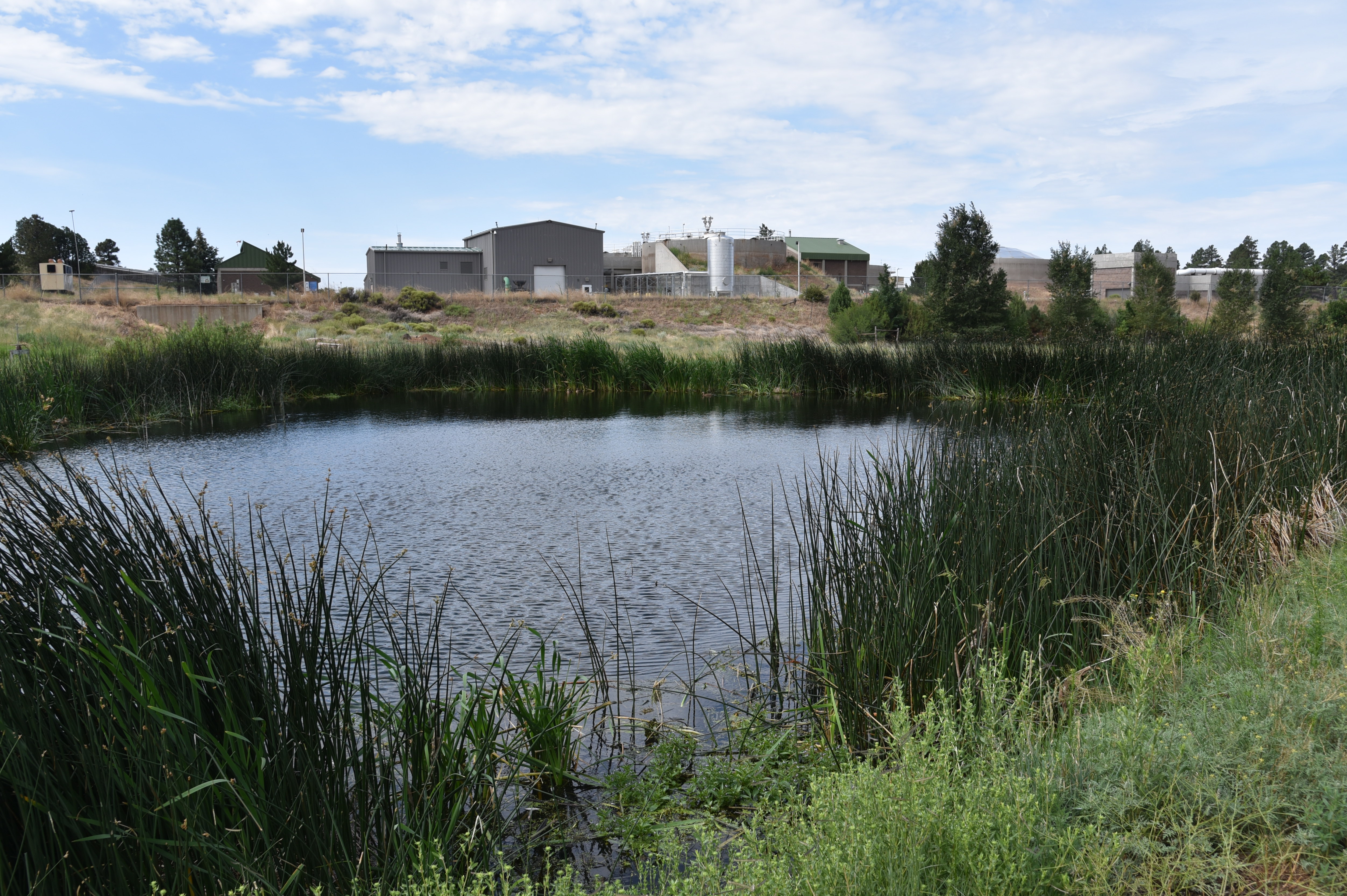
Deep water pond near wastewater treatment plant

Mt. Elden (left) and Sheep Hill cindercone viewed from the trails

Picture Canyon Natural and Culture Preserve protects a swath of rare habitats and human history huddled around a perennially moist branch of the Rio de Flag watershed, a natural stream system with headwaters at the base of the San Francisco Peaks and Mount Elden that flows in ephemeral tendrils through Flagstaff.

Slimleaf lima bean blooms May - October

Mountain tansy mustard bloom July - August

Named for panels of petroglyphs (rock art) etched into stone along one of the site’s three trails, the 478-acre parcel protects sensitive terrain, Native American heritage sites and wildlife habitats.

Along with a 1.2-mile section of the 800+-mile Arizona National Scenic Trail that bisects it, the preserve’s Tom Moody and Don Weaver trails provide easy walking tours that tie in visits to a deep-water pond, historic railroad trestle, waterfall, pithouse, petroglyphs and a crossing of the Rio de Flag waterway by way of a wooden bridge. For longer hikes, the trails also connect with the 44-mile, city-circling Flagstaff Loop Trail.

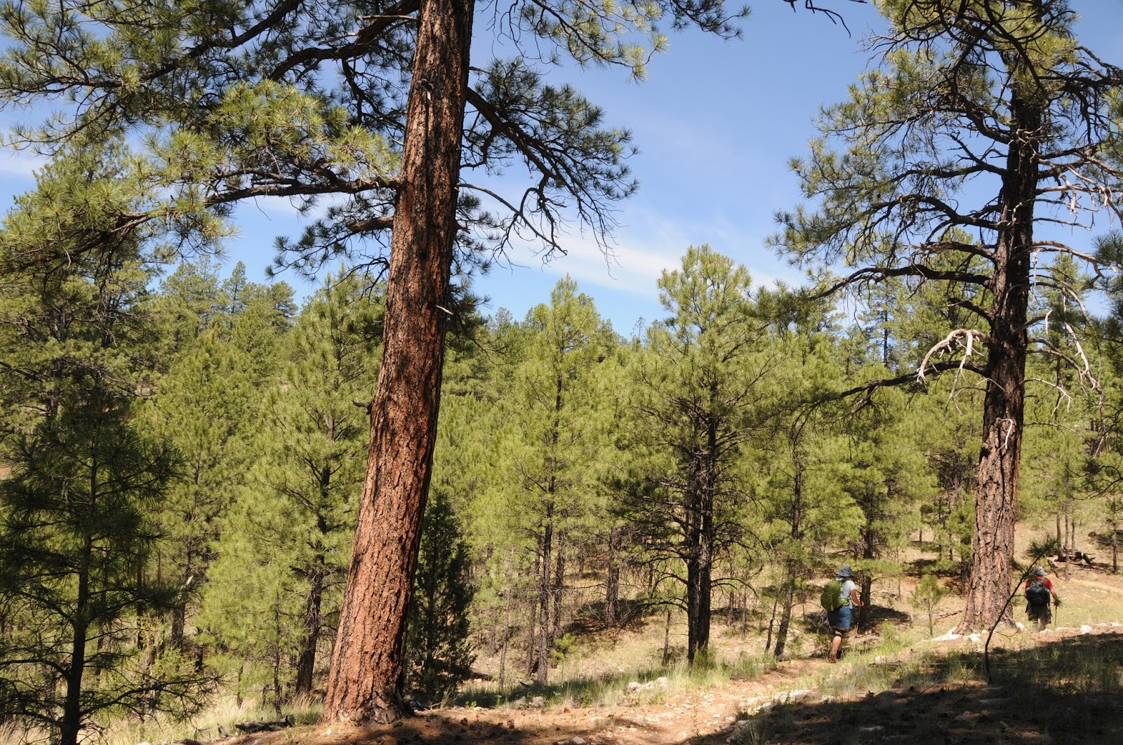
Pine-oak woodlands: one of several eco zones in the preserve

Preserve trails link with the AZT and Flagstaff Loop


The compact preserve on the drier, leeward (a.k.a. “rain shadow”) side of San Francisco Mountain packs in an amazing snapshot of Northern Arizona’s biodiversity in an ordinarily semi-arid environment.

Signs at the petroglyph site detail their significance

Buffalo gourds bloom May-Aug along the Rio de Flag

Basalt canyons, slopes and a variety of soil types create niches that foster myriad microclimate zones including meadows, pine forests, floodplains, and riparian corridors rife with willow and reeds.

A perennially flowing segment of the Rio de Flag

The preserve also serves native wildlife by providing a contiguous land bridge that allows elk, deer, and other animals to circumvent urban areas and safely cross between grasslands, forests, and wetlands.

Colorful layers of Sheep Hill cindercone

Prairie coneflower bloom Jun-Oct

Tom Moody trail traces the Rio de Flag floodplain

Listed on the National Register of Historic Places and designated as both a Northern Arizona Audubon Bird Sanctuary and an Arizona Game & Fish Department Arizona Watchable Wildlife Experience site, preserve visitors may spot waterfowl, large mammals, raccoons and more than 200 species of year-round and migratory birds.

Rock art panels decorate basalt cliffs

A map kiosk and brochures available at the trailhead give information about the site’s archeology, wildlife, and history to enrich the hike through this living sanctuary and outdoor classroom.

A waterfall trickles through a basalt canyon

LENGTH:

Tom Moody Trail: 3.9-mile circumference loop

Don Weaver Trail: 0.7-mile

Arizona Trail: 1.2 miles

RATING: easy

ELEVATION: 6,587 – 6,849 feet

GETTING THERE:

From Downtown Flagstaff, go 4 miles east on Historic Route 66, turn left on El Paso Flagstaff Road and continue 1 mile to the trailhead on the right.

INFO:

https://www.flagstaff.az.gov/2881/Picture-Canyon-Natural-Cultural-Preserve

Monday, June 7, 2021

Sandy Seep Trail

SANDY SEEP TRAIL

Sandy Seep Trail below east slopes of Elden Mtn

Short, easy and scenic, the Sandy Seep Trail offers quick access to a network of routes on the east flanks of Mount Elden in northeast Flagstaff.  While the 1.5-mile path makes for a sweet standalone hike, it also serves as an on-ramp for the 42-mile, city-circling Flagstaff Loop Trail and the 800+-mile, state-traversing Arizona National Scenic Trail. 
Extend the hike at the "sign vortex"

In addition, the route can be used to access two heart-pumping trails---Little Bear and Heart--that climb steep slopes to the ridgelines of Elden Mountain. 
Slimleaf lima beans bloom May - October

Located just a few clicks north of downtown off US 89, the old standard trail has been a stalwart pillar of the Mount Elden/Dry Lakes Hills trail system in Coconino National Forest. 
Mt. Elden seen from Sandy Seep Trail

Having already survived several devastating wildfires including the 1977 Radio Fire and the 2010 Schultz Fire, the trail is also within the scope of proposed changes that will improve forest health and enhance user experience in the popular recreation hub.  You can weigh in on how the changes might roll out.
Western blue flax blooms in clearings Apr-Sept

Coconino National Forest is asking for public input regarding proposed improvements to the non-motorized trails in the Mount Elden/Dry Lake Hills area in northeast Flagstaff.  Popular hiking, biking and equestrian trails in the heavily-used area have been deteriorating and a maze of unauthorized paths have resulted in environmental damage, trail-user confusion and safety concerns.  The proposed project includes plans for sustainable new trail construction, re-routes of existing trails, trailhead improvements and closure of some wildcat paths.

The public may comment online or at scheduled in-person events between June 1 and July 1, 2021.  Here’s the link to the plan maps, environmental analysis, contacts and comment form: https://www.fs.usda.gov/detail/coconino/news-events/?cid=FSEPRD917886

View of the seep from the Arizona Trail

In the meantime, hit the Sandy Seep Trail to gain an appreciation for this beautiful mountainous region and see for yourself what a re-boot will do for the area.  From the trailhead, the path is wide and easy to follow.  You’ll pass the first Arizona Trail/Flagstaff Loop junction at the 0.1-mile point before the path veers right through spotty pines and oak glens.  Views of 9,299-foot Mount Elden and 9,018-foot Little Elden Mountain bolster the trail’s western edge.  Sandy Seep Trail ends at the “sign vortex” at the 1.5-mile point.  Interestingly, the seep is not located on the eponymous trail, but a few yards ahead on the Little Elden Trail.  
Look for Spreading Dogbane June-August

Use this trail to access the Little Bear Trail

To get there, follow the Little Elden/Arizona Trail another 0.2-mile to where an Arizona Trail sign steers hikers to the right.  Within a few yards, the trail rises above a sunken basin ringed with reeds and wildflowers.


Sandy Seep is an onramp to the AZT and Flagstaff Loop

Sometimes soggy, but mostly dry, the seep is a favorite hangout for local wildlife like deer, squirrels and rabbits.  For an easy stroll, make the seep your turnaround point, or another good day hike out-and-back option is to continue another 2.7 miles to the Little Elden Springs trailhead.
Scenic spot on the Little Elden/Arizona Trail

LENGTH: 3 miles round trip for Sandy Seep or 8.4 miles roundtrip to the Little Elden Spring trailhead and back.

RATING: easy

ELEVATION: 6,885 – 7,270 feet or 6,885 - 7,320 feet

GETTING THERE:

Sandy Seep Trailhead as described here:

In Flagstaff, take US 89 north toward Page. One half mile beyond the Townsend/Winona Road intersection, turn left onto Forest Road 9139 and continue a few yards to the trailhead.

Little Elden Spring Trailhead option:

Drive 5 miles northeast of In Flagstaff go 5 miles north on US 89 to Elden Spring Road (Forest Road 556), turn left and continue 3.5 miles to the Little Elden Springs trailhead on the right.

INFO: Coconino National Forest

https://www.fs.usda.gov/recarea/coconino/recarea/?recid=55170

Arizona Trail Association

https://aztrail.org/explore/passages/passage-32-elden-mountain/

Flagstaff Loop Trail

https://www.flagstaff.az.gov/1521/Flagstaff-Urban-Trails-Bikeways-Map

Wednesday, June 27, 2018

ROGERS TRAIL

ROGERS TRAIL
Rogers Lake Natural Area
Southwest of Flagstaff, two recreation areas with divergent personalities are now linked.  The recently completed 5.4-mile Rogers Trail tethers the event-centric, party atmosphere of Fort Tuthill County Park with the subdued wilds of Rogers Lake Natural Area.
Switchbacks on Rogers Trail
The non-motorized, flowy trail that straddles the open space between the two Coconino County properties has several access points and many opportunities to create short day hikes, long loops or car shuttle excursions. 
A bee harvests nectar from Butter and Eggs
One convenient out-and-back circuit begins at a trailhead on Forest Road 532.  From the roomy dirt parking lot, pick up the Flagstaff Loop Trail heading west and follow it 0.9-mile to the beginning of Rogers Trail.  Roughly paralleling Woody Mountain Road, the meandering, single track holds steady at around 7100 feet, sweeping easily through wildflower meadows, and shady glens. 
The San Francisco Peaks seen from Rogers Trail
Watch for swarms of butterflies and bees drawing nectar from Butter and Eggs, New Mexican vervain and field bindweed blooms.  After passing by the Arboretum at Flagstaff, where there’s a short access path, the trail turns southwest heading toward the pine-smothered mound of 8045-foot Woody Mountain.  Near the four-mile point, a set of syrupy switchbacks take on the southeast flanks of the mountain. The smartly constructed trail eliminates much of the huff-and-puff of the 600-foot ascent. (I ran into several volunteer forest service workers who were improving drainages on this section.  It’s important that trail users don’t cut switchbacks because doing so will cause the path to degrade and create dangerous conditions.) 
Gambel oaks are common along the trail
The uphill segment winds through thick stands of Gambel oak, New Mexican Locust and Ponderosa pines.  Even with the dense tree cover, glimpses of the San Francisco Peaks can be seen through breaks in the foliage. Trailside basalt boulders, an understory of pine cones and clumpy grasses plus the rustlings of ravens, hawks and mountain blue birds in the canopies complement the trail’s pleasant, away-from-it-all feel.  The route levels out as it approaches its high point at the natural area border. 
New Mexican Vervain attracts pollinators
Continue hiking past the boundary to enjoy vistas of Rogers Lake rolling out 400 feet below.  The sprawling, high-elevation wetland is an important refuge for wildlife and native plant species and it’s common to sight pronghorn and elk skulking around the fringes and domestic cattle converging around puddles.
Acres of pinecones 
At the 6.1-mile point, a metal post marks the spot where Rogers Trail connects with the natural area system. Two Spot Trail heads off to the left while Gold Digger Trail takes the right fork.  For a satisfying 12-mile roundtrip day hike, turn around here.
View of Rogers Lake from the trail's high point
Otherwise, go either way at the junction for a two-mile downhill trek to viewing decks at the edge of the lake.
LENGTH: 5.4 miles one-way (6.1 miles one-way as described here)
RATING: moderate
ELEVATION:  7030 – 7680 feet
GETTING THERE:
EAST ACCESS (as described here):
From Flagstaff, go west on Historic Route 66 to Woody Mountain Road (Forest Road 231) on the left.  Go 1.8 miles south to Forest Road 532, turn left and go a few yards to the parking area on the right.  Follow the Loop Trail 0.9 mile to connect with Rogers Trail.
Woody Mountain Road is washboard-rough but passable by sedan.
Rogers Trail links Ft. Tuthill Park with the Natural Area
ALTERNATE MIDWAY ACCESS POINTS:
There’s a 0.3-mile spur path directly across from the entrance to Flagstaff Arboretum (3.7 miles south of Route 66 on Woody Mountain Road) and parking aprons where the trail crosses FR 390A and FR 9026 south of Woody Mountain Road.
WEST ACCESS at ROGERS LAKE:
Go 7.8 miles south on Woody Mountain Road to the Gold Digger trailhead.
The Two Spot trailhead is located another mile down the road.
INFO:
TRAIL MAP:

Friday, July 14, 2017

OBSERVATORY MESA NATURAL AREA

OBSERVATORY MESA NATURAL AREA
Flagstaff
Observatory Tank along Forest Road 515
Wavyleaf thistle and guests
Allow me to introduce A-1 Mountain, ruler of magma, queen of ashes and Mother of the Mesa. This dramatic introduction—admittedly inspired by a certain fantasy franchise—is an accurate description of the 300,000-year-old cinder cone located on the urban-forest interface west of Flagstaff. A-1 Mountain is the source of volcanic materials that built Observatory Mesa and other nearby geological features. Rising to 8,300 feet, the pine-cloaked mound is just one of many visual goodies dished out to visitors of the Observatory Mesa Natural Area.
A-1 Mountain is a 300,000 -year-old cinder cone volcano
The 2,251-acre site was acquired by the City of Flagstaff in 2013 to preserve native ecosystems and an essential wildlife corridor while allowing for  recreation.  Rich in biodiversity, the landscape is a mix of pine-oak woodlands, grasslands, shrubby range, tiny drainage areas and seeps that foster wetland species like willows, frogs, wild roses and salamanders.
Observatory Mesa
 
Hikers can access the area on dirt forest roads or by way of the Flagstaff Urban Trails System (FUTS) trailhead at Thorpe Park near downtown. Either way, both options merge at a hub in the middle of the mesa where the Mars Hill, Tunnel Springs, Flagstaff Loop and Observatory Mesa trails spin off in different directions.  Although both access points are close to town, the trailhead along Forest Road 515 has more of a woodsy feel than its city-inflected counterpart. 
Slash piles 
Beginning at the FR 515 trailhead requires some route finding. The side road at the kiosk is Forest Road 515D which is one of several non-motorized dead-end roads that wander through meadows, wetlands and forests replete with antelope, porcupines, fox and squirrels. You can wander along these scenic roads for hours, but if you want the most direct route to the FUTS hub, hike 2.6 miles farther up FR 515 (the road you came in on) from the parking spot at the kiosk. At 1.1 miles, go right at a fork and then stay straight on the main road at a second fork. Continue to a cattle guard and gate at the 1.3-mile point where Forest Road 9113C crosses, pass the gate and continue hiking on FR 515 to a hub of trail signs. From here, you can pick up the FUTS or return the way you came. 
Logs ready for transport
While hiking on the mesa, you'll see fresh-cut tree stumps and slash piles (stacks of branches). These products of forest thinning efforts are part of the Flagstaff Watershed Protection Program that's designed to reduce the threat of devastating wildfires and post-fire flooding while improving forest health to promote diverse habitats for sensitive species like the Gunnison’s prairie dog, boreal chorus frog and Mexican spotted owl. Signs at the hub have information about the program. During logging operations, heavy equipment is in use on and around the dirt roads, so stay alert and be sure to park well out of the way.
Yellow Salsify
LENGTHS:
Forest Road 515 hike to hub: 2.6 miles one-way, 7400' - 7560'
Observatory Mesa Trail: 1.6 miles one-way, 7070’ – 7370’
Mars Hill Trail: 1.9 miles one-way, 6933’ – 7402’
Tunnel Springs Trail: 1.9 miles one-way, 7014’ – 7404’
RATING: moderate
GETTING THERE:
Forest Road 515 Trailhead:
From the Interstate 17/40 interchange in Flagstaff, go 4.8 miles west (toward Williams) on I-40 to A-1 Mountain Road exit 190. Follow A-1 Road (Forest Road 506) 1.8 miles and continue straight on Forest Road 515. Pass a cattle guard and go 0.2 mile and park at the kiosk. No facilities. 
Thorpe Park Trailhead:
From downtown Flagstaff, go north on Humphreys Street to Cherry Avenue, turn left and continue to North Thorpe Park Road, turn right and drive a short distance to the parking area near the ball fields.  Pick up the Observatory Mesa Trail across the road near the disc golf course.

Monday, July 11, 2016

SKUNK CANYON-ARIZONA TRAIL-FLAGSTAFF LOOP CIRCUIT

SKUNK CANYON-ARIZONA TRAIL-FLAGSTAFF LOOP CIRCUIT
Flagstaff
Entrance to the Skunk Canyon slot
This pleasant stroll links a short, lesser known route with two of Flagstaff's most popular trails.
Offering a backdoor into a heavily used recreational corridor, Skunk Canyon Trail is a sleepy little gem accessible off of Flagstaff's Lake Mary Road near Walnut Canyon that shares dirt with the Flagstaff Loop and Arizona Trail. Over its 2.7-mile course, the 2-track trail follows the contours of a shallow gorge that morphs from a sun drenched, gaping meadow of hip-deep grasses and wildflowers into a skinny path in a woodsy slot canyon dripping in moss. Inside the slot "jewel" of the trail, towering pines, shallow limestone caves and tangled brambles complement its deeply shaded drainage.
Flagstaff Loop Trail 
After emerging from the dark forest, the trail enters another meadow before plugging in to Passage # 33 of the Arizona Trail. The AZT leg of the hike is a mile-long walk on a closed road under a canopy of Ponderosa pines to the junction with the Flagstaff Loop Trail. Sustainably constructed, the FLT makes a non-motorized hoop around town using sections of existing forest trails, abandoned roads and urban paths. When complete, the 42-mile project will anchor an interlaced trail system that will minimize negative environmental impacts and preserve green space for outdoor enthusiasts. This portion of the hike follows a single track on the slopes above Skunk Canyon and features glimpses of the San Francisco Peaks and Mount Elden. Loamy soils and a patchwork of sun and shade provide ideal habitats for flowering plants like Richardson's geranium, wild lima bean, Western blue flax, sunflowers and the mint-scented blooms of New Mexican vervain.
Stock tank along Skunk Canyon Trail
Hike Directions:
From the trailhead, hike out on the Skunk Canyon Trail--a dirt 2-track heading northeast. At the half-mile point, veer right onto a wider dirt road heading into a meadow. Ignore all unsigned spur paths. Do not be confused by the bikers you will probably see racing along a trail to the left---that's the Flagstaff Loop Trail and this trip's return route. Stay on the 2-track that passes by two stock tanks before narrowing into a single track that enters the slot canyon.  At 2.7 miles you'll come to an unsigned "T" junction at the Arizona Trail. Turn left here and hike 1 mile to the signed Flagstaff Loop junction, turn left and hike 1.3 miles back to the Skunk Canyon Trail and retrace your steps 1.3 miles to the parking area.
Richardson's geranium
LENGTH: 6.3 miles
RATING: easy
ELEVATION: 6,475' - 7,027'
Western blue flax
GETTING THERE:
From Phoenix, go north on Interstate 17 to exit 339, Lake Mary Road (Forest Road 3) located just south of the I-40/I-17 interchange in Flagstaff. From the bottom of the off ramp (across from a Circle K), turn right and go 2.1 miles south on Lake Mary Road to S J Diamond Road on the left. Follow this good dirt road 0.2 mile to the end where there's a small parking area and gate. Generic forest service and game & fish signs are posted, but nothing indicating “Skunk Canyon”--no worries though, you're in the right place.
INFO:
Flagstaff Loop Trail:
Arizona Trail Association
MORE PHOTOS: