Find A Trail. Start Your Search Here:

Showing posts with label Mogollon Rim. Show all posts

Monday, September 9, 2024

Sandrock Canyon

SANDROCK CANYON

An Arizona Sister alights on Gambel oak

Arizona Sisters are hard to ignore.  Adorned with distinctive white markings and orange wing tips the eye-catching butterflies are familiar sights in oak woodlands. 

FR9361A crosses Sandrock Canyon

Native to Central America and the American Southwest, Adelpha eulalia are easy to spot flitting among oak canopies from late spring through fall.
Fossil Springs overlook at end of FR9361A

Unlike many other butterflies, this colorful species with a wingspan of 3 to 5 inches does not normally feed on flowers.  
Sandstone ledges over Fossil Springs Wilderness

Oak trees are their host plants and primary food source, but they can also be observed perching around mud puddles and water holes. 
Arizona Sisters stand out in oak forests

The pine-oak woodlands and riparian canyons of Arizona’s Mogollon Rim provides ideal habitat.  They have a knack for finding beautiful places to live and produce three or more broods per year between March and December.  Hikers can take a step into their terrain by seeking out quiet trails and backroads located between 4,000 and 8,000 feet in elevation where several species of native oaks thrive.  
Amazing views from above Fossil Springs

Forest Road 9361A in Coconino National Forest departs from a who-knew trailhead 27 miles east of Camp Verde on State Route 260.
Agaves grow on the rim over Fossil Springs

 
The dirt two-track leads into prime butterfly territory with a jaw-dropping beautiful payoff at the end.

From the trailhead, the FR9361A heads through a barbed wire gate and a concrete tunnel under SR260. 

Sandrock Draw Tank on FR9361A

There are three wire gates along the route. Be sure to close each gate behind you. At the 0.3-mile point, the road is signed as FR9361D, but maps show it as FR9361A, either way, it goes to the same destination.  
Sandrock Draw Tank is a wildlife magnet

A short walk past the sign, pine-shaded Sandrock Draw Tank, a created waterhole, attracts a host of wildlife. 
Water hole near the FR9361Q junction

Birds, dragonflies and Arizona Sisters twitching along its muddy fringe are common sightings.  Sandrock Draw gradually widens becoming a canyon that feeds into Fossil Springs Wilderness.
Tunnel under SR260 at the trailhead

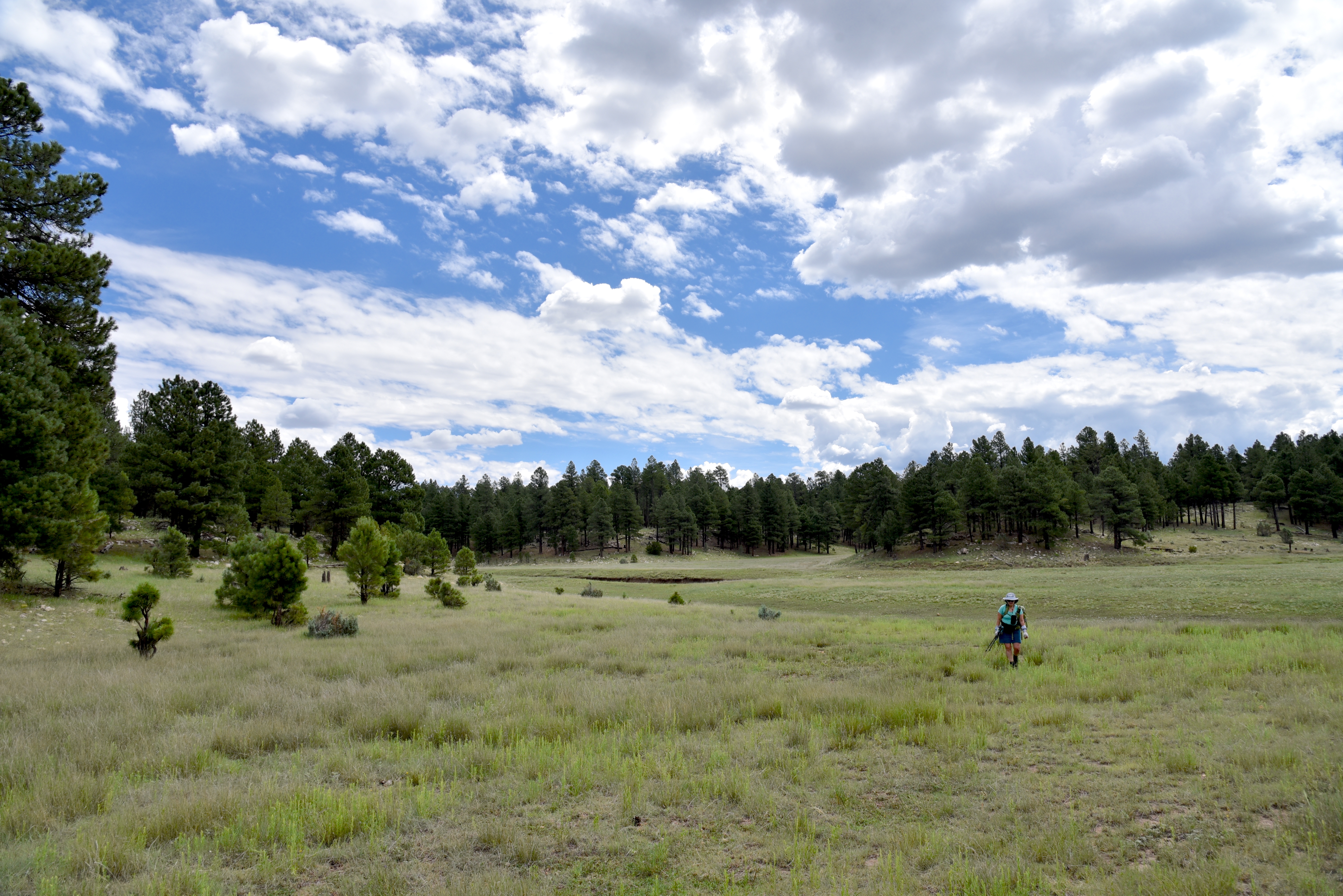
Just beyond the tank, the route heads left at a fork and continues to the 0.9-mile point where the route veers right at the FR9361H junction to stay on FR9361A.  Here, the road traces the Sandrock Canyon dipping and climbing through juniper meadows and Ponderosa pines with occasional mountain vistas peeking through dense tree cover.  

FR9361A ends just yards from the overlook

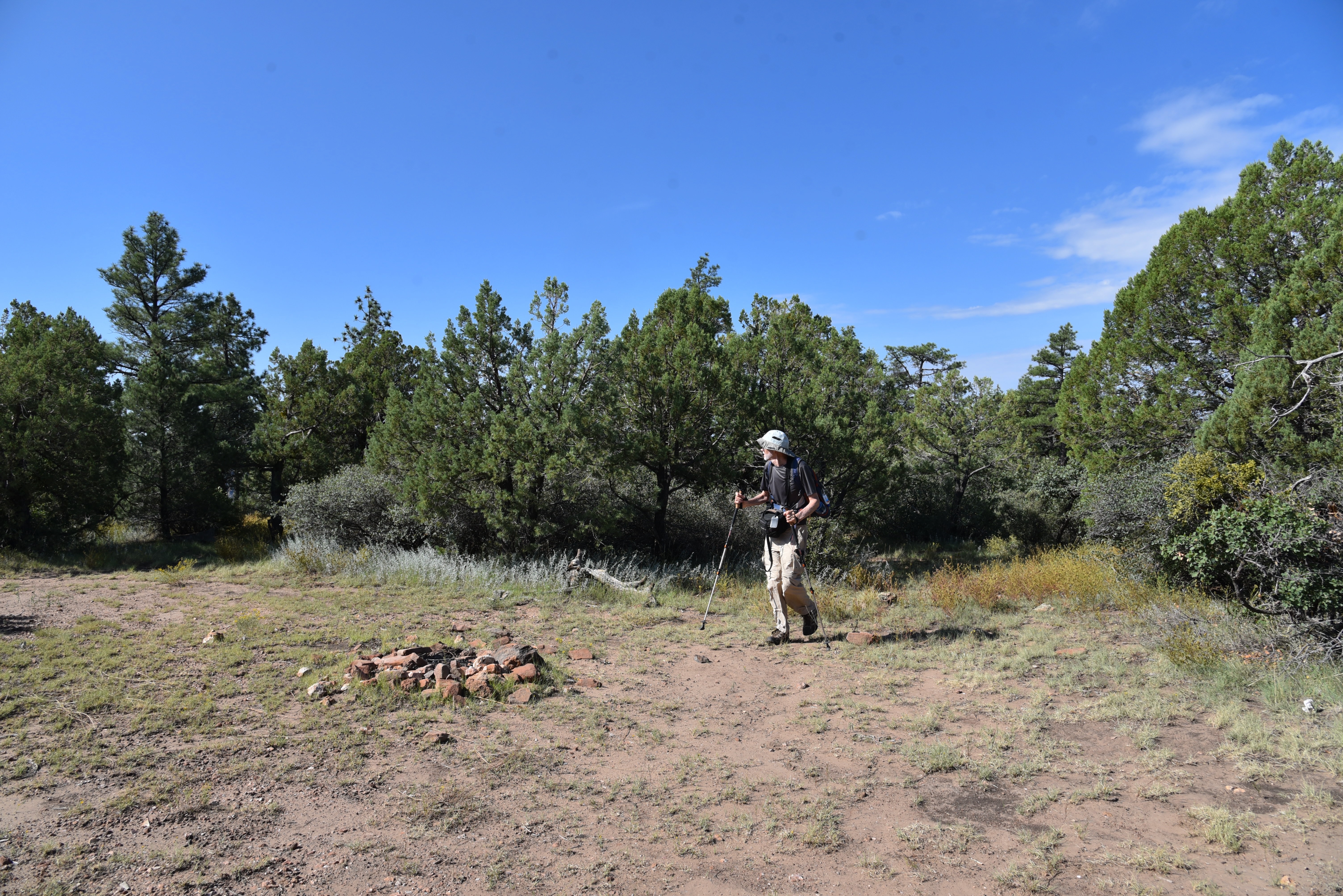
A major road fork at the 1.6-mile point is marked by a small water hole and the junction with FR9361Q.  The route heads right to again stay on FR9361A.  The final 0.8-mile leg of the hike passes through an enchanting green tunnel--bound to turn gold in autumn-- of Gambel oaks replete with Arizona Sister activity.  The lightly travelled dirt road narrows as it makes a moderate descent to its terminus at a non-descript circular campsite that belies the spectacle located just a few yards beyond. 
Mountain vistas from a sunny meadow

Faint game paths wind through a maze of agave, cacti and ancient Alligator junipers landing hikers at an overlook above Fossil Springs Wilderness.  Sandstone ledges protrude over a gorge that plunges 1,000 feet to the wilderness floor that’s home to Fossil Creek, one of Arizona’s most popular water-centric recreation areas. 
There are 3 gates on the hike. Close them behind you!

Broken agaves at the overlook

Free of the (permit-required) traffic and visitors splashing in the waterfalls, the view from above gives a seldom seen overview of the scope and magnitude of the 11,550-acre wilderness below.
Ponderosa pines shade the route


LENGTH:  4.8 miles roundtrip

RATING: easy

ELEVATION:  6,375 – 6,149 feet

GETTING THERE:

From Interstate 17 in Camp Verde, go 27 miles east (toward Payson) on State Route 260 to Forest Road 142 located past milepost 245 on the left.  Immediately past the cattle guard, turn left into a dirt parking area.  A high clearance vehicle is recommended.

The dirt parking area also serves as an access point for the General Crook Trail No. 130.

Monday, August 5, 2024

Willow Valley Dam

WILLOW VALLEY DAM

Sign on FR9352Q

Willow Valley on the Mogollon Rim is best known for its narrow, cliff-bound course. Rugged back country trails including Maxwell, Tramway, Calloway and the milder Willow Crossing lead into its chiseled sandstone depths in West Clear Creek Wilderness. At its lower reaches, Willow Valley merges with Clover Creek where both empty into West Clear Creek.

Bar D Corral on FR 93

Experienced, well-equipped hikers must brave rough roads, sketchy vertical descents, wading and scrambling to explore the wilderness end of the Coconino National Forest valley located roughly 40 miles south of Flagstaff.
Flat Draw Tank near Bar D Corral


But the valley’s upper reaches in the Plateau Lakes region southeast of Mormon Lake are a whole other story.  On the windy expanse, the valley is a shallow, yawning break in the landscape, hemmed in by fringes of Ponderosa pines. 

Calliopsis bloom June - September

It’s a beautiful, more accessible side of the valley. Replete with water holes, corrals and a maze of dirt roads, the bucolic slice of forest stands in stark contrast to its deeper, wilder end.
Scene along FR 93

A few miles south of the community of Happy Jack, off Lake Mary Road, Forest Road 93 serves as a route to Willow Valley Dam and a quiet pocket of forest that’s easy for just about anybody to explore on foot.

The hike follows Forest Road 93, a level dirt track with lots to see along the way. 

Wild geranium bloom May - September

At the 0.75-mile point, the road meets Bar D Corral, a collection of barbed wire, fencing and other cattle roundup structures.  Nearby, the glassy pools of Flat Draw Tank reflect trees and sky while providing water for wildlife and domestic cattle. 
Willow Valley scene on FR234C

Another mile, and the road comes to Wingfield Corral with its tangle of fencing and complex construct of metal and wood.  At the  north end of the corral, a secondary dirt road heads east. 
The breached Willow Valley Dam

It’s not signed, but this is Forest Road 234C, a 0.2-mile route that crosses over Willow Valley south of the dam. It’s a fun detour, but to get to the dam, skip FR234C and continue 0.2-mile past the corral and head right on Forest Road 9352Q which is open only to foot travel. 
Puddle in the break of Willow Valley Dam

The 0.3-mile dirt road ends at a grassy swale.  Open to the sky, the wide depression is also known as Willow Valley Lake. 
While rain-scoured channels and ample greenery hint that water occasionally runs through, the Willow Valley Dam that had contained the “lake” has partially collapsed. 
Willow Valley Dam seen from FR 9352Q

The earthen embankment is still impressive, though. Its shrub-encrusted walls stand high above the valley with ephemeral puddles at its base. 
Willow Valley "Lake" is a moist swale

Wildflowers thrive in the moist soil and robust elk tracks suggest that the site is still an important wildlife resource.  
Wingfield Corral on FR 93

Forest Road 9352Q continues up a knoll to a shady overlook above the dam that frames picture perfect views of a snippet of Willow Valley’s origin story.

LENGTH:  6 miles roundtrip (out-and-back to the dam beginning near Lake Mary Road)

RATING: easy

ELEVATION:  6,924 – 6,745 feet

GETTING THERE:

From Flagstaff, go 42 miles south on Lake Mary Road (County Road 3) to Forest Road 93 on the left past milepost 302 signed for Willow Valley Dam.  Park along any of the dirt turnouts or dispersed camping sites along the road.  FR93 is maintained dirt suitable for all vehicles for about a mile. After that, high clearance is recommended.

Monday, June 17, 2024

Headwaters Trail

HEADWATERS TRAIL 

A "beach" at West Clear Creek

Of all the hiking routes that descend into West Clear Creek Wilderness—Willow Crossing, Tramway, Maxwell, and the eponymous West Clear Creek Trail---the Headwaters Trail is the most challenging. The 13,600-acre wilderness spans the Red Rock and Mogollon Rim ranger districts of Coconino National Forest.
Sunrise in seen from West Clear Creek

Along its 20-mile length, which is defined by the steep-walled canyon carved by West Clear Creek, the terrain moves through high desert at its lower edge near Camp Verde where it spills into the Verde River to pine-oak woodlands at its headwaters on the Mogollon Rim near Clints Well.
Headwaters Trail is steep and slippery

Steep, scrappy and often obscured by pine needles, the half-mile Headwaters path makes an abrupt plunge into a canyon-bound stretch of the creek.

Dogwood and willows along West Clear Creek

Sometimes called the Point Trail, the short access path is favored by anglers and campers that hang out on the shady rim 600 feet above the perennial waterway. 
Hanging gardens on West Clear Creek

The climb down is convoluted and slippery, ducking among conifers, oaks and moss-encrusted boulders. The primitive trail drops onto a beach where red-osier dogwood and willows sink roots into the debris strewn water course. 
Anglers and hikes in West Clear Creek

Extending the hike beyond the butt-slide descent involves wading and using foot paths that wend around the creek’s edges in the shadow of towering cliffs.  Exploring may be done either up or downstream.
Wading is required to explore along the creek

From the point where the trail lands on the beach, head left to see the famous “hanging gardens”, limestone cliffs draped with drooping green plants that sway over shallow depressions in the rock walls. Or, go right and follow the waterway to a gallery of ancient rock art. 

Wilderness wonders of West Clear Creek

All told, the stunning scenery of this near the headwaters of West Clear Creek makes the difficulty of getting to it worth the effort.  

LENGTH: 1-mile roundtrip (from the rim to the creek)

ELEVATION: 6,600 – 5,950 feet

RATING: insane

GETTING THERE: From Payson, go north on State Route 87 (toward Pine-Strawberry) to State Route 260. Turn left (west) and continue 3.1 miles to Forest Road 144, near milepost 249. Turn right (east) and go 1.8 miles to Forest Road 149, turn left (north) and continue to a 3-way junction at Forest Road 142. Go right onto FR 142 and drive 0.9 miles to Forest Road 142E on the left---this is an easy-to-miss unmarked road—if you reach Forest Road 142F, you’ve gone too far. Follow FR 142E 2.7 miles to a large, unsigned parking area. Roads are rough dirt and gravel. High clearance vehicles required.

INFORMATION: refer to the Coconino National Forest map, USGS map, Calloway Butte


Monday, April 8, 2024

General Crook Trail: Mud Tanks Draw

GENERAL CROOK TRAIL: MUD TANKS DRAW

Tanque Aloma on the General Crook Trail

Most of what remains of the historic General Crook Trail are eroding two tracks, toppled rock cairns, tree blazes, a few telegraph insulators, and roadside monuments. 

Forest Road 142H in Mud Tanks Draw

Originally constructed in the early 1870s, the trail stretched for 200 miles along the edge of the Mogollon Rim in Central Arizona between Fort Verde and Fort Apache.
White chevrons mark the General Crook Trail

The dirt track served as a military and civilian supply route for nearly 50 years before being replaced more efficient travel corridors. 
Evie the Aussie shepherd herds her hikers

In the 1970s, Boy Scouts located and signed bits of the route with chevron-shaped white metal markers and rock cairns, many of which are still in place today to guide hikers through the notoriously sketchy path.  Popular reclaimed passages of the old wagon road trace Rim Road (Forest Road 300) and State Route 260 in Coconino National Forest.
Storm clouds over Mud Tanks Draw

 
The third gate near Tanque Aloma

Roughly 22 miles east of Camp Verde, a portion of the General Crook Trail winds through a hilly, juniper-studded landscape situated between West Clear Creek and Fossil Springs Wilderness areas.  The pastoral backcountry is an alloy of dust and juniper welded into a knobby expanse.
Tanque Aloma on the General Crook Trail

Mountain vistas on General Crook Trail

The resin-scented air augments the raw, wind-sculpted landscape of ruffled hills, grassy rangeland, and shrubs disrupted only by whirlwinds and the occasional rogue coyote or herd of cattle.

First gate where General Crook Trail leaves FR142H

From a non-descript trailhead off State Route 260, the hike to the historic backroad segment begins with a short walk on Forest Road 142H.  The dirt two track twists through Mud Tanks Draw, an area of low ground between ridges where water runoff collects in a chain of pools, rivulets, and mucky ponds.  

Ideal lunch spot near Tanque Aloma

The shallow funnel ruptures the scrubby terrain with payloads of rain and snow melt that flows down from the rim above West Clear Creek eventually dumping into Fossil Creek.  The half-mile walk on FR142H ends at a twig-and-barbed-wire gate off to the right where there’s a 142H sign. 

Buffalo-bur in Tanque Aloma

The first set of General Crook chevrons are tacked to the gate.  This is the General Crook Trail crossroads. For this trip, the route continues straight ahead (not through the gate) following sporadic chevrons nailed to fence posts.
Evie on General Crook Trail, April 6, 2024

Although it’s not signed, this segment of the Crook Trail is also named Forest Road 9243P.  The road makes an easy ascent, dodging junipers, catclaw and a smattering of firs and Ponderosa pines.  
Highest point of the hike on General Crook Trail

A second gate marks the beginning of big mountain vistas that continue to expand as the trail works its way to a third gate at the base of a prominent mesa. 
Trail chevrons on the second gate

Just past the third gate, the muddy waters of Tanque Aloma can been to the right (north) and a short walk uphill to the hike’s high point gives a bird’s eye view of its place in the landscape.  While the road continues west to connect with FR9243N, this trip turns around at the top of the ridge and backtracks to the tank where a spur road leads to the water.  Tanque Aloma’s muddy banks are trampled with footprints of domestic cattle, deer, raccoons, coyotes and myriad little critters and birds.  It’s an important water source for wildlife in the semi-arid terrain.  
Turnaround point on the hike

Ringed with buffalo-bur and coniferous trees, the tank’s reflective qualities are a photographer’s dream.
Apron Tank at the trailhead

  A couple of gigantic junipers along the spur road make for shady lunch spots within view of ravens and hawks riding airwaves above the water.
Trailhead off State Route 260

LENGTH:  5.85 miles out-and-back as described here

RATING: moderate

ELEVATION:  5,819 – 6,137 feet

GETTING THERE: From Interstate 17 in Camp Verde, take the State Route 260 exit 287 and continue 22 miles east (toward Payson) to Forest Road 142H on the left just past milepost 241. Forest Road 142 H is not signed, but there’s a stop sign and cattle guide a few yards in.  For reference, Apron Tank, a shallow pool that sits on both sides of the road, is at FR142H.  There’s parking in a dirt turn out past the cattle guard.  (If you pass under power lines, you’ve gone a mile too far).