Find A Trail. Start Your Search Here:

Tuesday, December 29, 2020

Heifer Pasture

HEIFER PASTURE

Birds flock above the Heifer Pasture well site

The first bird barely caused a stir.  The single white-crowned sparrow alighted on a winter-bare mesquite branch, ruffled its wings and turned against the whipping prairie wind.  Moments later, a house finch with brilliant red chest plumage landed on the opposite end of the branch, initiating a sort of see-saw balancing act with its smaller companion.  Then, in a flurry, there were dozens. The mesquite tree was flush with birds hanging on every twig, sitting silently waiting for who knows what.  

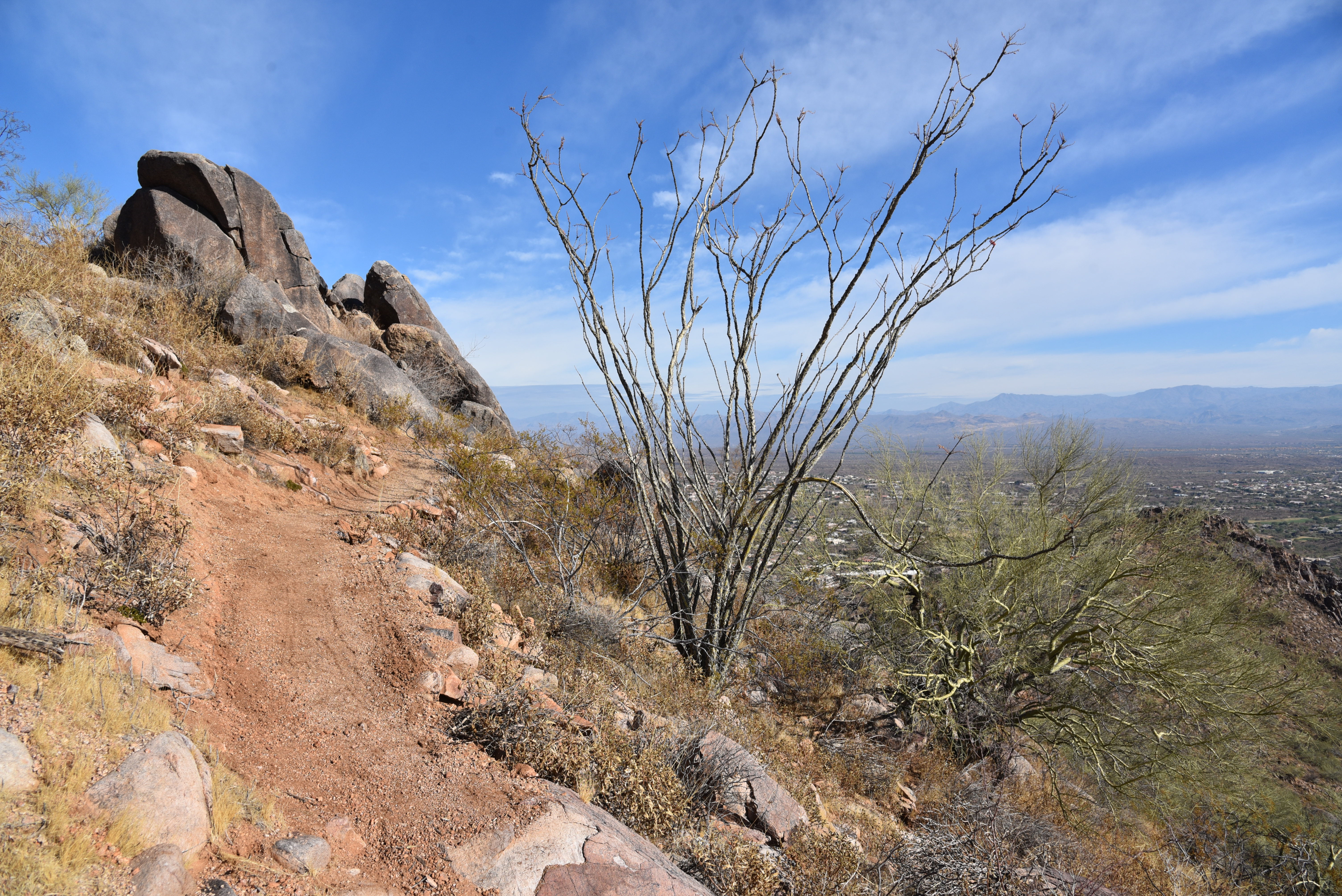
Estler Peak (left) and Bradshaw Mountains 

The scene repeated on nearby junipers and catclaw shrubs.  Hundreds of birds alternately flocking, flying and perching on the sparce vegetation of Heifer Pasture.  
Cattle gather at Heifer Pasture well

Their sheer numbers and propensity to congregate in large groups near where I was hiking teased of a crux moment in a Hitchcock film or maybe a nefarious carcass lying unseen in the drainage that paralleled my route.  Clearly, my film noir addiction muddled my perception, for birds behaving like this is the natural way of things on the high grasslands of Prescott National Forest. 
The hike follows Forest Road 9650R

Heifer Pasture is a quiet place. Other than the rustling of feathers and bellows of domestic cattle the stretch of hilly rangeland 3 miles east of Interstate 17 is as silent and peaceful and its pastoral name implies. 

Heifer Pasture well attracts wildlife and cattle

Birds perch in mesquites at Heifer Pasture well

 The pasture can be explored by way of a maze of forest roads that are used by ranchers, equestrians and ATV riders. But the rough dirt two-tracks are also great for hikers who appreciate solitude, far-reaching vistas and lots of avian company.  One easy route is Forest Road 9650R which spins off Dugas Road north of Cordes Junction.  Flanked by the imposing pinnacle of Estler Peak to the west and a bank of volcanic bluffs and mesas to the east, the road embarks on a mild uphill climb through breezy savannah dotted with low-growing trees and shrubs.  
A white-crowned sparrow rests on a shrub

At the 0.4-mile point, veer right at a major junction, pass an old gate and follow the disintegrating track northeast as it makes its way toward Heifer Pasture Well.  The 262 feet of elevation gain on this segment is barely noticeable, but as the vegetation gives way from scrub to yucca and cacti, views of the Bradshaw Mountain range to the west begin showing up in majestic style.  At the high point of the hike, the road is smothered in acres of knee-high, golden grasses.   From this vantage point, the sliver of Interstate 17 cutting through mountain passes is evident only by the glint of passing big rigs and motor homes. 
Bradshaw Mountains views doom FR 9650R

  
Rustic gate on FR 9650R

Off to the west, sunlight bounces off the blades of the Heifer Pasture Well windmill that’s tucked into a cleft between two prominent buttes.  The road makes a sharp bend and comes to a gate near Black Butte Tank which was dry on my recent visit.  The gate is secured with a rope and must be closed after passing through.  
Bucolic scene at Heifer Pasture well

A few yards beyond the tank, the creaky windmill pumps groundwater into a metal stock tank where cattle lap their fill and graze the collection of feed tubs scattered about.   
Domestic cattle roam in Heifer Pasture

The birds found this place too. Attracted by the water and free buffet, hundreds of birds of species beyond my identification skill set congregate in this idyllic setting. Their fluid areal displays are worth hanging around to witness. 
Black Butte tank near Heifer Pasture well

 Forest Road 9650R continues on beyond the well, passing corrals and more tanks before connecting with the Great Western Trail.  If you want to add miles to this scenic trek, consult the Prescott National Forest map to see the many connecting routes and exploratory options nearby.
Entry gate at Heifer Pasture well site


LENGTH: 3.6 miles roundtrip to the well and back

RATING:  easy

ELEVATION:  3,889 – 4,151 feet

GETTING THERE:From Interstate 17 north of Cordes Junction, take exit 268 for Orme/Dugas Road. Turn right at the bottom of the offramp and go 3.5 miles on Dugas Road (County Road 171) to Forest Road 9650R on the left.  Park in the turnouts a few yards in.  Dugas Road is maintained dirt suitable for all vehicles.  

Tuesday, December 15, 2020

Ridgeline Trail

RIDGELINE TRAIL

View from the new Ridgeline Trail

The latest addition to the Fountain Hills McDowell Mountain Preserve trail system delivers a great workout over its compact, sinuous course.  Aptly dubbed the Ridgeline Trail, the path which debuted in Fall 2020, traces the spine of a chain of hills in the preserve’s southeast sector.

A steep section of the Ridgeline Trail

The trail’s ingenious build, ample directional signage and meticulously groomed tread glides through the mountainous terrain like a knife through buttah.
While the trail is rated as difficult, it lacks the precipitous traverses, confusing junctions, insanely steep inclines and slippery descents typically associated with the rating. 

Ridgeline Trail hugs the spine of a chain of peaks

Fountain Hills viewed from the Overlook Trail

But don’t be fooled by its tame appearance and deceptively effortless 226 feet of elevation change from low point to high point. The route is a grinding rollercoaster of twisting descents and false summits that add up to over 900 feet of gain-and-loss over the 3.8-mile trek.
The route follows a lumpy ridgeline

 From the Adero Canyon trailhead in the foothills above Fountain Hills, the hike begins with a mild walk on the Overlook Trail.  This short connecting trail has several scenic viewpoints and is perfect for those looking for a quick up-and-back with great vistas. But for a full dose of mountain exposure, follow Overlook 0.6-mile to its end and continue on the Ridgeline Trail. 
Switchbacks ease the climbs on Ridgeline Trail

The slim path is not open to bikes so you won’t encounter speeding traffic that could be dangerous where the trail hangs on the edge of stony outcroppings.  Within a quarter mile, an unobstructed view of the full length of the lumpy ridge shows what lies ahead. 
Hike begins on the Overlook Trail

The trail stays high on the backbone of a series of mounds, clefts strewn with chipped quartz and cholla-embellished flats with views that grow and change throughout.  Early in, the McDowell and Cave Creek Mountains to the northwest soar above an expansive valley dotted with homes.
Distance Four Peaks seen from Ridgeline Trail

Quartz specimens line the route

Midway through the hike, views of the familiar Weaver’s Needle and Flatiron formations in the Superstition Wilderness, Mazatzal Mountains, Four Peaks, Red Mountain and the distant conical form of Mount Ord take over.  After what feels like a dozen or more ascents and descents, a final climb lands hikers on the craggy nose of the ridge.  Although the terminus is not the highest elevation of the hike, the isolated nub stands clear of view-blocking cliffs and ravines that characterized the hike up to this point opening up 360-degree vistas.  From this dizzying spot, the importance of preserving natural environments is visually apparent. 

The route has over 900 feet of elevation change

View from the end of Ridgeline Trail

In the distance, hazy layers of wilderness mountains fade into a sprawling river basin at the confluence of the Verde and Salt Rivers.  Directly below, golf greens, subdivisions, shopping centers and highways lap at the cusp of this little jetty of saved space.  It’s something to be thankful for in a tumultuous 2020.
An edge-hugging section of Ridgeline Trail

LENGTH:  3.8 miles roundtrip

RATING: difficult

ELEVATION: 2,364 – 2,590 feet (950 feet of accumulated elevation change)

GETTING THERE:

Adero Canyon Trailhead

14800 N. Eagle Ridge Drive, Fountain Hills.

From State Route 87 in Fountain Hills, go 3.2 miles west on Shea Blvd. to N. Palisades Blvd. Turn right (north) and continue 1mile to Eagle Ridge Drive, turn left and go 2.3 miles to the trailhead.

PRESERVE HOURS: Sunrise to sunset daily. No fee.

INFO:

Fountain Hills McDowell Mountain Preserve

https://www.fh.az.gov/295/McDowell-Mountain-Preserve-Trails

Sonoran Conservancy of Fountain Hills

https://www.scfh.org/

Monday, December 7, 2020

Lower First Water Creek

LOWER FIRST WATER CREEK

The rugged course of First Water Creek near Canyon Lake

In the ragged wilderness below Canyon Lake, the gorge of First Water Creek embodies an otherworldly character that’s somewhere between Tolkien’s Middle- earth and the surface of an asteroid.  The raw, craggy waterway doesn’t spill its wonders easily—it takes work to get into the heart of the remote, obstacle-ridden north end of the creek that flows between the lake and the Garden Valley area in the Superstition Wilderness near Apache Junction.  But once inside, the journey serves as a sort of gateway adventure to technical canyoneering.

Water lingers in a cove south of Canyon Lake

Inside the narrows of First Water Canyon

While this hike doesn’t require climbing gear (at least in dry conditions), it does require a fair amount of scrambling and route-finding.  Right from the start, it’s a challenge.  At the parking area located on State Route 88, the trail begins by the wood power line pole at the south end of the dirt lot.  Cluttered with brush and loose rock, the first few yards can be difficult to find. After that though, the well-worn route that drops 400 feet to the creek becomes easier to follow.  A few sections of slick rock and some minor down-climbing are interspersed with easy passages and drainage jumps. 

A hiker admires jasper band embedded in volcanic rock

A pair of good nubby boots, long pants, a hiking stick and the composure to spot your moves are all that’s needed to get through without a scratch.

At the half-mile point, the route passes a barbed wire fence that marks the wilderness boundary just a few drainage hops above the creek bed.

Desert tobacco blooms year round in the creek bed

A group of massive, round boulders mark the entryway to the creek.  The house-high volcanic globs that are replete with foreign rock inclusions and cavities, signal the start of a two-part exploratory trek that’s rich in geological interest.

Water pools in a rock cavity in First Water Creek

The first part is a short hike to a cove at the south edge of Canyon Lake. Head north (go left from the entry point) and hike 0.2-mile through a wide corridor of sand and cobbles surrounded by pillars of tuff--compressed volcanic ash flows.  Underfoot, look for colorful bands of jasper that fill cracks in the tuff and “lithic waves” of white ash worn smooth by millions of years of exposure and running water.  As the route snakes its way to the cove, the cliffs abruptly close in to contain a tiny green oasis where cottonwood, mesquite and ash trees, hackberry shrubs and buffalo bur soak up moisture from the ebb and flow of lake water that seeps into the damp box canyon. 

Inside the narrows of First Water Canyon

How far hikers can get into the stony lagoon depends on the season.  Dark stains and tell-tale wear on the vertical cliff faces record how water levels fluctuate over time in this finger inlet.  Make the last walkable sand bar your turnaround point and double back to the entryway big boulders. 
The hike into the canyon follows a sketchy route

The hike into and out of the canyon requires some scrambling

Part two of the hike is more challenging.  Head south following the creek bed into an imposing slot canyon and get ready to pick your way through a quagmire of stone.  From the entry point, it’s possible for experienced hikers to follow the creek bed south for 6 miles, give or take depending on workarounds, to where it comes out near Hackberry Spring at the horse trailer parking lot on Forest Road 78 (First Water Road).  But don’t be fooled by the short length. With continually changing conditions that require creative path finding and hand-over-foot maneuvers on an extremely rocky base, the full trek takes all day.  Know what you’re getting into and head out fit and prepared.  For a less arduous day hike, just go as far as you feel able and turnaround before the intimidating route overwhelms.

"Picture rocks" are among the hike's many points of interest

 
A hiker finds a workaround in the narrows of First Water Canyon

Within a few yards of entering the slot, the scrambling begins with a crawl over a six-foot boulder jam that lands above a scoured drop pool that usually has some water.  It’s slow going for the next half-mile where the creek course is completely bound by soaring columns of jointed volcanic stone, crusty, lichen-covered pillars, acres of rock slabs, flood debris and scattered “picture rocks”--boulders laced with brilliant inclusions that have been tossed and tumbled into gem-like specimens. 
The route goes south to the Hackberry Spring area

There's nteresting geology throughout the hike

Exiting the cove box canyon

Finding a route through the narrows is tricky

Cottonwood trees at the cove entry

Wildflowers like desert pea, desert tobacco and lavender add spots of purple and green to the rough, buff-and-russet colored gorge.  

Buffalo bur grows from the sandy creek bed

Regardless of how far you end up hiking along this fractured, fabulous desert creek, the stunning beauty born from tumultuous volcanic eruptions makes for a memorable trip.
Mounds of volcanic tuff line the course of First Water Creek

Huge boulders at the beginning of the creek hike


LENGTH:  3 miles roundtrip as described here or 6 miles one way to the First Water horse lot.

RATING: moderate-difficult

ELEVATION: 1,983 – 1,582 feet as described here or 2,300 to the horse lot.

GETTING THERE:

North end: Canyon Overlook Trailhead as described here:

From Phoenix, go east on U.S. 60 to the Idaho Road exit 196. Turn left at the bottom of the off ramp and go 12 miles on State Route 88 (Apache Trail) to the Canyon Overlook trailhead at milepost 208.

There are no signs or facilities at the trailhead.  Roads are 100% paved. 

South end: First Water horse lot:

From Phoenix, go east on U.S. 60 to the Idaho Road exit 196. Turn left at the bottom of the off ramp and follow State Route 88 to First Water Road (Forest Road 78) which is just past Lost Dutchman State Park between mileposts 201 and 202 on the right.

Follow FR78 for just over 2 miles to the horse parking lot (NOT the First Water trailhead) on the left and park there.  From the lot, hike 0.1 mile up FR78 to an unmarked dirt road on the left where there’s a closed gate. Pass through the gate and continue down into First Water Canyon and the corral area. From the corral, hike east (straight ahead) along the informal paths that lead to First Water Creek. Hike north in the creek bed. FR78 is maintained dirt with a few rough spots but suitable for all carefully-driven vehicles.


Tuesday, November 24, 2020

Hassayampa River Hike from Kerkes Trailhead

Kerkes Trailhead

The leafy fringes of the Hassayampa River

Hiking on sand has many benefits.  The constant sinking and shifting of the soft, uneven substrate helps build strength in foot, ankle and leg muscles while the extra exertion required to slog through the pace-slowing mineral grains is a calorie-busting bonus.  A sandy place makes for a great post-holiday redemption hike to atone for those extra slices of pie that somehow settle around the waistline.
The Kerkes Trailhead in Wickenburg offers legal access to the river bed

Although land-locked Arizona is located many miles from the nearest ocean, it’s still possible to get all the benefits of sand hiking without the long drives; if you know where to go. 

Cottonwood trees display golden foliage in late Fall

Washes, desert sand dunes, drifts of weathered sandstone and dry riverbeds serve just as well as any coastline.  A good place to gain your inland sea legs is the Hassayampa River.

Domestic cattle roam the area near Downtown Wickenburg

Running for 100 miles between the Bradshaw Mountains near Prescott and the Gila River south of Phoenix the Hassayampa River flows mostly underground. Except after storms, the wide, sandy corridor is dry and stable enough to stroll, ride or drive.  The new Kerkes trailhead in Wickenburg, which opened in December 2019, provides legal access to the Hassayampa River bed for hikers, equestrians and off-highway vehicle use.  The roomy trailhead sits above the river corridor where a dirt road cuts through tangled mesquite thickets to land recreationists at a signed gateway. From this point, just follow the riverbed in either direction.  In late fall and early winter, head south (go right from the trailhead sign) to augment the good work out, with a spectacular “desert Autumn” foliage display. The pseudo-beach environ swaps ocean waves for miles of fine-textured sand, course gravel and water-transported debris. Along the waterway margins, cottonwoods and willows that tower above mesquite forests and random saguaros display brilliant yellow foliage. 

Seep willows grow in the sandy river bed

While reminiscent of an oceanside, the river retains a distinctly Old West flavor.  
Flood debris left behind from when the river flows after storms.

Less than a mile from Downtown Wickenburg, domestic cattle often wander into the riverbed as do javelina, rabbits, coyote and deer. 

Thick mesquite forest at the Kerkes trailhead

The sandy river bed makes for a good workout

On the west side of the river, the rumble and whistles of passing trains add a rural soundtrack to the hike.  The southbound trip ends at the 1.34-mile point where the water course enters the Hassayampa River Preserve, one of the few places where the river flows above ground.

The Kerkes trailhead was completed in December 2019.

Cottonwoods & willows line the course of the Hassayampa River

When hiking here, wear sturdy footwear with good ankle support. A hiking pole comes in handy for keeping your balance.  Whether hiked as this short 2.68-mile out-and-back option or as a longer trek heading north, you’ll feel the burn.

A festive Wickenburg welcome.

LENGTH: Southbound: 1.34 miles to the Hassayampa River Preserve boundary (fee area)

RATING: moderate

ELEVATION: 1,970 – 2,039 feet

GETTING THERE:  From Phoenix, go north on Interstate 17 to State Route 74 (Carefree Highway).  Follow SR 74 west (toward Wickenburg) for 30 miles to U.S. 60. Turn right and continue to the U.S. 60/93 traffic circle in Wickenburg.  Veer left through the circle, merge onto S. Kerkes Street and continue 0.2-mile to the trailhead on the left.