Posts
Posts


DEVIL’S BRIDGE
 |
| Hikers on the way to Devil's Bridge |
Hiking has many benefits. Beyond the healthy perks of physical activity, being in the outdoors boosts mental well being, fosters an appreciation for nature and builds a sense of stewardship for our public lands. It’s also a great way to meet people with similar interests.
 |
| Pilgrimage on the Chuckwagon trail to Devils' Bridge |
And with recent reports on the negative impacts of loneliness, it would seem hitting the trails would be a win-win. The trick is to pick trails that attract crowds of people more in the game for the social aspects than for an isolated backcountry experience. Enter Devil’s Bridge--one of the busiest hiking destinations in Arizona.
 |
| Mescal trail crosses Dry Creek |
The iconic Sedona trail that leads to a scenic natural sandstone arch has been a big draw for ages. Its popularity is bolstered by several factors--easy access, relatively short distance with only moderate difficulty, and a huge ooh-ahh punch at the end.
 |
| Trails to Devil's Bridge are well signed |
Thousands make the pilgrimage each year to queue up for a photo atop the 50-foot-high arching formation in Red Rock Secret Mountain Wilderness in Coconino National Forest just a few miles from Uptown Sedona.
 |
| Mescal Mountain (center) from Chuckwagon |
Based on personal experience, many of the visitors have limited time and or experience and want to get the most bang per hiking mile. A survey of license plates in the trailhead parking area belays the nationwide fame of Devil’s Bridge.
 |
| Doe Mountain and juniper snag |
Montana, Utah, Massachusetts, Iowa, Texas, Illinois, South Carolina, California, California, California. People on the trail are generally courteous, eager to talk and more than happy to snap a photo of you and your group. Some have inspiring stores. Others just want to know the names of surrounding rock formations (Mescal Mountain, Doe Mountain, Bear Mountain and Cockscomb on this hike). Either way, striking up a conversation is effortless.
 |
| Devil's Bridge is in a wilderness area |
Anybody who has read my blog over the years, knows I prefer more off-the-wall, less crowded trails over the hyper popular kind. So, what the heck was I doing there on a recent weekend after avoiding it for 18 years? Entertaining winter visitors with a gnawing need to check this off their bucket list.
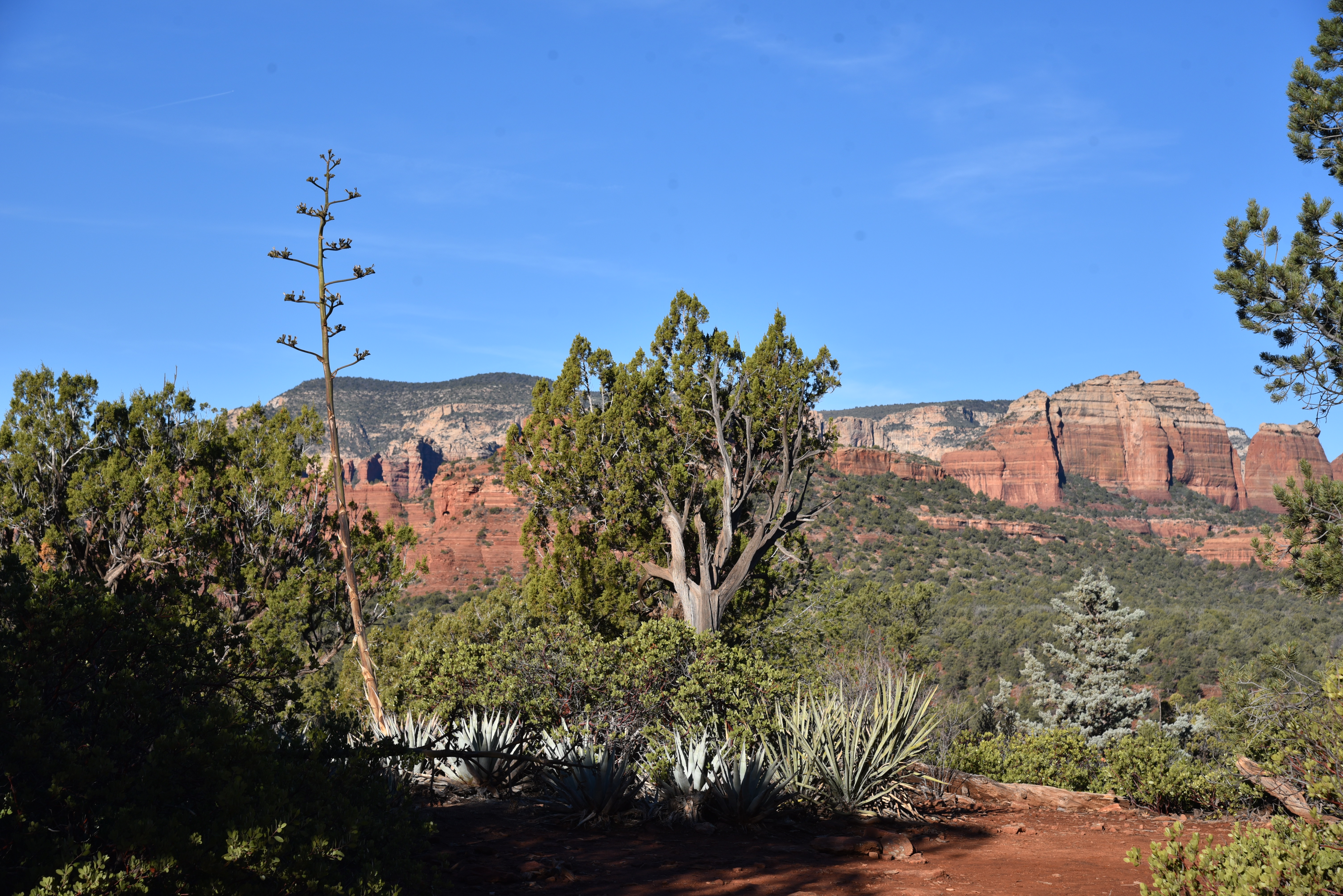 |
| Mountain vista on Chuckwagon trail |
Since my guests were fit but not really hikers, we took the short route beginning at the Mescal trailhead one of the four best ways to access the trail including the free Sedona Shuttle service.
 |
| Cockscomb (L) and Doe Mountain |
We arrived at 7:30 a.m. and scored one of the last open parking spaces. Trail traffic along the first well-signed mile which follows the Mescal and Chuckwagon trails was constant, often coming in fits and spurts of small groups. Bottlenecks begin where the route gets steeper, ascending uphill on rough cut sandstone staircases. About 0.2-miles before the bridge where the route crosses into the wilderness area, traffic slows to a near standstill as hikers meet a fork with one leg heading to the space below the arch and the other to the final stairs to the top.
 |
| Crowd-free Devil's Bridge--18 years ago. |
On weekends, we’re talking an elbow-to-elbow scenario of chatty, awestruck hikers. It’s not the ideal experience for some, but anybody who ventures here ought to know that and shouldn’t expect solitude. Having been there and done that, I decided to opt out of the line that was tantamount to those at major theme parks but without the turnstiles. I waited in a cypress-shaded alcove with a nice family visiting from Europe while my friends earned their check mark, some fabulous photos, and a couple of new friends.
LENGTH:
From the Mescal Trailhead: 4 miles roundtrip
From the Dry Creek Vista Trailhead: 5.8 miles round trip
From Devils Bridge Trailhead: 1.8 miles roundtrip
RATING: moderate
ELEVATION: 4,500 – 4,910 feet
GETTING THERE:
SEDONA SHUTTLE--preferred method!
Service to Mescal and Dry Creek trailheads.
DEVIL’S BRIDGE TRAILHEAD:
From the State Route 179/89A traffic circle in Sedona, go 3.2 miles west (toward Cottonwood) on SR 89A to Dry Creek Road. Turn right and continue 2 miles to the turn off for Forest Road 152 on the right. Follow FR152 past the Dry Creek Vista trailhead for about a mile to the signed Devils Bridge parking area. The road beyond Dry Creek Vista is very rough. A high clearance/4x4 vehicle is required. There are no facilities or fees.
DRY CREEK VISTA TRAILHEAD:
From the State Route 179/89A traffic circle in Sedona, go 3.2 miles west (toward Cottonwood) on SR 89A to Dry Creek Road. Turn right and continue 2 miles to the turn off for Forest Road 152/Dry Creek trailhead on the right and continue a short distance to the parking area. There’s a restroom at the trailhead. No fees.
MESCAL DAY USE TRAILHEAD:
From the State Route179 /US89A traffic circle in Sedona, go 3 miles west on 89A (left, toward Cottonwood) to Dry Creek Road (Forest Road 152C), turn right and continue 2.9 miles to Long Canyon Road (Forest Road 152D), turn right and go 0.2 mile to the trailhead on the left. There’s a restroom at the trailhead. No fees.
INFO & MAP:
Coconino National Forest
https://www.fs.usda.gov/recarea/coconino/recarea/?recid=55292