Find A Trail. Start Your Search Here:

Showing posts with label volcano. Show all posts

Monday, July 31, 2023

Arizona Trail Passage 34: FR418 to Kelly Tank

ARIZONA TRAIL PASSAGE 34 SAN FRANCISCO PEAKS

Forest Road 418 to Kelly Tank

Aspens and pines on the Arizona Trail Passage 34

An Arizona “alpine start”-the pre-dawn trailhead call for a mountain hike- can be timed by the stars. Basically, if Orion has faded into the dawn, it’s already too late.

Hip-high ferns near Forest Road 418

The iconic winter constellation with its prominent three-star belt arcs over the night sky from December to late April.
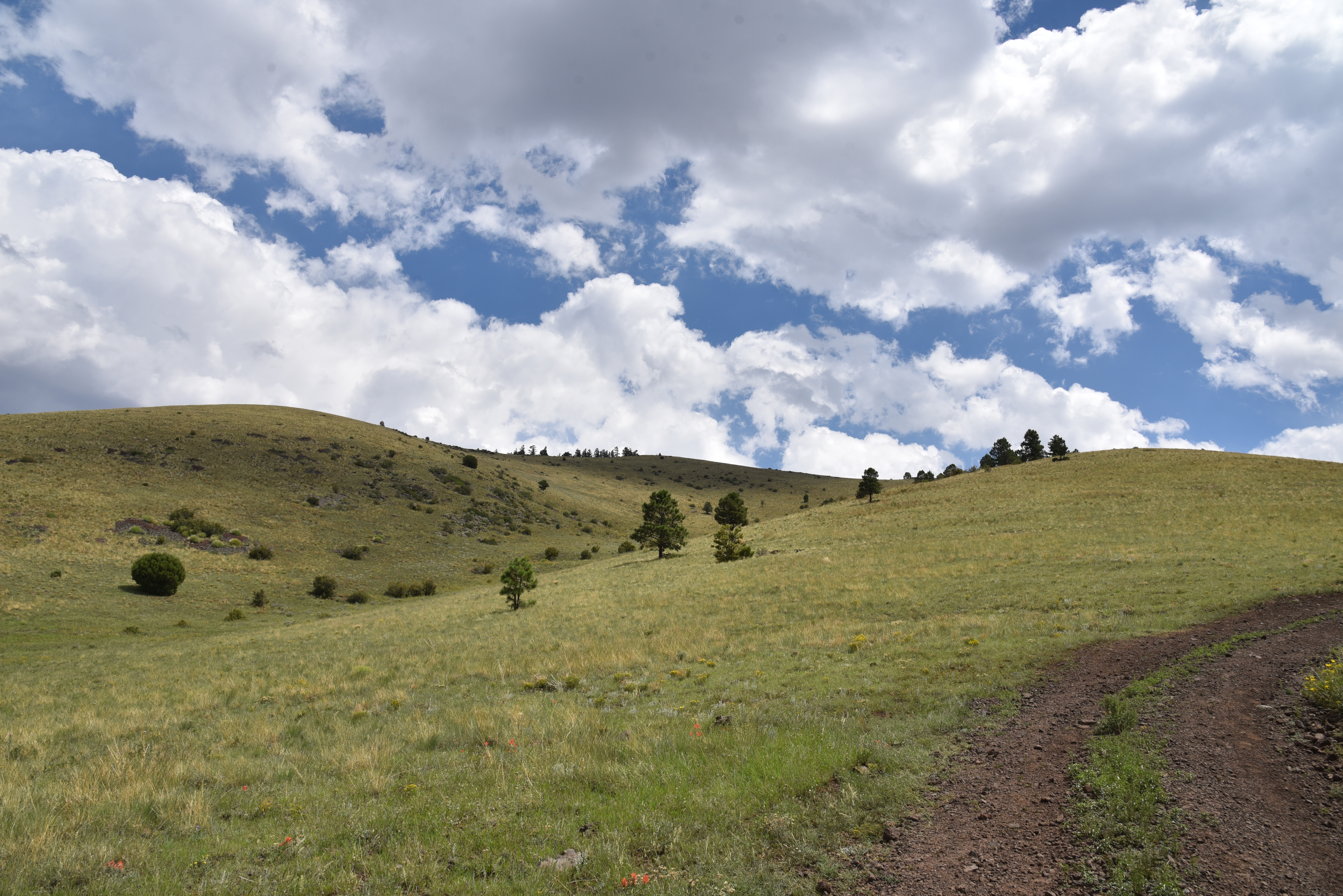
Storm builds over the White Horse Hills

It then disappears for a few months before making its summer debut in the early morning hours of August. Visible low on the eastern horizon around 4 a.m., Orion the Hunter signals the hour Phoenix area day hikers must leave the Valley to beat high country monsoon storms. 
When thunder roars, go indoors.

There are three things to know about summer hiking on Arizona’s mountain trails. First, temperatures will be cooler, but fickle. Second, mountains make their own weather, often churning out thunder, lightning, high winds, and rain after 11 a.m. And finally, being caught on a mountain or in the open during a monsoon storm is a potentially deadly situation.  That’s why it’s smart to follow The Hunter’s lead and head out super early to be off peaks and into safety before noon.
Silverstem lupine bloom June - October

Per the National Weather Service, “When thunder roars, go indoors.” For more lightning safety education, visit: 
https://www.weather.gov/safety/lightning.

In addition to staying alive, early morning hiking has many benefits.  

Alpenglow on the Walker Lake cinder cone

The crack of dawn is the best time to observe wildlife and witness the syrupy amber “alpenglow” the sun paints on mountain slopes.
Kendrick Peak viewed from the Arizona Trail

The San Francisco Peaks Passage 34 of the Arizona National Scenic Trail is one worth setting the alarm to experience.  The Flagstaff area favorite runs for 35.3 miles between the Weatherford Trailhead at the south edge of the peaks to Babbitt Ranch in Coconino National Forest.
Monsoon clouds over the Arizona Trail

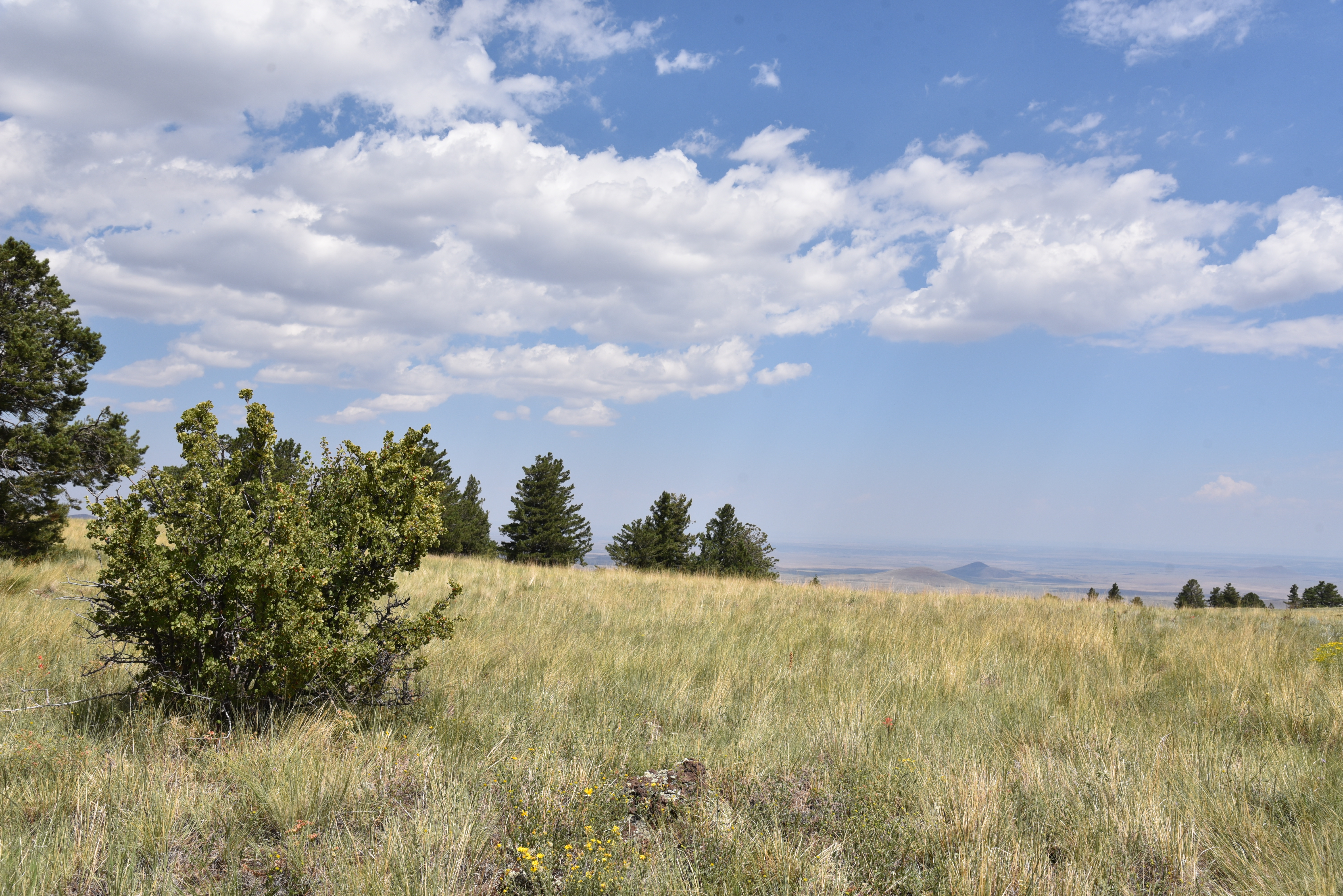
Along its mostly easy course, the trail cuts through aspen glens, dense coniferous forests, meadows, and juniper-studded rangelands.  The entire passage is hemmed in by mounds and craters of the San Francisco Volcanic Field, an 1,800 square mile swath of the Colorado Plateau with over 600 volcanic features.
A hiker photographs a scenic moment on the AZT

Arizona Trail gate at FR 514

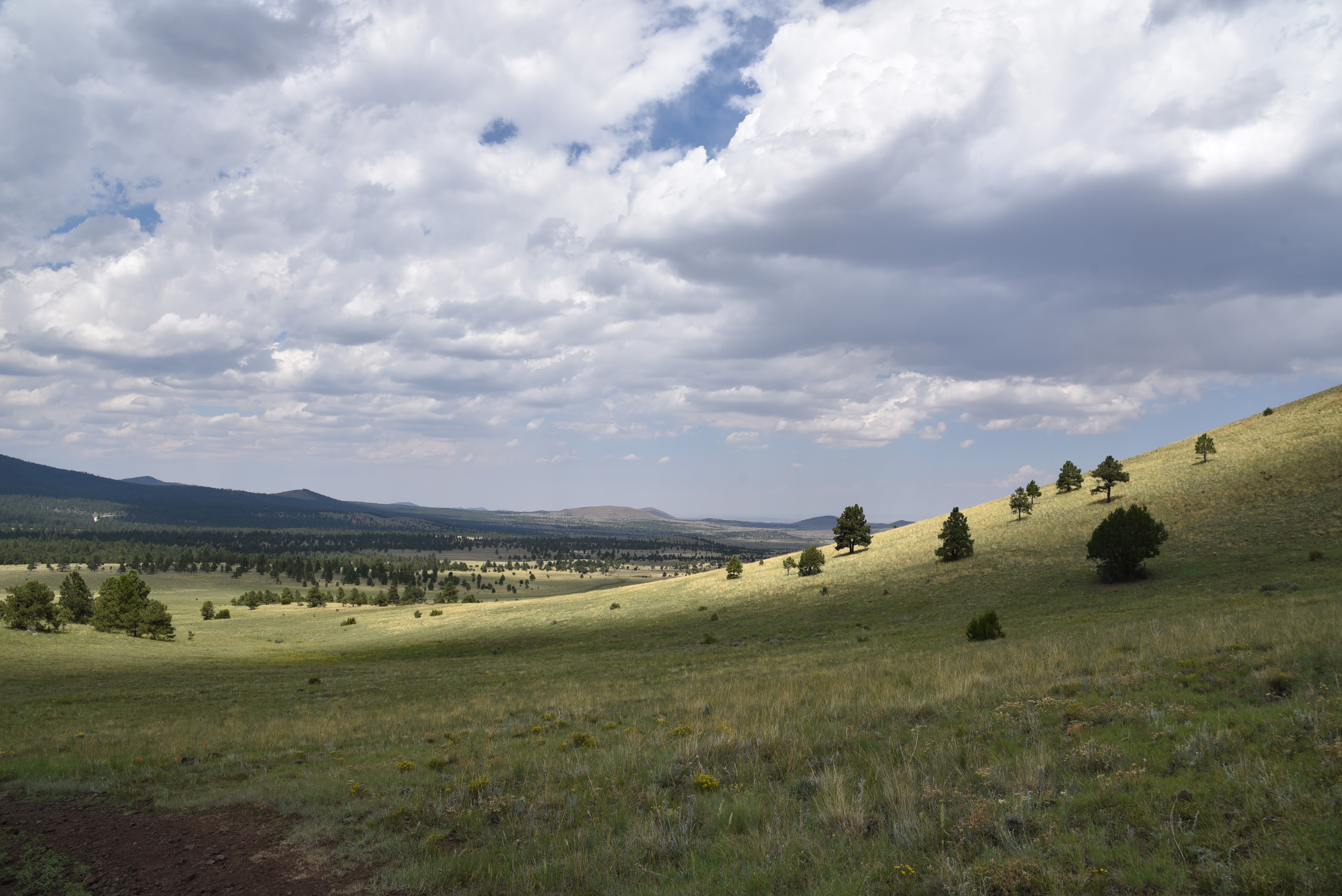
Passage 34 rounds the slopes of 12,633-foot San Francisco Mountain ( the Humphreys Peak Trail goes to its summit), a dormant stratovolcano, and heads north through a maze of cinder cones and lava flows.  For a volcano-centric day hike, the segment of the passage that runs between Forest Roads 418 and 514 is a beauty.

The 6.8-mile out-and-back trek begins in a thicket of aspens on the northwest edge of San Francisco Mountain.  An understory of ferns, lupines, and tall grasses lap at the legs as hikers take on the gentle inclines. Within a half-mile, the trail parallels the Walker Lake cinder cone.

San Francisco Mountain viewed from AZ Trail

A hikeable road leads to the summit of Saddle Mountain

Standing at over 8,400 feet, its pine-fleeced crater contains a shallow pond. The swampy pool is not visible from the trail, but a nearby dirt road leads to its innards. To the east, the weathered peaks of the White Horse Hills rise over Deadman Wash.
Western yarrow blooms June - September

The mostly treeless, isolated volcanic landforms top out at 9,065 feet with a choppy fringe of Ponderosa pines huddled at their bases. 
Elk leave "antler rub" scars on aspen trees

As this hike approaches its turnaround point at Forest Road 514, the tree cover thins out opening views of  10,418-foot Kendrick Peak to the west and 8,864-foot Saddle Mountain straight ahead. Both have trails to their summits. At hike’s end across from Kelly Tank, an Arizona Trail gate  marks the route’s transition into more arid terrain where junipers, brush and wide-open spaces commandeer the viewscape. Still, the mountain-borne lightning storms that happen on a near daily basis in summer are something to monitor and avoid.  An alpine start helps.

Gathering storm over the White Horse Hills

LENGTH: 6.8 miles out-and-back

RATING: easy

ELEVATION: 8,300 – 7,721 feet

GETTING THERE:

SOUTH ACCESS: FOREST ROAD 418 TRAILHEAD:

From Flagstaff, go 19.5 miles north on U.S.180 to the northern entrance  for FR151 (Hart Prairie Road) just past milepost 235.  Turn right and continue 1.6 miles to FR418. 

Continue 1.1 miles on FR418 to a dirt parking apron on the right. Hike begins on the north side of the road. Forest roads are maintained dirt suitable for most vehicles.

NORTH ACCESS: KELLY TANK TRAILHEAD:

From Flagstaff, go 21 miles north on U.S. 180 to Forest Road 514 (Kendrick Park Road) at milepost 236.6. Turn right and continue to just past the 3-mile marker at Kelly Tank and park in the dirt lot on the right at the beginning of Forest Road 9006R. This is directly across from an Arizona Trail gate.

Forest roads are maintained dirt suitable for most vehicles.

INFO & MAPS:

https://aztrail.org/explore/passages/passage-34-san-francisco-peaks/

Tuesday, May 2, 2023

Black Mountain Canyon

BLACK MOUNTAIN CANYON

Parsons Tank on FR 9243B in Prescott NF

It’s just 582 feet downhill from the paved byway of State Route 260 to the rocky course of Black Mountain Canyon but hiking the dirt back road to get to get to it is deceptively more complicated. Located in a hilly section of the Upper Verde River Volcanic Field in Yavapai County 15 miles east of Camp Verde, Forest Road 9243B cuts through dramatic terrain with a backstory of lava flows, ash deposits, water-scoured canyons and countless geological disruptions. 

The rocky course of Black Mountain Canyon

The rough two track heads north from a dirt pull out along SR 260 in Prescott National Forest on a roller coaster style course that challenges hiking legs with over 1,000 feet of elevation change and delights the eyes.
Bill Williams Mountain on far right horizon

Cliff-rose bloom April - September

The sparsely shaded road wastes no time delivering outstanding vistas and a tour of the area’s diverse eco-zones.  The trailhead is bolstered by two volcanic land forms one being Thirteenmile Rock Butte (5,515 feet) a prominent basalt-topped formation that served as a waypoint on the historic 200-mile General Crook Trail built in the 1800s to connect a chain of military forts that ran from Eastern Arizona along the Mogollon Rim to the Prescott area.
Yucca bloom April - July

 
FR 9243B goes between two volcanic buttes

The other geological standout is an unnamed 5,283-foot volcanic pinnacle with a broken east flank that exposes a base of red and black cinders. Forest Road 9243B begins with a run right between the two stony massifs.
Exposed red cinders tumble from a volcanic butte

Open to off-road vehicles, hikers, bikers and equestrians, the road is a scenic destination for any type of travel, although, the many details along its course are best observed on foot.
Velvet ash trees line the road near Black Mtn Canyon

 
Within the first quarter mile, the road hits a high point overlooking the Verde Valley. On clear days, the distant silhouette of Bill Williams Mountain near the City of Williams can be seen standing over green valleys and red rocks on the northwest horizon.  
Rabbit thorn blooms April - June

The route then makes the first of several dips-and-climbs passing by the exposed cider pit before rounding uphill again for another big vista moment before it begins an undulating downhill spiral. 
FR9243B traces the edge of Black Mountain Canyon

At the 0.8-mile point, the route continues straight ahead where an unmarked dirt road (FR9243C) veers to the left.  Vegetation along the first mile is of the typical high desert variety.  Yucca, junipers, rabbit thorn, cliff-rose, scrub oak, skunk bush and cacti dominate the landscape with an understory of primrose, lupines, lilies, wild carrot and other wildflowers coloring the loose cinder-strewn substrate.
Thirteenmile Rock Butte

Following a steep downhill section, the water of Parsons Tank comes into view in a juniper-ringed depression.

Verde Valley view from FR 9243B

The road swings around the tiny pool where the footprints of skunk, bobcats, deer and raccoons signal the importance of this created waterhole to wildlife. Yet another uphill section lands hikers at a gorgeous vista point above the final descent to Black Mountain Canyon.
Delicate American carrot bloom March - May

Verde Valley viewed from Parsons Tank

On the last edgy plunge, vegetation gradually changes from desert to riparian with ash trees and fruit-bearing shrubs entering the mix. 
Pursh plantain bloom February - July

The road meets the canyon bottom at the 2-mile point.  Marked by a tree-lined boulder crossing, the major drainage makes for a good turnaround point. But the hike may be extended on a maze of dirt roads shown on the Prescott National Forest map.
Strawberry hedgehog cactus bloom Mar - May

LENGTH: 4 miles round trip

RATING: moderate

ELEVATION: 4,374 – 4,956 feet (1,077 feet of accumulated elevation change)

GETTING THERE:

From Interstate 17 in Camp Verde, take the State Route 260 exit 287 and continue 15.7 miles east (toward Payson) to Forest Road 9243B on the left just past milepost 234. Pass the gate (close it behind you) and park in the turn outs along the road.

INFO:

https://visitcampverde.com/general-crook-trail/

Tuesday, September 1, 2020

Antelope Mountain

ANTELOPE MOUNTAIN

View from the saddle of Antelope Mountain near Greer

A drive along State Route 260 in the White Mountains between Pinetop-Lakeside and Springerville is a tour of extremes.
Fish Creek Corral frames a view of Antelope Mountain

The scenic byway begins in dense woodlands replete with lakeside retreats that comes to an abrupt end near the turn off for the town of Greer where the landscape jumps from piney to pastoral. 

Ellis Wiltbank Reservoir sits at the base of Antelope Mtn.

Like a splash of cold water, the terrain suddenly changes into sprawling grasslands and isolated pine-covered knolls. Figuring prominently in the landscape are hundreds of lumps, bumps, slumps and conical hills--welcome to the complex geology of the Springerville Volcanic Field.  This swath of cinder cones and lava flows sits at the southern edge of the Colorado Plateau, a roughly 130,000 square mile collection of some of the country’s most remarkable landforms (think: Zion, Capitol Reef and the Grand Canyon) that covers the four corners region of Utah, Colorado, New Mexico and Arizona.
A monsoon storm builds over Antelope Mountain

Springerville Volcanic Field seen from Antelope Mtn.

Sparsely vegetated, the sunny plains sit just north of the course of the Little Colorado River and its tributaries that drain into the Mount Baldy Wilderness area where a mass of lakes, marshes and moist riparian zones stand in stark contrast to the shrubby, windswept volcanic highlands.

Insects feed on a Mountain tail-leaf bush on Antelope Mtn.

Hiking in this bizarre area is both challenging and rewarding.

A textbook-perfect cinder cone seen from Antelope Mtn.

While 10,134-foot Greens Peak, the highest point in the field, is easily accessible on national forest land, many of the other notable volcanic features in the area are located along rough back roads that pass through a patchwork of national forest, state trust, tribal, municipal and private lands, so it’s important that you trek in sync with the laws.

Pollinators alight on New Mexican vervain blooms


One such place to explore is Antelope Mountain, a fascinating cinder cone which is on State Trust Land.  A permit is required to hike the rough dirt road to its 9,003-foot summit. State Trust Land Recreational permits are inexpensive, easy to obtain online and most, including the one for individual hiking access, are good for a full year.  In some cases, such as where Passage 30: Coconino Rim of the Arizona Trail crosses State Trust land north of Flagstaff, a permit is not required as long as you stay within the 15-foot corridor of the trail. That is an exception, though. If you’re recreating on State Trust land, you’ll need a permit.

Antelope Mountain is a cinder cone volcano

Steep approach to the saddle of Antelope Mountain


The deceptively easy-looking road that climbs Antelope Mountain begins at a nondescript turnout off State Route 260 six miles north of the town of Greer.  The first mile is a simple traipse among spotty trees and the wire-and-wood complex of the Fish Creek corrals where the first of two road gates marks the warm up section to the steep climbing ahead. From this segment, the road cut that snakes up the nearly treeless mountain is clearly visible. While it may not look that imposing from a distance, it makes a steady, 30-degree ascent with no breaks. It’s all up, all the way.

A hazy view of Escudilla Mtn on the far right horizon

Road cut visible on the barren south slopes of Antelope Mtn.

Soon, glimpses of Ellis Wiltbank Reservoir, which is on private property, appear in a shallow basin to the left of the road. Look carefully and you might spot domestic cattle, elk and big horn sheep roaming around its mucky perimeter.  At near the 1.5-mile point, pass a second gate that marks the State Trust Land boundary (per state land regulations, leave the gate as you found it, either open or closed) and get ready for the uphill grind.  One hairpin switchback at the 8,500-foot point is all you get in terms of climb-mitigating road engineering.  The rest of the hike makes a straight shot up the mountain’s south flank to the top with the final quarter-mile to the saddle below the summit ridge being the steepest. But great vistas of Escudilla Mountain on the New Mexico border, Mount Baldy, Pole Knoll and White Mountains grasslands take the sting out of the effort. 

Late summer is the best time to see sunflowers in the White Mtns.

Defunct communication equipment on Antelope Mtn.

Looking west from the lone switchback on Antelope Mtn.

On the saddle, the road splits. The left fork goes to the summit proper while the right one leads to scenic overlooks and a heap of defunct equipment, including what appears to be old analogue TV antennas.  A smattering of wind-tortured fir trees standing among outcroppings of basalt boulders and scree line the summit spur. Visible between the trees, a textbook-perfect cinder cone with a symmetrical crater sits 500 feet below the mountain’s north face while dozens of other more lopsided and eroded specimens are scattered on the prairies below.

Forest Road 558 leads to the top of Antelope Mountain

Looking east from the summit of Antelope Mountain

A wild geranium blooms among buckwheat flowers

The road tops out on a bald knob where a huge cairn made of cinders denotes the mountain’s highpoint.  On the top, the tower-clutter summit of Greens Peak can be seen to the west while the diverse mix of forests and open plains of east-central Arizona roll out all around making the quad burning hike well worth the effort.

View from the saddle of Antelope Mountain

Greens Peak (far R horizon) seen from Antelope Mtn

A permit is required to hike on Arizona State Trust Land


LENGTH:  6 miles round trip

RATING: moderate

ELEVATION:   8,149 – 9,003 feet

GETTING THERE:

From Show Low go 45 miles east on State Route 260 (White Mountain Blvd.) to Forest Road 558 on the left.  This easy-to-miss road is located 0.7-mile past the State Route 373 turn off for the town of Greer, just past a big Leaving Apache National Forest sign. There’s a parking turnout a few yard in and additional parking farther up the road near a corral. Hike the road to the summit.


AN ARIZONA STATE LAND TRUST RECREATIONAL PERMIT IS REQUIRED FOR THIS HIKE. GET ONE HERE:

https://land.az.gov/applications-permits/recreation


INFO on the Springerville Volcanic Field

http://azgs.arizona.edu/azgs-photo-tags/springerville-volcanic-field