Find A Trail. Start Your Search Here:

Showing posts with label Sycamore Canyon. Show all posts

Saturday, September 7, 2019

SYCAMORE POINT TRAIL

SYCAMORE POINT TRAIL 
Sycamore Point sits above Sycamore Canyon Wilderness 
Roughly 23 miles southeast of Williams, Arizona’s second largest canyon splits the landscape at the juncture of three national forests and two wilderness areas.
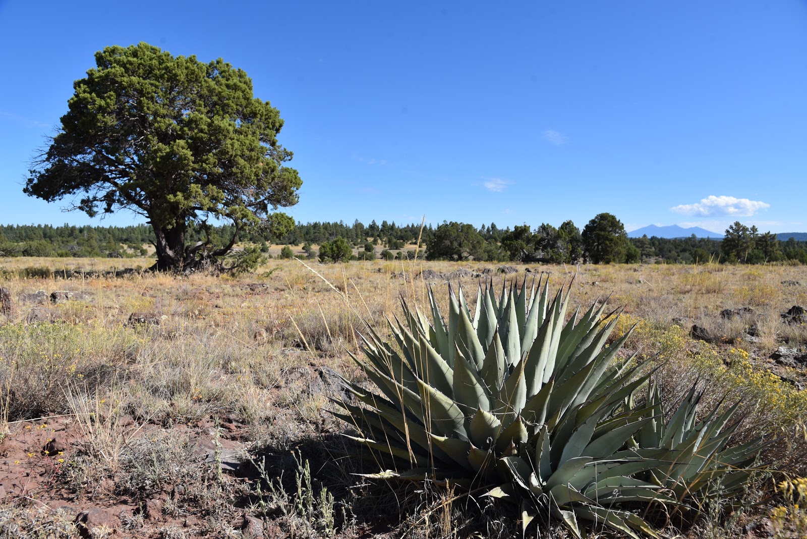
High-desert grasslands: one of several eco-zones on the hike
Anchoring a 55,937-acre wilderness, Sycamore Canyon is one of the most remote and primitive gorges in the state. Unlike the Grand Canyon--which claims the number one spot in terms of canyon size-- there are no maintained roads, amenities or reliable water sources within Sycamore Canyon.
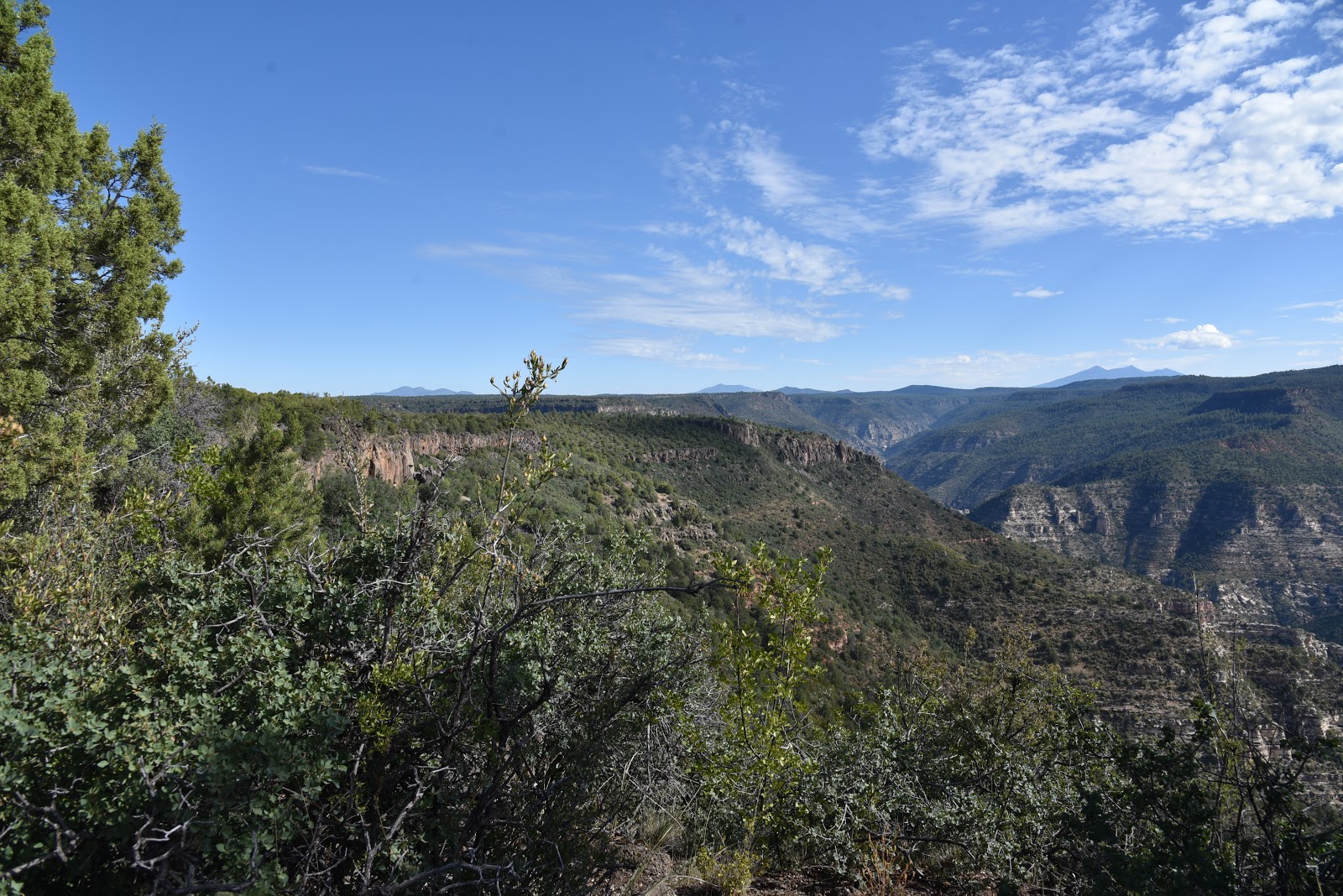
A sheer drop off marks the rim of Sycamore Canyon  
Except for a few easy-access, well-travelled trails like Parsons Spring near Cottonwood and the Sycamore Rim Trail south of Williams, exploring in and around this wilderness is not for the casual visitor. Those who venture into its deepest corners best be prepared to navigate miles of tire-eating, confusing back roads to get to trailheads, hike on strenuous paths and carry enough water for the entire trip. Despite the fact that maps show Sycamore Creek meandering through the canyon, water is a rare find.
AZ's second largest canyon is raw and untamed.
Meadows define the mid-section of the hike
The trail is open to hikers, bikes and motorized vehicles
Although a multi-day backpacking trip is the optimum way to experience the multifarious features of this unforgiving backcountry, there’s an easier way to get an overview of the canyon’s scale and diversity. A hike or bike ride on the Sycamore Point Trail #131 culminates at a breathtaking overlook that rivals those along the south rim of the Grand Canyon, but without the crowds and concession stands. This ersatz Ooh Aah Point sits near the intersection of the Prescott, Kaibab and Coconino National Forests, where the Red Rock Secret Mountain and Sycamore Canyon Wilderness areas collide 1000 feet below. There are no guard rails to stall a fall, so use extreme caution when approaching the edge. 
Domestic cattle graze in the forests around the trail 
The 10-mile out-and-back trek follows the graveled, rough tail-end of Forest Road 110 that has been designated as multi-use recreational trail.  From the trailhead near JD Dam Lake, the hike begins by heading southeast on a dirt track through shady pine-oak forests. Watch for tiny bike trail signs placed at junctions to stay on track. Near the 2.5-mile point, the environment changes from thick woodlands to open meadows before gradually emerging on a grand plateau with sweeping, high-desert grasslands dotted with pinion pines, agave and Alligator junipers. Soon thereafter, first glimpses of the canyon rim appear on the eastern horizon backed by hazy views of Kendrick Peak and the San Francisco Peaks near Flagstaff. 
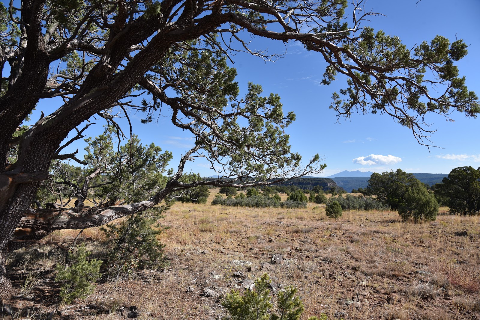
Distant San Francisco Peaks seen from Sycamore Point
A twisted Alligator juniper survives on an open prairie.
Where the road ends, a wide gravel roundabout makes a swing around the edge of the canyon. Ringed by junipers, shrubs and an understory of yucca and cacti, views of the 20+-mile-long chasm are dominated by russet-stained buttes and chiseled limestone pillars.
Spent agaves frame Bill Williams Mtn on center horizon
At the brim, a sheer drop off unsettles the nerves while expansive views of the of the wild canyon assault the senses like a rogue tidal wave.  From the precipitous perch, layer upon layer of complex geological features and eco-zones roll out below.
Beautiful rangeland near the canyon's rim.
The point juts out from the edge of the Colorado Plateau to showcase a rare mix of mountain peaks, coniferous woodlands, high deserts and faint strips of riparian trees and shrubs that sink roots into seasonal water pools around Sycamore Creek and feeder streams that drain into the Verde River.
High-desert scrubland near trail's end
Directly under the overlook, the impossible to spot Winter Cabin and Taylor Cabin trails wind among buff-and-vermillion-colored cliffs and water-sculpted ravines while the tree-covered mesas above Sedona’s Oak Creek Canyon bolster the eastern horizon. 
The isolated, exposed and utterly raw beauty visible from this rim-top platform might inspire you to start training and preparing for an expedition into the wilds beneath it. But, an extended dive into Sycamore Canyon requires skill and a healthy dose of humility.
Mountains of Prescott NF on the southwest horizon
Pine forests shade the first 2 miles of the hike.
Follow the bike signs to stay on course. 
It’s easy to succumb to the come-hither call of the canyon, but surviving its clutch is a whole other matter.
Pinion pine are common along the trail
LENGTH: 10 miles out-and-back
RATING: moderate
ELEVATION: 6583 – 6296 feet
GETTING THERE:
From Interstate 40 in Williams, take the Garland Prairie exit 167, go left at the off ramp and drive south on the access road. Just over the railroad tracks, make a sharp left onto Forest Road 141 and continue 7.9 miles to Forest Road 109. Turn right on FR 109 and continue 5.6 miles south to Forest Road 12, veer left and continue 4.9 miles to the signed trailhead at FR 110. There’s a parking turnout a few yards to the left of the sign. Access roads are gravel/dirt with some washboard sections that are suitable for passenger vehicles.
INFO: Kaibab National Forest


Tuesday, September 1, 2015

WHITEHORSE LAKE TRAILS

WHITEHORSE LAKE TRAILS
Kaibab National Forest
Whitehorse Lake Trail #33

Due to some very serious competition, the two little trails at Whitehorse Lake don't get the attention they deserve. Located adjacent to several classic hiking destinations on the Kaibab National Forest south of Williams, it's no wonder these lakeside gems live in unheralded obscurity.
Although these mini treks are certainly not in the same league as the nearby Sycamore Canyon Rim Trail, Overland Road or the epic routes ascending Bill Williams Mountain, they are ideal for a warm up leg stretch or educational strolls with kids. Also, they're situated within Whitehorse Lake Campground, which makes the perfect base camp for hitting the aforementioned famous trails.
Whitehorse Lake #33 begins at a parking area near camp Loop F where there's a map sign and a supply of brochures with descriptions for 12 numbered points of interest along the route. The one-way trail ends at a blocked road gate near camp Loop B.
From the "F" trailhead, go left and hike out over a dam built in 1934 to improve wildlife and recreational opportunities in the area. Follow the posts through pine-oak woodlands, marsh areas and reed-choked coves. Features along the way include waterbird habitats, "yellow-bellie" Ponderosa pines, wildflowers, bird and bear feeding sites and mushroom logs. At post #9, the Canyon Overlook Trail #70 veers off for an optional 2.5-mile roundtrip hike to a scenic point over Sycamore Canyon. Both trails have short sections where the route is obscured by deadfall and leaf litter, but finding your way isn't too challenging. Beyond post #12, the trail swings through prime critter country along the southeast shore of the 35-acre lake before ending directly across the water from the start point. Retrace your steps or follow campground roads back to the trailhead.
LENGTH:
Trail #33: 2 miles roundtrip
Trail #70: 2.5 miles round trip
RATING: easy
ELEVATION: 6,600'-6,625'
FACILITIES: restrooms, camping, fishing (fee)
GETTING THERE:
From Williams, go 8.2 miles south on 4th Street (turns into Perkinsville Road, County Road 73) to Forest Road 110 at milepost 177. Turn left and go 7.2 miles to Forest Road 109, turn left and continue 3 miles to the lake. Follow the signs to either day use area nears Loops B or F. There are no fees for day use only. Roads are paved and sedan-friendly dirt/gravel.
INFO: Kaibab National Forest
MORE PHOTOS:

Monday, January 21, 2013

SYCAMORE CANYON WILDERNESS


DOGIE TRAIL
Sycamore Canyon Wilderness
Descent into Sycamore Canyon: Jan. 19, 2013

Big enough to awe but small enough to conquer, Arizona's second largest canyon is no simpering runner-up.  Whereas our #1 gorge, the Grand Canyon, is sculpted into over a million acres of  knotted cliffs and soft bends by Colorado River water, its little sibbling looks like a 55,937-acre, rough-hacked slice of geological layer cake. From it's head on the forested plateaus and prairies near Williams to its spring-fed riparian oasis outlet in the Verde River Valley near Cottonwood, the canyon's diverse terrain spans three national forests (Kaibab, Prescott and Coconino) and two wilderness areas (Red Rock and Sycamore Canyon).  One of dozens of routes leading into the wilderness, the Dogie Trail #116 accesses the canyon's midsection in the heart of Sedona's red rock country and is a convienient entre for backpackers setting out on the Taylor Cabin Loop circuit.  For a location sandwiched less than 10 miles from two busy towns, the Dogie Trail exudes a  primitive "out-there" kind of feel.  The trail's geological confection is one of blaze-red sedimentary sandstone and buff-colored limestone with a frosting of inky-black, volcanic basalt.  Wind and water working over 290 million years have etched bizarre works of art on the canyon walls while shaking loose a mixture of sand,  marine fossils and chunks of glitzy quartz which have spilled  down gullies to settle  underfoot along the route.  The pinion pines, scrub oaks and junipers bursting from the trail's  ancient rock pediment offer  little shade, which is why the best window of opportunity to enjoy a nice cool outing here is from November through March. Temperatures topped out in the high 50s when we hiked here this weekend, but it felt much warmer. This repurposed cattle trail (a "dogie" is an orphaned calf)  is maintained in an respectful, unobnoxious kind of way, which is to say that the path is clear but not overworked and signs are posted only at important junctions to preserve the wilderness experience.  When used for an out-and-back day trip, keep in mind that you'll be hiking down on the way in and up on the way out and even though 400' of elevation change may not sound like much, the constant dips and rises over loose-pebble ledges and rocky creek beds will test your stamina more than expected.
Doggies on the Dogie Trail

LENGTH: 5.4 miles one way
RATING:  moderate
ELEVATION: 4850' - 4450'
BEST SEASONS:  spring, fall, winter
FACILITIES: none
DISTANCE FROM PHOENIX: 117 miles one way 
GETTING THERE:
From Phoenix, travel north on I17 to the McGuireville exit 293.  Go left onto Cornville Road and continue 13 miles to AZ89A.  Turn right and go 7 miles on  89A  to FR 525 just past milepost 364 on the left.  Turn left and go 2.8 miles on 525 to a fork in the road with a sign for "Palatki", turn left here to get on FR525C---which is not signed.  Continue 8 miles on FR525C, there are many side roads but 525C is  well signed and dead ends at the trailhead.   ROAD CONDITIONS: The access roads are good dirt with just a few moderately rough spots and a short section of mountain grades.   Although high-clearance is preferable, carefully-driven passenger cars can get thru just fine.   Call ahead, though,--the forest service sometimes closes the access roads due to weather. 
INFO:
Red Rock Ranger District, Coconino National Forest, 928-203-7500, 928-203-2900 
MORE PHOTOS:

Monday, June 28, 2010

PARSONS TRAIL, MAY 2009

2023 UDATE: THIS TRAIL HAS BEEN HEAVILY DAMAGED BY FIRES, IS IN TERRIBLE CONDITION AND THE FOREST SERVICE IS NO LONGER MAINTAINING IT. Parson's Trail Coconino National Forest Revisited this remarkable canyon last summer and, as always, had a blast. Lots of water, massive red-rock cliffs, riparian forests and interesting geology make this hike a perennial favorite. Enjoy these new photos. HIGHLIGHTS: Spectacular canyon, swimming holes, riparian forests LENGTH: 7 miles roundtrip ELEVATION: 3,700 – 3,200 feet RATING: easy DISTANCE FROM PHOENIX: 150 miles one-way GETTING THERE: From Phoenix, travel north on I-17 for 90 miles to exit 287 for AZ 260. Go left (west) on 260 and continue for 14 miles to the town of Cottonwood. Once in Cottonwood, go straight through town on Main Street and Broadway (US 89A) following the signs to Tuzigoot National Monument toward the town of Clarksdale. Turn right onto the signed road to Tuzigoot, cross the Verde River Bridge (at the half-mile point) and take the first left onto Sycamore Canyon Road (CR 139). The road turns into maintained dirt and then merges into Forest Road 131. Continue for 10.5 miles following the FR 131 and the Sycamore Canyon road signs to the trailhead where there are no facilities. The dirt roads are passable by sedan but a high-clearance vehicle is recommended. INFORMATION: Red Rock Ranger District  www.fs.fed.us/r3/coconino/recreation/red_rock/parsons-tr.shtml

Sunday, September 28, 2008

PARSONS TRAIL

2023 UPDATE: THIS TRAIL HAS BEEN HEAVILY DAMAGED BY FIRES, IS IN TERRIBLE CONDITION AND THE FOREST SERVICE  IS NO LONGER MAINTAINING IT. The cool spring water that gurgles to the surface year-round in the  lower portion of Sycamore Canyon attracts a motley crew of outdoor enthusiasts.  Popular with the locals and out-of-towners alike, you are bound to run into hikers, backpackers, bird watchers, rambunctious kids, ecstatic Labrador retrievers and the occasional  group of skinny dippers.  Most of the commotion ends after the first mile where the going gets a bit too rough for casual visitors.  The trail begins with  a steep, 300-foot descent into the canyon (remember this for the way back) and is marked by a series of sometimes hard-to-find carins made of river rock wired into 50-gallon drum-size cylinders.  Rains and floods change the terrain frequently, so it's smart to pay attention along the route which includes numerous creek-crossings. Dense riparian vegetation, including wild grapes, holly, squash and cattails, flourishes in the moist sandy soil around the seep areas and springs.  There are several deep pools, suitable for swimming an done of the best is nestled in a beautiful cover surrounded by limestone ledges under a canopy of sycamore and walnut trees.
LENGTH:  7.4 miles round trip
RATING: easy
ELEVATION GAIN: 300 feet
GETTING THERE:
From Phoenix, go north on I-17 for 90 miles to exit 287 (Highway 260).  Go west on Hwy. 260 
to the town of Cottonwood.  From there, go straight through town on Main St and Broadway (aka Highway 89A) following the signs to Tuzigoot National Monument.  Turn right onto thesighed Road to Tuzigoot and continue for less than a half-mile, cross the Verde River Bridge and then take the first left onto  Sycamore Canyon Road (CR 139).  The road turns into maintained dirt and merges with FR 131.  Continue on FR 131 for 10.5 miles to the trailhead.