Find A Trail. Start Your Search Here:

Showing posts with label Tucson. Show all posts

Tuesday, April 11, 2023

Amerind Trails

NEW TRAILS COMING TO DRAGOON

Newly constructed trails at the Amerind Museum

Right around the turn of the century, I took a break at the Texas Canyon rest stop during a road trip from Willcox to Phoenix, looked out over the gorge below and thought, “Cool rocks. I wonder if there are any hiking trails in there.” 

Granite formations in Texas Canyon

Turns out, that particular slice of Chihuahuan Desert along Interstate 10 an hour east of Tucson where restaurants and roadside services are sparse, was on private property with no way for curious hikers to explore the wonderland of weathered igneous stone.
Trail designer Sirena Rana in Texas Canyon

That’s about to change, though.

Cottonwoods surround a pond on the Amerind Trails

 
This October, a 5.7-mile trail system is set to open in Texas Canyon on the Amerind Museum property in the community of Dragoon.

“Texas Canyon is so amazing,” says Sirena Rana founder of Trails Inspire and designer of the Amerind Trails. “ There’s so much interesting geology and a lot of people have wondered what it looks like inside.  Up until now, there were no public trails.”

Sirena Rana on the trail to whale rock

The stony parcel of Texas Canyon sits in the shadow of the Dragoon Mountains between the towns of Benson and Willcox. Nearby attractions like the Chiricahua National Monument, Cochise Stronghold, Willcox Playa Wildlife Area, Tombstone, Southern Arizona wineries and acres of Coronado National Forest are big draws for tourists and locals alike.

The tafoni rock in Texas Canyon

But Dragoon and the Amerind Museum remain comparatively under the radar.  The Amerind Museum is a sort of hybrid museum, art gallery and research facility dedicated to archeology, Indigenous cultures and Western art that’s been around since 1937.
Whale rock is a highlight of the Amerind Trails

Seeking to extend its reach, enrich visitor experience, and build interest in the area, museum officials contacted Rana after seeing her presentation on how trails can benefit communities to explore adding hiking trails to their property in Texas Canyon.

“When designing trails, the first thing I do is find the people who know about the land. Locals, neighbors, hikers and experts who know what’s special about the terrain,” Rana says.  “To me, the most important thing is to make trails accessible to all. I like a series of stacked loops that allow for a lot of options and are customizable for all levels of difficulty and lengths.”

Routing the 5.7 miles of trails through the dramatic, boulder-strewn terrain was tricky, but extensive site scoping and design research paid off.

Windmill with Dragoon Mountains on horizon

The whale trail departs from a picnic area

“We found routes by using the grasslands in between the rocks and natural granite passages while keeping close to interesting control points like cliffs, dramatic rock formations and ponds,” Rana shared. The careful planning has yielded unique pathways into some of the area’s standout geological wonders including a naturally sculpted tafoni rock and the (soon-to-be Instagram darling) whale rock.

Dragoon Mountains seen from Amerind Trails

The stone pillars, balanced rocks, slabs, grottos, spires, and fractured joints within the trail system are the result of millions of years of geological activity and weathering of quartz monzonite (aka granite) that crystalized underground.  As the land surface slowly eroded, the harder granite intrusion was exposed to the elements that would shape them into the bizarre forms seen today.
Golden corydalis color the grasslands Feb - Jun

For trail construction, Rana selected an Arizona company that specializes in building sustainable recreational trails that respect natural landscapes and cultural resources.

“For construction we used Flagline Trails, a Flagstaff-based contractor,” Rana says.  “They are incredibly talented and the crew did an amazing job. They took my design and made it as good as can be. The system has three access points, north and south loops plus an out-and-back trail to whale rock. There will be benches placed along the routes and signage and painted paw prints to mark the trails where they cross bedrock will be installed over the summer. The trails will be open for day use only .  There’s no camping at the site, but there are plenty of places to camp and stay in neighboring towns and in Coronado National Forest.”

Trail construction began on January 3, 2023 and wound up in April. 
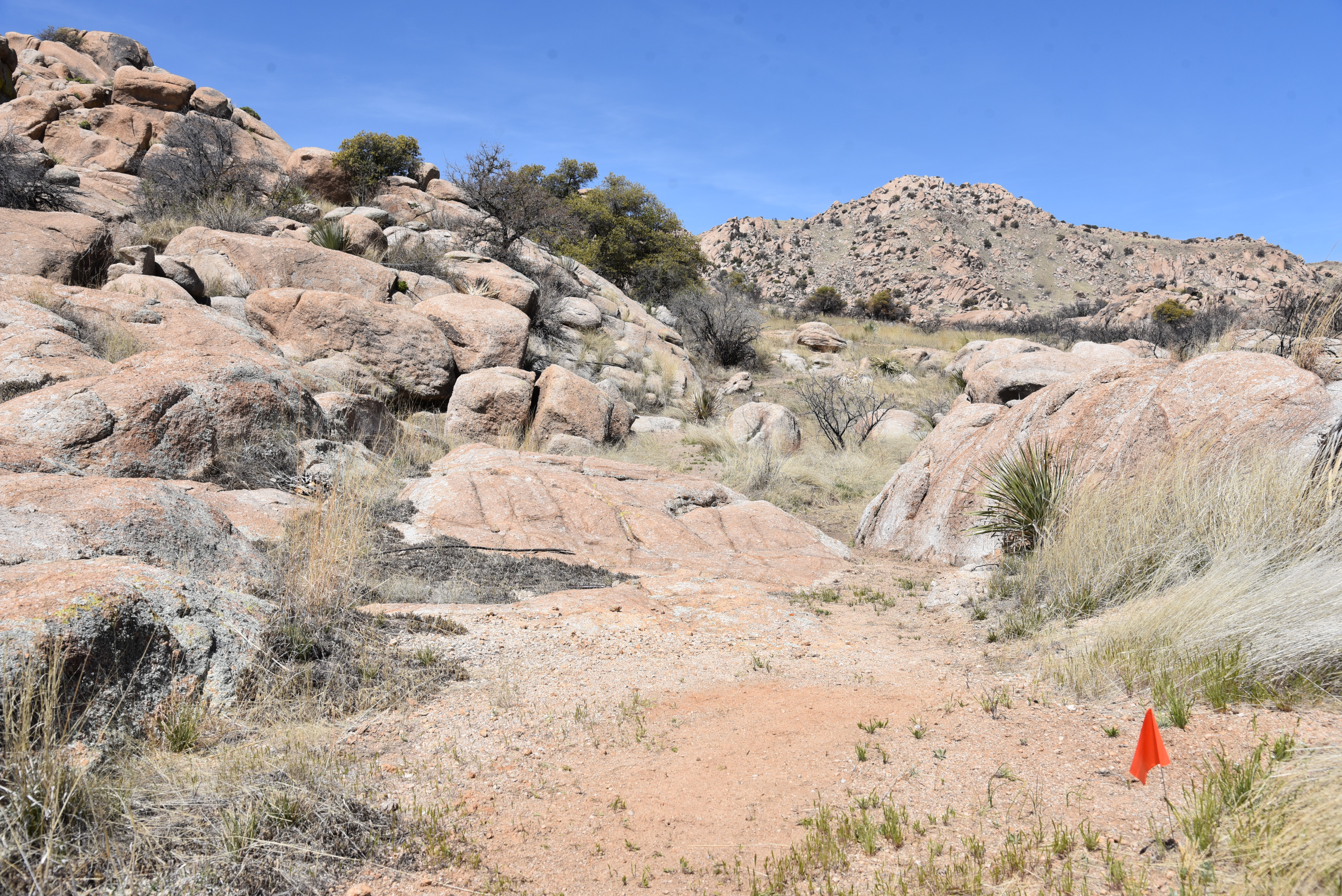
Painted paw prints will mark the trail where it crosses bedrock

Using “Amerind Trails” as a working title, official naming of the trails is in the works. “We handed off the naming of trails, and signage placement with our recommendations to the Amerind Foundation,” Rana says. “I’m thrilled with how the trails turned out and they are sure to be a great contribution to the community.”
Interesting geology dominates the landscape

A grand opening event will be scheduled for October and if all goes as planned, the community of Dragoon is going to need a restaurant.

LENGTH: 5.7 miles

RATING: easy-moderate

ELEVATION: 4,643 - 4,873 feet

GETTING THERE:

Amerind Museum

2100 N. Amerind Rd., Dragoon, AZ.

From Interstate 10 south of Tucson, take the Dragoon Road exit 318 and follow the signs 1 mile south to the Amerind entrance on the left.  

HOURS: The museum is open Tuesday – Sunday 10 a.m. – 4 p.m.. Closed on major holidays. Trails will be open for day use only.

There’s no camping on the property, but there are nearby campgrounds and lodging.

FEE: $10 - 12

FACILITIES: picnic tables, restrooms, museum exhibits and events

INFO:

TRAILS WILL OPEN OCTOBER 7, 2023.

Amerind Museum

amerind.org

Trails Inspire LLC

trailsinspire.com

Flagline Trails LLC

flaglinetrails.com


Monday, February 27, 2023

Painted Hills Trails Park

PAINTED HILLS TRAILS PARK

View from the "false summit" on Bactrian Summit Trail

Described as a happy medium between urban parks and more remote mountain trails, Pima County’s hybrid “trails parks” fill the need for easy access to natural outdoor spaces. 

Painted Hills Trails Park is a 289-acre slice of desert space located in the far northeast corner of Tucson Mountain Park, just west of Interstate 10.

Lush desert vegetation on the Mosaic Trail

The mini but mighty park has seven interconnected trails that include two short mountain summit up-and-back trips.  All seven well-signed and maintained routes wind through dense saguaro forests with outstanding views throughout. 

Recoil Peak Trail

The in-your-face landscape show begins with the Santa Catalina Vista spur that spins off the 0.9-mile Mosaic Trail. The little loop overlooks a wash that runs between two cactus-encrusted hills. The V-shaped crack frames peeks at the jagged silhouette of the Santa Catalina Mountains that rise to 9,171 feet above the Tucson basin.
Saguaros & mountain vistas are the park's hallmarks

Santa Catalina Mountains seen from Slingshot Trail

Visible on the southwestern flanks, the Pusch Ridge Wilderness makes an abrupt, stony endcap.

The Mosaic Trail traces the southern flanks of Bactrian Summit, gaining elevation easily as it runs through tall saguaros, prickly pear, ocotillo and a rick understory of jojoba, fairy duster and other species of desert shrubs and wildflowers. 

Distant Rincon Mountains viewed from Recoil Peak

Tucson Mountains viewed from the Slingshot Trail

For hikers unfamiliar with the term “false summit”, the Bactrian Summit trail delivers a crash course in the subject.
Desert Hyacinth "Blue Dicks" bloom Feb. - May

The short but somewhat steep path ascends to a knoll, but it’s immediately obvious that the breezy spot is not the true summit, but the false summit. Getting to the actual high point requires a brief downhill dip followed by a final climb to the top. 
Trails are well-signed and maintained

As the highest point in the park, Bactrian Summit is the best visual platform. 
A bench marks the park's high point on Bactrian Summit

Stretching out in all directions, views extend to the Rincon Mountain in the southeast and the Tortolita Mountains to the north.  Under it all, the Tucson cityscape creeps up to nearby Tumamoc Hill, Sentinel Peak (“A” Mountain) and the peaks of surrounding Tucson Mountain Park.  
Desert vistas galore on Slingshot Trail

A second hilltop side trip, Recoil Peak departs from the Slingshot Trail near the Monsoon Loop junction.
Slingshot Trail crosses a desert wash

Recoil Peak hovers over busy Speedway Boulevard and a maze of cul-de-sac communities.  Slingshot Trail does what it says, it boomerangs around the park’s colorful hills, jumping washes and dodging rock outcroppings on its way back to the trailhead.
View from the Santa Catalina Vista trail

LENGTH: 4 miles of trails

RATING: easy-moderate

ELEVATION:  2,508 – 2,770 feet

GETTING THERE:

3590 W. Anklam Rd., Tucson.

From Interstate 10 in Tucson, take the Speedway exit 257.  Follow Speedway 2.2 miles west (go right) to Greasewood Road, turn left (south) and continue 0.8-mile to Anklam Road. Turn right and go 1.2 mile to the trailhead on the right.

The lot accommodates about 19 vehicles but there’s no room for equestrian staging.

HOURS:  dawn to dusk daily

FACILITIES:  none

DOGS: unlike most of Tucson Mountain Park, leashed dogs are allowed in Painted Hills Trails Park provided owners clean up after them and pack out waste.

INFO & MAPS:

Pima County Natural Resources Parks & Recreation

https://webcms.pima.gov/government/natural_resources_parks_and_recreation/parks/


Thursday, March 17, 2022

Tumamoc Hill

TUMAMOC HILL

View of Santa Catalina Mountains from Tumamoc Hill

Just about everybody putting one foot in front of the other on Tumamoc Hill does so with a goal in mind, and the volcanic mesa just off Interstate 10 in Tucson holds enough interest to satisfy the physical and mental aims of its assorted visitors. Among the thousands who trudge up the distinctive  3,107-foot mound each year are casual walkers, spandex-clad runners, sightseers and families pushing strollers.  

See-forever views on Tumamoc Hill summit

In terms of popularity, the road/trail within the  860-acre University of Arizona ecological preserve rivals the likes of iconic Phoenix trails like Camelback Mountain and Piestewa Peak in visitation.
Tumamoc Hill is a wildlife sanctuary

The hill’s magnetic quality can be attributed to numerous factors. It’s close to town, easy to access and the approachable paved trail offers a moderate workout packed with educational opportunities.

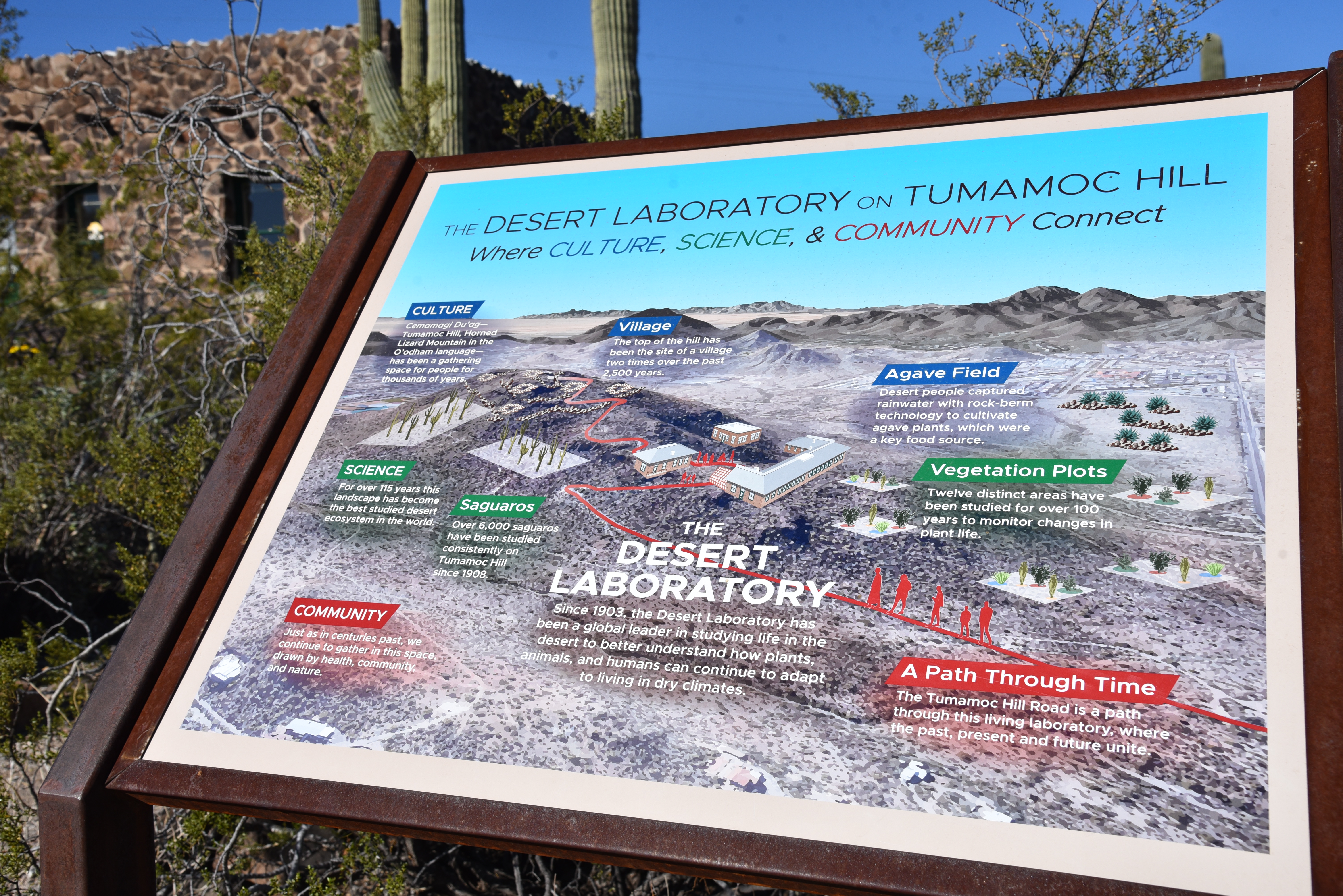
Designated a National Historic Landmark in 1975, the U of A Desert Laboratory which sits on a saddle halfway up the hill, is dedicated to ecological preservation and is a center of research, education and finding science-based solutions to challenges faced in the Sonoran Desert.

Tumamoc Hill is home to U of A Desert Laboratory

Visitors interested in augmenting their hike can download the Tumamoc Tour app. It’s an hour-long audio-video companion for smart devices that serves as a virtual docent that expounds upon on the history, ecology, archeology and native wildlife and plants encountered along the way up the hill.  

Colorful brittlebush color the hill's volcanic slopes

Even without the app, strategically-placed interpretive signs illustrate key points of interest such as the Agave Heritage Garden and an overview of the Desert Laboratory complex. 
Tumamoc Hill is an outdoor classroom

One sign explains that the name Tumamoc Hill derives from the Tohono O’odham language and means “Horned Lizard Mountain”.  Specifically, the eponymous reptile is the Regal Horned Lizard, which is the only species that lives on the hill, is an apt ambassador for the dozens of animals that thrive within the sanctuary.
The second half of the hike is steep

The 1.5-mile serpentine road hike that ascends the hill’s north face begins its 700+-foot climb on an easy grade.

An app and signs provide teaching moments

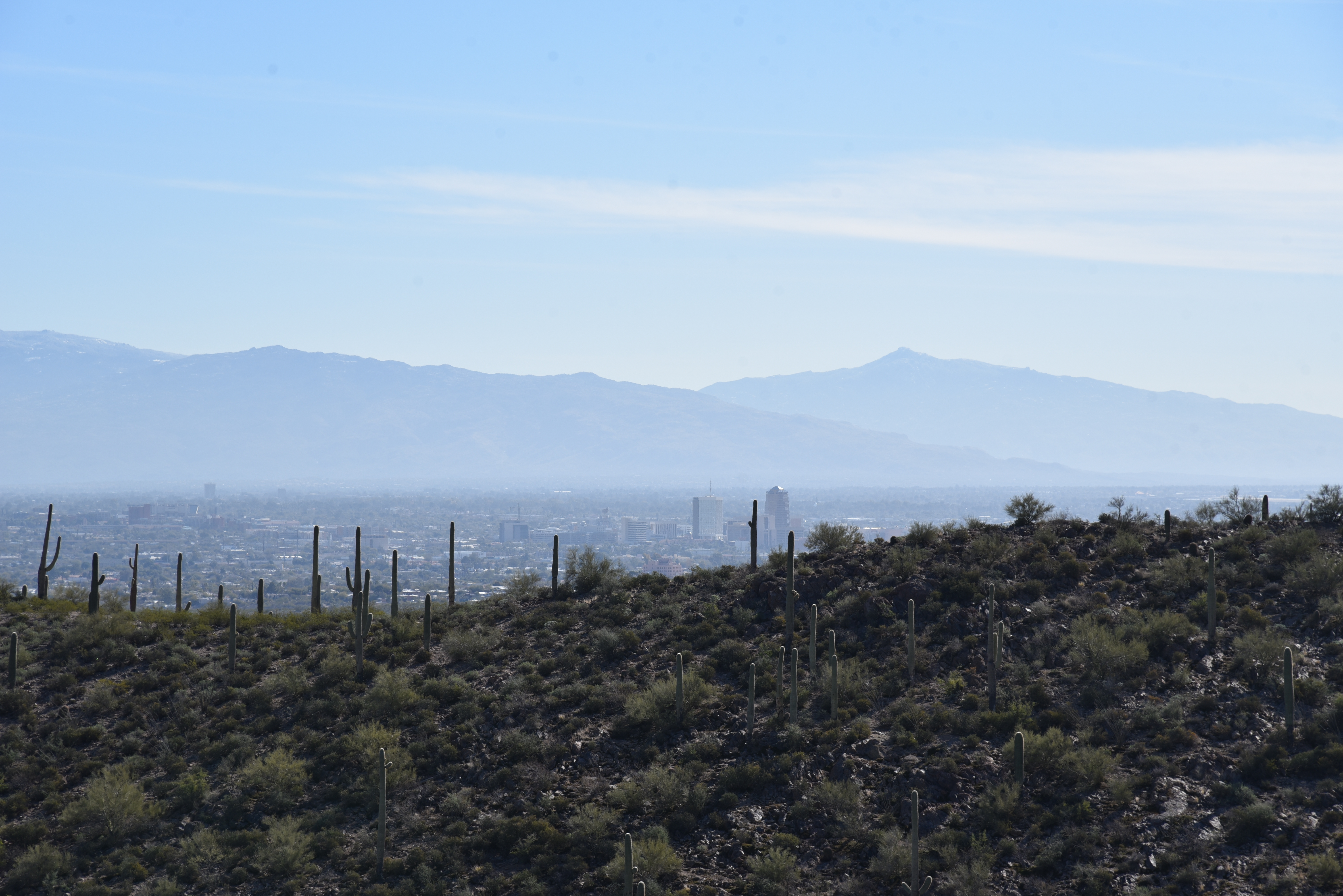
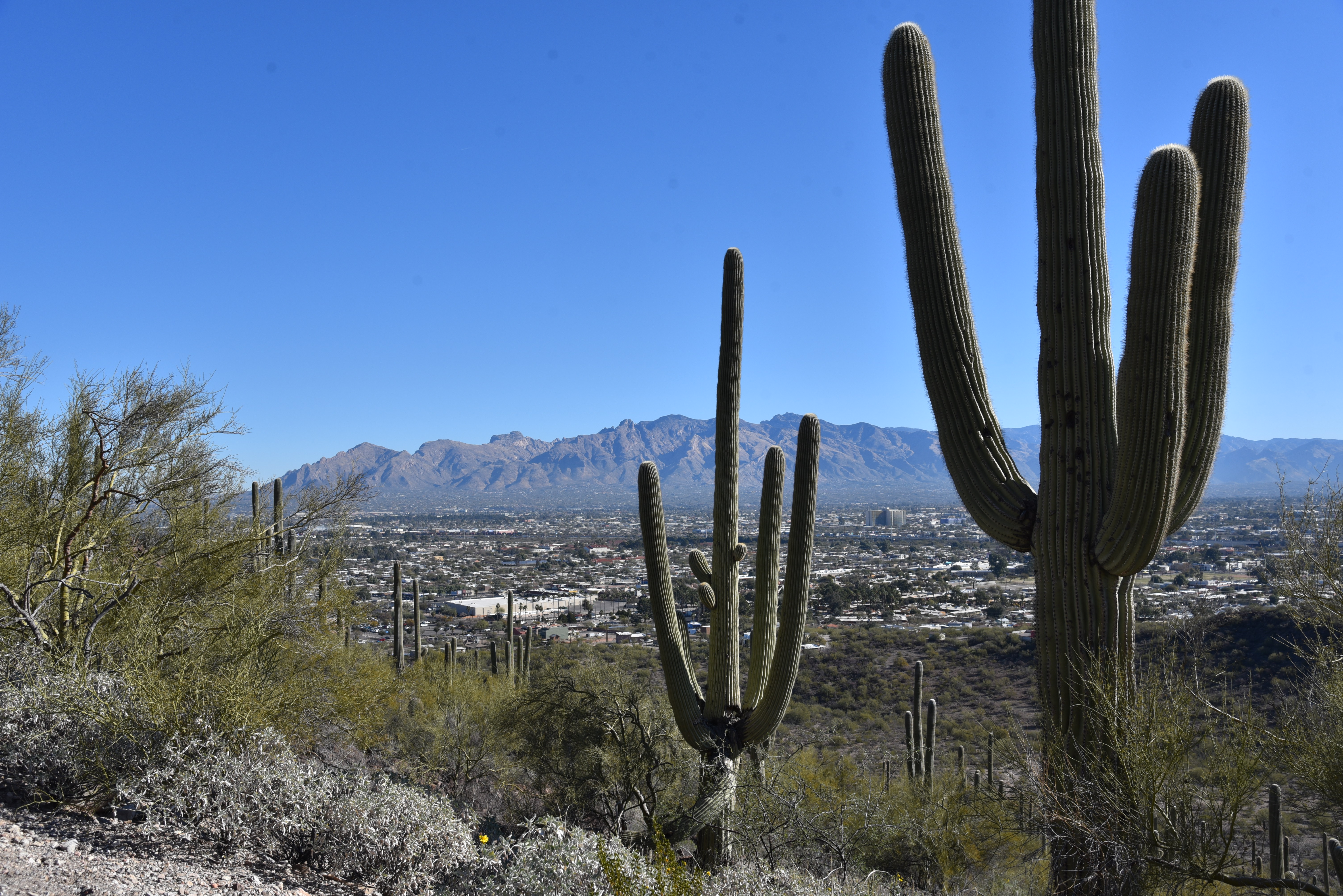
  The going gets demonstrably steeper beyond the Desert Laboratory site where  hikers can refill water bottles, take a break at benches placed at scenic overlooks or make use of the portable restrooms.  Beyond the laboratory, the road turns upward on a series of switchbacks that get more vertical at each turn and reveal vistas of the Santa Catalina Mountains to the north and nearby Sentinel Peak (2,897 feet) that’s better know as “A Mountain”. 
Saguaros line the road up Tumamoc Hill

Distant glimpses of Picacho Peak and Mount Wrightson peer out above the urban grid of downtown Tucson and surrounding suburbs topping out with a see-forever summit panorama.
Mountain vistas abound on Tumamoc Hill

Restored greenhouse at the Desert Laboratory

LENGTH: 3 miles roundtrip

RATING: moderate

ELEVATION:  2,339 – 3,098 feet

GETTING THERE:

From Interstate 10 in Tucson, take the Speedway Blvd./St. Mary’s Road  exit 257. Follow the frontage road south and turn right onto St. Mary’s Road. Continue 0.93 mile to Silverbell Road, turn left and go 0.2-mile to Anklam Road. Turn right on Anklam and go 0.15-mile to the trailhead at Tumamoc Hill Road across from St Mary’s Hospital. Park along the street, not in the medical facilities parking lots.

HOURS: 4 a.m. – 10 p.m. daily

RULES: Pets, bikes and skate boards are not allowed. Hikers must stay on the paved road.

INFO:

https://tumamoc.arizona.edu/tumamoc-hill/overview


Tuesday, March 2, 2021

Tortolita Preserve

TORTOLITA PRESERVE

Candelabra saguaros are the preserve's icons

The saguaro cactus is one of the most iconic plants of the Sonoran Desert.

They thrive in Arizona’s warm, low desert areas and their creamy white blooms are the state’s official flower.  Growing up to 50 feet with lifespans of 150-200 years, the signature cacti take on many forms.  They exist as single columns, many-armed giants and sometimes develop elaborate contorted crests.  But in the sandy washes of the Tortolito Preserve in Marana, the elegant branching specimens are known as candelabra saguaros. 

The hike has a posh, botanical garden feel

It makes sense that the thorny cacti would take on a moniker that mirrors the area’s posh vibe.  Surrounded by golf greens in the foothills of the Tortolito Mountains a few miles north of Tucson, the preserve bumps up against one of Arizona’s most luxurious resorts, the Five-Star, Five-Diamond Ritz-Carlton Dove Mountain. 
Twin Peaks (c: horizon) seen from the preserve

Hiking in the 2,400-acre preserve is more like a stroll through a botanical garden than a backcountry hike.  Established in 2009, the desert expanse is outfitted with a 9.2-mile ,non-motorized trail that traces the preserve’s perimeter for a tour of rich desert plant life and gorgeous mountain vistas. 

The "Old-Timer" ironwood

Flat, easy and maintained to resort-class standards, the trail passes among dozens of impressive “candelabras” as well as palo verde “tunnels”, acres of chain fruit cholla and several ancient, gnarled ironwood trees (including the famous "Old-Timer") known for their frothy, pea-like pink blooms that color the desert in springtime.
Tortolito Mountain views

The 9.2-mile perimeter trail is well-signed

Mountain views are a hallmark of the preserve’s appeal.  To the north, the Tortolita Mountains that rise to 4,300 feet, are home to more than 30 miles of more difficult trails can be accessed by way of the Wild Burro trailhead near the resort. 

Cholla ribs display a honeycomb pattern

Gnarly, ancient ironwoods are common on the trail

To the west, the distinctive form of Twin Peaks is a dominant presence.
A palo verde "tunnel" along the route

While the mountain routes might be beyond the skill sets of casual visitors, the preserve trail offers an alternative way to appreciate the desert-mountain natural space in a tamer, leisurely fashion.

Tortolito Preserve trailhead

Post hike, treat yourself to some of the area’s top-shelf dining, shopping and hotel accommodations. Or, for the full star treatment, splurge with a weekend at the Ritz with a gemstone healing massage, poolside cocktails and a candelabra-lit gourmet meal. 

Signs mark points-of-interest along the way

LENGTH: 9.2 miles total

RATING: easy

ELEVATION: 2,300 – 2775 feet

GETTING THERE:

State Land /Moore Road Trailhead

6250 W. Moore Road, Marana.

From Interstate 10 in Marana, take the Tangerine Road exit 240. At the bottom of the off ramp, go 5 miles east on Tangerine Road to Dove Mountain Blvd.  Turn left, go 1 mile to Moore Road, turn left and continue 1 mile to the trailhead.  Pass the state land gate (close it behind you) and park in the large dirt lot.  The hike begins at the map kiosk.  There are no restrooms or water at this trailhead.

The preserve is on State Trust land, but a permit is not required.

No facilities

INFO:  Town of Marana
https://www.discovermarana.org/directory/tortolita-preserve-and-trail-system/

Monday, February 1, 2021

Enchanted Peak

ENCHANTED PEAK

Rincon Peak (center) seen from ElGrupo Trail

From the Enchanted Hills Trails Park trailhead in Tucson, Enchanted Peak, a prominent, 2,795-foot hill, stands out to the northeast.  From this vantage point, its steep slopes appear insurmountable, yet the trails that lead to its summit are surprisingly manageable.  

The summit of Enchanted Peak

Occupying a 356-acre natural area within the east side of Tucson Mountain Park, the tiny parcel at the edge of suburbia packs in 7 miles of non-motorized use trails. 

A crested saguaro on the El Grupo Trail

Winding around the eponymous Enchanted Hills Wash, the interconnected network of trails showcases rich Sonoran Desert vegetation and huge mountain vistas. 
Tecolote Trail circles the base of the peak

There are many ways to enjoy trekking within the park, but, if you’re like some hikers, that peak will be an irresistible destination.  To get to the prize, begin by hiking east on the park’s arterial El Grupo Loop. 
The slopes of Enchanted Peak appear insurmountable

While the trails are well-designated with map posts, some junction signs are offset from the turnoffs, so pay attention.  Numerous shortcut trails and add-on loops lend themselves to customized treks, but if you just can’t get that peak out of your head, here’s the quickest route.

Fire 7 Trail approaches the base of the peak

Follow El Grupo to 1-mile through wide open country and boulder passages where an impressive crested saguaro stands just north of the trail.  Turn left onto the High Noon Trail, hike 0.3 mile, turn left and pick up the Fire 7 Trail which switchbacks up to the base of the peak. 

Tumamoc Hill seen from High Noon Trail

Where the trail meets the peak-circling Tecolote Trail, head right and hike 0.2-mile to the Enchanted Peak Trail.  This final, 0.3-mile path makes a sinuous ascent over bare rock and edgy clefts with outstanding views of high mountain ranges to the east. 

Stone passages are common on the route

For experienced hikers, the climb is only moderate in difficulty until the last few yards where it makes an abrupt and very vertical assault on the summit.  
Summit sign names prominent peaks

On top, an interpretive sign mounted on the small, rocky pinnacle shows the names, distances and heights of prominent mountains in the Tortolita, Santa Catalina and Rincon ranges visible on the near and far horizons.  Look for Mount Kimball (7,258 feet), Mount Lemmon (9,157 feet), Mount Bigelow (8,450 feet), Rincon Peak (8,284 feet) and nearby Tumamoc Hill (3,108 feet), all destinations near trails that get some serious height and present inspiration for more ambitious mountain adventures.
Tortolita Mountains seen from the summit trail


To complete this trek, descend and hike the opposite way around Tecolote Trail and El Grupo Loop or use the excellent signage to wander at will.

Park trails are well signed

LENGTH:  4.1 miles as described here

RATING:  moderate

ELEVATION:  2,479 – 2,795 feet (717 feet of accumulated elevation change)

GETTING THERE:

From Interstate 10 in Tucson, take the Starr Pass Blvd. exit 259.  At the bottom of the offramp, turn right, follow Starr Pass Blvd. 0.5 mile and turn right on Mission Road.  Go 1.3 miles on Mission Road to 36th Street, turn right and continue 2.1 miles to the trailhead.

HOURS: the park is open daily from dawn until dusk. No fees.

INFO:

Enchanted Hills Trails Park

3280 W. 36th Street, Tucson

https://webcms.pima.gov/cms/one.aspx?portalId=169&pageId=578991