Find A Trail. Start Your Search Here:

Sunday, December 30, 2018

Indian Spring Wash

Indian Spring Wash
Indian Butte framed by last season's yucca sprouts.
By way of Forest Road 532, it’s a six mile hike from Bartlett Dam Road to the Verde River. The road is neither the most efficient nor the easiest way to get there, but it offers a pleasant backcountry trek over varied terrain with outstanding views.  The road is part of a cluster of recently restored shared-use routes in the hills between Horseshoe Reservoir and Bartlett Lake northeast of the Valley. 
The first mile is a sandy slog in Indian Spring Wash.
Overlooking the Verde River Valley
Open to ATVs, bikes, horses and hikers, the roads wind through a part of the Tonto National Forest Cave Creek Ranger District.   
Desert honeysuckle bloom in the wash.
A map at the trailhead gives an overview of the system, which at first glance, can be intimidating. However, Forest Road 532 is well-signed and easy to follow. The hike begins in the sandy spillway of Indian Wash. Deeply rutted and softened by motorized traffic and periodic flooding, the first mile is tantamount to walking on a beach. The washy walk dodges among giant granite pillars, sandbars and a 
robust showing of desert hackberry, mesquites, turpentine bushes, desert honeysuckle and blooming wildflowers. At the 1.9 mile point, the road moves out of the wash and into the hills as it head up to the saddle between Indian Butte (3745 feet) to the east and Saint Clair Peak (4230 feet) to the west. The first rise provides amazing vistas of landscape of rolling foothills trees, cholla, yucca and shrubs, but the big story here is the mountain vistas. Silhouettes of the Four Peaks, Sierra Ancha and McDowell Mountains form a seamless, peak-centric horizon.  The road tops out where Forest Road 1104 head off toward St. Clair Peak and FR 532 begins its 1500-foot dive down to the river. Take a moment here to scope out wall of wilderness peaks backing the Verde River Basin ahead. It’s a long way down (and it feels even longer on the way out) but the wide road mitigates the struggle with passes by rugged cliffs, scenic overlooks and reed-addled riparian areas down in the wash. 
Just beyond the 5-mile point, heavily-used Forest Road 42 bisects the route signaling the final approach to the river. The road ends roughly halfway between the two lakes near a primitive camping area called Devil’s Hole. If you didn’t pack for an overnighter or arrange to have somebody with an ATV pick you up, enjoy the sights before trudging back the way you came.
Point where the route leaves the wash.
Saint Clair Peak
McDowell Mountains on the horizon.
Forest Road 532 ends at the Verde River
Trailhead map shows the system of shared-use roads.
LENGTH:
To the river: 5.8 miles one-way
To the highpoint: 2.4 miles one-way
RATING:  moderate-difficult
ELEVATION:
Trailhead: 2725 feet
Highpoint: 3303 feet
River: 1800 feet
GETTING THERE:
From the Pima Road/Cave Creek Road intersection in Carefree, go 4.1 miles north on Cave Creek Road to Bartlett Dam Road. Turn right and continue 9 miles to the trailhead on the left where there’s a gate and map kiosk. There’s plenty of parking along the road.


Wednesday, December 26, 2018

Dawa-OK-Arizona Cypress Loop

The Freedom Tree: An Alternative Instagram Moment
The Freedom Tree

Take a drive up Sedona’s Dry Creek Road on any weekend between October and April and you’ll encounter hordes of pedestrians and a quagmire of vehicles packed in a haphazard, bumper-to-bumper mass that’s strung out for miles. This is the overflow parking from the Dry Creek Vista Trailhead located on adjacent Forest Road 152.
View from the Dawa Trail
Most of the vehicle occupants are going to Devils Bridge. 
Devils Bridge is one of hundreds of awesome natural wonders in Sedona’s red rock country.
Doe Mountain seen from the Ok Trail
The russet sandstone arch can be reached via the convenient (and notoriously crowded) trailhead and a moderate trek, making it one of the most heavily-visited destinations in the high-desert forests northwest of downtown.
Blue grama grass in a meadow near Dry Creek
For me-- a hiker who generally shuns crowds-- the Devils Bridge Trail has a claustrophobic feel. It’s just a scenic vista removed from the essence of a carnival ride where customers are herded through a turnstile for their shot at a three-minute thrill and a requisite yoga-pose Instagram moment.  No, thanks.
Why put up with this craziness when there’s another cool sight about a mile beyond the commotion where you won’t have to jockey for a parking spot to get a fantastic look-at-me photo. May I recommend a hike to the Freedom Tree. The tree is dead, and I made up the name, but the massive skeleton of what appears to have been a coniferous species, is a noteworthy feature in the Cockscomb Trail System.  Located in a quiet pocket of Coconino National Forest between the famous bridge and Red Rock Secret Mountain Wilderness, the system has dozens of miles of trails that wander along Dry Creek and its feeder washes. To get to the tree, begin at the tiny Dawa trailhead--really just a dirt turnout--on Boynton Pass Road. Hike a few yards and hang a left on the Ok Trail.
The red ridge of Mescal Mtn seen from the Dawa Trail.
This short passage features wonderful views of Doe Mountain to the west and Mescal Mountain to the north. In less than a half mile, head right at the Arizona Cypress junction. After and easy crossing of the usually dry creek bed, thick stands of cypress, junipers, yuccas and sycamore trees wrap the trail in greenery and shaggy bark textures. Soon, a gigantic, twisted snag appears where the trail makes another sandy creek crossing.  Soaring to perhaps 30 feet, the woody frame sprawls skyward.
The Freedom Tree stands at the edge of Dry Creek.
Its gnarled branches and dominating presence reminded me of the scene in the movie Braveheart where Scottish rebel William Wallace famously hurls his sword and arms toward the heavens while yelling, “freedom”.  The divergent narratives of Wallace and the tree both represent a departure from sacred norms and known places. 
The route crosses Dry Creek and feeder washes.
Although the tree appears well-grounded and able to remain standing for many years to come, both it and Devils Bridge will eventually succumb to the forces of nature.  Whether that happens in the next years or not for centuries, the demise of the bridge (hopefully when there are no hikers on board) will be headline news.
A sandy wash crosses the Dawa Trail.
The deceased conifer, though, will likely just fall over and join disintegrating log jams in Dry Creek, barely causing a ripple in the Instagram universe.
Arizona cypress trees sport shaggy bark.
To complete your visit to the photogenic tree, hike south to the Dawa Trail where you can hang a right and follow it back to the trailhead for an easy 2.7-mile circuit or create your own trip using any of the connecting trails that offer freedom from the masses.
A shady section of the Arizona Cypress Trail
Stay on trails to protect sensitive soils and emerging plants.
LENGTH: 2.7-mile loop
RATING: easy
ELEVATION: 4339 – 4485 feet
GETTING THERE:
From the State Route 179/89A traffic circle in Sedona, go 3.2 miles west (left) on SR 89A to Dry Creek Road. Go 2.8 miles north on Dry Creek Road, veer left at the Long Canyon Road junction and continue 0.5-mile on Boynton Pass Road to the parking turnout on the left. A Red Rock Pass is not required at this trailhead.
INFO & MAPS:


Monday, December 17, 2018

SUTHERLAND TRAIL

SUTHERLAND TRAIL
Sutherland Wash in Catalina State Park
Amazing geology, abundant wildlife and a fantastic fusion of terrains are just a few of the many features of the Sutherland Trail in Tucson.
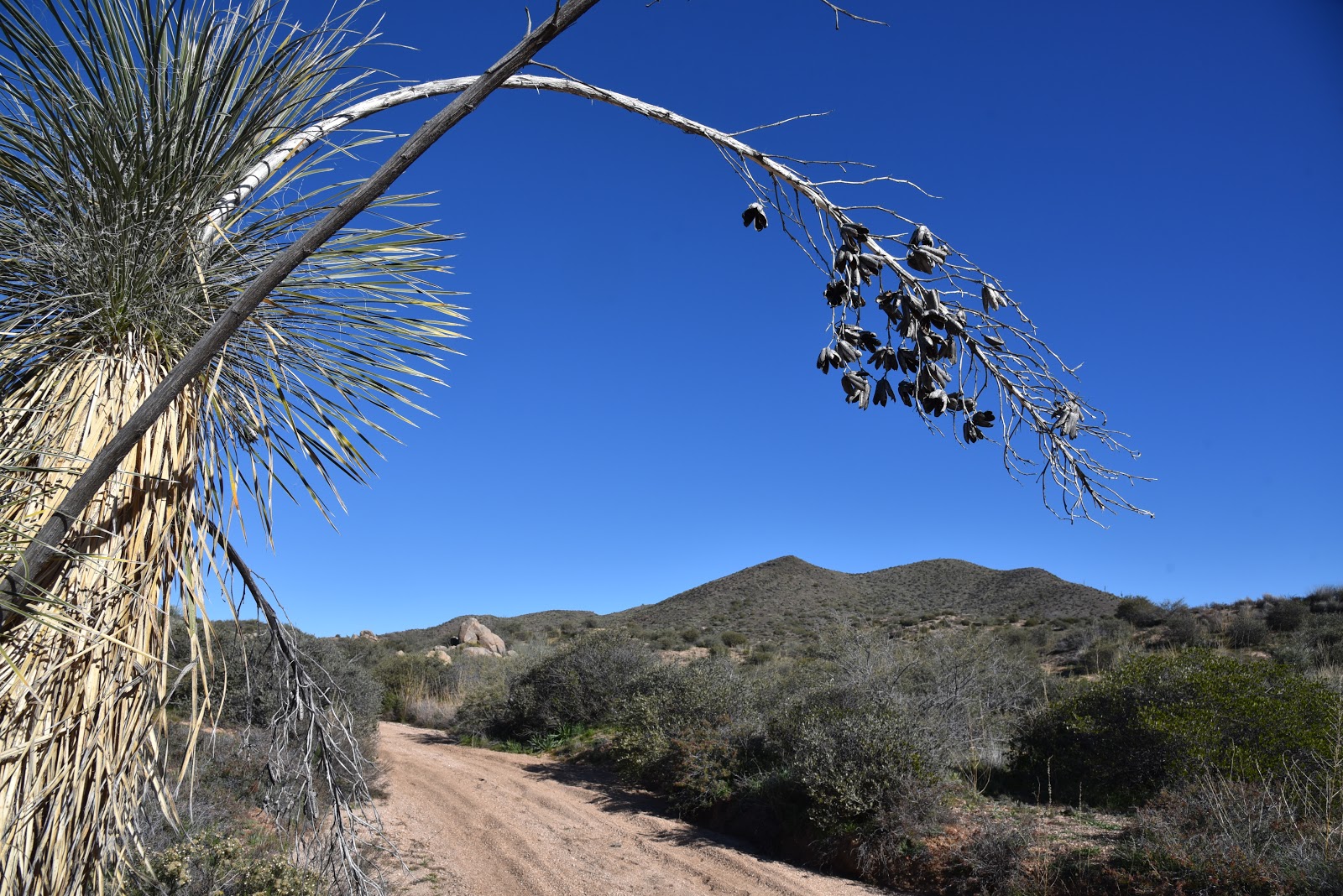
Views of Pusch Ridge and the Santa Catalina Mtns.
The 9-mile route that begins as a groomed path in Catalina State Park and ends near the top of Mount Lemmon where it intersects the Arizona Trail melds a collection of tame walks and grueling mountain climbs.  The trail’s dramatic mood shifts can be attributed to the contrasting ambiences of the park, Coronado National Forest, Pusch Ridge Wilderness and a protected Desert Bighorn Sheep Management Area.
Fascinating geological features are everywhere.
Water pools in Sutherland Wash
Looking west over the Canada del Oro channel.
Whether you’re interested in the full-strength trek or a mild sampler, Sutherland Trail adapts to fit.  The trail’s first 2.6 miles are within park boundaries and make for an approachable stroll with minimal climbing.  The well-signed route complements the park’s diverse repertoire of trails, offering a customizable, visually-rich journey.
The beautiful Santa Catalina Mountains.
An Arizona Ash tree frames a saguaro-cluttered ridge
Ocotillos front Pusch Ridge peaks.
The route departs the main trailhead, tracing the sandy course of Sutherland Wash at the base of the Pusch Ridge and the Santa Catalina Mountains.  Draped by mesquite trees and flanked by a wall of massive saguaros, this easy passage puts the granitic pinnacles and deep fractures of the Catalinas front-and-center. Soaring to over 8000 feet, the geologically complicated mountains are the result of millions of years of upheavals, volcanism and erosion that’s still shaping the landscape today. 
At the edge of the park boundary, the trail feels more wild.
Within a half-mile, the trail makes a dip into the wash where a smattering of velvet ash, willow and other riparian trees sink their roots deep into the sandy pediment.  During wet periods when water shimmies over the soft channel, hikers must use stepping stones and sandbars to hop the rivulets. 
Stream terraces seen from Sutherland Trail
A few steps beyond the crossing on a knoll above wash, a metal sign gives a fly-over explanation about the formation of the mountains seen across the wash.

For a more detailed account,  geek out over  A Guide to the Geology of Catalina State Park and the Western Santa Catalina Mountains by John V. Bezy.
Saguaros and riparian plants grown in close proximity.
It’s available as a free e-book on the park website.
Stepping stones and sandbars assist wash crossings
Just around the bend at the junction with the park’s 2.3-mile Canyon Loop circuit, the trail begins its uphill assault. 
Reflecting pool near the Canyon Loop Trail junction
The Sutherland Trail passes through bighorn sheep territory
For a shorter option, take the easy loop which gains only 300 feet of elevation as it crosses the wash several times on its way back to the trailhead. 
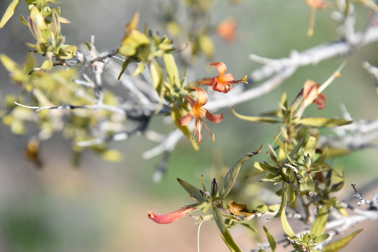
Chollas soak up sun in the savannah-like open range.
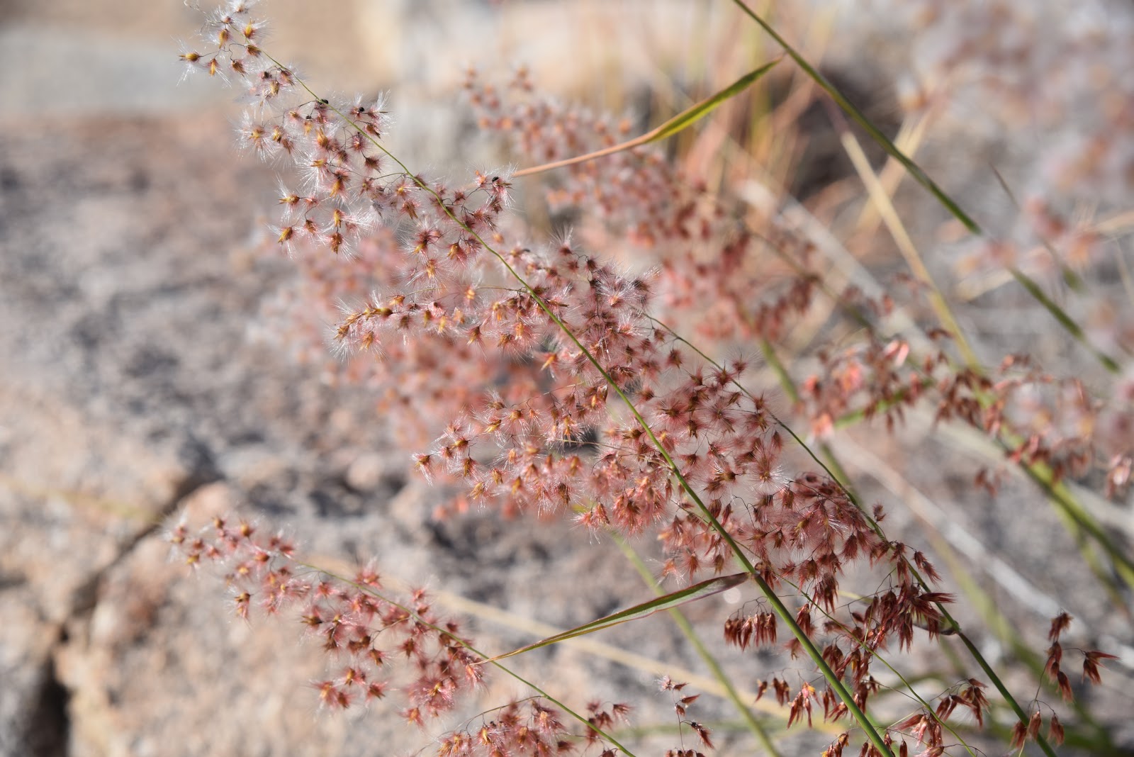
Many species of grasses grow along the trail.
From this point, Sutherland Trail ascends to a sunny grassland above the Canada del Oro--a natural, water-carved channel that carries runoff from the watershed of Mount Lemmon.  A short climb up a ridge on wooden steps opens up views of cobbled stream terraces and the Tucson Mountains to the west. 
Soaptree yuccas in the Pusch Ridge Wilderness Area
Replete with cholla, wild grasses and fruit-bearing shrubs, this open savannah-like segment ducks in-and-out of the wilderness and the bighorn sheep management area on a slender, meandering single track. Before roaming through the sheep recovery area, it's smart to read up on how to do so responsibly by visiting the Arizona Game and Fish Department website https://www.azgfd.com/hunting/species/biggame/bighornsheep/. Also, as sheep are easily disturbed by dogs, please leave Fido at home. 
As it passes among jointed boulders stuffed with crystalized quartz, patches of mesquite, floodplains and soaptree yuccas growing from cracked, stone outcroppings, the route takes on a more primitive feel.   At the 2.6-mile point, it’s decision time.  To continue on Sutherland, head right at the Trail Link junction for a difficult ascent up toward Mount Lemmon. For an 8.8-mile loop, follow the link 2.2 miles, and take the 50 Year Trail south back to the park. Otherwise, retrace your steps and enjoy the tour in reverse.
LENGTH: 9.1 miles one way full trail or 2.6 miles one-way for the park segment
RATING: easy to difficult
ELEVATION: 2700 - 8560 feet full trail or 2700-3360 park segment
GETTING THERE:
From Interstate 10 in Tucson, take the Tangerine Road exit 240 and go east to State Route 77 (Oracle Road). Turn left (south) and continue 0.7 mile to the park entrance on the left.
Pay fee at the gate and continue 1.4 miles to the trailhead.
DOGS: leashed dogs are allowed in the park but may not enter the Desert Bighorn Sheep Management Area.
FEE: $7 daily fee per vehicle.
INFO: Catalina State Park
Arizona Game and Fish Department, Bighorn Sheep information:
https://www.azgfd.com/hunting/species/biggame/bighornsheep/

Monday, December 10, 2018

PROMENADE-SONORAN LOOP

PROMENADE-SONORAN LOOP

Fountain Hills McDowell Mountain Preserve
Ocotillo frame Superstition Wilderness peaks.
Sonoran Trail dips and climbs through rugged foothills.
A Red-tailed hawk glides above the Verde River basin.
Adero Canyon Trailhead officially opened on 11-17-2018.
Stop and smell the desert lavender while hiking.
With the restroom plumbing and water lines nearly complete and the access road mostly paved, the new Adero Canyon Trailhead in the Fountain Hills McDowell Mountain Preserve was officially opened on November 17, 2018. 
The Promenade Trail follows a wide dirt road.
After decades of planning and construction, the roughly 1000-acre preserve now occupies a mountainous sliver of space between manicured golf communities and the hiking hubs of Scottsdale McDowell Sonoran Preserve and McDowell Mountain Regional Park. 
Four Peaks seen from the Promenade Trail
The mini-but-mighty preserve located in the far northwest corner of town really packs a punch in terms of varied hiking opportunities. The preserve has more than 11 miles of non-motorized trails that range in difficulty from very easy to extremely challenging.
Excellent signage keeps hikers on track.
Perhaps the most tantalizing hiker-gravy of the trail complex is its connectivity. Although most of the preserve’s routes are contained within its borders, the Sonoran, Andrew-Kinsey and Dixie Mine trails cross into the adjacent park and preserve.  These property-spanning paths offer seamless foot travel among the popular northeast Valley hiking hubs. 
Brittlebush are prolific bloomers along the trails.
Although each of the preserve’s trails has its own character, they all capitalize on their advantageous location overlooking the Salt and Verde River basin. Here, scenic vistas come in the form of both low hanging fruit and hard-won jewels. Ostensibly, the big jewels are gained by clambering up and over the extreme course of the Western Loop Trail, but a walkabout on the less-arduous Promenade and Sonoran Trails unpacks similar dramatic scenery.  
Wolfberry shrubs bear bright orange fruits.
Lacy Tansy-Aster bloom along the trails.
From the trailhead, the Promenade Trail follows a wide, edge-hugging road on the preserve’s eastern foothills. Trails within the preserve are well-signed and outfitted with location markers that correspond with maps available online and at the trailhead, so getting around is simple as long as you pay attention.
Arching ocotillos shade the Sonoran Trail.
As it swings around chunky bluffs, unobstructed views of the iconic Four Peaks and Superstition Wilderness soar above green valleys and sprawling suburbs. As the route swings northwest, distant silhouettes of Sierra Ancha Mountains back the rugged expanse of the Tonto National Forest. At the 0.8-mile point, take either the Sonoran or Lower Sonoran Trail at location marker ST1/LST1.  
Junction for the loop portion of the hike.
Both legs of the difficult-rated loop have some steep sections and loose rock where the path descends and rises through a craggy notch. Continue less than a mile to the crossover link at marker LST5 and swing back on the opposite leg. 
Sonoran Trail spills into McDowell Mtn Regional Park
While hiking the loop, don’t let the big mountain and valley panoramas dominate your experience.
Desert lavender shrubs frame views of Tonto NF mountains.
A veritable botanical garden of flowering plants tickle the fringes of the trails.  Wolfberry shrubs, cholla cacti, brittlebush and desert lavender drape over the route adding pops of color to the heady hike.  
LENGTH: 3.3 miles
RATING: moderate-difficult
ELEVATION: 2460 – 2170 feet
GETTING THERE:
Adero Canyon Trailhead: 14800 N. Eagle Ridge Dr. Fountain Hills.
From State Route 87 in Fountain Hills, go 3.2 miles west on Shea Blvd to N. Palisades Blvd. Turn right (north) and continue 1mile to Eagle Ridge Drive, turn left and go 2.3 miles to the trailhead.
HOURS: Sunrise to sunset daily
FEE: no fees unless you cross into MMRP ($2 per person).
INFO: