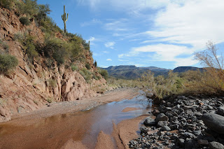


 HAUNTED CANYON
Superstition Wilderness
Tony’s Cabin is still standing, as it has for decades, at the edge of a sycamore-lined creek in Haunted Canyon. Abandoned long ago, it serves now as a shrine to a camaraderie of hikers who have never met. The weathered log building is lovingly maintained and stocked with canned foods, matches and other survival essentials, like beer, by outdoors enthusiasts just passing through. Be it a stash for the lost or an offering to the spirits that inhabit the wilderness, you too can become part of the tradition by depositing a can of beans of your own. Undulating and traversing a variety of terrain, the Haunted Canyon trail starts out as an easy-to-follow stroll, but quickly demands more of your quads and route-finding skills. Views from the high ridgelines into the forests and meadows are worth the effort. Keep in mind that the downhill sections on the way in become uphill slogs on the way out.
Except for some tortured looking cottonwoods, and the calls of fugitive owls, the trail does not seem haunted. Native Americans slapped the moniker on the canyon as a determent to outsiders. But, slag heaps and tailings ponds along the drive to the trailhead are ample evidence that phantoms are no match for the lure of copper.
LENGTH: Optional. 7.5 miles out and back
RATING: moderate - difficult
ELEVATION RANGE: 3,200 – 4,900 feet
GETTING THERE: From Phoenix, take Hwy 60 east past Queen Creek to the Pinto Valley mine exit (FR 287). Follow the paved road almost 3 miles to the mine entrance. Turn left and follow the “public access” signs. Keep bearing left until you reach the Trail 203 sign.
INFORMATION: Tonto National Forest, Superstition Wilderness


 RED CREEK
Tonto National Forest
Crystal clear, gurgling waters, red rock cliffs, shady mesquite forests and towering canyon walls make hiking Red Creek an especially relaxing experience. A tributary of the Verde River, Red Creek creates a narrow band of green in the desert and supports abundant plant and animal life. Simple and serene, the trail follows the creek and 4x4 roads. Stream hopping is a major feature of this hike but the creek bed is gravel (not mud) and the water is anything but deep or treacherous.
The creek emerges from the canyon at about the 3-mile mark and trickles into a desert wash with big-sky views and miles of river rock underfoot. On the near horizon, a ribbon of green jutting over the desert ridges is a sure sign that a major water source is nearby. Keep following the trickle and it will lead you to the rushing waters and sandy beaches of the upper Verde River.
LENGTH: 8 miles out-and-back
RATING: Easy
ELEVATION CHANGE: 400 feet
GETTING THERE:
From Carefree, follow Cave Creek Road (which will turn onto FR 24) for 32 miles to the FR 269 junction (Bloody Basin Road) and turn right. Go about three miles and turn left onto FR 18 and proceed for roughly 2.5 miles. Park in a dirt turnoff just before the steep descent to Red Creek. Expect to spend 2.5 hours on dirt roads. NOTE: FR 18 is very rough and requires at least a high clearance vehicle.


