Find A Trail. Start Your Search Here:

Showing posts with label Marcus Landslide Trail. Show all posts

Friday, November 10, 2017

MARCUS LANDSLIDE TRAIL

MARCUS LANDSLIDE TRAIL
Marcus Landslide Trail
Scottsdale's McDowell Sonoran Preserve is home to dozens of impressive geological features. While many, like Tom's Thumb, and Brown's Mountain, are impossible to miss, the one that eclipses them all takes a trained eye to locate and appreciate. 
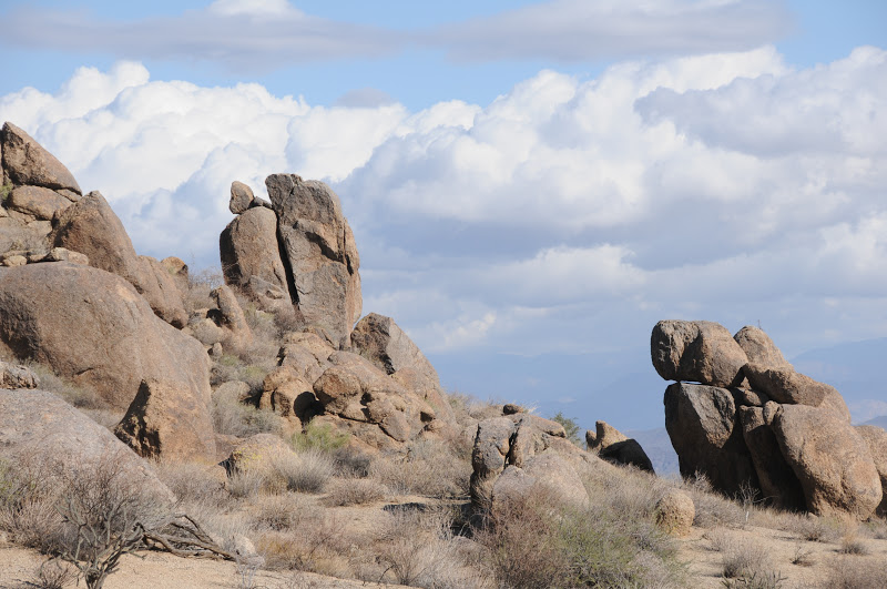
Granite boulders along the trail
If you didn't know it was there, you'd probably never even notice the massive rockfall area called Marcus Landslide. Discovered in 2002 by a pair of local geologists, the nearly mile-long wreckage is comprised of an estimated 25.8 billion pounds of rubble.
Mushroom rock
The slide occurred during the Pleistocene Ice Age about a half-million years ago when a colder, wetter climate may have instigated the slide which shaved 1,200 feet off the ridge line releasing energy equivalent to an atomic bomb blast. The trail, which is named for former Arizona State University geography professor Melvin Marcus, loops among the slide's components giving a comprehensive overview of the magnitude and scope of the event.  Although interpretive signs placed along the eponymous trail that leads to the site give enough information for the casual visitor,  scheduled steward-led hikes get deeper into the science.
Marcus Landslide site
This highly-trained corps of McDowell Sonoran Conservancy volunteers in bright blue shirts will help you gain an appreciation for the complex beauty of the McDowell Mountains.
Besides the ubiquitous landslide, the easy trail makes a loopy tour through crops of weathered granite “mushroom” rocks and stony hackberry-lined corridors with breathtaking views of the Fountain Hills area, Verde River valley and Superstition Wilderness. The more you learn about this fascinating, 30,580-acre slice of pristine Sonoran Desert, the more you'll want to return again and again to hike its more than 180 miles of trails.
Mushroom nursery
LENGTH: 3.7-mile loop (4.2 miles with optional side trips)
RATING: easy
ELEVATION: 2,800’ – 2,500’
HOURS: sunrise to sunset daily
FACILITIES: restrooms, NO water
BEST SEASON: October -April
View of Four Peaks 
GETTING THERE: Tom's Thumb Trailhead:
From the Loop 101 in Scottsdale, take the Pima/Princess Road exit 36 and continue 5 miles north on Pima to Happy Valley Road. Turn right (east) and go 4.1 miles on Happy Valley to Ranch Gate. Turn right on Ranch Gate, follow it 1.2 miles then turn right onto 128th St. and continue 1 mile on 128th to the signed trailhead. Roads are paved all the way.
INFO:
McDowell Sonoran Conservancy: http://mcdowellsonoran.org/home
Scheduled Hikes: http://www.mcdowellsonoran.org/events/
McDowell Sonoran Preserve
Arizona Geological Survey

Monday, November 12, 2012

Edge of the suburbs desert hike


ROCK KNOB-PEMBERTON-BOULDER-MARCUS LANDSLIDE LOOP
McDowell Sonoran Preserve-McDowell Mtn. Regional Park
Boulders near Rock Knob

With a glinty grainy tread way of decomposing granite underfoot and haze-muddled views of the Mazatzal, Superstition and McDowell Mountain ranges hugging the horizon, this spectacular loop hike in a shadeless basin of Sonoran Desert showcases a lot of what we love about our local landscape.

Cradled between a preserve area and a county park, this swath of boulders and cholla is a stubborn holdout amidst garrisons of swanky golf communities lapping at its fringe.  Thanks to the foresight and persistence of concerned citizens, this precious local gem remains closed to development and open for climbing, hiking, biking and equestrian activities.  Although its proximity with the red-tile-aqua-pool suburbs of Scottsdale and Fountain Hills puts a mild pox upon the wilderness experience, the up side is easy access to the great outdoors.  My favorite part of this thrown together trek is the geology and the big-sky views.  The route passes by the jumble of granite known as Rock Knob, the lower end of Marcus Landslide and numerous stone "sculptures" and "mushroom" rocks.  As the terrain is rather flat, there are unobstructed vistas---look for Superstition Wilderness landmarks Weaver's Needle and the Flatiron in the east and, if you hit the trail at the right time, you'll get a peek at the famous waterspout in Fountain Hills. A spur path on the return leg of the loop leads to a lookout spot with an interpretive sign identifying these key features.
Saguaros on the Boulder Trail

HERE'S THE HIKE PLAN:  from the trailhead, hike 0.3 mile east on the Marcus Landslide Trail to the junction for Rock Knob Trail.  Follow Rock Knob 0.5 mile to the McDowell Mtn Park boundary where you'll need to deposit $2 and secure your permit.  Continue another 0.6 mile on Rock Knob to Pemberton Trail, turn right (southeast) and hike 1.1 miles to Boulder Trail.  Pick up Boulder and continue 1.1 mile to Marcus Landslide (back in the preserve), turn right (north) and trek 1.4 miles back to the trailhead.

LENGTH:  5 miles according to park maps; 5.4 miles by my GPS track
RATING:  moderate
ELEVATION: 2,800' - 2,280'
FACILITIES: restroom at trailhead, no water
FEE: $2 per person to enter McDowell Mtn Regional Park (exact change req)

GETTING THERE:
Tom's Thumb Trailhead:
From the loop 101 in Scottsdale, take the Pima/Princess Road exit 36 and continue 5 miles north on Pima to Happy Valley Road.  Turn right (east) and go 4.1 miles on Happy Valley to Ranch Gate. Turn right on Ranch Gate, follow it 1.2 miles then turn right onto 128th St. and continue 1 mile on 128th to the signed trailhead. Roads are paved all the way.
INFO:

MORE PHOTOS:

Saturday, October 20, 2012

New trail in the McDowell Sonoran Preserve


MARCUS LANDSLIDE TRAIL
McDowell Sonoran Preserve
Marcus Landslide Trail: Oct. 20, 2012

approaching some "mushroom" rocks
A little bit of history was made this morning as stewards of Scottsdale’s McDowell Sonoran Preserve stepped out on the inaugural guided hike of the brand new Marcus Landslide Trail.  Freshly cut, the new route is an homage to the complex geology of the north side of the McDowell Mountains.  Colorful signs along the trail enlighten hikers about the surrounding terrain---including an explanation of how the area’s signature “mushroom” rocks formed.  But of course, the main attraction is the ubiquitous landslide.  I must add that, to really appreciate this trail, take one of the steward-led hikes.  Our leader today was steward Don, and I was blown away by all his knowledge and professional speaking skills.  Learn about upcoming guided hikes here: http://mcdowellsonoran.org/content/pages/guidedHiking
If you didn't know it was there, you'd probably never even notice this massive slump in the mountainside. Discovered in 2002 by a pair of local geologists, the nearly mile-long wreckage  is comprised of an estimated 25.8 billion pounds of rubble---that's enough material to fill Sun Devil Stadium six times.  The slide occurred during the  Pleistocene Ice Age about a half-million years ago when a colder, wetter climate may have instigated the slide which shaved 1,200 feet off the ridgeline releasing energy equivalent to an atomic bomb blast.   The trail, which is named for former ASU geography professor Melvin Marcus, loops among the slide's components giving a comprehensive overview of the magnitude and scope of the event. The hike takes off from the new Tom's Thumb Trailhead (officially opened Oct. 18, 2012) following an easy grade through typical desert scrub with views of the Fountain Hills area, Verde River and Superstition Wilderness.  Incredibly, the preserve receives no tax dollars and is funded entirely by contributions to the McDowell Sonoran Conservancy from hikers like you (and generous major contributors). This is pretty amazing when you consider the impressive facilities, quality of staff and meticulous trail maintenance.  So, when you’re checking out upcoming hikes, leave a donation to help ensure ongoing protection of our Sonoran Desert hiking trails.
Preserve steward, Don talks geology

LENGTH: 3.7-mile loop (4.2 miles with optional side trips)
RATING:  easy
ELEVATION: 2800’ – 2,500’
HOURS: sunrise to sunset daily
FACILITIES: restrooms, NO water
DOGS: leashed dogs are allowed on trails but not on guided hikes
FEE: NONE-- unless you take a connecting trail into adjacent McDowell Mountain Regional Park.  Then, it’s $2 per person---exact change required for the self-pay permit station.
GETTING THERE:  Tom's Thumb Trailhead:
From the loop 101 in Scottsdale, take the Pima/Princess Road exit 36 and continue 5 miles north on Pima to Happy Valley Road.  Turn right (east) and go 4.1 miles on Happy Valley to Ranch Gate. Turn right on Ranch Gate, follow it 1.2 miles then turn right onto 128th St. and continue 1 mile on 128th to the signed trailhead. Roads are paved (finished just this past week!) all the way.
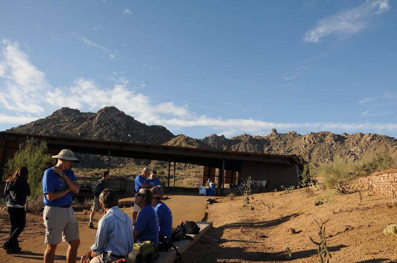
Tom's Thumb trailhead

INFO:
McDowell Sonoran Conservancy: http://mcdowellsonoran.org/home
480-998-7971
McDowell Sonoran Preserve
Earthly Musings: the blog of geologist Wayne Ranney
Arizona Geological Survey

MORE PHOTOS:

Thursday, October 18, 2012

New Tom's Thumb trailhead opens today.

Tom's Thumb: iconic pinnacle in the McDowell Mountains 
The long awaited Tom's Thumb trailhead was officially opened this morning.  In addition to providing convenient access to hiking and climbing in the northern reaches of the McDowell Sonoran Preserve, the trailhead also serves as a gateway to the park's newest attraction--the Marcus Landslide Trail.  Sure to be a big draw for geology buffs and casual hikers alike, the 4-mile interpretive route explores Arizona's second largest landslide.  A special grand opening event is planned for this Saturday, Oct. 20, 2012 beginning at 8 a.m.. There will be guided hikes, climbing demos and lots of fun things to do in celebration of the return of "hiking weather" to the Valley.

INFO & MAP: http://mcdowellsonoran.org/trailhead/displayLocation/8
TOM'S THUMB HIKE: http://arizonahiking.blogspot.com/2010/02/toms-thumb.html