Find A Trail. Start Your Search Here:

Showing posts with label Maricopa County Parks. Show all posts

Tuesday, April 26, 2022

NEW Trail Ambassador Opportunity

BECOME A TRAIL AMBASSADOR FOR MARICOPA COUNTY PARKS

Spur Cross Ranch Conservation Area


Maricopa County Parks has just created a new volunteer position– “Trail Ambassador”.  The Trail Ambassador will observe trail conditions and report needed repairs to staff, provide guidance to trail users, and reinforce proper trail etiquette and  Leave No Trace principles.  Hikers, bikers, and equestrians can serve as Trail Ambassadors.

Maricopa County Parks are located across the Valley, so there’s one near you!

• Cave Creek Regional Park, Cave Creek

• Spur Cross Ranch Conservation Area, Cave Creek

• White Tank Regional Park, Waddell

• Estrella Mountain Regional Park, Goodyear

• Lake Pleasant Regional Park,

• McDowell Mountain Regional Park, Fountain Hills

• San Tan Regional Park, Queen Creek

• Usery Mountain Regional Park, Mesa

• plus, the Maricopa Trail connects them all!


TO LEARN MORE ABOUT THIS NEW OPPORTUNITY

CONTACT:

Bill Klewer

Volunteer Coordinator

602-506-9512

Bill.klewer@maricopa.gov


Wednesday, January 6, 2021

Get Hooked on the Maricopa Trail in 2021

SPUR CROSS-MARICOPA TRAIL

Beautiful back country on the Maricopa Trail

Sometimes, an addiction is a good thing.  Swapping a junk food obsession or a movie streaming fixation for a commitment to healthful foods and regular outdoor recreation are the kinds of addictions that improve quality of life.  Kicking bad habits isn’t easy, but hiking can help wean even the most devout triple-burger-with-the-works aficionados off the artery-hardening stuff.

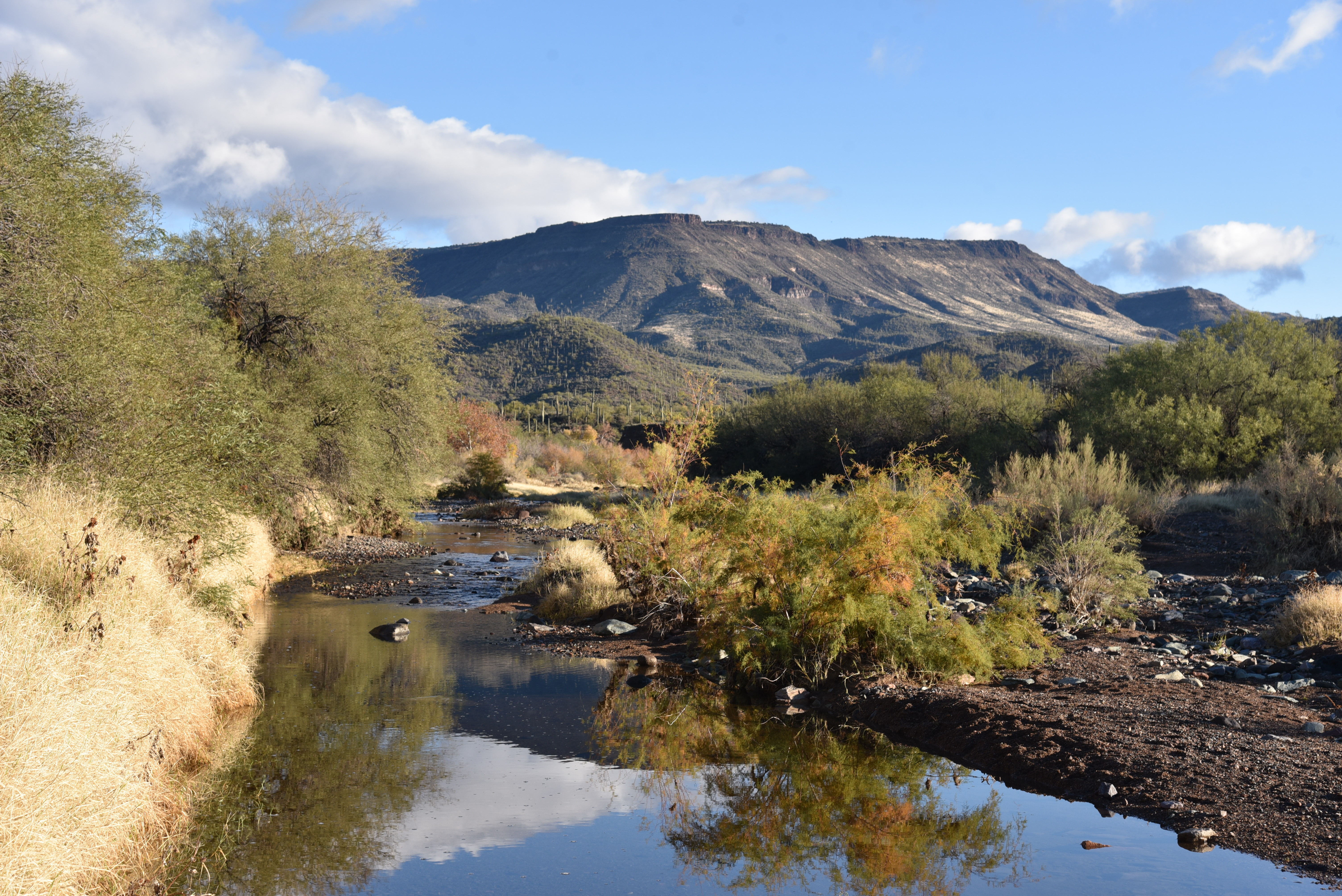
The route crosses Cave Creek several times

That’s because, like eating potato chips, once you start, it’s difficult to stop.  And when you really get into it, you’ll be inspired to get fit to take on longer, more difficult treks.

A bird verifies Audubon Arizona important bird area

As with goals in general, it helps to have a plan. 

An old forest service sign on the Maricopa Trail

For Phoenix-area hikers, there’s a ready-made plan already in place. It’s called the Maricopa Trail.  The 315-mile route circumnavigates the Valley, connecting 10 county regional parks, urban centers, suburbs and national forest trails.  Outfitted with dozens of trailheads and community access points, the trail is easily accessed from anywhere in the Valley.  While the route is still expanding and improving, the main course is complete. There’s a beginning, middle and end which makes it a perfect choice for anybody who wants to earn the feeling of accomplishment that comes with completing a long-distance hike without committing to a months-long, non-stop journey. This one can be knocked off in approachable day hikes. 
The Maricopa Trail is 315-mile route

The route passes through a stony corridor

Of course, to get “addicted” it’s best to start with the juiciest segment.  While naming the “best” segment of the Maricopa Trail is purely subjective, the bit that goes from Spur Cross Ranch Conservation Area in Cave Creek to the Skull Mesa trailhead in Tonto National Forest is as fine a candidate as any.

Rich in biodiversity, ecozones, history and scenic beauty, this short, easy hike is a great way to sample and possibly get hooked on the Maricopa Trail. Begin by hiking north on the Spur Cross Trail, an old ranch road that has been incorporated into the trail.  Right from the start, the hike embodies a remote feel as it delves into hilly back country along the leafy corridor of Cave Creek.  The waterway fosters a healthy community of cottonwoods, sycamores and mesquite trees where many species of birds thrive in the area that has been named an important bird area by Audubon Arizona. 

An abandoned corral on the Maricopa Trail

The Tonto National Forest boundary

After a mild uphill walk and a couple of usually dry creek crossings, the trail enters Tonto National Forest. Staying close to the creek bed, the last mile passes through rocky corridors and cliffs cluttered with enormous saguaros. A few creek hops later, the path meets the Skull Mesa trailhead where a vintage wood sign displays a map and key mileage notes.
Huge saguaros grow along the route

From this point, the Maricopa Trail continues on through one of its most remote, rugged and mountainous sections.  But for an introductory outing, the wood sign makes for a good turnaround point that will inspire you to come back for more.
Elephant Mtn is a dominate feature on the hike

LENGTH:  4 miles roundtrip

RATING: easy

ELEVATION: 2,263 – 2,407 feet

GETTING THERE:

Spur Cross ranch Conservation Area:

37622 N Cave Creek Road, Cave Creek.

From Loop 101 in Phoenix, take Cave Creek Road north to Spur Cross Road (on the left just as you enter the downtown area) and go 4.5 miles north to the parking area. 

FEE: $3 per person daily fee. Bring exact change.

INFO:

https://www.maricopacountyparks.net/things-to-do/activity/maps/


Monday, November 25, 2019

MARICOPA TRAIL: WHITE TANK-GRAND AVENUE SEGMENT

MARICOPA TRAIL: WHITE TANK-GRAND AVENUE SEGMENT

MULE DEER TRAIL

White Tank Mountain Regional Park
Hikers traverse a ridge on the Maricopa Trail
Most succinctly stated, the Maricopa Trail is a microcosm of the Valley of the Sun.
Over its 317-mile course, the non-motorized recreational trail connects 10 county parks, wanders through open desert and farmland, tethers to suburbs and urban centers and passes by the canals, dams and lakes that deliver water to the one of the largest and fastest-growing areas in the Southwest.
Beautiful White Tank Mountains
Hikers pass among ironwood trees along the Maricopa Trail
If you want a walking tour of the Valley’s diverse nature, this is your hike.
The Maricopa Trail represents decades of planning, development and construction in partnership with Maricopa County, Maricopa Board of Supervisors, Maricopa County Parks and Recreation Department and dozens of volunteer organizations and individuals that contribute time and resources to build and maintain the trail.  Phase 1 of the project (completion of the Valley-circumnavigating loop) was completed earlier this year. Phase 2 will roll out this year with designs for a spur trail that will connect with the planned 70,000-acre Vulture Mountain Regional Park in Wickenburg that’s on track to open in 3-5 years.  The trail is a huge accomplishment that few communities across the country can match.
“I talk with many county park directors across the country and they are envious of what we have in the Maricopa Trail,” said R.J. Cardin Director, Maricopa County Parks and Recreation Department. 
Board members of the MT + Park Foundation at MuleDeer TH
The trail is organized into 20 segments, each with multiple trailheads and walk-in access points that tie together existing trails, roads and fresh-built paths.
Every section presents a unique snapshot of every corner of the county. From the rugged backcountry of the far north Valley that runs through Tonto National Forest to easy water-centric strolls at Lake Pleasant and easy family favorites like the sandy trails in San Tan Mountain Regional Park.  No matter where you live in the Valley, chances are, you’re not too far from the Maricopa Trail.
“To me, the Maricopa Trail is a fast and easy way to escape the city and be one with nature,” said Bill Klewer, Volunteer Coordinator, Maricopa County Parks and Recreation Department.
“I really appreciate that the trail can be accessed in so many locations throughout the county.”
Kiosks similar to this one are being installed on the trail
With so many options, where do you start?  The county parks are a good choice for those just getting to know the trail.  Well-signed and impeccably-groomed, the sections of the trail that run through parks are low-risk, amenity-rich gateways.  One west valley segment to try is the where the trail shares space with the Mule Deer Trail in White Tank Mountain Regional Park in Waddell. The park map shows multiple ways to incorporate the trail into a day hike or long-distance trek. 
A scenic spot on the Mule Deer segment of the MT
A pleasant out-and-back suggestion begins at the Mule Deer trailhead. Head south and follow the dirt single track that traces the park’s southeast boundary through rumpled washes and lush stands of ironwoods and Palo verde trees that clutter moist drainages.  A brief uphill climb lands hikers on a ridgeline with vistas of patchwork grids of cotton fields and subdivisions, agricultural flatlands and distant city high rises.  All around, a fringe of mountain ranges circles the Valley.
Far-reaching vistas are a signature feature of the MT.
Up close, the White Tank Mountains, bolster the trail’s western edge while the Sierra Estrella, Cave Creek and Bradshaw Mountain appear as hazy mounds on the distant horizons. 
Saguaros tower over a wash on the Maricopa Trail
The route drops back down to the desert floor slipping among picnic sites in an unassuming gnarled path. At the 2.25-mile point, the trail meets a junction where a spur path leads to the nature center, a must-see stop when visiting the park.  For a quick sampler hike, the nature center makes for a good turn around point, unless, this snippet of a larger entity has inspired you to tackle the entire trail.  Fall through spring is the perfect time to explore the Maricopa Trail. And with new kiosk signs designed by the nonprofit Maricopa Trail + Park Foundation and manufactured with a grant from REI Co-op being placed at new access points across the Valley in the coming weeks, navigating the course will be easier and more attainable than ever.  
The trail traces the park's southeast edge
The nature center at White Tank Regional Park
The Maricopa Trail connects 10 county parks
LENGTH: 4.5 miles out-and back as described here, 17.2 miles entire segment.
RATING: moderate
ELEVATION:  1,506 – 1,377 feet
GETTING THERE:
White Tank Mountain Regional Park
20304 W. White Tank Mountain Road, Waddell, AZ
From Phoenix, take Interstate 10 west to the Loop 303 North exit.  Go north on Loop 303 and exit at Northern Avenue. Go left (west) at the off ramp and continue west on Northern to Cotton Lane. Turn right (north), go 1 mile to Olive Avenue, turn left (west) and go 4 miles to the park entrance.
FEE: $7 daily fee per vehicle
FACILITIES: restrooms, water, picnic areas, horse staging, nature center, camping (fee)
INFO:
Maricopa Trail + Park Foundation

Sunday, June 18, 2017

Fruits of the Desert Guided Hikes

FRUITS OF THE DESERT GUIDED HIKES
Spur Cross Ranch Conservation Area, Cave Creek
Saguaro fruits ripen in early July
The Rim is on fire, Flagstaff is covered in smoke, there's a blaze on Mt.Graham and who knows what other wildfires will break out and cause closures to our high-country hiking trails over the next few weeks?  Of course, we must first be concerned with the safety of firefighters and the communities surrounding the blazes. No matter how badly we Valley dwellers want to escape the heat and hike in the cool pines, we should stay out of the way. So, what? Give up hiking until the monsoon comes? No way. Instead, stay in town and take part in a hike that celebrates the annual ripening of saguaro fruits.  Ranger Kevin Smith at Spur Cross Ranch Conservation Area in Cave Creek has educational hikes planned for July 1, 7 and 8 that focus on the identification of wild foods hiding in plain sight along local trails.
Harvesting saguaro fruits
The treks start early and end before the heat of day kicks in. Ranger Smith leads participants into the hills above Cave Creek and demonstrates traditional techniques for harvesting cactus fruits and other desert delicacies.  And, yes, the tour includes free tastes. So, why not learn a little bit about native Sonoran Desert edibles while getting your exercise and waiting for the rains to return. There’s no need to sign up, just show up promptly at 7 a.m.
Plus, this program is part of the “County Parks are Getting Wet 
‘n’ Wild this Summer” promotion. At the end of the hikes, there will be a drawing for a family four-pack (4 free tickets) to the Wet ‘n’ Wild Water Park.
Engelmann prickly pear fruit
LENGTH: variable but usually 2-3 miles
RATING: easy
ELEVATION: 2,200' - 2,800'
Tasty jojoba seeds

GETTING THERE:
From Loop 101 in north Phoenix, exit at Cave Creek Road and drive 15 miles north to Spur Cross Ranch Road, turn left and continue 4.2 miles to the parking lot on the left.
FEE: $3 per person permit required. Bring exact change for the self-serve pay station.
INFO:

Wednesday, March 8, 2017

WILD BURRO TRAIL

WILD BURRO TRAIL
Globemallow & lupine along the trail
Lake Pleasant Regional Park
Cove on Lake Pleasant
Whether you love ’em or hate ‘em, you’re likely to encounter rogue donkeys on the Wild Burro Trail.  One of the newer routes in Lake Pleasant Regional Park, the moderate two-mile path passes thru prime burro territory. The desert-adapted, North African imports first arrived in Arizona in the 1600s carrying supplies with Jesuit priests. Valued for their strong backs and hardy work ethic, the burros soon found additional employment with prospectors. During boom times, they hauled ore but when the mines went bust, they either wandered off or were released into the wild where they thrived in the arid territory. Today, their descendants wander in loose-knit social groups and are easily spotted along the park’s lakeside trails. The free-roaming herds and their habitat are protected by the Bureau of Land Management.
Globemallow are abundant along the trail in springtime
The Lake Pleasant Herd Management Area encompasses 103,00 acres around the Agua Fria River where approximately 480 burros graze. Even if you don’t spot any burros, the trail has plenty more to offer. The route winds around coves and rolling hills studded with cacti and wildflowers. Look for flotillas of American coots, roosting egrets and magnificent blue herons in flight. If you do luck out and run into some burros, keep in mind that they are wild animals that are naturally distrustful of humans. When approached, they will usually run but can bite and kick when they feel trapped or threatened. Therefore, it’s best to observe them from a distance.

LENGTH: 2 miles one-way
Wild burros are best observed from a distance.
RATING: moderate
ELEVATION: 1860’-1568’
GETTING THERE:
From Phoenix, go north on Interstate 17 to Carefree Highway (State Route 74. Go 15 miles west on SR74 to Castle Hot Spring Road, signed for Lake Pleasant. Turn north (right) onto Castle Hot Spring Road and continue past the main gate (pay fee first) to the south trailhead located near a large water tank just past the turn off for Peninsula Blvd. The trail begins across the road.
FEE: $6 daily fee per vehicle
About the wild burros:

Monday, August 15, 2016

HIKES THAT FEED THE BRAIN

RANGER LED EVENTS AT MARICOPA COUNTY REGIONAL PARKS
Ranger led hikes exercise both body and brain

It's common knowledge that there are many benefits associated with hiking. The exercise is good for your body and the rhythmic pounding of boots on earth and the sweat-fueled endorphin bliss afford a respite from the hassles of everyday life. Hiking just might be  the sweetest, most satisfying form of self-healing known to human kind. But the perks don't end with the physical gains. There are brain-fortifying learning opportunities right along the beaten path---if you know where to look for them.
A geologist describes Go John diorite
Abundant mental stimulation is within easy reach at Maricopa County Regional Parks. With close to town sites located near lakes, streams, mountains and sprawling valleys, the park system is sort of a microcosm of desert life. Although solo hiking within the parks provides a good workout with a side of grand scenery, it just skims the surface in terms of understanding the surrounding environment. To gain insight into the fascinating world through which park trails wander; participate in a ranger led hike or activity. Many of the system's twelve parks and recreation areas host events year-round including early morning and moonlight hikes to beat the summer heat.
Learn about ancient rock art

The menu of events range from kid-pleasing, silly fun (“Bug Theater", anyone?) to explorations of ancient cultural sites that enrich the nature experience for hikers of all ages. If you want to learn about edible desert plants, identify which creepy crawlies are poisonous, demystify complex geological specimens or are looking to meet new friends on a fitness hike, there's sure to be an upcoming event to suit your needs.
These hills hold many secrets...

Some ranger-led treks like "Hohokam Houses" which is offered regularly at Spur Cross Ranch Conservation Area in Cave Creek, venture into sensitive archeological areas that are normally off limits. To the unenlightened visitor, ancient cultural sites might look like random rock piles, but under the tutelage of a ranger, back stories culled from the rubble tickle the imagination. You'll learn about clues unearthed by excavations that hint at the community structures, survival strategies and life ways of long-gone inhabitants while gaining an appreciation for the preservation of heritage sites. And, oh yeah, there is one more hiking benefit specific to park programs---freebies. As an added incentive to get moving during the summer months, some events culminate with a drawing for a family 4-pack (4 tickets) to Wet 'n' Wild Water Park. Check the parks website for details.
UPCOMING PROGRAMS:

Monday, February 1, 2016

FAIRY DUSTER LOOP & MARIPOSA HILL TRAIL

TWO NEW TRAILS IN SPUR CROSS
Spur Cross Ranch Conservation Area, Cave Creek
Elephant Mountain stands out over fresh-cut Fairy Duster Loop

If you image the trails of Spur Cross Ranch Conservation Area as an ice cream sundae, Fairy Duster Loop and Mariposa Hill Trail are the whipped cream and cherry on the top. Neither trail requires much effort to hike, but they perfectly complement the area's more rough-hewn, difficult routes with soft footing and sweet views. Opened in January 2016, they offer short, pretty detours that connect with backbone route Spur Cross Trail (Maricopa Trail) to explore new territory on the site's east side.
Fairy Duster Loop traces the foothills above mesquite-cluttered Cottonwood Wash where profuse plant life makes the trek sort of like hiking through a mini botanical garden. In addition to the shrub for which it's named, plants you'll find along the flowing path include joboba, buckwheat, filaree, ratany, cholla cactus, brittle bush and dozens of wildflowers, making it a good choice for a springtime bloom snooping hike.
Mariposa Hill Trail is named for a delicate lily that decorates its flanks. This trail follows what used to be Old Cottonwood Canyon Road to a lookout point with big views of Cave Creek and the saguaro-studded mountains of Tonto National Forest.
These fresh-cut routes can be hiked alone or tagged on to old favorites like the Metate Trail, for a longer loop. Here's one trail mix option.
From the trailhead, hike 0.1-mile north on Spur Cross Trail (SX) , turn right onto Fairy Duster Loop. Hike the 0.6-mile loop, then head 0.7-mile north (right) on SX to Mariposa Hill Trail. Hike 0.2-mile to the top and then back down. Continue 0.2 mile on SX to Metate Trail, follow it 0.8 mile back to SX, turn left and go 0.3 -mile back to the trailhead.
LENGTH: 2.9 miles (loop described here)
ELEVATION: 2,200'-2,468' (loop described here)
Fairy Duster Loop: 0.6-mile loop (2,330' - 2,385')
Mariposa Hill: 0.2 one way (2,400' - 2,468')
RATING: easy-moderate
FEE: $3 daily per person. Bring exact change for the self-serve permit kiosk.
GETTING THERE:
From Loop 101 in north Phoenix, exit at Cave Creek Road and drive 15 miles north to Spur Cross Ranch Road. This is an easy-to-miss junction located just before entering the busy main drag of Cave Creek. It is signed and the turn off is on the left. From here, the road jogs north and then makes a tight turn to the left at Grapevine. Continue 4.2 miles to the parking lot on the left. The last mile of the road is good dirt.
INFO:
Spur Cross Ranch Conservation Area:

Monday, September 7, 2015

MORGAN CITY WASH

MORGAN CITY WASH
Lake Pleasant Regional Park
Morgan City Wash is open only to ranger-led hikes

From a lookout point near the 10-lane boat ramp at Lake Pleasant Regional Park, an emerald gorge is visible winding through the foothills below. Morgan City Wash occupies an area south of the lake where the high water table and a perennial creek support a dense forest of cottonwood, mesquite and willows. This lush, riparian ecosystem stands out in brilliant contrast to the muted tones of the surrounding desert. Within the 0.75-mile green zone, rare birds, native fish, dragonflies, amphibians and myriad critters like fox, raccoons and javelina thrive amid flood-scoured bends and water-sculpted stone escarpments. To protect the sensitive nature of this rehabilitating site, visiting the wash is only possible through regularly-scheduled, guided hikes. Park Interpretive Ranger Terry Gerber leads the way armed with deep insight (and a rather silly, but effective battery-powered cooling fan) of the area's history, geology and wildlife. The 4-mile treks descend from the lake along exposed saguaro-lined routes before entering the shady canopy of the wash. Along the way, Gerber describes animal tracks, bird calls, plants and interesting features such as Rattlesnake Arch and the “cowboy bathtubs”. If you haven't been out to the park lately, now is the perfect time to enjoy these cool hikes and get reacquainted with this north Valley recreation site.
With over 8 miles of new trails added this past year and an upgraded visitor center slated to open in early 2016, Lake Pleasant Regional Park is a hiker's paradise located less than an hour north of Downtown Phoenix.
Upcoming guided hikes to Morgan City Wash. Check the park website for details:
Sept 19: Hike & Splash
Oct 9: Hike into a Desert Forest
Oct 24: Hike and Splash
LENGTH: 4 miles
RATING: moderate
ELEVATION: 1,740' – 1,440'
FEE: $6 daily fee per car
GETTING THERE:
41835 N. Castle Hot Springs Road, Morristown. 928-501-1710
From Phoenix go north on Interstate 17 to Carefree Highway/State Route 74 exit 223. Head 11 miles west (toward Wickenburg) to Castle Hot Springs Road (milepost 19) turn right and drive 2 miles to the main park entry ( Lake Pleasant Access Road) and follow the "hike" signs to the meet up spot.
INFO: Lake Pleasant Regional Park
MORE PHOTOS:

Friday, January 3, 2014

OVERTON-GO JOHN LOOP


OVERTON-GO JOHN LOOP
Cave Creek Regional Park
The high point of Overton Trail

Some of the benefits of loop hikes are dynamic, ever-changing scenery and surprises around every bend. An easier, but equally interesting  alternative to Cave Creek Regional Park’s signature Go John loop, this circuit coils around a massif of crumbling schist and outcroppings of milky quartz. Because a local horse outfitter heavily uses this loop, hikers should be on the lookout for "road apples" and respect the equine right-of-way, by stepping aside when riders approach.  The route tops out at a mountain pass with picture postcard quality vistas of Elephant Mountain, Sugarloaf and Skull Mesa to the east and a muddled montage of peaks and valleys rolling out to the western horizon.  Here, a bench beckons visitors to relax and soak in the sights while a collection of artful native rock cairns decorate the trail's official high point. Moving on, the path heads downhill to connect with Go John Trail. With the tough part of the hike completed, veer right and it's all downhill from here.
Geology on Go John Trail

LENGTH: 3.4- mile loop
RATING: moderate
ELEVATION: 2126' - 2501'
FEE: $6 daily fee per vehicle
FACILITIES: restrooms, water, picnic areas, nature center

GETTING THERE:
37900 N. Cave Creek Parkway, Cave Creek 85331
Take I-17 north to Carefree Hwy (SR74). Head east (right) and continue 7 miles to the park entrance at 32nd Street.  Follow the main park road to the Overton trailhead at the nature center.

A guided horse trail ride

INFO:  Maricopa County Parks & Recreation: 623-465-0431
MORE PHOTOS:

Thursday, January 2, 2014

SPEAR S RANCH


MARICOPA TRAIL: SPEAR S RANCH DAY HIKE
Phoenix

Spanning 240 miles and linking 10 county parks, the Maricopa Trail is a unifying, non-motorized system of existing paths, closed roads and new construction. Forming a massive circle around the Valley of the Sun, its course brushes against busy recreation sites, suburban neighborhoods and desert wilds with entry points in the parks and at special trailheads.  Spear S Trailhead was established in 2011 and gives access to a splendid stretch of rangeland via paths established by the Hohokam people who lived in the area from  
trailhead
about 300 B.C. to 1500 A.D. This is also cattle country, and a plaque near the trailhead features a list of early homesteaders whose roads and ranch sites still imprint the land. The Spear S trailhead is located roughly halfway between Lake Pleasant, Cave Creek Regional Park and Spur Cross Ranch Conservation Area, making it a convenient launch for both day hikes and backpacking.
One scenic option is to do an out-and-back hike to the Cave Creek area parks. This route jogs along saguaro inhabited hillsides, shady washes painted green with plant life and heart-stirring open desert terrain with 3219' Apache Peak as a central beacon along the way.   Trail signs are posted at all junctions, but can be easy to miss.  At the 2.9-mile point, the trail splits.  Turn north to continue to Spur Cross or stay straight for Cave Creek.

LENGTH:
4 miles one-way to Cave Creek Regional Park, or
6 miles one-way to Spur Cross Conservation Area
RATING: moderate
ELEVATION: 2050' - 2295' (as described here)
FACILITIES: none
GETTING THERE: Andy Kunasek at Spear S Ranch Trailhead: 41799 N. New River Road.
Go north on I-17 to Carefree Hwy (SR74) exit. Go east (right) to 7th Street, turn north (left) and go 4.5 miles on 7th St  (turns into New River Road) to the trailhead on the right (located just
Apache Peak
before Linda Lane).
INFO & MAPS: Maricopa County Parks & Recreation, 602-506-2930
MORE PHOTOS:

Thursday, July 7, 2011

HARRY I. DALTON-DRAGONFLY LOOPS


HARRY I. DALTON-DRAGONFLY LOOPS
Jewel of the Creek Preserve, Spur Cross Ranch Conservation Area
Entering the Jewel of the Creek

Riparian area

Relaxing in cottonwood air conditioning

Cave Creek


Don’t you just hate it when the National Weather Service issues a “heat advisory” with an “expiration date” of a few days?  Seriously, folks, if you live in the Valley, you know the “alert” has an annual effective date of May 1st through October 1st.  Given that outdoor recreation in triple digit heat can be deadly, this can be problematic for hikers.  Although driving north to hike in the pines is one way to escape the inferno, there are some sweet summer trails right here in the Phoenix area-- but you’ll need to start early and find a trail with cool cottonwoods. Standing beneath a cottonwood tree on a sweltering summer morning is like being in an air-conditioned room.  The trees suck up moisture at night and exhale cool air during the day, creating shady respites from the heat.

The Dragonfly Trail, which opened in April 2009, was engineered to showcase the desert foothills and thriving riparian environment along the perennial pools of Cave Creek, where lots of cooling cottonwoods grow tall and wide.  We can thank the efforts of the Desert Foothills Land Trust (DFLT) for securing the preservation of this delicate eco-system and for also raising the funds needed to plan for and build the trail.
NOTE: This hike describes only the 1-mile loop section of the Dragonfly Trail.  The entire route (part of the Maricopa Trail) is 2.6 miles in length and makes a great winter hike.
Another early morning summer destination brought to you by DFLT is New River Preserve (see separate blog entry).

LENGTHS: (including access road hike):
Harry Dalton Nature Loop: 0.75-mile
Dragonfly:  1.7 miles
RATING:  easy
ELEVATION: 2,400’ -2,200’
FEE: $3 daily fee per person (exact change is required at the self-serve permit kiosk)
DOGS:  please respect this fragile riparian preserve by keeping dogs on leash, and pack out all waste.
KIDS: excellent choice
HORSES: not allowed
GETTING THERE:
From Loop 101 in Scottsdale, exit at Cave Creek Road and drive 15 miles north to Spur Cross Ranch Road.  Here, you’ll turn left, then right, then left again through a tricky intersection to stay on Spur Cross Ranch Road.  Continue 4.2 miles north to the dirt parking area on the left just past the Spur Cross Stables (SCS) gateway.

INFO:
MARICOPA COUNTY PARKS:
DESERT FOOTHILLS LAND TRUST:

MORE PHOTOS: