Find A Trail. Start Your Search Here:

Showing posts with label Brown's Ranch. Show all posts

Wednesday, October 28, 2020

Corral Loop

CORRAL LOOP 

McDowell Sonoran Preserve

Brown's Mountain seen from Brown's Ranch Road

A mile and a half north of the busy Brown’s Ranch trailhead, a gnarled mesquite tree grows through and around the crumbling walls of concrete feed trough.  Nearby, tangled barbed wire, weather-worn and clinging tenuously to wood posts, surrounds a conglomerate of disintegrating foundations and rusty metal scraps.  
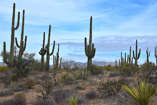
Saguaros tower over the Corral Trail

The relics are what remains of Brown’s Ranch.  Established in 1916, the 44,000 acre operation ran cattle in the mountainous desert space before being abandoned in mid-century.  The historic site, which is now part of the McDowell Sonoran Preserve, is the key attraction on the Corral Trail in the popular Scottsdale recreation hub.
Yuccas sway above Brown's Ranch Road

Desert plants grow among the ruins of Brown's Ranch

The ranch site can be reached by following Brown’s Ranch Road north to the Corral Trail.  The 2.3-mile path swings through gorgeous Sonoran Desert between the distinctive flat-top form of Brown’s Mountain (3,253 feet) and the jumbled granite mounds of Cholla Mountain (3,406 feet).  The first set of ranch ruins appear off to the left just a few yards from the road junction.  

A Phainopepla bird perched on a yucca eyes nearby mistletoe

A bird nest (usually cactus wren) built into a cholla cactus

Even with encroaching cacti, catclaw, frothy turpentine bushes and stray twigs poking through cracked stonework, the old west character is so animated here that you might expect to find cattle grazing among the ruins.  Any present-day rustlings, though, are those of browsing javelina, deer, rabbits, lizards and chattering Phainopeplas—black, red-eyed birds with head crests that resemble cardinals-- feeding on invasive mistletoe drooping from ironwood trees.

A disintegrating foundation at the Brown's Ranch site

Cholla Mountain (center) & Granite Mountain (right) seen from Brown's Ranch Road

A string of barbed wire fencing trailing off from the main site soon dissolves into thickets of jojoba bushes and spiny yucca that line the trail as it swings north and west through open desert with towering saguaros and distant views of the Cave Creek Mountains to the north and Sierra Ancha Mountains to the east.  Occasional glimpses of sagging fences are the only relics visible until near where the trail reconnects with Brown’s Ranch Road.

Blue Palo Verde trees grow along the route

Beware of the notoriously sticky "Jumping Cholla"

Navigating the trails of McDowell Sonoran Preserve is easy

The desert reclaims its territory

Cave Creek Mountains seen from Brown's Ranch Road

Here, a round cinder block structure that at one time held ranch resources now serves as a sort of giant planter for mesquite trees surrounded by untamed clusters of "jumping cholla" (Chain Fruit Cholla) that provide fodder for pack rats and nesting habitat for cactus wrens.  Tread lightly while exploring these fragile remains that are slowing being reclaimed by environmental forces and desert creatures. Leave what you find, watch where you step--there are no cow pies, but those pesky magnetic cholla stems (and snakes, maybe) can ruin your day--and enjoy the trip back in time.

LENGTH: 5.5 miles

RATING: easy

ELEVATION: 2,645 – 2,763 feet

GETTING THERE:

Browns Ranch Trailhead.

30301 N. Alma School Pkwy., Scottsdale.

From Loop 101 in Scottsdale, take the Pima/Princess exit 36, travel 6.5 miles north on Pima to Dynamite Road.  Turn right and continue 2.7 miles to Alma School, turn left and drive 1 mile to the trailhead. The preserve is open sunrise to sunset daily. There are restrooms at the trailhead.

INFO:

https://www.scottsdaleaz.gov/preserve

https://azmemory.azlibrary.gov/digital/collection/splimage/id/18/


Monday, October 19, 2015

BUCKSHOT-HAWKNEST CIRCUIT

BUCKSHOT-HAWKNEST CIRCUIT
McDowell Sonoran Preserve, North
Buckshot Trail

I have a new favorite trail in Scottsdale's McDowell Sonoran Preserve. Again. This happens every time I overcome my penchant for hiking well-known long paths with spectacular scenery and try something different. Although it's only 0.8-mile long, Buckshot Trail wins laurels because it straddles the gap between the familiar and the untried. It shoots off from the heavily travelled Brown's Ranch site to connect with the newer Hawknest Trail that arches over the preserve's north section for nearly its entire width. On the day I discovered this desert jewel, a huge group of hikers was assembled at the trailhead preparing to trek the 7.7-mile Cholla Mountain Loop--one of the area's most scenic circuits. They invited me to join them, but the drone of "been there done that" rattling in my cerebellum won over and I plowed north toward new-to-me territory instead. As with all hikes, trying to comprehend the unique character and secrets of an unexplored trail by viewing it as a line on a map is kind of like presuming to know the traits of a wine without having tasted it. Will it be a nobel Grand cru or some pedestrian vin du pays? The essence of the Buckshot Trail falls somewhere between Night Train and a hoity toity Bordeaux--amusing yet rich. Packed with massive saguaros, blooming shrubs and yucca-framed vistas, it's just far enough off the beaten paths to offer savory solitude. Only one other hiker (a preserve steward) and a handful of mountain bikers, crossed my path. Excellent maps available online and at the trailhead show numerous ways to cobble your own circuit using Buckshot Trail. Here's the route I took: From the trailhead, hike 1.9 miles north on Brown's Ranch Road to marker CL6 and turn right onto Corral Trail (note, this is 0.6 mile beyond the first Corral Trail access point). Go 0.5 mile on Corral, turn left on the Buckshot Trail and continue 0.8 mile to Hawknest Trail. Turn right (north) at the sign and hike 1.5 mile to Broken Spoke Trail, turn left and go 0.6 mile to High Desert Trail. Turn right (south) and go 0.7 mile to Corral Trail and follow the signs back to the trailhead.
On the return leg of the trip, solitude evaporated as I encountered some of the Cholla Mountain group and dozens of other hikers funneling onto arterial Brown's Ranch Road for the final mile-long trudge back to civilization and perhaps a nice Chianti.
LENGTH: 8.8 mile loop
RATING: easy
ELEVATION: 2,610' – 2,770'
HOURS: sunrise to sunset daily
GETTING THERE:
Brown's Ranch Trailhead
30301 N. Alma School Road, Scottsdale.
From Loop 101 in Scottsdale, take the Pima/Princess exit 36, go 6.5 miles north on Pima to Dynamite, turn right and continue 2.7 miles to Alma School Road. Turn left and continue 1 mile to the trailhead. There are restrooms, water and maps at the trailhead. No fee.
INFO: McDowell Sonoran Preserve
http://www.scottsdaleaz.gov/Assets/ScottsdaleAZ/Preserve/Preserve+North+Area+Trail+Map.pdf
MORE PHOTOS:

Saturday, January 25, 2014

BLACK HILL-GRANITE MOUNTAIN LOOP


BLACK HILL-GRANITE MOUNTAIN LOOP
McDowell Sonoran Preserve
Granite Mountain Loop

Sandwiched between palm-tree-caressed swaths of upscale homes, sprawling ranches and a wall of 7000-foot-high mountains rising over the Verde River Valley, Scottsdale's McDowell Sonoran Preserve is a refuge for marauding herds of javalina, deer and city dwelling hikers, bikers and equestrians looking to unwind. It's an open, airy place reminiscent of Montana's "big sky county" replete with far-reaching views and western character. The Black Hill Trail delves into the guts of this natural sanctuary, following a wide, decommissioned dirt road lined with jumbo saguaros and thickets of yucca.
Smothered in desert plant life, the area's myriad wildflowers and blooming shrubs erupt in brilliant waves beginning in January when blood-red chuparosa flowers and shock-yellow clusters of desert rock peas serve as opening acts for a riot of color that ends with the annual show-stopping blast of creamy white saguaro blossoms in May.
Black Hill Trail ends at Powerline Road where a battalion of electrical towers strung together over the desert reminds that civilization shares this space.  At this point, a network of connecting trails makes for endless hiking combinations. One to try is the 4.2-mile Granite Mountain Loop, which begins directly across the road. The trail's highest point is 2,780-foot "Scenic Overlook". Here, a patchwork of homes in the valley below mingles with pristine desert and the muted silhouettes of the Superstition Mountains on the southern horizon. Added goodies on the loop include a noble crested saguaro near the Branding Iron trail junction and an optional side trip to geological wonder, Balanced Rock.

Black Hill Trail

LENGTH: 8.8 miles (9.6 miles with Balanced Rock)
RATING: moderate
ELEVATION:  2540' - 2780'
HOURS: open daily sunrise to sunset
GETTING THERE: Fraesfield Trailhead.
From Loop 101 in Scottsdale, take the Princess/Pima exit 36 and go 6.5 miles north on Pima to Dynamite Blvd./Rio Verde Dr.  Turn right and go 5.6 miles to the trailhead on the left.  There's a restroom but no water at the trailhead.

Desert Rock Pea

INFO & MAP: McDowell Sonoran Preserve

MORE PHOTOS:

Sunday, December 1, 2013

WHISKEY BOTTLE TRAIL


WHISKEY BOTTLE TRAIL
McDowell Sonoran Preserve

With its boozy moniker and fresh-cut course, this trail, which departs from  Fraesfield Mountain trailhead, is an intoxicating trek.  Meandering through a seemingly endless expanse of yucca-studded “horse country” the well signed network of trails enables carefree hiking for experts and greenhorns alike. Whiskey Bottle begins with a brief climb along the east flank of Fraesfield Mountain.  Below, a yawning vegetation-rich wash where rain lingers in mud-fringed pools is a favorite “pub” for thirsty bands of local deer, javelinas and coyotes.  The trail’s high point provides a platform to wrangle your bearing by checking out views of surrounding mountains---Four Peaks to the east, white “golf ball” topped Humboldt Mountain to the north and to the distant southeast, the iconic spire of Weaver’s Needle in the Superstition Wilderness cuts a muted lavender silhouette.  The trail scoots along the preserve’s southern boundary passing an upscale golf course near the Dixileta Trail junction.  Although the route’s name suggests otherwise, the only relic of trailside imbibing is a rusted can of Modelo lodged in the roots of a mesquite tree.  However, members of the golf community might get a Manhattan at the club after 18 holes.

Jiding Javelina

LENGTH: 5.8 miles roundtrip
RATING: moderate
ELEVATION:  2540’ – 2764’

GETTING THERE: Fraesfield Mountain Trailhead,
From Loop 101 in Scottsdale take the Princess/Pima exit 36 and go 6.5 miles north on Pima to Dynamite Blvd./Rio Verde Dr.  Turn right and go 5.6 miles to the trailhead on the left. No facilities or water. Trailhead is open daily from sunrise to sunset.

INFO:

Saturday, November 30, 2013

BALANCED ROCK TRAIL


BALANCED ROCK TRAIL
McDowell Sonoran Preserve

Balanced Rock

Even in a terrain replete with natural sandblasted granite sculptures, Balanced Rock stands out.  Located in the heart of the newly opened Brown’s Ranch cluster of trails, this massive mushroom-shaped behemoth stands tall and precariously exposed atop a weathered slab of igneous stone. Flanked by a complement of lesser boulders and a wind-tortured juniper, the hows and whys of the monolith’s predicament are fodder for inquisitive minds.  The path to the rock is a short detour easily accessible via connecting trails. Although it is popular as a side trip off longer loop treks, the rock can be reached most directly by hiking 1.2 miles on Powerline Road to the Balance Rock Trail junction.  From here, it’s 0.9-mile to the rock and 1.6 miles to trail’s end. A map at the trailhead shows other hike combinations. 

Balanced Rock Trail

LENGTH: 5.6 miles roundtrip (or 4.2 to the rock and back)
RATING: easy
ELEVATION: 2570’ – 2646’
GETTING THERE: Granite Mountain Trailhead, 31402 N. 136th St. Scottsdale.
From Loop 101 in Scottsdale, take the Princess/Pima exit #36 and go 6.5 miles north on Pima to Dynamite Blvd./Rio Verde Dr.  Turn right and continue 5.9 miles to 136th St., turn left and go 1.8 miles to the trailhead on the left. Trailhead is open sunrise to sunset.  No facilities.
INFO & MAPS: McDowell Sonoran Preserve
MORE PHOTOS:

FRAESFIELD TRAILHEAD

Yes---it's open.

Located at the southern end of the new Brown's Ranch extension of Scottsdale's McDowell Sonoran Preserve, Fraesfield trailhead provides plenty of paved parking and access to dozens of  trails, but no other facilities. 2020 UPDATE: restroom, interpretive signs and shade ramadas now installed.

GETTING THERE: 
From Loop 101 in Scottsdale, take the Princess/Pima exit 36.  Go 6.5 miles north on Pima to Dynamite Blvd.(which will turn into Rio Verde Dr). Turn right (east and continue 5.6 miles to the trailhead on the left.
INFO & TRAIL MAPS:
http://www.scottsdaleaz.gov/preserve

Saturday, October 26, 2013

Rocks, ruins and excellent views.


CHOLLA MOUNTAIN LOOP
McDowell Sonoran Preserve
The Ampitheater

Strewn with relics of an early 20th-century ranching operation, the flat, sandy acreage of North Scottsdale's McDowell Sonoran Preserve is besieged by an arc of rough-edged peaks. The weathered rock mounds rise abruptly as skyscrapers in molded cones and awkward heaps of mixed stone scattered like wayward gendarmes on a spent battlefield.  Noteworthy among these peaks is Cholla Mountain.  A brand new trail with two scenic viewpoints circles the north-south-running ridge. At the south end is a little place called The   
Cathedral Rock
Amphitheater--a bend of beveled granite showcasing a feature presentation of Verde River Valley views.To the northeast, grottos within the impossible-to-miss stony bastion of Cathedral Rock frame saguaro-studded views of Sonoran Desert bluffs and basins.
Cathedral Rock

HIKE DIRECTIONS:
Maps at the trailhead detail numerous ways to hike around Cholla Mountain.  Here's what we did:
Hike north on Brown’s Ranch Road to the Corral Trail junction. Go right and hike to Dry Gulch Trail. Follow Dry Gulch to Cholla Mtn Loop Trail. Hike the loop and retrace your steps back to the parking lot. 
LENGTH: 7.7-mile loop
RATING: moderate
ELEVATION: 2710' - 2855'
FACILITIES: water, restrooms, bike racks, horse trailer parking, maps

GETTING THERE:
Brown's Ranch Trailhead, 30301 N. Alma School Pkwy. Scottsdale 85262
From Loop 101 in Scottsdale, take the Pima/Princess exit 36, travel 6.5 miles north on Pima to Dynamite Road.  Turn right and continue 2.7 miles to Alma School, turn left and drive 1 mile to the trailhead.
McDowell Sonoran Preserve MAP:
McDowell Sonoran Conservancy
MORE PHOTOS:

Sunday, October 13, 2013

Brown's Ranch Trailhead GRAND OPENING this Saturday, Oct. 19, 2013


BROWN'S MOUNTAIN SUMMIT
McDowell Sonoran Preserve
Brown's Mountain

Desert hiking; how we have missed thee.  The return of cool temperatures and close-to-home Valley hiking gets an added boost this year with the opening of Brown’s Ranch Trailhead.
Everything old is new again in this beautiful swath of North Scottsdale desert.  For years, local hikers have been familiar with the maze of social trails orbiting Powerline Road north of Dixileta. With no enforced rules or designated routes to protect the area's cultural artifacts and fragile terrain, this "wild west" free-for-all recreation site was on its way to becoming either an outdoor slum or swanky golf community.  Instead, the City of Scottsdale and the McDowell Sonoran Conservancy have restored the granite-and-saguaro landscape to a glorious nature preserve.  Cleaned up, packed with amenities and staffed during peak months by superstar volunteer trail stewards, roughly 60 of the planned 120 miles of recreational trails were opened to the public on June 10, 2013.  The choice of hiking trails here can be overwhelming, so a good way to get acquainted with this new section of the preserve is to scope it out from to its high point---Brown's Mountain.  Maps at the parking lot and plentiful trail signs make navigation a cinch---just head out from the trailhead and trek toward the big hill straight ahead. The real beauty of this trail system is its connectivity.  Endless combinations of loops or out-and-back routes can be created to suit hikers of all stripes.
Brown's Mountain Trail

LENGTH: 3 miles roundtrip (trailhead to Brown’s summit and back)
RATING: moderate
ELEVATION: 2,710' - 3,253'
HOURS: sunrise -sunset daily
FACILITIES: paved parking, restrooms, water, horse hitch, bike racks, maps

GETTING THERE:
Brown's Ranch Trailhead: 30301 N. Alma School Pkwy. Scottsdale 85262.
From Loop 101 in Scottsdale, take the Pima/Princess exit #36, go 6.5 miles north on Pima to Dynamite Road.  Turn right and continue 2.7 miles to Alma School Road, turn left and go 1 mile to the trailhead.
NOTE: trailhead parking will be CLOSED from 1 p.m. Friday 10-18-13 through Saturday 10-19-13 noon for the grand opening event.  Park at Pinnacle Peak Patio (10426 E. Jomax) and take the shuttle, which will run from 7:30 a.m. to noon on Saturday.
Brown's Mountain Summit trail

McDowell Sonoran Conservancy
MORE PHOTOS:

Thursday, June 13, 2013

Scottsdale's Brown's Ranch Trailhead now open!


BROWN'S RANCH TRAILHEAD NOW OPEN!
McDowell Sonoran Preserve

The long awaited Brown's Ranch Trailhead in north Scottsdale was opened for public use on Monday June 10, 2013. Fifty-five miles of new and rebuilt non-motorized trails are now signed and ready to explore----and many more are planned as work continues to expand the system to the north and west. I'll be heading out there this weekend, so stay tuned for photos and a trip report.
Grand opening ceremonies are planned for Saturday October 19, 2013.
HOURS: gates are open roughly sunrise to sunset daily---a specific time schedule is available online.
FACILITIES: 200-car parking lot, restrooms, water, shade ramadas, equestrian staging area.

GETTING THERE:
30301 North Alma School Parkway, Scottsdale.
From Loop 101 in Scottsdale, take the Pima/Princess exit 36 and head north on Pima to Dynamite Road. Turn right (east) and go 2.9 miles to Alma School Pkwy, turn left (north) and drive less than a mile to the trailhead.

MAP:
INFO:

Friday, April 5, 2013

52 miles of new, local trails set to open in June


BROWN'S RANCH TRAILHEAD UPDATE
McDowell Sonoran Preserve, Scottsdale
UPDATE: June 10, 2013---trailhead is now open to the public. 
Work continues on the much-anticipated JUNE 2013 opening of North Scottsdale's Brown's Ranch trailhead. The McDowell Sonoran Conservancy is still in need of dedicated volunteers to staff and patrol what will undoubtedly be a VERY popular destination. Check out the website below learn how to get involved. The next volunteer orientation is APRIL 13, 2013.
Linda Raish, the Conservancy's Community Development Director has provided the following

The City of Scottsdale expects the following to be ready by June, 2013:
  • Trailhead complete and operational
  • 52 miles of trails operational from the trailhead including trails around Cone Mountain, Brown's Mountain, Little Granite Mountain and Fraesfield.
  • Trail signs installed along these 52 miles of trail
  • Trail map
  • Granite Mountain Trailhead complete and operational (136th Street and power line corridor .The city has created sustainable trails that accommodate multiple users. Sustainable trails are trails that have been built on proper grades, that use side-hill contour trails and that do not run down a fall line (thus decreasing possible erosion).  This will mean that users will not experience the ruts that have long been the norm in the area. 

The majority of the 52 miles of trail are 32" to 48" wide (except for trails built along previous jeep roads, which may be a bit wider). Depending on use, most trails will naturalize to become between 12" to 18" (forming a single track). There are 140 miles of total trails on the trails plan for the north area, which means that an additional 90 miles of trail will be developed beginning in October 2013. 

The Conservancy will begin to patrol the area in September, with the expectation that our patrol program will be fully functional in October, 2013. Also, Pathfinders will begin trailhead shifts in October, to talk to visitors about which trails will be best for their fitness level.  The Grand Opening of the trailhead is tentatively scheduled for Saturday, October 19, 2013.
Just a reminder that people should not try to access the trailhead or trails until June as they will be ticketed!!
INFO: