Find A Trail. Start Your Search Here:

Showing posts with label Fisher Point. Show all posts

Monday, April 30, 2018

FLAGSTAFF'S FAY CANYON

FLAGSTAFF'S FAY CANYON
Fay Canyon
Not to be confused with the Fay Canyon Trail in Sedona, Flagstaff’s version is a totally different experience. The meandering trail that follows the course of a gully that feeds into majestic Walnut Canyon southeast of town is a mellow, woodsy walk.  Located just east of the heavily-traveled Sandy’s Canyon trail off Lake Mary Road, the Fay Canyon route is a quieter trek with similar qualities.  
Creeping Barberry
The unsigned route is a little tricky to follow. Hike up Forest Road 9477B to the 0.3-mile point, veer left at a gate and pick up a single track heading north.  For reference, there’s a sign warning of heavy horse traffic a few yards down the trail. 
A ravine bisects Fay Canyon
Within a short distance, the trail makes a sharp turn to the right and begins a downhill plunge on long switchbacks.  This piney segment decends on an easy grade to emerge in at the head of the canyon.  Over the next two miles, the gorge gradually transforms from a steep-walled sliver to a gaping valley. Bisected by a water-scoured ravine, the canyon has horse trails on both banks. These can be confusing, but they eventually merge. Just keep heading north and you’ll be fine. 
Arizona valerian
Along its expanding course, the trail passes by pockmarked limestone cliffs, rock shelves and shallow caves.
Fay Canyon
A closer look at the limestone reveals crystal-filled geodes, entrenched fossils and glinting quartz nodules. 
Tiny crystals in limestone
In moister areas beneath the mixed conifer canopy, an understory of thorny-stemmed wild roses, gooseberries and willows grow in profusion among clumpy grasses and patches of creeping barberry, Arizona valerian and daisies galore.
At the 2.6-mile point, the trail ends in an airy meadow where the Arizona Trail passes through. 
Lizards are easy to spot in Fay Canyon
This is the turnaround point for an out-an-back hike, however, trail signs show distances for continuing to the Flagstaff Urban Trails System, Marshall Lake or Fisher Point.  One fun option is to make the short, but steep walk up to Fisher Point. Known for wild winds that churn up speed as they funnel through a network of forested gorges, the area surrounding Fisher Point is a fascinating enclave of contorted rock formations softened by wildflower fields and swaying pines. 
Dunes beneath Fisher Point
To get to the lookout point 400 feet above the major trail junction, follow the signs 1.2-miles and enjoy the breezy vistas. 
Wild rose
View from Fisher Point
LENGTH: 2.6 miles one-way for Fay Canyon, or 8.2 miles round trip with Fisher Point option.
RATING: moderate
ELEVATION: Fay Canyon : 6,620'-6,950' or 7,033' to Fisher Point
GETTING THERE:
From Flagstaff, go 4 miles south on Lake Mary Road to S. Wildlife Road (at the “Hitching Post Stables” sign).  Turn left and drive a few yards to a “T” intersection, veer left and continue less than 0.1 mile to the sign that reads Walnut-Skunk-Fay Closure Area, No Motor Vehicles.  Parking is very limited.  Please respect private property in the area by not blocking roads or driveways.

Monday, April 15, 2013

Fisher Fire update

UPDATE: 4-17-2013
Although the Fisher Fire has been declared "100% contained" as of yesterday afternoon, there's still no word as to when the Sandy's Canyon and AZT segment near Fisher Point will be re-opened.  Here's a link to the fire map:
http://azdailysun.com/map-of-fisher-fire/pdf_547c7218-a62e-11e2-bdbe-0019bb2963f4.html

Hikers, because Sandy's Canyon trail is one of my favorites,I've been following this fire very closely and will post forest service press releases as they send them to me.  Looks like fire fighters are making progress.....

Sandy's Canyon: fire was approximately here...

From: "Magee, Brienne U -FS" <bmagee@FS.FED.US>
Date: April 15, 2013 9:15:54 AM PDT
To: <USDA-FS-NEWS@NEWSBOX.USDA.GOV>
Subject: SOUTHWESTERN-NEWS-RELEASE: Coconino National Forest
April 15, 2013

           
Fisher Fire update, 8:30 a.m.

Flagstaff, Ariz. – The Fisher Fire crept and smoldered last night, but did not grow in size. Firefighters have a line around the fire and will continue to strengthen them today. Fire managers want to be sure lines hold through the high winds, however, before they declare an increase in containment.


Size: Approximately 40 acres
Containment: 50%
Location: near Fisher Point approximately four miles south of Flagstaff and two miles northeast of Lake Mary Road and the Canyon Vista Campground.
Date Reported: Saturday, April 13 at approximately 4pm
Cause: Human caused, under investigation
Resources: Approximately 100 personnel including four hotshot crews (Flagstaff Hotshots, Prescott Hotshots, Pleasant Valley Hotshots, and Blue Ridge Hotshots), engines, water tenders, a dozer and several overhead
Closures: The Sandy’s Canyon Trail and Arizona Trail at Fisher Point have been temporarily closed.

Smoke may be visible from the Flagstaff area and will drift to the east; expect smoke to be noticeable in Walnut Canyon, I-40, and the Continental Country Club area.

###

Sunday, April 14, 2013

Fire closes Sandy's Canyon & AZT near Fisher Point

FISHER FIRE UPDATE
Hi Hikers, well, we have our first trail-impacting forest fire of the season.  The human-caused Fisher Fire was reported yesterday.  Here's the forest service press release


Fisher Point

April 14, 2013          
Fisher Fire update, 10:30 a.m.
Flagstaff, Ariz.The Fisher Fire, south of Flagstaff, burned actively throughout the night. This morning it is approximately 40 acres. Winds are expected to continue today, increasing this afternoon.

Fisher Fire Facts
Date Reported:
Saturday, April 13 at approximately 4pm

Size: Approximately 40 acres

Location: near Fisher Point approximately four miles south of Flagstaff and two miles northeast of Lake Mary Road and the Canyon Vista Campground.

Cause: Human caused, under investigation

Resources: Approximately 80 personnel including three hotshot crews, three engines, two water tenders, a dozer and several overhead

Closures: The Sandy’s Canyon Trail and Arizona Trail at Fisher Point have been temporarily closed.

Smoke will be visible from the Flagstaff area and will drift to the east; expect smoke to be noticeable in Walnut Canyon, I-40, and the Continental Country Club area.
 

###

Sunday, September 11, 2011

ARIZONA'S OTHER FAY CANYON

FAY CANYON
Flagstaff
When creeping barberry leaves take on a red blush, the last days of summer in Arizona’s high country are upon us. And so it was with this harbinger of frost underfoot that we set out to enjoy the last few bittersweet weeks of northern Arizona hiking. To do so, we selected yet another “who knew” trail in Flagstaff.  With numerous limestone caves, ancient sand dune rock formations and acres of alpine meadows, Arizona's 
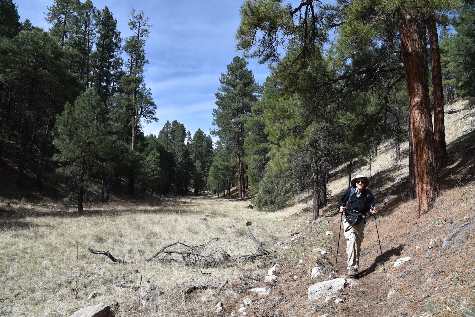
other Fay Canyon is a joy to explore.  Unlike the famous (and crowded) red rock, Fay Canyon located in Sedona’s high desert, this trail sees much less activity.  That's likely because there are few resources describing this hidden gem of a hike.  Conveniently located in the Mormon Lake area, this route through a shallow valley connects with the Walnut Canyon Passage of the Arizona Trail, Flagstaff Urban Trails System and Sandy's Canyon.  The trail is almost completely shaded as it travels the margins of a lush gorge flanked with bizarre geological structures and deep canyon drop offs.  To add length, we included a side trip to Fisher Point. Here’s how:
HIKE DIRECTIONS: from the trailhead, hike 0.3 mile along the double-track dirt road paralleling Lake Mary Road.  At the gate/fence located where the road makes a sharp right hand turn, pass the gate and continue straight (north) along a footpath.  From here, the trail is well maintained and easy-to-follow.  At two points along the route, the trail splits—in both cases, stay to the left and take the higher paths. (I’m pretty sure the splits merge eventually, but it’s just smart to stay on the main trail).  At the 2.6-mile point, Fay Canyon Trail ends at a “Y” intersection with the Arizona Trail. Here, head right (east) along a well-signed path to continue on to Fisher Point and the dunes.

Whether hiked alone or as a leg on longer treks, this quiet canyon trail offers a perfect way to enjoy one last summer mountain trek.
Creeping Barberry turns red when temperatures drop

LENGTH: 8.2 miles roundtrip as described here. Fay Canyon alone: 2.6 miles one way
RATING:  moderate
ELEVATION: 6,220' – 7,033' (this description), Fay Canyon only: 6,620'-6,950'
DISTANCE FROM PHOENIX:  148 miles one way
GETTING THERE:
From Phoenix, go north on I-17 to exit 339, Lake Mary Road (Forest Road 3) located just south of the I-40/I-17 interchange in Flagstaff.  From the bottom of the off ramp (across from a Circle K), turn right and go 4 miles south on Lake Mary Road to S. Wildlife Road (at the “Hitching Post Stables” sign).  Turn left here and drive a few yards to a “T” intersection, veer left and continue less than 0.1 mile to the sign that reads: “ Walnut-Skunk-Fay Closure Area, No Motor Vehicles”. Parking is very limited.  Please respect private property in the area by not blocking roads or driveways.
INFO:
PRINT MAP : Emmitt Barks Cartography “Flagstaff Trails Map”
Flagstaff Ranger District, Coconino National Forest, 928-526-0866

MORE PHOTOS: