Find A Trail. Start Your Search Here:

Showing posts with label Payson Area Trails System. Show all posts

Saturday, September 12, 2026

Stewart Ridge

 STEWART RIDGE

View of Mazatzal Mountains from Stewart Ridge

The Stewart Ridge Trail has been around for ages, existing as a gray zone social trail.

Summit on Stewart Ridge

For years the popular route was neither sanctioned nor actively blockaded by the forest service.
North Peak--center horizon

Mogollon Rim vista

But as part of a major trail enhancement push in the Payson-Pine-Strawberry area, Stewart Ridge has finally gained legal status.
Yuccas on Stewart Ridge

The trail is located in Tonto National Forest and had been adopted into the Payson Area Trails System (PATS).
Hike starts on the Over the Top Trail

While it’s just under a mile in length, Stewart Ridge delivers generous doses of both physical exertion and scenic beauty.
 
A herd of elk on Stewart Ridge

From the Mud Springs Trailhead not far from downtown Payson, the hike begins with a short walk over slick rock and tree-lined edges on the newly adopted Over The Top Trail.
Trail on Stewart Ridge

At the 0.3-mile point, a sign post marks the turn off for Stewart Ridge.
Edgy section on the ridge

Right from the start, the trail heads uphill over a rocky single track.
Stewart Ridge junction

There are a few segments of level path, but it’s mostly a steady, not-too-difficult climb.
summit

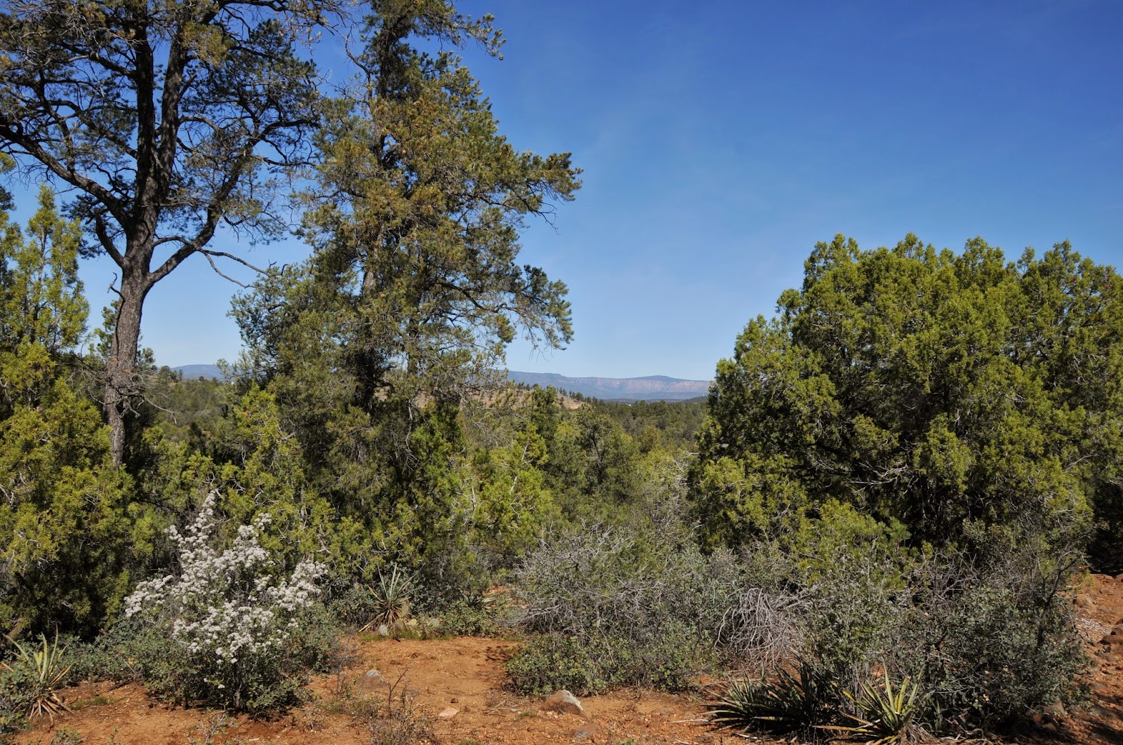
Once out of the lower elevation tree cover, the ridge is open to the sky with views of the Mogollon Rim on one side and the Mazatzal Mountains on the other.
 

Near the high point of the trail

Rife with cactus, yucca, agaves and sporadic junipers and firs, the trail moves among boulders and waist-high grasses before taking on the final push to a small summit at trail’s end. 
Summit mound ahead


The rock cluttered mound reveals breathtaking 360-degree vistas of national forest, wilderness, distant mountain peaks and pine-shaded residential neighborhoods.
Overlooking Payson


To extend the hike, just descend and pick up the mile-long Over The Top trail which tethers to the recently unveiled maze of loops and connectors in the Boulders Area Trail System. 

Mud Springs trailhead


LENGTH: 2 miles round trip (out-and-back hike)

RATING: moderate

ELEVATION: 4,758 - 5,433 feet (1,284 feet of accumulated elevation change)

GETTING THERE:

MUD SPRINGS TRAILHEAD:

From State Route 87 (aka Main Street)  in Payson, go 1 mile east on E. Phoenix Street and turn right on Gibson Court.  Continue a short distance to the trailhead on the left.  There’s limited street side parking in the residential area.  Mind the private property. 

Tuesday, September 1, 2026

Billy Goat Trail

BILLY GOAT TRAIL

View of the Mogollon Rim and Monument Peak

The Town of Payson has long been an exceptional hiking destination.

Billy Goat Trail

Its location at the base of the Mogollon Rim where the Tonto and Coconino National Forests merge and offer a variety of hiking environments from high-desert to tall pines which makes it perfect for year-round outdoor recreation.
 
New signs in the Boulders Area Trail System

Payson is also an Arizona National Scenic Trail Gateway Community, solidifying its status as a hike epicenter. While the old standards around town—the Highline National Recreation Trail, Houston Loop, Horton Creek, and the Payson Area Trails System (PATS) are perennial Rim Country favorites, new trail development and maintenance had stagnated over the past few years.
Antelope Sage blooms July - October

That’s all changing now as the Payson-Pine-Strawberry corridor is about to explode with exciting new non-motorized routes.
 
Boulder passages throughout the hike

The big push includes 15 miles of new and improved trails in the Granite Dells area, a 15-mile Pine-to-Payson connector, a 20-mile expansion on Houston Mesa as well as other plans still in the works. Additionally, the Town of Payson and Tonto National Forest, Payson Ranger District will address issues of limited neighborhood access and parking quagmires with two new trailheads off Granite Dells Road. 
Cypress trees and manzanita line the trail

A few trails in this ambitious multi-year project have already rolled out starting with the adoption of two former social trails in the Granite Dells (aka, the Boulders) area south of downtown Payson. 
Granite Dells from Billy Goat Trail

Boulders Area Trail System (BATS) is taking shape with the official legalization of  the old “200” and “300” social trails and 6 miles of new non-motorized trails underway. 

Monsoon over the Rim

Now dubbed “Billy Goat” and “Bootleg” respectively, the user-created tracks in Tonto National Forest have been buffed up, trimmed and outfitted with signs at all junctions and folded into the Payson Area Trail System (PATS).
A footbridge spans a drainage on Billy Goat

Picking this low hanging fruit was a no-brainer because, well, trying to eradicate social trails is rather like bringing a butter knife to a gunfight and also, the trails are amazing. 

Foxtail dalea bloom June - October 

Hiking or riding the re-worked Billy Goat Trail is a great way to get a sense of what’s to come. 

A tight squeeze on the Billy Goat Trail

Beginning with a short walk on the legacy Cypress Trail, Billy Goat spirals off heading uphill over vast slabs of granite. 
Mogollon Rim and Monument Peak

Forests of cypress, oaks, firs and pines soar over tangles of manzanita yucca and agaves as the trail works it way to high-point vistas with never-ending view of the Mogollon Rim, Monument Peak and the surrounding dells.
Epic vistas all around


At the Bootleg junction, the trail begins its downhill sweep, jogging among gigantic boulders and slick rock passages. It’s truly a gem that’s earned its legal status. 
Trailhead kiosk

“Adventure Where We Live” is Payson’s slogan, and while that’s always been an apt descriptor, the town’s next chapter is a super-charged venture that ties into legacy routes, builds connectivity for long distance treks and adds inviting new paths for outdoor enthusiasts of all ilks and abilities. 

trailhead

LENGTH: 3.1-miles 

RATING: moderate

ELEVATION: 4,722-5,001 feet

GETTING THERE:

CYPRESS TRAILHEAD:

From State Route 87 in Payson, go 2 miles east (right at the intersection) on East Phoenix Street to where the road ends at a turnaround.  Park on the curbs and observe all no parking areas. Hike begins at Phoenix Street Trail Access sign. 

KEEP UP WITH THE PROGRESS:

https://adventurepayson.com/

Monday, October 23, 2017

AMERICAN GULCH

Three Ways to Explore Payson's American Gulch
End of American Gulch South Trail
American Gulch is a tributary gorge of the East Verde River that encompasses an area of juniper-studded hills and riparian corridors on the west side of Payson. Replete with natural springs, stock tanks and a maze of dirt roads, the rugged terrain offers a variety of outdoor recreation opportunities.
Juniper-shaded South Trail
Three disjointed but thematically cohesive trails---all named American Gulch--- explore this strip of high desert and chaparral. The American Gulch North, South and Loop Trails anchor the western edge of the 20-plus-mile Payson Area Trails System (PATS) network of interconnected city and forest service paths.  Together, the name-sharing threesome are like a flyover of the area's natural history and the town's efforts to restore and protect its sensitive fringe habitats. 
North Trail follows Forest Road 508
All three can be easily hiked in an afternoon and a good way to tackle the circuit is to start on the most remote and work your way in. The South trail is characterized by a series of moderate dips and climbs on a shared-use dirt road. It begins on the outskirts of town near a willow-clogged intermittent stream and follows a deeply-rutted ATV track to a high point overlooking the manicured greens of the Payson County Club and hazy peaks of the Mazatzal Wilderness.  
Bobcat print near a stock tank
The varied terrain and an array of water sources make this a productive place for wildlife viewing and birding.  At this writing, the  South trail dead-ends at a barbed wire gate 1.1 miles from the trailhead but future PATS plans include connecting the South and North trails, so for now, you’ll need to backtrack and drive to the later. The North trail is a pleasant, easy trek at the edge of suburbia. Following Forest Road 508, the half-mile walk through open-air pinion-juniper woodlands ends at a gravel pit popular with dirt bikers and 4-wheelers. Although it's not part of the PATS, adjacent Forest Road 67 makes for a way to add some miles with a few quad-burning climbs, curious limestone formations and awesome vista points with views of the Mogollon Rim. The road meanders through the Tonto National Forest for miles, but a good turnaround spot is a ledgy lookout roughly 1.5 miles from the Graff trailhead.
American Gulch Loop Trail
South trailhead
The final destination is an urban-centric stroll on a paved-and-gravel walking path just off Main Street. The half-mile Loop trail and open space park is the result of Town of Payson and Gila County rehabilitation efforts made possible through a grant from Arizona Game & Fish Department. Recent plantings of fruit trees and flowers plus the addition of benches and wildlife-viewing areas contribute to the goal of making this formerly blighted area between the Sawmill Crossing shopping center and Westerly Road a point of pride and social hub of the downtown district.
Hazy view of the Mogollon Rim from Forest Road 67
Yuccas along the South Trail
LENGTH: 3.7 miles total
RATING: easy-moderate
ELEVATION:
North: 5000' - 5160'
South: 4760' - 4960'
Loop: 4800'
Juniper berries
GETTING THERE:
American Gulch South:
From State Route 87 (Beeline Hwy) in Payson, go 2.6 miles west on Main Street, which will turn into Country Club Drive and then Doll Baby Ranch Road. The signed trailhead is on the right with parking across the road. The last half-mile is on sedan-friendly dirt. Avoid this road after rain because there's a creek crossing that floods making the it impassable.
Graff Trailhead (North):
From State Route 87 (Beeline Hwy) in Payson, go 1.7 miles west on Main Street, which will turn into Country Club Drive and turn right on Vista Road. Continue 1.3 miles north to Bulla Drive, veer left and go 0.2 mile to Whitehouse Drive.  Follow Whitehouse 0.25 mile to Graff Drive, turn left and drive 0.3 mile to the trailhead.  
Loop Trailhead:
From State Route 87, go 0.3 mile east on Main Street, turn left on Westerly Road and continue a few yards to the trailhead on the right.

Monday, April 10, 2017

BOULDERS LOOP

BOULDERS LOOP
Payson
Stewart Creek trickles along Boulders Loop
Sometimes, a trail’s name and its reputation dovetail like a fine hewn joint. The Boulders Loop Trail in Payson is such an excellent example of this that it has earned a local moniker: “Boulderpalooza”.  And that’s not the only home-grown terminology inspired by this twisted little trail that whirls through creek-scoured back country a few miles southeast of town.
Resident trail maven, photographer and hike-stick-maker Randy Cockrell, who leads treks for the Payson Packers hike group, shared some insight into the informal names locals have bestowed upon landmarks along the route.
Hikers navigate "Boulderpalooza".
But first, let us discuss why this entertaining Payson Area Trails System (P.A.T.S.) route might also be dubbed, “Boulder Confusion”. Finding the trailhead is the first of several challenges. To get to the loop from the Monument Peak trailhead, hike 0.5 mile down FR 435 to where the gorge of Stewart Creek appears on the right. An unmarked trail on the right had been the access point, but was washed out during the heavy rains of 2016-17. Instead, continue another 0.25 mile and locate the wide, sandy ATV access point. Hike down into the gorge, veer right and look for the tiny P.A.T.S. trail sign up on the opposite bank. Scramble up the embankment to reach the loop.
The loop's north leg has great views.
Go right to hike the north loop first. This way, you’ll get all the tough climbing out of the way. This easy-to-follow section makes its ascent through a shady cypress-oak woodland. Use your huffing and puffing as good excuses to stop and view the “shark fin” rock formation and a stunning landscape emerging behind you. The trail then dives back down to meet Stewart Creek again for the first of several effortless crossings. At the one-mile point on the loop, the trail intersects “sign vortex”. This apt alias describes a clearing cluttered with both forest service and PATS signs of wood, Carsonite composite and plastic tree emblems. Ignore the magical forces attempting to get you lost. Go left. Now on the south leg of the loop, the terrain changes from forest to an exposed pocket of granite heaps weather-sculpted into fanciful forms that resemble a certain cartoon mouse, dragons and bowling balls. There’s also the “world-famous Butt Crack Rock”. (Okay---that last name was on me.) The rocky corridor can be difficult to navigate. This past winter was not kind to the usually impeccable signage, plus, tight curves, slippery descents and tangent social trails might cause some head-scratching.
Randy Cockrell of Payson ponders the mystery circles.
Hang in there, though. Once through the maze, you’ll spot signs to get you back on the main course. 
Near the end of the loop, a massive slab of peachy granite bears mysterious circular impressions.
Certainly, there’s a scientific explanation for the curious pock marks. However, it’s more fun to toss around theories of space aliens, blunt-footed dinosaurs or freak forces of nature. Summon your creative energies because this is a phenomenon in need of a name.

LENGTH: 4 miles
RATING: difficult
ELEVATION: 4550’- 4750’
Butt Crack Rock
TRAILHEAD:
From the intersection of State Routes 87/260 in Payson, turn right and go less than a mile east on SR260 to Granite Dells Road (located just past the Safeway center). Turn right and go 3.3 miles on Granite Dells Road (which will turn into Forest Road 435 after 1.3 miles) and park at the Monument Peak trailhead on the left.
INFO & MAPS:

Wednesday, March 2, 2016

HOUSTON LOOP

HOUSTON LOOP
Payson Area Trails System
View of the Mogollon Rim from Houston Loop
For a short, moderate-rated trail, this one really packs a punch. It's wide, well-signed and within shouting distance of suburbia, but what's not advertised about Payson's Houston Loop is its unrelenting ups-and-downs that can catch the first-timer off guard. The quad burning workout pays off with
high point vistas of the Mogollon Rim hovering above the metal rooftops of woodland retreats. Where the trail dips into the canyons around Houston Creek, Ponderosa pine trees throw shade over moist drainages imprinted with elk tracks. Elk rarely venture more than a quarter mile from water sources, so keep an eye out for them where the trail hops over rivulets and puddles. The trail's bonus attraction is a Cold War Era curiosity known as a seismic bunker. The metal structure built into a hillside has been abandoned for years and is now under siege by local graffiti rebel forces. It's a dank, creepy place (mind the Bud Light cans underfoot) that you'll want to observe from the outside only. Beyond the den of debauchery, the trail redeems itself as it ascends an exposed ridgeline and heads into the woods. The route follows deeply rutted, dodgy 4x4 roads that are popular with bikers and ATV riders. In my experiences on this trail, the wheeled users have been responsible and courteous around hikers. With its carousel of changing scenery, history side show, challenging dips and climbs and close-to-town access, this trail makes for an entertaining Rim Country trek.
LENGTH: 4.5-mile loop from the Chaparral Ranch trailhead OR 9.6 miles roundtrip from Houston Mesa trailhead
RATING: moderate
ELEVATION:
4,800’ – 4,950’ (Chaparral) OR 4,800’ – 5,200’ (Houston Mesa)
GETTING THERE:
Chaparral Ranch Trailhead: From the intersection of State Routes 87/260 in Payson, go right (east) onto 260 and continue 2.4 miles to Chaparral Pines Drive. Turn left (north) and go 1.2 miles to the Chaparral Ranch Trail access turnout. There's parking for about 3-4 vehicles. Do not block private driveways in the area. Large groups should access this trail via the Houston Mesa Trailhead. Houston Mesa Trailhead: From the intersection of State Routes 87/260 in Payson, go 1.7 miles north on 87 to Houston Mesa Road. Turn right (east) and continue 0.8 mile to the trailhead on the right (past the “horse camp”). From here, follow Houston Trail 3 miles to the loop.
Cold War Era bunker
INFO & MAPS:
http://media.wix.com/ugd/5b27be_ac107b0dfb5e48689a45387e775aa37f.pdf

Monday, December 14, 2015

SNOW HIKING IN PAYSON

MONUMENT PEAK LOOP SNOW HIKE
Payson Area Trails System
Snow hiking Monument Peak Loop: Dec. 13, 2015

Snow days in Payson are rarer than those in Flagstaff or the White Mountains, but when they do occur, getting to good snow hiking trails is a lot easier than at the higher elevations where deeper accumulations and unplowed forest roads can thwart access and frustrate even the most experienced trekkers. The Payson Area Trails System (PATS) network of routes winds around a through town with easy-to-find trailheads along residential streets so there's usually no need to chain up or kick in the four wheel drive to enjoy a wintery walk.
A good bet for a snow hike is the Monument Peak Loop. Because it runs through a mix of shady pine forests, manzanita scrub and sunny meadows with intermittent streams, you'll get a smorgasbord of deep drifts, gentle dustings, frost-kissed cypress trees and ice capped pools. The trail is well-signed and heavily traveled by locals so chances are the path will have already been packed down by time you arrive. However, it's smart to head out with equipment to keep yourself safe. Hiking poles, layers of technical fabric clothing (ditch the cotton jeans) and boots with good traction are essential. Some hikers insist that a pair of slip on crampons make all the difference. Additionally, keep in mind that snow and ice is most treacherous when it starts to melt. An early start means you'll face colder temperatures, but you'll also have a better chance of avoiding slips and muddy boots. The photos here are from a hike on December 13, 2015 following a storm on the previous day. It was 27 degrees when we started around 9 a.m. and 34 degrees at 10:30 a.m.
LENGTH: 3.3-mile loop
RATING: easy
ELEVATION: 4,630' - 4,795'
GETTING THERE:
From the intersection of State Route 87/260 in Payson, go less than a mile east on SR260 to Granite Dells Road (located just past the Safeway center). Turn right and go 3.3 miles on Granite Dells Road (which will turn into Forest Road 435 after 1.3 miles) to the Monument Peak trailhead on the left.
INFO & MAPS: Payson Area Trails System
MORE PHOTOS:

Monday, March 16, 2015

ROUND VALLEY TRAIL

ROUND VALLEY TRAIL
Payson Area Trails System
View of the Mogollon Rim

The Payson Area Trails System (PATS) is a collection of routes weaving through the business districts and suburbs of this north-central Arizona town. The trails tie in nicely with nearby Tonto National Forest routes and most are open to hikers, equestrians, bikers and ATV users alike. Round Valley Trail begins in a quiet residential neighborhood with a climb along foot paths and 4x4 roads that leads to scenic high points with far-ranging views of the flat-topped profile of the Mogollon Rim and majestic peaks of the Mazatzal Mountains. Because many unsigned roads bisect the route, be sure to look for PATS signs to stay on track. Even though it's close-to-civilization, the trek offers a genuine outdoor escape as it runs through undulating juniper-pine forests south of town. In springtime, wildflowers like the ground hugging, purple blossoms of the Featherplume dalia and wild carrot pop up from the loose, rocky soils. One of the trail's most prolific spring bloomers is a shrub called Gregg's Ceanothus which sprouts tiny white or pink flowers that release a lilac fragrance from March through May. After topping out at 5200', the trail dips down into Round Valley and curves toward Highway 87 where the sweet wildflower breezes mingle with the aroma of burgers and fries as the path approaches its west trailhead at the Sonic restaurant lot on the Tonto Apache Reservation.
LENGTH: 4.5 miles one-way
RATING: easy-moderate
ELEVATION: 4800' - 5200'
GETTING THERE:
EAST TRAILHEAD:
From Phoenix, travel north on State Route 87 (Beeline Highway) to Payson. Just past the Mazatzal Casino, turn right on Phoenix Street (easy to miss, near the Circle K), drive 1.6 miles to Gibson Court, turn right and continue 0.1 mile to the inconspicuous trailhead on the left. There's parking along the road and in a cul de sac a few yards up the street. Do not block private drives in the area.
WEST TRAILHEAD:
Located at the south end of the Sonic restaurant at SR87 and Green Valley Pkwy. near the Mazatzal Casino.
INFO: Payson Area Trails System
MORE PHOTOS:

Sunday, March 3, 2013

CYPRESS-BOULDERS LOOP TRAIL


CYPRESS-BOULDERS LOOP
Payson
Water on the Cypress Trail: March 2, 2013

Snow on North Boulders Loop: March 2, 2013
The seasons of spring and fall share a common, landscape transforming magic.  While autumn is famous for painting the Arizona high country in warm fiery hues, spring brings on a rush of “pop up” snow melt rivers to our deserts.  March and April are the best months to view the transient water works in the Payson area.  There’s still enough snow on the peaks and hiding out in shady canyons to keep ravines and gullies flowing, but it won’t last long. Located close to town in a surprisingly untamed terrain of weathered granite dells and abrupt mini-canyons, the Cypress-Boulders Loop, is an ideal place to experience snowmelt runoff.  The trail is shared-use and open to hikers, equestrians, bikes and ATVs, and thus sees lots of action especially during this prime time.  When we hiked here this week, water was everywhere and we found ourselves hopping rivulets and ogling at water chutes cascading over bare rock every few minutes.  Forests of pines, junipers and of course cypress trees mixed in with open, boulder-studded fields form a patchwork of shade and sun along the route.  Although this hike would be pretty anytime of year, cool temperatures and rare water make it exceptional in spring.
HIKE DIRECTIONS:
From the trailhead, follow Cypress Trail 2.5 miles to the junction for Boulders Trail.  Take either the north or south leg and hike the 2.7-mile loop back to this junction, then retrace your steps back to the trailhead.

LENGTH:  7.3 miles round trip
RATING:  moderate
ELEVATION:  4485’- 4932’
GETTING THERE:
From Phoenix, travel north on SR87 (Beeline Hwy) to Payson.  At the intersection of SR87 and SR260, go right and follow 260 less than a mile to Granite Dells Road on the right just past the Safeway.  Go 1.9 miles on Granite Dells to a small easy-to-miss sign for Cypress Trail.  There’s no official parking area, just find a spot along the road being mindful of the private driveways in the area.
ALTERNATE ACCESS TO THE LOOP:
Go 3.3 miles on Granite Dells Road (which will turn into FR435 after 1.3 miles) and park at the Monument Peak trailhead on the left just before a roadblock.  From here, hike down to the roadblock on FR435 and hike 0.5 mile (crossing 3 concrete bridges) to the Boulder Loop trailhead—look for a sign on the cliff wall on the left.  The trail begins on the dirt road heading downhill to the right. NOTE: From the first P.A.T.S. sign above the gorge, the trail continues directly across the gorge.  (NOTE: when we hiked this trail in April 2017, this access trail had been washed away. To reach eh trail, continue another 0.25 mile down FR435 and follow the ATV track to cross the gorge) You can see the signs high on the opposite embankment. 
INFO:
Payson Area Trails System (PATS)
http://www.paysonrimcountry.com/payson-area-trails-system-fd7b3