Find A Trail. Start Your Search Here:

Wednesday, December 30, 2015

GRAND OPENING of SKYLINE REGIONAL PARK

GRAND OPENING of SKYLINE REGIONAL PARK
Buckeye
This Red-tail hawk was released into the park in June
Hikers, the big day has arrived. Grand Opening ceremonies for Skyline Regional Park in Buckeye will be held on Saturday, January 9, 2016. This West Valley park adds miles of new trails in the area south of the White Tank Mountains. The festivities will include wildlife exhibits, tours, hikes and giveaways. So, come on out and give this amazing project a proper debut.

WHEN: Saturday, January 9, 2016
TIME: 10 a.m. to 2 p.m.
WHERE: 2600 N. Watson Road, Buckeye. From Interstate 10, take the Watson Road exit and go 2 miles north to the park.
INFO:

Tuesday, December 29, 2015

BLACK MESA LOOP

BLACK MESA LOOP
Superstition Wilderness Area
View of Weaver's Needle from Black Mesa Trail
It may be just a stone’s throw from town, but hiking out from the First Water Trailhead at the western edge of the Superstition Wilderness is a surprisingly alien experience. Because the first mile or so of hiking in this area is considered to be easy, the site is a big draw for parents herding a mixed lot of dogs and kids outfitted with Sponge Bob backpacks and spiffy shoes that light up in sync with their stride. A very popular circuit here is the Black Mesa Loop that uses the Dutchmans, Black Mesa and Second Water trails for a continually-changing tour of  this wild pocket in Tonto National Forest.
Easy at first, the route transitions into a twisted collection of dips, climbs and tricky crossings of boulder-clogged washes and creeks. After the first 2 miles, the crowds become noticeably thinner. A sturdy pair of boots and hiking poles for balance will help get you through the rough parts to reap the rewarding views of a volcanic landscape scoured by millions of years of exposure to the earth’s turbulent elements. You'll be swallowed up in a wonderland of oddly-shaped pinnacles, gaping canyons and rugged arroyos. Add to that, the effects of changing light over the course of an afternoon, and it’s easy to feel as if you have been transported to another planet. For an extra treat, hang around until dusk and watch the stars come out for a show that's more brilliant than light-up shoes.
HIKE DIRECTIONS:
From the trailhead, follow the access path 0.3 mile to the Dutchman's Trail #104 junction. Veer right (south) and follow #104 3.9 miles to the Black Mesa Trail #241 junction. Turn left (northwest) here and continue 3.0 miles on #241 to the Second Water Trail #236 junction, turn left (south) and follow #236 1.5 miles back to the Dutchman's junction, turn right and hike 0.3 mike back to the trailhead.
LENGTH: 9-mile loop
RATING: easy-moderate
ELEVATION: 2,200' - 2,750'
GETTING THERE:
From Phoenix, go east on US 60 to the Idaho Road (State Route 88) exit. Turn left and follow Idaho to SR88, turn right and continue to First Water Road (Forest Road 78), which is located about a half mile past the entrance to Lost Dutchman State Park (between mileposts 201 and 202) and is signed for First Water Trailhead. Turn right and go 2.6 miles to the trailhead. Forest Road 78 is on maintained dirt with some potholes and washboard sections passable by carefully-driven sedan.
INFO: Mesa Ranger District, Tonto National Forest
MORE PHOTOS:
https://www.facebook.com/media/set/?set=a.10203717519137223.1073742056.1795269672&type=1&l=61b8878058

Monday, December 28, 2015

Ethical Hiking for 2016

ETHICAL HIKING FOR 2016
Stay on designated trails

During my 2015 hiking adventures, I noticed a disturbing trend. It seems the popularity of off-trail and bush whack hiking has been growing. I've witnessed this firsthand, read endless news reports about off-trail hikers needing rescue and saw hiking clubs promoting these types of outings on their websites. Although cross country travel on some public land is not necessarily illegal; I question the ethics of such use. Land management agencies across the board are embracing sustainable practices for recreational management. These include paying special attention to trail construction, ATV access, group size limitations and educating the public about the damage caused by irresponsible use.
For hikers, the message is simple----stick to established trails. This rally cry encompasses more than the cartoonish cliche of the "militant tree-hugger". It is supported by science (see one good source below) and rooted in maintaining access while preserving irreplaceable resources for future generations.
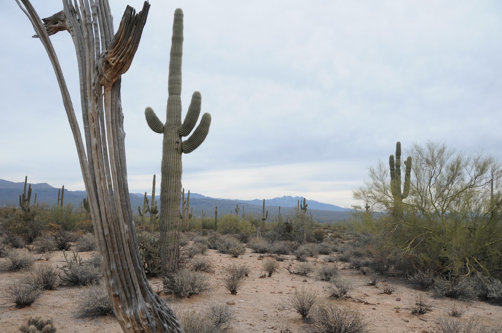
Don't trample pristine land---use the trail
Here a just a few reasons why hikers should stay on trails:
• Studies have shown that initial, low levels of trampling on pristine land causes the most severe damage.
• Unofficial social trails can cause confusion and lead to hikers getting lost.
• Social trails are built without the benefit of environment impact studies and are largely of poor design making them dangerous for users and harmful to sensitive vegetation.
• Delicate soil crusts that contain organisms essential for forest health take hundreds of years to form are destroyed by one boot print.
• Off-trail exploring can harm fragile archeological sites.
• There are hundreds of abandoned mines in Arizona that are not obvious until somebody gets injured.
• Trail cutting and widening along with carin building cause erosion and encourage others to follow suit.
• Off-trail hikers can trigger higher defense response in wildlife.
• Contrary to popular belief, hiker-blazed routes are NOT automatically adopted into the land agent's scope of official trails. If you have an idea for a new trail---contact the agency.
• Even a short off-trail traipse to find a good lunch spot causes damage. Take breaks on durable surfaces like established camp sites or trail-side logs.
• The seeds of invasive species have been documented to stay lodged in shoes for hundreds of miles. When you cut into soft, untraveled land, these seeds may take root causing devastating disruption of the ecosystem.
• Hiking off trail puts the search and rescue workers who will come to save your butt at unnecessary risk.

As the popularity of hiking for leisure, fitness, healing and personal growth continues to rise, paying attention to sustainability will become more and more important.
My New Year's wish for 2016 is that individual hikers and groups alike adopt and share sustainable trail ethics with a vengeance.
Arizona has a deep bench of hiking clubs that organize events, teach skills, donate countless hours of volunteer work and foster lasting friendships and a love of the outdoors. These same wonderful clubs have a great opportunity to promote stewardship by example.
See you on the trail in 2016!

Leave No Trace Center for Outdoor Ethics


Monday, December 21, 2015

ESCONDIDO TRAIL

ESCONDIDO TRAIL
McDowell Mountain Regional Park
View of Four Peaks from the Escondido Trail

There's a cool virtual tour of the Escondido Trail on the McDowell Mountain Regional Park website. It's a beautiful slide show describing the route's scenic features, elevation profiles and loop options. This is the park's first online tour and it's great for both vicarious thrills and inspiration to hike the trail in real life.
Constructed in late 2013, the trail can be accessed at established trailheads or from its many connecting routes. One option is to begin at the Lousley Hill Trailhead and hike 5.1 miles south to the Four Peaks Staging Area as either an out-and-back or car shuttle trek.
Because of its flowing style, hairpin turns, graceful bends and few obstacles, the trail feels fast underfoot. Located in the park's far east end, the mostly unshaded trail showcases expansive mountain views, a smattering of gigantic saguaros and a twisting walk through the quarry-like mounds and washes around the Lousley Hills.
The trail's fast track nature makes it a favorite among mountain bikers and runners. For hikers, the smooth pathway is perfect for a joint-friendly, swift paced jaunt.
LENGTH: 6.2 miles one-way (10.2 out-and-back as described here)
RATING: moderate
ELEVATION: 1,620' - 1,930'
FEE: $6 daily fee per vehicle
FACILITIES: restrooms, picnic areas, horse staging, visitor center
GETTING THERE:
Lousley Hill Trailhead:
From Loop 202 in Phoenix, take the State Route 87 (Beeline Highway) exit 13. Go 11.5 miles north to Shea Blvd. Follow Shea 0.5 mile to Saguaro Blvd., turn right and continue 3.7 miles to Fountain Hills Blvd. Turn right and go 4 miles to the park entrance.
Follow McDowell Mountain Park Drive 4.8 miles to Lousley Drive South, turn right continue 0.3 mile to the parking area
INFO & VIRTUAL TOUR:
MORE PHOTOS:

Monday, December 14, 2015

SNOW HIKING IN PAYSON

MONUMENT PEAK LOOP SNOW HIKE
Payson Area Trails System
Snow hiking Monument Peak Loop: Dec. 13, 2015

Snow days in Payson are rarer than those in Flagstaff or the White Mountains, but when they do occur, getting to good snow hiking trails is a lot easier than at the higher elevations where deeper accumulations and unplowed forest roads can thwart access and frustrate even the most experienced trekkers. The Payson Area Trails System (PATS) network of routes winds around a through town with easy-to-find trailheads along residential streets so there's usually no need to chain up or kick in the four wheel drive to enjoy a wintery walk.
A good bet for a snow hike is the Monument Peak Loop. Because it runs through a mix of shady pine forests, manzanita scrub and sunny meadows with intermittent streams, you'll get a smorgasbord of deep drifts, gentle dustings, frost-kissed cypress trees and ice capped pools. The trail is well-signed and heavily traveled by locals so chances are the path will have already been packed down by time you arrive. However, it's smart to head out with equipment to keep yourself safe. Hiking poles, layers of technical fabric clothing (ditch the cotton jeans) and boots with good traction are essential. Some hikers insist that a pair of slip on crampons make all the difference. Additionally, keep in mind that snow and ice is most treacherous when it starts to melt. An early start means you'll face colder temperatures, but you'll also have a better chance of avoiding slips and muddy boots. The photos here are from a hike on December 13, 2015 following a storm on the previous day. It was 27 degrees when we started around 9 a.m. and 34 degrees at 10:30 a.m.
LENGTH: 3.3-mile loop
RATING: easy
ELEVATION: 4,630' - 4,795'
GETTING THERE:
From the intersection of State Route 87/260 in Payson, go less than a mile east on SR260 to Granite Dells Road (located just past the Safeway center). Turn right and go 3.3 miles on Granite Dells Road (which will turn into Forest Road 435 after 1.3 miles) to the Monument Peak trailhead on the left.
INFO & MAPS: Payson Area Trails System
MORE PHOTOS:

Saturday, December 12, 2015

BLACK CANYON NATIONAL RECREATION TRAIL

BLACK CANYON NATIONAL RECREATION TRAIL
Drinking Snake Segment
Windmill near Dripping Spring

I love snakes. Snakes are great. If it weren't for snakes, rodents would probably be the dominant species on Earth and we'd all be speaking ratish. So, naturally, a trail named Drinking Snake would jump off the map and onto my must do list. But, like many hikers, running into a snake on the trail sends a chill up my spine. One of the biggest concerns I hear from hikers is the fear of snake encounters. Various theories culled from both credible science and the crusty archives of pseudo-psychiatry offer divination into the angst of ophidiophobia. First, there's a global assumption that all humans fear snakes. This has been exploited by therapists and Hollywood alike. For instance, if you say you're not afraid of snakes on the analyst's couch or in a job interview or, you may be pegged as a liar. Then there's the movie, Snakes on a Plane with its preposterous restroom viper attack scene. In a more credible arena, scholarly writings suggest that natural selection may have favored those who learned to avoid snakes. Basically, people who ran lived to reproduce and go hiking. This idea is supported by reports of lunkheads who pick up rattlesnakes for ill-fated photo ops.

After the initial snake encounter adrenaline rush runs its course, it's then possible to appreciate the beauty of serpents and their role in the environment.
And yes, the Drinking Snake Segment of the Black Canyon Trail is as good a place as any for herpetological hoopla. This 4.8-mile stretch of the 78-mile route that runs from Phoenix to Mayer cuts through foothills and grasslands fed by Big Bug and Antelope Creeks. In addition to transient water, the creeks provide a rich habitat for the tasty critters snakes love. Mice, squirrels, lizards, rabbits, birds and other snakes are all on the menu. But, from a snake's perspective, anything that's not food (hikers, dogs, livestock) is a waste of venom. Trekkers who are aware of their surroundings and give serpents their space are in little danger. Although there are rattlers along this trail, you're more likely to run into innocuous species like garter, king and gopher snakes. Additionally, the vipers are less active in cold weather which is also the best time to hike this exposed route. The hike begins with a walk on Forest Road 9218A where you'll pass a gate then turn left where the road splits at the 0.3-mile point. After another 0.3-mile, the trail becomes a singletrack and continues 2.4 miles to a scenic windmill and water tank above Dripping Spring Canyon. From here, you're back on a Jeep road for the final 1.8-mile haul to the Antelope Creek Segment.
Above Dripping Spring Canyon
LENGTH: 4.8 miles one-way
RATING: easy
ELEVATION: 3,932' – 4,220'
GETTING THERE:
Spring Valley Trailhead:
From Interstate 17, take the Bloody Basin Road exit 259, go 3.3 miles west (Crown King Road, Forest Road 259) to the ghost town of Cordes, turn right (north) Antelope Creek Road (County Road 74) and continue 3 miles to the trailhead on the left at Forest Road 9218A. Roads are sedan-friendly dirt/gravel.
INFO:
Black Canyon Trail Coalition
Living with Venomous Reptiles:
Snake Bite First aid:
Snake Avoidance Training for Dogs:
MORE PHOTOS:

Tuesday, December 1, 2015

BLACK CANYON NATIONAL RECREATION TRAIL

BLACK CANYON NATIONAL RECREATION TRAIL
Big Bug Segment
Bradshaw Mountain views on the Big Bug Segment of BCT

You'd be hard pressed to find another Arizona route imbued with as much history as the Black Canyon Trail. Records of its many centuries of use are preserved in rock art, public documents and the dens of wily desert critters. Since its origins as a Native American footpath, it has morphed into a cattle driveway and wagon road before settling into its current role as a recreational trail for hikers, bikers, equestrians and (in a few places) ATVs. Running for roughly 78 miles in a twisting, north-south thread between the Carefree Highway north of Phoenix to the town of Mayer outside of Prescott, the route traces the foothills and valleys of the Bradshaw Mountains. The trail is organized into convenient segments---each with its own set of defining characteristics. Depending on where you are on the trail, you'll see smatterings of the ruins, petroglyphs, ranches, mining operations and windmills that document the trail's diverse heritage. Augmenting the artifacts is a continually changing mix of ecosystems ranging from canyon-bound, moist riparian strips to dry scrubby savannah.
The northernmost Big Bug Segment falls squarely on the "scrubby" end of the scale. It's a wind-in-your-face kind of hike though exposed rangelands with mountain views all around. The first mile runs through a bucolic territory of homesteads and horses along Highway 69. After rounding a bend, the route ducks into a quiet habitat where every thump of a hiking boot has the potential to rouse rabbits and scrub jays from their juniper tree sanctuaries. Just beyond the 2.5-mile point, the trail crosses Antelope Creek Road then follows a Jeep track 0.6-mile to connect with the Drinking Snake segment. Along the way, keep an eye out for packrat middens. They look like scrap piles but further inspection reveals tiny entrances covered with everything from roots and twigs to cow dung and bones that are occasionally topped off with stray parts (belt buckles, lens caps, socks) left behind by (or pilfered from) travelers. These rodent abodes are built upon over many generations and some are tens of thousands of years old. The tiny time capsules can contain treasure troves of mummified and fossil plant, animal and human relics. What is garbage to the untrained eye is gold to the scientists who study the middens to understand biotic and climate change over time. So, through their unsavory housekeeping habits, the rat's have become "accidental archivists" and important contributors to the history of a classic Western trail.
LENGTH: 6.2 miles out-an-back (as described here)
RATING: easy
ELEVATION: 3,950' - 4,140'
FACILITIES: vault toilet
GETTING THERE:
Big Bug Trailhead:
From Interstate 17 in Cordes Junction take exit 262 for State Route 69 heading north toward Prescott.
Set your odometer and drive 4.2 miles to a point 0.7-mile past mile marker 266, (N 34 21.823 W 112 10.556) turn left onto an unmarked drive and continue 0.1 mile to the trailhead. To find the trail, pass the gate near the restroom and stay to the right of the fences and corral. (There was a large carin here on our visit). Follow the trail though a drainage, and veer right at the top of a rise where the trail splits. Follow the trail to the right of a fence line and you'll soon see a BCT sign. From here, the trail is easy to follow.
INFO & MAPS:
Black Canyon Trail Coalition
MORE PHOTOS:

Monday, November 16, 2015

CASA GRANDE MOUNTAIN TRAILS

CASA GRANDE MOUNTAIN TRAILS
Casa Grande
The Ridge Trail 

Casa Grande Mountain Park resides in the desert space between a world of truck stops and freeways and valleys of checkerboard farmlands. Here, mornings break to the hum of traffic, blaring train horns and veils of mist drifting off crops. Despite its proximity to the busy Interstate 10/8 interchange, the park has quality hiking, especially at its southern end where the din of industry is absorbed in cholla-fleeced foothills and stony clefts.
The 1,025-acre park has more than 18 miles of non-motorized use trails. The system is made up of stacked loops with varying levels of difficulty anchored by the 4.86-mile Ridge Trail that traces the mountain's eastern flank. Although the Ridge Trail is well-signed, some of the others are not, but finding your way around isn't too tough. Also, because wildcat social trails muddle the terrain, it's smart to download the park map before heading out. Official trails are marked by metal posts with arrows that use standard alpine color codes (black for difficult, blue for moderate, green for easy). Follow the posts to stay on track.
Two trailheads offer distinctly different experiences. At the north end, the Peart Trailhead appeals to those looking for easy, close-to-town hiking, while the Arica Trailhead provides access to the park's midsection and more difficult options.
While on the trail, scan the horizon for the profile of Picacho Peak and the jagged silhouette of the Sawtooth Mountains. Underfoot, look for the Arizona Fishhook Pincushion cactus that appears to grows out of solid rock in calf-high clusters blooming pink in spring before producing cherry-red fruits that linger through winter.
LENGTH: 18.29 miles
RATING: easy to difficult
ELEVATION: 1,500' - 2,350'
FACILITIES: porta potty, interpretive sign, benches, trash can
GETTING THERE:
Peart Trailhead:
From Interstate 10 in Casa Grande, take the Jimmie Kerr Blvd. exit 198 (State Route 84) and travel 2.6 miles west to Peart Road. Turn left (south) and continue 1.7 miles to where a "hiker" sign points to a dirt road on the left. Follow this sedan-friendly road 0.4 mile to the trailhead.
Arica Trailhead:
From Interstate 10 in Casa Grande, take the Sunland Gin Road exit 200 and head 0.1 mile south to Arica Road (just past the Loves truck stop). Turn right and continue 1.5 mile to the trailhead. The last half-mile is on rough dirt but is passable by sedan.
INFO & MAPS:
MORE PHOTOS:

Monday, November 9, 2015

SUNRISE MOUNTAIN TRAIL

SUNRISE MOUNTAIN TRAIL
City of Peoria
Looking east from Sunrise Mountain

Who knew that a suburban trail toggled to a kiddie playground could offer a respectable hike?
Sunrise Mountain Trail does just that with a three-tiered system of loops wrapping around a chain of peaks jutting above a sea of residential communities in Peoria. The trail begins at WestWing Park where colorful swings and slides are complemented with restrooms, drinking water and plenty of parking.
One of the beautiful things about this system is that it's set up with both easy and difficult options
designed in a way that makes short work of customizing treks to suit individual preferences.
Although the first tier is rated easy, some climbing is required to reach the half-mile point where the first of several junction posts points the way for a moderately-challenging summit route or an easier slope-clinging circuit.
The route graduates to moderate-rated tier two with a series of ups-and-downs among granite outcroppings and breezy stands of palo verde trees. The roller coaster style trail never stays flat for long, wobbling between highpoint vistas and low slung saddles. After a steep descent off a cactus speckled ridge, tier three takes off on a difficult -rated swing around the flanks of the mountain's eastern most knob. An optional side trail makes the hike's final ascent to a 1,840-foot stub hovering over a landscape of freeways, subdivisions and distant mountain views.
LENGTH: 4.6-miles out-and-back including access trail
RATING: easy-difficult
ELEVATION: 1,270' -1,840'
GETTING THERE:
From Phoenix, go north on Interstate 17 to Loop 303 exit 221. Turn left (west) and continue 7 miles to Lake Pleasant Parkway exit 131, turn left (south) and go 2.3 miles to WestWing Parkway, turn left and go 1 mile to WestWing Park on the right. Trailhead is accessed via a 0.1-mile dirt road that leaves from the far east end of the parking lot. A large boulder plaque on a crest near WestWing School marks the start point.
INFO & MAPS:
City of Peoria

Tuesday, November 3, 2015

APACHE WASH LOOP

APACHE WASH LOOP
Phoenix Sonoran Preserve
Apache Wash Loop Trail

In an environment where plants and animals must adapt and invent to survive, desert washes play a critical role in managing life's most precious commodity. These serpentine natural gutters corral and horde rain water in ways that create ribbon-like forests and natural underground reservoirs.
A sure-fire way to get an education about the transformative power of washes is to take a hike on the Apache Wash Loop Trail in the Phoenix Sonoran Preserve. The trail dodges through and around a water-scoured furrow and its companion linear oasis that coils through flatlands below a chain of minor desert peaks.
The rugged, tree-lined trench is scoured by storms that come mostly in torrential bursts accompanied by churning clouds and lightning theatrics. During these downpours, massive walls of water roll off surrounding slopes into low lying channels forming transient rivers of debris. Flowing washes are far more dangerous than they appear, so to avoid being swept away, never attempt to hike (or drive) through one while water is running. There are warning signs where the trail crosses the wash, so pay heed. Porous soils soak up the rainfall almost as quickly as it appears but the benefits are long-lasting. The fringe of green lining the wash is made up of deep-rooted trees and shrubs like mesquite, palo verde, catclaw and ironwood that tap into underground water reserves. This tightly woven community of desert adapted plants huddled among water-tumbled boulders, sandbars and super size saguaros provide pleasant shade spots along the route. Although wildlife is most active at dawn and dusk, javelina wallows, nests and burrow diggings belie a robust critter population dependent on the wash and its reliable stashes of water and food.
The easy loop trail is simple to follow and offers both shortcut options and access to an optional summit climb. Posts at every junction show your position, distance and elevation. After hiking the loop, take a side trip up to Apache Vista to get a bird's eye look at the meandering miracle of the wash.
LENGTH: 6.7 miles (including access trails)
RATING: easy
ELEVATION: 1700' - 1820'
GETTING THERE:
Apache Wash Trailhead.
1600 East Sonoran Desert Drive, Phoenix.
From Loop 101 in north Phoenix, take Cave Creek Road exit 28, go 4.5 miles north to Sonoran Desert Drive, turn left (west) and continue 3.5 miles to the trailhead on the right.
INFO & MAPS: Sonoran Preserve Ranger Office: 602-262-7901

Monday, October 26, 2015

JOE'S CANYON-YAQUI RIDGE

PASSAGE 1
Arizona National Scenic Trail
Start of the Arizona Trail at the U.S.-Mexico border

If you're reading this, you might be a hiker who has been motivated to take a good long trek by recent movies like Wild and A Walk in the Woods . While these inspiring films romanticize long distance hiking, it's important to do your homework and manage your expectations before hitting the trail.
Here in the Southwest, the obvious draw for a marathon hike is the 817-mile Arizona Trail.
Like many people with a day job whose long-term plans include hiking the entire route from Mexico to Utah, I've been chipping away at the miles in opportunistic grabs and passage-long chunks.
Turns out, this bit-by-bit style is the way most hikers approach the Arizona Trail. Sirena Dufault, AZT Gateway Community Liaison says," You don't have to hike the entire AZT to enjoy it. It's a "choose your own adventure", where you decide how much of a challenge is comfortable for you. Hikers who have completed the trail range from age 19 to folks in their 70s. Some have done it in 21 days while others section hike it for a decade or more." Shawn Redfield, AZT Trail Director concurs. "A through- hike is nothing more than a bunch of section hikes done in series with resupply breaks in between. Preparation is critical, though. There is a small portion of hikers who are not prepared and as the popularity of long distance hiking grows, fueled by recent movies based on it, this translates into hikers who become a danger to themselves and the people who will come to help them."
Redfield adds that research and conditioning for a though-hike can take months and that it's vital to understand the AZT's special challenges of water scarcity, heat, elevation change and remote terrain where rescue is not an option. (Become a member of the of AZT Association to get access to tons of current trail information, water data and opportunities to speak with others who have conquered the route: http://www.aztrail.org/membership/join.html).

On October 24th, I stood at the U.S.-Mexico border where a simple sign denotes the beginning of the AZT. It took me 12 years to get there. Having hiked parts of Passage 1 from Montezuma Pass, through Miller Peak Wilderness (with a side trip to the 9,466' peak) and on to Parker Canyon Lake, this last mile was one of several blaring holes on my progress map. Prior attempts had been rained out, burned out or thwarted by schedule conflicts, so I vowed to bite the bullet and hike rain-or-shine to bridge this gap by the end of 2015. Rather than starting at the traditional Montezuma Pass trailhead, I chose to approach from the Coronado National Monument Visitor Center by hiking 2.4 miles on the Joe's Canyon Trail then 1-mile south on Yaqui Ridge Trail (AZT) to the border. This exceptional trek begins with a 1,400 foot ascent up a rugged drainage to Smuggler's Ridge, a knife-edge saddle with see-forever views overlooking the Mexican State of Sonora. The final mile makes a 600 foot decent to a border monument that marks the beginning (or end) of Arizona's most epic journey. Next up in my gap-plugging adventure: the Mazatzal Divide.
LENGTH: 6.8 miles roundtrip
RATING: moderate
ELEVATION: 5,006' - 6,493'
GETTING THERE:
From Tucson, travel south on Interstate 10 to State Route 90 Exit 302 and go 25 miles south to Sierra Vista. Connect with State Route 92 and continue 16 miles to S. Coronado Memorial Drive and follow it 4.7 miles (road becomes E. Montezuma Canyon Road) to the Coronado National Memorial Visitor Center (open 8 a.m. to 4 p.m. daily. Closed Thanksgiving and Christmas). Trail begins a few yards up the road beyond the center. Parking is free. Restrooms.
INFO:
Coronado National Memorial:
MORE PHOTOS:

Monday, October 19, 2015

BUCKSHOT-HAWKNEST CIRCUIT

BUCKSHOT-HAWKNEST CIRCUIT
McDowell Sonoran Preserve, North
Buckshot Trail

I have a new favorite trail in Scottsdale's McDowell Sonoran Preserve. Again. This happens every time I overcome my penchant for hiking well-known long paths with spectacular scenery and try something different. Although it's only 0.8-mile long, Buckshot Trail wins laurels because it straddles the gap between the familiar and the untried. It shoots off from the heavily travelled Brown's Ranch site to connect with the newer Hawknest Trail that arches over the preserve's north section for nearly its entire width. On the day I discovered this desert jewel, a huge group of hikers was assembled at the trailhead preparing to trek the 7.7-mile Cholla Mountain Loop--one of the area's most scenic circuits. They invited me to join them, but the drone of "been there done that" rattling in my cerebellum won over and I plowed north toward new-to-me territory instead. As with all hikes, trying to comprehend the unique character and secrets of an unexplored trail by viewing it as a line on a map is kind of like presuming to know the traits of a wine without having tasted it. Will it be a nobel Grand cru or some pedestrian vin du pays? The essence of the Buckshot Trail falls somewhere between Night Train and a hoity toity Bordeaux--amusing yet rich. Packed with massive saguaros, blooming shrubs and yucca-framed vistas, it's just far enough off the beaten paths to offer savory solitude. Only one other hiker (a preserve steward) and a handful of mountain bikers, crossed my path. Excellent maps available online and at the trailhead show numerous ways to cobble your own circuit using Buckshot Trail. Here's the route I took: From the trailhead, hike 1.9 miles north on Brown's Ranch Road to marker CL6 and turn right onto Corral Trail (note, this is 0.6 mile beyond the first Corral Trail access point). Go 0.5 mile on Corral, turn left on the Buckshot Trail and continue 0.8 mile to Hawknest Trail. Turn right (north) at the sign and hike 1.5 mile to Broken Spoke Trail, turn left and go 0.6 mile to High Desert Trail. Turn right (south) and go 0.7 mile to Corral Trail and follow the signs back to the trailhead.
On the return leg of the trip, solitude evaporated as I encountered some of the Cholla Mountain group and dozens of other hikers funneling onto arterial Brown's Ranch Road for the final mile-long trudge back to civilization and perhaps a nice Chianti.
LENGTH: 8.8 mile loop
RATING: easy
ELEVATION: 2,610' – 2,770'
HOURS: sunrise to sunset daily
GETTING THERE:
Brown's Ranch Trailhead
30301 N. Alma School Road, Scottsdale.
From Loop 101 in Scottsdale, take the Pima/Princess exit 36, go 6.5 miles north on Pima to Dynamite, turn right and continue 2.7 miles to Alma School Road. Turn left and continue 1 mile to the trailhead. There are restrooms, water and maps at the trailhead. No fee.
INFO: McDowell Sonoran Preserve
http://www.scottsdaleaz.gov/Assets/ScottsdaleAZ/Preserve/Preserve+North+Area+Trail+Map.pdf
MORE PHOTOS:

Monday, October 12, 2015

OLD CAVES CRATER

OLD CAVES CRATER
Flagstaff
Exploring a geological hiccup

Talk about a room with a view! Imagine waking up in a cave atop an extinct volcano and seeing a 12,000 foot massif to the west and endless prairies to the east. That's what the Sinagua people enjoyed from a summit abode on a half moon-shaped cinder cone east of Flagstaff.
Now known as Old Caves Crater, the pueblo originally had as many as 80 rooms. Exactly how the encampment was used and why it was abandoned in the early 14th century remains a mystery, but an intriguing collection of crumbling foundations and shallow rock shelters provide fodder for the imagination.
This cinder cone is unusual, because unlike typical volcanoes of this type, its lava flow happened on the summit instead of at the base. After upside down eruptions splattered thick heaps of molten rock over the mountain top, “geological hiccups” of steaming gasses escaping from the gooey blobs created the maze of grottos and tunnels that are now the highlight of a popular hiking destination.
A 7-mile system of trails explores the archeological site and the Fort Valley Experimental Forest that surrounds the mountain. From either of the two trailheads, follow the wide black cinder road to connect with the 1.4-mile summit ridge trail. The moderate, pine-shaded single track climbs 510 feet to the caves. On the way up, vegetation morphs from pine-juniper forests into sparse, windswept patches of cliff rose and thigh high shrubs. You'll want to stay alert while exploring to avoid trampling on fragile artifacts or falling into one of the caverns. As with all heritage sites, leave only foot prints and take only photos. Do not attempt to reconstruct walls or "fix" anything. The trails are laid out in a double loop format bisected by the summit route. Map signs at the trailheads clearly show the layout making it easy to customize the length of your trek.
LENGTH: up to 7 miles
RATING: moderate
ELEVATION: 6,660' - 7,170'
GETTING THERE:
Dump Road (north) Trailhead:
From Flagstaff, go east on Interstate 40 to exit 201 for U.S. Route 89 north. Continue 5.6 miles north to Cinder Lake Landfill Road (FR6010) marked only by a "landfill" sign north of mile marker 423. Turn right and go 0.7 mile to the trailhead.
Silver Saddle (south) Trailhead:
From Flagstaff Mall on U.S. Route 89, go 3.5 miles north to Silver Saddle Road, turn right and continue 0.5 miles to the trailhead on the left past milepost 422.
INFO: Coconino National Forest

Monday, October 5, 2015

PINE VALLEY RIDGE TRAIL

PINE VALLEY RIDGE TRAIL
Village of Oak Creek
Pine Valley Ridge Trail

2021 UPDATE: THIS TRAIL HAS BEEN REROUTED AND RENAMED the Rabbit Ears and Little Rock Loop. See April 2023 blog entry for update. Sometimes there are just not enough parking spaces. This is conspicuously expressed at the Bell Rock Pathway trailhead in the Village of Oak Creek. Even though there's room for dozens of vehicles, the lot fills up quickly especially on weekends and during winter visitor season. That's because it provides access to the Big Park system of trails that includes some of Red Rock Country's most scenic, easy paths around iconic Bell Rock (a famous vortex site) and Courthouse Butte. If you encounter a packed lot, don't give up on your hiking ambitions----there's another way in. The system can also be accessed via the Pine Valley Ridge Trail that begins at the Jacks Canyon/Hot Loop Trailhead to the southeast. This relatively new route climbs 440 feet on a rocky backbone skirting subdivisions and the border of Munds Mountain Wilderness. Although the trail is obvious, it's not marked with signs. The toughest navigation involves finding where the route begins. From the trailhead gate where there's a sign for Jacks Canyon #55, hike about 20 feet down the road you came in on (do not pass thru the gate) and look for a red dirt single track on the right. Follow this trail 0.1 mile to the gate at Jacks Canyon Road, carefully cross the street, pass through a second gate and begin hiking uphill. At a third gate, turn right and from here, the path is clear although sketchy in some places. Just pay attention and you'll be fine.
At roughly 1.5 miles, beautiful views of the mesas of Jacks Canyon and Sedona's celebrated sandstone formations begin rolling out on all sides. From the high point, the profiles of Cathedral Rock, Capitol Butte and Cockscomb stand out from seldom seen perspectives. The trail then heads downhill to the junction with the Big Park and Courthouse Butte Loop Trails at the 2.4 -mile point. A map sign shows options for joining the wide-eyed masses orbiting Bell Rock, or you can skip the crowds by simply retracing your steps for a mellow 4.8-mile out-and-back hike.
LENGTH: 2.4 miles one-way to Big Park
RATING: moderate
ELEVATION: 4,270' - 4,710'
GETTING THERE:
From Interstate 17, take the State Route 179 Sedona exit 298, turn left and go 6.5 miles on SR179 to Jacks Canyon Road. Turn right and continue 1.9 miles to the trailhead turnoff (Forest Road 179G) on the right directly across from Canyon Ridge Trail.
INFO: Coconino National Forest
MORE PHOTOS:


Wednesday, September 30, 2015

FALL COLOR UPDATE 2015: Lockett Meadow Access

Vehicle access to Lockett Meadow to be managed for fall color viewing

FLAGSTAFF, Ariz., Sep. 30, 2015 — For Immediate Release.  Coconino National Forest plans to manage vehicle access to Lockett Meadow over the next couple of weekends to ensure public safety and allow safe travel up and down the road that leads to the meadow.
            During the weekends of Oct. 3-4 and Oct. 10-11, Forest Service personnel will be positioned in Lockett Meadow and also at the bottom of the road that leads to the meadow (near the junction of Forest Roads 552 and 418). Once the maximum capacity of approximately 50 vehicles has been reached in Lockett Meadow, personnel will manage traffic and allow one vehicle access as another departs.
Lockett Meadow is a popular destination for viewing fall colors and aspen stands as they turn yellow in the inner basin of the San Francisco Peaks. Forest Road 552, which is used to access the meadow, is a narrow forest road alongside a steep cliff that can be unsafe and difficult for opposing traffic to pass one another. Drivers should pay particular attention to oncoming traffic and blind corners.
Forest visitors are encouraged to seek other locations besides Lockett Meadow to view fall colors—especially on the weekends.  This includes the Around the Peaks Scenic Loop Drive on Forest Road 418, Snowbowl Road and the Snowbowl Scenic Chairlift, Elden Lookout Road (Forest Road 557), Hart Prairie (Forest Road 151) and Forest Road 300 along the Mogollon Rim. For more information and destinations to view fall colors on the Coconino, please visit http://tinyurl.com/napr8tf.
Lockett Meadow Campground has 17 campsites ($14/night) that are on a first-come, first-served basis.  The 50-vehicle restriction will not apply to those camping at Lockett Meadow.
  (re-posted from Forest Service press release 9-30-15)

Tuesday, September 29, 2015

FOOTHILLS & GUINDANI TRAILS

ABOVE GROUND HIKING AT KARTCHNER CAVERNS STATE PARK
Hikers on the Foothills Loop Trail

When massive blocks of Mississippian Escabrosa Limestone get jostled around by eons of geological turbulence, the results can be both transformative and magical. The Whetstone Mountains south of Benson are a good example of earth's dynamic forces at work. The range began when sediments at the bottom of an ancient inland sea solidified into layers of soft rock. Multiple episodes of faulting and uplifting formed the skyline of peaks that soar to over 7,000' and a chunk of limestone that slipped off the range's eastern flank that became the incubator of a celebrated natural wonder. From the outside, this slipped block appears as an unspectacular, ocotillo-studded hill. But inside, are the water-sculpted wonders of Kartchner Caverns State Park. Within the living wet caves, mineral deposits built over hundreds of thousands of years are still growing. It's like walking through a stadium-size geode.
Cave tours must be scheduled in advance. The half-mile excursions are naturally lit (no amusement park theatric here) and set to a soothing soundtrack. Guides tell the story of the cave's discovery and describe the science behind the bizarre formations that hang like melted wax, pulled taffy and flowing sheets of "liquid" stone. After the tour, you'll want to check out two above-ground hiking trails that explore the Chihuahuan semi-desert grasslands and oak-juniper forests that surround the property. The Foothills Loop Trail winds though a riparian area, savannah-like pastures and sandy washes with breathtaking mountain views. This hike is augmented with numbered posts that correspond with a free trail guide available at the Discovery Center. For a more challenging trek, the Guindani Trail #398 leaves the Foothills Trail, crosses into Coronado National Forest and makes a 1,000' climb to a scenic saddle where the peaks of the Huachuca Mountains near Sierra Vista hover over Arizona's border with Mexico.
LENGTH:
Foothills Loop: 2.5 miles
Guindani Trail # 398: 4.2 mile loop
RATING:
Foothills: moderate
Guindani: difficult
ELEVATION: 4,750' - 5,620'
GATE HOURS: 7 a.m. - 10 p.m.
GETTING THERE:
From Tucson, take Interstate 10 east to exit 302 for State Route 90 (Sierra Vista/Fort Huachuca). Go 9 miles south on SR 90 to the park entrance on the right.
Cave Tour Reservations:
520-586-2283

Thursday, September 24, 2015

FALL COLOR COUNTDOWN 2015

FALL COLOR COUNTDOWN 2015
Abineau-Bear Jaw Trail
Here in Arizona, fall color season runs from late September through December. Autumn leaf-peeping begins in the high elevations of Flagstaff, the White Mountains and sky islands like the Santa Catalina Mountains near Tucson and Mount Graham near Safford. Above 8,000', you'll find mostly aspens---the quintessential mountain tree. The season trickles down to the Mogollon Rim, Prescott, Payson and Sedona, usually peaking in late October through early November. Look for electric red maples, golden oaks, ash, alders and hoptrees.  Finally, desert trees like cottonwood, sycamores and willows turn tawny toward the end of November. Here are some perfect hiking trails for fall color. Find trails descriptions and directions by scrolling to the  TRAIL INDEX on this blog. You can also click on "fall color" to read about 165 hikes for autumn splendor:
EARLY-MID OCTOBER:
Abineau-BearJaw, Flagstaff
Inner Basin, Flagstaff
Veit Springs, Flagstaff
Wilson Meadow, Flagstaff
Pole Knoll, Greer
West Baldy, Greer
Icehouse Canyon, Globe
Marshall Gulch, Tucson
Ash Creek, Safford
MID-LATE OCTOBER:
Barbershop Trail, Mogollon Rim
Rim Lakes Vista, Mogollon Rim
West Fork of Oak Creek, Sedona
LATE OCTOBER- EARLY NOVEMBER:
Red Rock State Park, Sedona
Huckaby Trail, Sedona
Baldwin Trail, Sedona
NOVEMBER-DECEMBER:
Hackberry Spring, Superstition Mountains
Jewel of the Creek, Spur Cross Ranch
New River Nature Reserve, New River
Boyce Thompson Arboretum, Globe
HANDY RESOURCES:
National Forest Service (AZ is in Region 3)
Flagstaff-Sedona Updates
Flagstaff Leaf-O-Meter:

Monday, September 21, 2015

BULLDOG SEGMENT of the MARICOPA TRAIL

MARICOPA TRAIL
Bulldog Canyon Trailhead to Pass Mountain Trail
Granite outcroppings on Maricopa Trail

Loop trails are fantastic inventions. Hiking on one feels sort of like a following a cinematographer filming a visually-rich sequence that ends where it began. Arizona has some impressive hiking hoops. Revered for their flowing, long lengths and community-unifying qualities, projects like the Flagstaff Loop Trail (42 miles), Prescott Circle Trail (54.4 miles) and the grand dame of them all--Maricopa Trail-- act as the glue for regional, non-motorized recreation systems. When complete (target 2017), the Maricopa Trail will form a 310-mile loop around Greater Phoenix, connecting parks, suburbia and surrounding cities. The thrill of trekking on fresh dirt is rekindled each time a new segment drifts into pristine tracts or provides an alternate path to familiar hiking haunts. With the recent opening of a 1.4-mile section in the East Valley, there's now another way to approach the popular Pass Mountain (PM) Trail. Previously, access to PM was only though Usery Mountain Regional Park or a lot off Meridian Road in Mesa. This new western approach from Bulldog Canyon Trailhead will eventually tie in with a yet-to-be-constructed corridor to the Granite Reef recreation area near the Salt River. Volunteers are needed to complete the work and you can sign up to be part of this historic effort by visiting the Maricopa Trail + Park Foundation website: http://mctpf.org/.
The "Bulldog" segment makes an easy, 300-foot ascent to the junction with 7.5-mile PM Trail (not signed). Roughly 5.6 miles of the PM loop trail is on the Tonto National Forest and there's no fee to hike on this scenic section. However, if you cross into the part of the trail that's in Usery Mountain Park, be prepared to pay the $2 per person fee (exact change required). You can avoid the fee by heading left at the junction. From here, its just under 2 miles to the saddle overlooking a valley straddling the desert space between the Superstition and Goldfield Mountains. This makes for a good turn around point for those left their wallets at home or are not up to the 10.3-mile circuit.
LENGTH: 1.4 miles one way (trailhead to PM)
or 10.3 miles roundtrip with Pass Mountain Loop
RATING: easy-difficult
ELEVATION: 2,010'- 2,340' (2,740' with PM)
FEE: $2 per person if you enter the park on foot. Exact change required.
GETTING THERE:
From Phoenix, go east on US60 to the Ellsworth Road exit. Go north 8.2 miles north on Ellsworth (turns into Usery Pass Rd.) to the trailhead corral on the right past milepost 22 which is 1.6 miles north of the Usery Mountain Park entrance.
Maricopa Trail:
Maricopa Trail + Park Foundation:
MORE PHOTOS:

Tuesday, September 15, 2015

LONGVIEW TRAIL

LONGVIEW TRAIL to PIONEER PARK
Prescott
Grasslands and mountain views on Longview Trail

The Prescott Circle Trail (PCT) is a non-motorized trail system that works like a 54-mile wagon wheel around the city with spokes radiating to myriad recreational goodies in "everybody's hometown". The route is a master work in trail design with multiple access points  and connectivity to city and county parks,  lakeside recreation areas, campgrounds and wooded paths within Prescott National Forest. This super network layout makes it simple to explore the 54-mile circuit at either a leisurely day hike pace or a more ambitious, multi-day backpack trip.  Downloadable maps and an excellent app for smart phones and tablets are available on the city's website.
Segment #10 of the route links Williamson Valley Road with Pioneer Park via the Longview Trail. This short trek winds through sprawling grasslands and juniper scrub with the hulking mound of Granite Mountain dominating its western flank. From the trail's high spots, hazy glimpses of Sedona's red rock canyons and the peaks of Flagstaff punctuate a landscape of golden prairies. At the 1.78-mile point, the trail enters Pioneer Park. From here, you can continue on PCT or make a customized hike using the park's 9-miles of loop trails. Although Prescott Circle Trail was officially completed in summer 2015, it will continue to evolve with added trailheads, scenic spur loops and ongoing improvements to optimize the outdoor experience for hikers, equestrians and mountain bikers. Whether sampled as an effortless stroll from a kid-friendly park or tackled from its feral fringes, the trail serves up a balanced blend of trekking opportunities. 
LENGTH:
Longview Trail: 1.78 miles one-way
Pioneer Park Trails: 9 miles cumulative
RATING: easy-moderate
ELEVATION:
Longview Trail: 5,419' - 5,547'
Pioneer Park Trails: 5,220' - 5,580'
GETTING THERE:
There are many ways to get to this trailhead. Here's a convenient route when coming from Phoenix.
From State Route 69 in Prescott, go 2 miles north on Prescott Lakes Parkway (across from the Prescott Gateway Mall near milepost 294 ) to State Route 89. Turn right, continue 3.5 miles to Pioneer Parkway, go left and drive 5 miles to Williamson Valley Road. Turn right and make an immediate turn into the lot at the Welcome to Williamson Valley sign.
Maps & Apps, City of Prescott:
Yavapai County Parks:
MORE PHOTOS: