Celebrate &
Support the Maricopa Trail
 |
| Full Circle. |
On Saturday,
November 17, 2018, the sweet aroma of singed wood at Cave Creek Regional Park marked
the completion of Phase 1 of the Maricopa Trail. Using a hot branding iron, Former Maricopa
County Board Supervisor Andy Kunasek and current Maricopa County Board
Supervisor, Steve Chucri brought the nearly two-decade-long effort of building
the Valley-circumnavigation route full circle by burning the initials “MT” into
a wood panel, exactly as was done at the trail’s 2004 groundbreaking.
 |
| Ceremonial final shovelfuls. |
 |
| American Conservation Experience. |
The branding
followed a ceremonial tossing of the final shovelfuls of dirt onto the trail
and the unveiling of a new informational kiosk at the Overton trailhead where
the Maricopa Trail departs the park on its 315-mile journey. Speakers, information booths, guided hikes and the release of two Harris's Hawks rehabilitated by Wild at Heart, a rescue organization for birds of prey, made for a full morning of festivities.
 |
| Brian Derrick |
Initial plans
for the trail were rolled out in 2000. What followed was years of cooperative planning
and elbow grease across multiple governmental agencies, businesses, communities
and volunteer organizations.
The primary
driver was Andy Kunasek, an outdoor enthusiast and former public servant who
saw the value in creating a non-motorized trail that would connect
ten county parks to provide recreational opportunities while protecting natural
and cultural resources along its route.
 |
| Andy Kunasek |
Often
referred to as “The Father of the Maricopa Trail”, Kunasek pushed for the financial
support, alliances, easements and ongoing partnerships that made the route
possible. He is also the founder of the Prickly Pedal mountain bike race which
supports the Maricopa Trail + Park Foundation (MT+PF), a nonprofit organization
that provides sustainable financial support and volunteer trail maintenance.
 |
| Maricopa Trail + Park Foundation |
The annual event will take place on January 19, 2019 and will include a grueling
40-mile race on the trail between Spur Cross Ranch Conservation Area in Cave
Creek and Lake Pleasant Regional Park, a 13-mile Fun Ride tailored to more
casual riders and the ever-popular Kids Race where young riders ages 6 to 11
vie for medals and glory. New this year—for
non-bikers-- is an 8k trail run that will feature a rumble through the trail’s
rugged beauty and diverse terrain. But
you don’t have to be a rider or runner to show your support for the trail. Spectators
can enjoy a day of fun and activities followed by an awards ceremony and
post-ride party by the lake with live music, food and beer garden.
 |
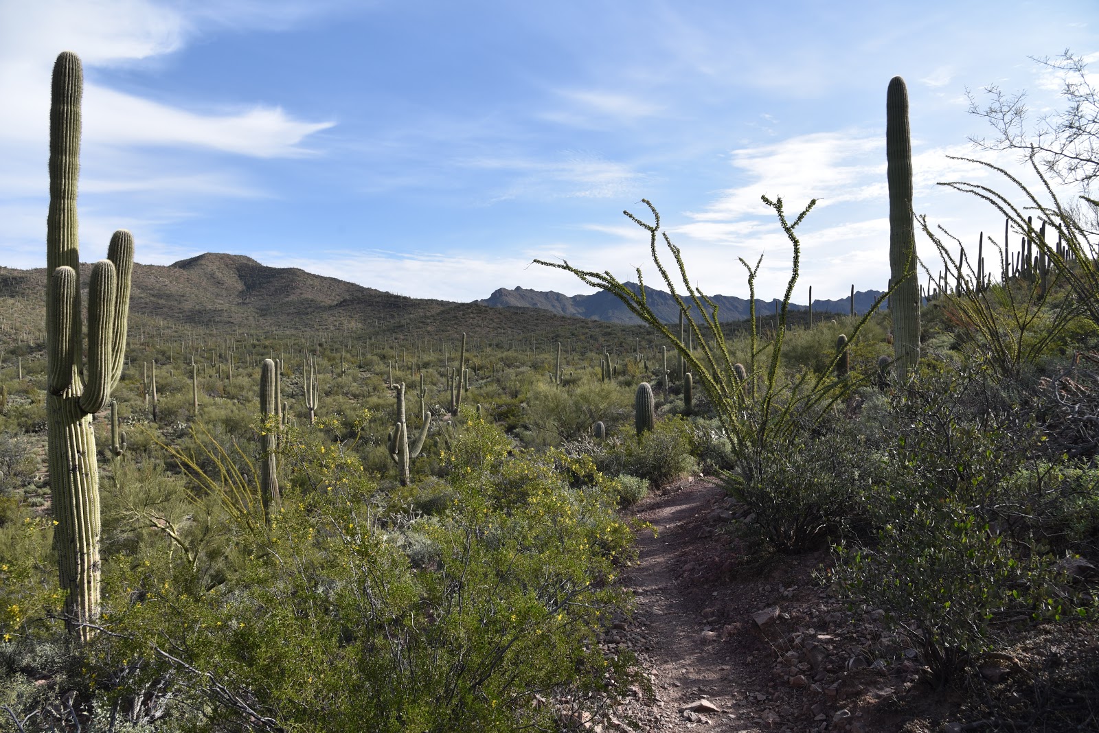
| Desert beauty on the Maricopa Trail. |
 |
| Hiking the Maricopa Trail |
 |
| Hawk release |
Although the
main big loop is now complete, the Maricopa Trail will continue to evolve and
grow with added connectivity to municipal parks, communities and urban centers.
With dozens of trailheads and access
points along its route, it’s easy to step out on the trail from just about anywhere
in the Valley. A good place to start is
at Cave Creek Regional Park with a moderate
 |
| Dedication ceremony |
 |
| Prickly Pedal Bike Race 2018 |
trek to the Andy
Kunasek at Spear S Ranch Trailhead.
 |
| Scorpion demonstration |
This
stretch of the trail wanders through a lush and diverse desert landscape in the
shadow of Apache Peak.
 |
| Harris's hawks take flight |
Running through
washes, mesquite forests and foothills lodged between the Tonto National Forest
and north Phoenix suburbs, the segment has a remote feel and outstanding
vistas. Hike this section as a 13.2-mile
out-and-back or a 6.6-mile one way car shuttle.
As Brian Derrick, MT+PF President said at the dedication ceremony, “One
of the best ways you can show support for the trail is to get out and hike on
it.”
PHOTO CAPTIONS
Full Circle: RJ Cardin, Maricopa County Parks and Recreation Director displays the ceremonial brand denoting the completion of Phase 1 of the Maricopa Trail.
Ceremonial Final Shovelfuls: Dignitaries place the final touches on the trail.
American Conservation Experience:
The Flagstaff-based volunteer organization began assisting with Maricopa Trail building and maintenance in 2016.
Brian Derrick: Maricopa Trail + Park Foundation President spoke about the importance of trail maintenance and volunteerism.
Andy Kunasek: The Father of the Maricopa Trail spoke about the history of the trail.
Maricopa Trail + Park Foundation:
Board members, Larry Sneed and Jan Hancock, invite visitors to check out the volunteer trail maintenance trailer provide by REI.
Desert beauty on the Maricopa Trail: View from the trail that runs between Cave Creek Regional Park and Spear S Ranch.
Hiking the Maricopa Trail:
View from the trail that runs between Cave Creek Regional Park and Spear S Ranch.
Hawk release: Steve Chucri, Maricopa County Board of Supervisors Chairman and former Chairman, Andy Kunasek get ready to release rehabilitated Harris's hawks into the park.
Dedication ceremony: RJ Cardin, Maricopa County Parks and Recreation Director emceed the event.
Prickly Pedal: Finish line scene from the 2018 race.
Scorpion: An Arizona Game and Fish representative displays a scorpion at the event.
Harris's hawks take flight: Two raptors rehabilitated by Wild at Heart fly into their new home. A silhouette of a Harris's hawk appears in the Maricopa Trail logo.
Maricopa Trail Anthem-Cave Creek-Spur Cross Segment Sampler:
LENGTH: 6.6
miles one-way
RATING: moderate
ELEVATION: 2050'
- 2295'
GETTING THERE:
Cave Creek
Regional Park Overton Trailhead:
37900 N. Cave Creek Parkway, Cave Creek.
From Carefree Highway in Cave Creek, go north on 32nd Street
to the park entry gate. Follow the main
park road to the Overton trailhead at the nature center. There’s a $7 daily fee per vehicle.
Andy Kunasek at
Spear S Ranch Trailhead:
41799 N. New
River Road.
From Carefree Highway
in Cave Creek, go north 4.5 miles north on 7th Street, (turns into New River
Road) to the trailhead on the right just before Linda Lane.
INFO & MAPS:
Maricopa Trail
Prickly Pedal
Bike Race: January 19, 2019.
Maricopa Trail +
Park Foundation