Find A Trail. Start Your Search Here:

Showing posts with label Mount Elden-Dry Lake Hills Recreation Planning Project. Show all posts

Monday, June 2, 2025

Taawa Trail

TAAWA TRAIL

A steep drop-off on the Taawa Trail

One of Flagstaff’s newest hiking routes is destined to become an Arizona high-country classic.  

Completed in the fall 2024, the Taawa Trail is the last trail to be built in Flagstaff’s Mount Elden-Dry Lake Hills (MEDL) area and is one of the few designated for hiker-only use.  The challenging yet approachable path seamlessly melds easy mountain traipses with aggressive climbing. 

A survivor Alligator Juniper on the Taawa Trail

It’s kind of like eating ice cream with habanero sauce.

The close-to-town MEDL trail system has been popular with non-motorized trail users since its debut in 1987. In addition to its recently expanded menu of new stacked loops, the area also shares space with the Arizona National Scenic Trail and the Flagstaff Loop Trail.

Volcanic boulders line the Taawa Trail

View of the San Francisco Peaks from Taawa Trail

Trail planning, design and construction was a hyper-local effort with contributions from the U.S. Forest Service Coconino National Forest Flagstaff Ranger District, American Conservation Experience, and many volunteer hours and fundraising events organized by local bike organizations and local businesses.

The Taawa Trail is for hikers only

The results are breathtaking.  New signage mitigates the formerly confusing and disruptive unauthorized paths.  Beautiful singletracks follow the natural contours of the land as they meander through diverse eco zones that rise from pinion-juniper woodlands where tiny cacti huddle among boulders to aspen glens and high elevation fir-spruce forests.  All in just a few miles of switchback-mitigated climbing.

Claret cup cactus color the trails May -July

The Taawa Trail –which is named for the Hopi word for sun spirit or creator--replaces a maze of social paths including the Lost Burrito Trail on its lower half. 

Access Taawa Trail from the Rocky Ridge Trail

The trail’s upper segment is all new, sustainable construction aligned to protect wildlife, keep hikers safe and deliver an exceptional outdoor experience.  The 2.1-mile trail that ascends more than 1,000 feet can be accessed from the Shultz Creek Trailhead by hiking 0.6-mile on the Rocky Ridge Trail to the Taawa junction. 
A steep, tricky spot on the upper Taawa Trail

It’s easy going for the first mile up to where the trail makes its first crossing of the Big Bang Trail. 
Make a return loop using the Big Bang Trail

That’s where a set of tight, edgy switchbacks take on the foothills.  Steep and exposed, the thin path climbs steadily through stony passages in pine-oak woodlands. 
A shady segment on the Taawa switchbacks

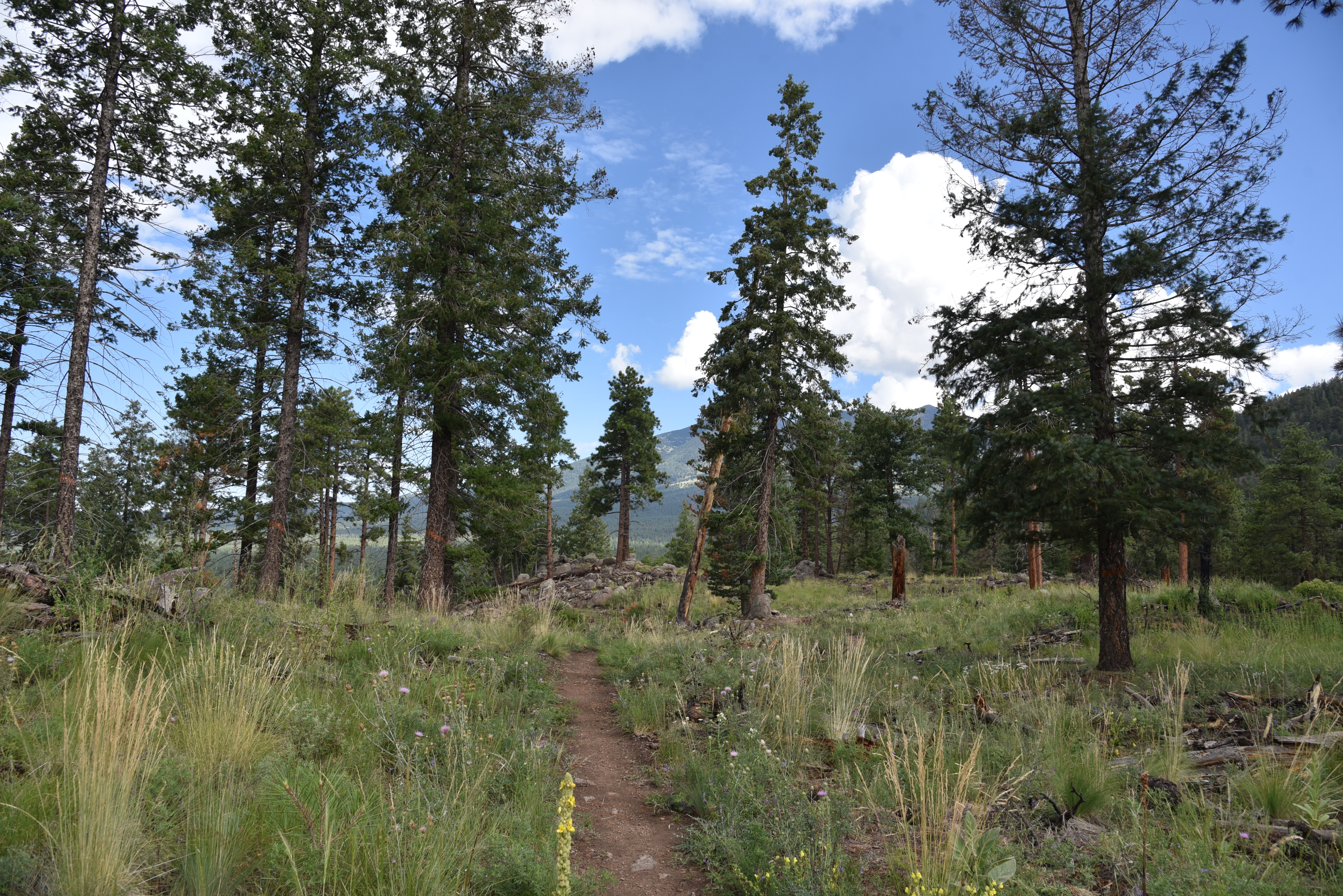
The vertical assault calms down after about a half mile, leveling out in patchy high meadows where trees part just enough to give up fantastic views of the San Francisco Peaks and the town of Flagstaff below.  The trail ends at its high point at the second Big Bang Trail junction.
Summer storms build quickly in mountain climes

From here, hikers can either back track or make a return loop using Big Bang for a slightly longer, more challenging trek.

LENGTH:  5.4 miles out-and-back as described here.  6.4 miles with Big Bang return option.

RATING:  moderate-difficult

ELEVATION: 7,160 – 8,422. feet

GETTING THERE:

Schultz Creek Trailhead: In Flagstaff, go 3 miles north on U.S. 180 (Humphreys Street) and turn right on to Schultz Pass Road (Forest Road 420). Continue 0.5-mile on FR 420 and make a hard left at the Elden Lookout Road (Forest Road 577) "Y" and go another half mile on FR 420 to the parking area on the left.  There are no fees or facilities at the trailhead. 

INFO:

https://www.fs.usda.gov/r03/coconino


Monday, August 28, 2023

Dipper-Apollo-Pluto-Spacewalk Circuit

DIPPER-APOLLO-PLUTO-SPACEWALK CIRCUIT

Impressive monolith on the Pluto Trail

Flagstaff has a long and colorful association with astronomy and space exploration. Notable mentions include the discovery of Pluto from the Lowell Observatory by Percival Lowell in 1894. And in the 1960s, the Apollo astronauts trained in the Cinder Hills area to test procedures in volcanic craters that resembled the lunar landscape prior to landing on the real thing in 1969.

Apollo Trail winds through volcanic boulders


Additionally, Flagstaff has the distinction of being named the first International Dark Sky City in 2001.

A hairpin curve on the Dipper Trail

That’s a big deal because the city’s policies on limiting nighttime light pollution have many benefits including improving human health, protecting sensitive wildlife and ecosystems and maintaining clear skies for stargazing and studying the universe.
Mountain vistas on the Spacewalk Trail

 (Learn more at darksky.org)

In homage to the Northern Arizona city’s outer space heritage, a new maze of trails in the Mount Elden-Dry Lake Hills (MEDL) area was opened to the public in August.

Wildlife browse sand sage August - November

New MEDL trails connect with Rocky Ridge Trail

 Part of the Schultz stacked loop system, located just a few miles north of downtown, the new Dipper, Apollo, Pluto and Spacewalk trails tie into the previously unveiled Big Bang Trail.
Pluto Trail passes a recovering burn scar

They also add toned muscle to Old Standard backbone routes like Rocky Ridge, Sunset, Brookbank and Upper Oldham Trails.
Mt. Elden seen from the Apollo Trail

Built by Coconino National Forest and Arizona Conservation Corps with the assistance of local volunteers, the trail names slap a celestial sugar coating on a decidedly terrestrial domain.
Wildflower meadow on Spacewalk Trail

While the area’s high elevation and slightly lower O2 levels might give lowlanders (if you’re from Phoenix, you’re a lowlander) a mini case of the woozies, the trail designs minimize the impact. These new routes are not of the old school straight-up-and-down ilk that seem engineered to make you feel like a looser.
Ancient alligator juniper on the Dipper Trail

These scenic paths capitalize on natural landscape contours, using sweeping switchbacks to ease climbs and tight hairpin turns to propel trail users around ravines and gullies.
Paintbrush color sunny spots March - September

The looped trails are easy to customize


To explore this new hub, begin at the Schultz Creek Trailhead, which was relocated away from the course of Schultz Creek this summer,  with a short walk on the Chimney Trail to connect with the Rocky Ridge Trail.

San Francisco Mountain seen from Dipper Trail

The route follows Rocky Ridge for 0.7 miles to where the Apollo Trail heads left.  The 0.3-mile connector path twists among lichen-encrusted volcanic boulders and sporadic tree cover, serving up appetizer views of what’s to come.
Sunflower meadows below the Dipper Trail

At the 1-mile point, Apollo intersects the Dipper Trail. For this trip, the route heads right taking on an edgy segment where enormous alligator junipers frame mountain vistas and glimpses of downtown Flagstaff before exposing first peeks at the sky-scraping silhouette of 12,633-foot San Francisco Mountain.
Mixed conifer woodlands on Pluto Trail

 
Immediately beyond the mountain preview, Dipper meets the Pluto trail at the 1.8-mile point.  Pluto is another capillary-type route of about a third of a mile that runs between the Dipper and Spacewalk trails.  The tightly coiled path jogs around a recovering burn scar and a prominent monolithic stone outcropping, then connects with the Spacewalk Trail. Great views of the peaks can be had by heading left at the junction.
Purple locoweed bloom June - September

Narrowleaf tick clover bloom July - September

The easy singletrack meanders for a half-mile through wildflower meadows and mixed conifer woodlands before bumping into the Big Bang Trail, the turnaround point for this exploratory trip. However, a quick map consult will show a full menu of loop options for longer or shorter hikes.

LENGTH:  4.66 miles out-and-back

RATING: moderate

ELEVATION: 7,160 – 7,765 feet (964 feet of elevation change)

GETTING THERE: Schultz Pass Trailhead: In Flagstaff, go 3 miles north on U.S. 180 (Humphreys Street) and turn right on to Schultz Pass Road (Forest Road 420). Continue 0.5-mile on FR 420 and make a hard left at the Elden Look Road (Forest Road 577) and go another half-mile to the  parking area on the left. There are no fees or facilities at the trailhead. 

INFO:  Coconino National Forest

https://www.fs.usda.gov/recmain/coconino/recreation


Friday, November 8, 2013

Major changes coming to Flagstaff's Mount Elden-Dry Lake Hills trails system

FOREST SERVICE WANT'S YOUR INPUT ABOUT PROPOSED 2014 FLAGSTAFF TRAIL CHANGES 
Coconino National Forest is asking for input regarding proposed changes to Flagstaff Ranger District trails around Mount Elden. Plans will impact the six trailheads and 14 routes that are currently within this system. Ideas being tossed around include: adding 23 miles of new shared-use trails, realignment of existing trails, trailhead improvements, better signage, and decommisioning unauthorized roads. The ultimate goal is to achieve a sustainable trail system that provides better access for hikers, climbers, equestrians and mountain bikers while protecting sensitive wildlife and archeological sites. The various studies, vetting processes and public commentary reviews will be completed in 2014 with final plans put into action thereafter. Voice your comments and concerns NOW!

How to be involved 
• Will the changes proposed meet your needs?
• If yes, what benefits do you foresee?
• If something is missing, what is it, and why is it important to you?

Submit comments to Brian Poturalski, Project Leader. 
5075 N. Highway 89, Flagstaff, AZ, 86005
comments-southwestern-coconino-flagstaff@fs.fed.us

COMMENTS ARE DUE BY NOVEMBER 30, 2013