Find A Trail. Start Your Search Here:

Showing posts with label Fossil Springs Wilderness. Show all posts

Sunday, March 1, 2026

Sandrock Pasture

SANDROCK PASTURE

Overlooking Fossil Springs Wilderness

Short in length but packed with a variety of terrain and points of interest, a walk on Forest Road 9266F delivers the goods over its 4-mile stretch. 

Sandrock Tank

The rough dirt route wanders through several vegetation zones as it works its way to the edge of Sandrock Canyon in the Fossil Springs Wilderness. 
Approaching the rim

FR 9266F starts in a meadow that’s lightly shaded with pine and juniper, then bends right at an intersection with FR9361C. 
Game trail to the rim

A few yards in, a fallen tree blocks the way, but is easily circumvented by foot travelers.  At the 0.4-mile point, the glassy water of Sandrock Tank appears on the right. 
Wild turkey track

Unnamed water hole on FR 9366F

The created water catchment in Coconino National Forest sits behind an earthen dam and is ringed with a rustic corral. 
The FR 9366F pine forest segment

Based on footprints seen around its rim, this is a popular drinking hangout for wild turkeys, coyote and raccoons. 
Limestone ledges over Sandrock Canyon

Past the tank, the road dips into a dense pine-oak forest, crossing drainages. 
Corral around Sandrock Tank

The short forest segment is the first of several ups-and-downs that account for over 1,000 feet of elevation change over the course of the hike. 
Rocky Mountain Spring Beauty

Emerging from the forest, the road heads uphill into sunny meadow dotted with junipers.
The end of FR9366F

Another small water hole on the left marks the beginning of glimpses of the rim of the Fossil Springs gorge.
A sunny meadow near no name tank

Just past the 1-mile mark, the wilderness cliffs are visible straight ahead as the road makes its final descent into Sandrock Pasture, a more arid zone of yucca, cacti, scrub and alligator junipers.
 
Wild candytuft

The road ends at 1.8 miles, but game trails lead to limestone ledges overlooking the dizzying gorge at the head of Sandrock Canyon.
trailhead 


LENGTH: 4 miles round trip

RATING: moderate

ELEVATION: 6,313 - 6,084 feet

CUMULATIVE ELEVATION CHANGE: 1,187 feet

GETTING THERE:

From Interstate 17 in Camp verde, go 26 miles east (toward Payson) on State Route 260 to Forest Road 9366F on the right just past milepost 244.There’s parking past the gate an in turnouts along SR260.

Tuesday, April 29, 2025

Piloncillo Ant Hills

PILONCILLO ANT HILLS

Cottonwood Basin Fumaroles

Ever see that movie “Them!”?  The 1954 black-and-white atomic-age chiller tells the story of mutant ants that go about eating humans in the New Mexico desert.  According to archival promotional clips, the monsters, mutated by atomic bomb test radiation, “claw out of the earth from mile-deep catacombs.”  Over the course of the film, it’s revealed that the ants are colonizing through underground tunnels, commandeered storm drains and rogue queen bees who have flown off to establish new nests.

Volcanic ash deposits along Fossil Creek Road

 Throw in some awesome flamethrower action, poison bombs, traumatized kids and vintage military aircraft and you’ve got the makings of a classic. Spoiler alert: in addition to their appetite for human flesh, the ants also like sugar.  
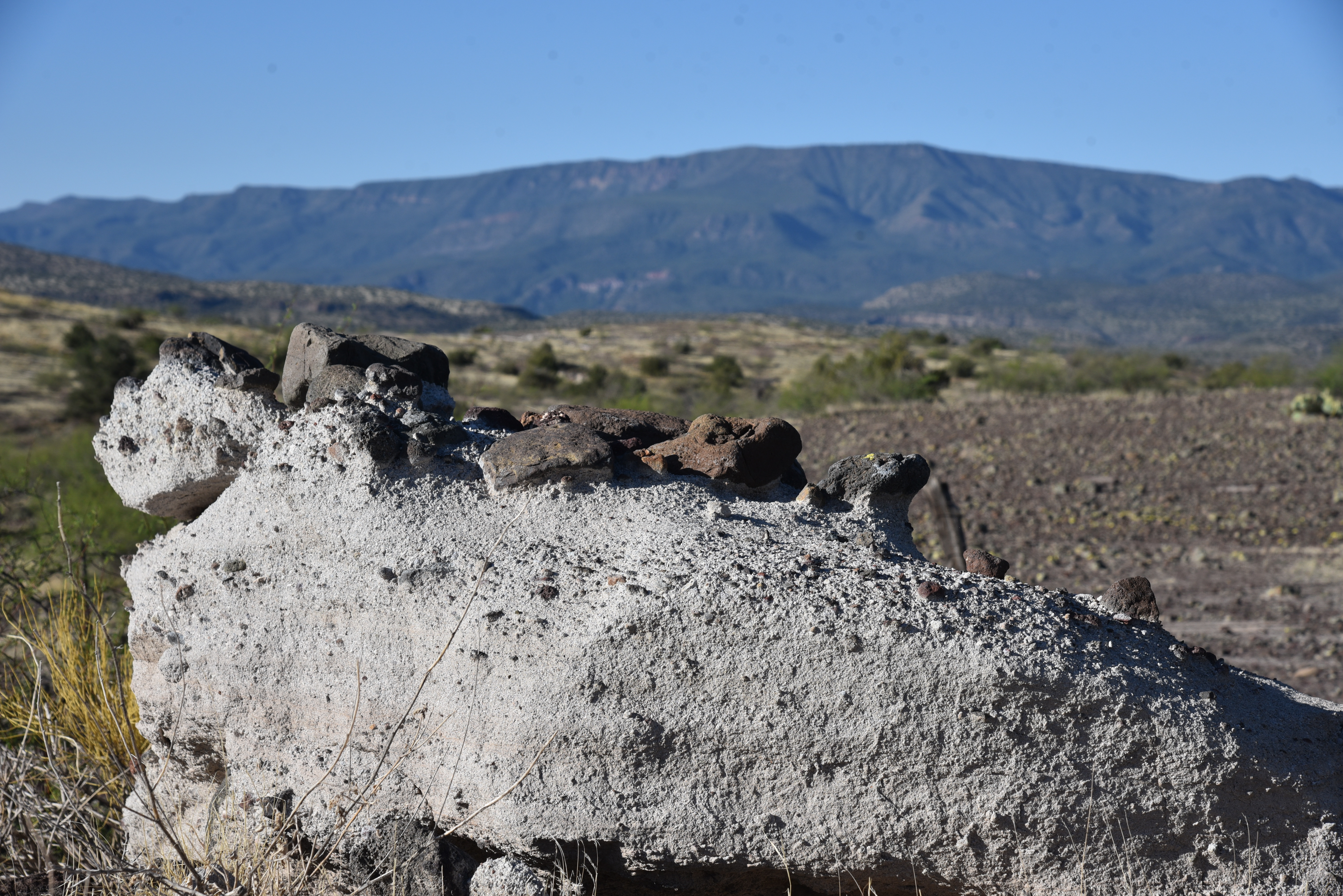
Chunks of basalt spill over volcanic ash on FR500

While the movie was filmed in what looks suspiciously like Joshua Tree National Monument, there’s a place in Arizona that could have provided a deeper sense of foreboding to the movie’s  bleak and tense theme.  Located 10 miles east of Camp Verde, the Cottonwood Basin Fumaroles in Coconino National Forest would make for a believable backdrop for mutant ants. 
Strawberry hedgehog flower among basalt & ash

The USGS defines fumaroles as “vents from which volcanic gas escapes into the atmosphere. Fumaroles may occur along tiny cracks or long fissures, in chaotic clusters or fields, and on surfaces of lava flows and thick deposits of pyroclastic flows. 
FR500 overlooking the fumaroles

They may persist for decades or centuries if they are above a persistent heat source or disappear within weeks to months if they occur atop a fresh volcanic deposit that quickly cools.” Geologists say that the Cottonwood Basin Fumaroles formed from volcanic ash deposited by nearby Hackberry Volcano that fell on an ancient freshwater lake about 7 million years ago.  The ash hit the calcium-rich water forming cement-like layers from which stream vented. 
Mountain vistas on FR 500

Over millions of years, the lake dried up and softer ash eroded away, leaving conical, honey-combed formations of petrified ash behind.  Locally known as the Tee Pee Rocks, the strange-looking array is tucked away in a shallow canyon just a few steps off Fossil Creek Road.  Visitors travelling on FR708 heading toward Fossil Creek Wild and Scenic River Sites usually fly right by this curious side attraction.  But a short hike leads to a couple of overlooks for views of the odd geological features.
Overlook on FR 500A

To visit the site, hike one mile downhill from the parking area off SR260 at Fossil Creek Road to FR 500 on the right where there’s a large primitive camping area. Then, hike 0.3-mile on FR 500 to an overlook.  Below, the chain of fumaroles appear as a sort of Pompeii-meets-Wat-Arun or Namibian termite hills gone wild.  With a nod to sugar-loving atom ants, “piloncillo ant hills” would be an apt description as well.

Scrambling down into the basin is not for amateurs. The area is rife with loose rocks, slippery inclines and hidden cracks poised to twist ankles. This is also prime rattlesnake habitat.  The fragile formations may have survived 7 million years of exposure, but it wouldn’t take much abuse from humans to destroy what’s left. So, it’s best to leave them alone and take in the sights from the overlooks. A second overlook is at the end of super-short FR500A, which starts at the camping area.  

Ash and xenoliths along Fossil Creek Road

Although the Tee Pee Rocks are the main attraction of this hike, that’s not all there is to see.  Geology nerds are treated to all manner of volcanic debris along the way.  Road cuts expose layers of volcanic rock, odd outcroppings stuffed with xenoliths and fields of colorful basalt blobs atop chalky slabs of hardened ash—all backed by cinematic mountain views.  Whether hiked alone or as a detour on the way to Fossil Springs, viewing the Tee Pee Rocks is a must-do for fans of Arizona weirdness.

Back home, re-imagine the hike by watching “Them!” with a sugary treat.  It’s probably streaming somewhere.

LENGTH: 3.7 miles round trip

RATING: moderate

ELEVATION:  3,429 – 3,315 feet

GETTING THERE:

From Interstate 17 in Camp Verde, go 10 miles east (toward Payson) on State Route 260 to Fossil Creek Road (Forest Road 708) on the right.  Park in the designated spaces. 

LEARN MORE ABOUT FURMAROLES:

https://www.usgs.gov/news/earthword-fumarole


Monday, September 9, 2024

Sandrock Canyon

SANDROCK CANYON

An Arizona Sister alights on Gambel oak

Arizona Sisters are hard to ignore.  Adorned with distinctive white markings and orange wing tips the eye-catching butterflies are familiar sights in oak woodlands. 

FR9361A crosses Sandrock Canyon

Native to Central America and the American Southwest, Adelpha eulalia are easy to spot flitting among oak canopies from late spring through fall.
Fossil Springs overlook at end of FR9361A

Unlike many other butterflies, this colorful species with a wingspan of 3 to 5 inches does not normally feed on flowers.  
Sandstone ledges over Fossil Springs Wilderness

Oak trees are their host plants and primary food source, but they can also be observed perching around mud puddles and water holes. 
Arizona Sisters stand out in oak forests

The pine-oak woodlands and riparian canyons of Arizona’s Mogollon Rim provides ideal habitat.  They have a knack for finding beautiful places to live and produce three or more broods per year between March and December.  Hikers can take a step into their terrain by seeking out quiet trails and backroads located between 4,000 and 8,000 feet in elevation where several species of native oaks thrive.  
Amazing views from above Fossil Springs

Forest Road 9361A in Coconino National Forest departs from a who-knew trailhead 27 miles east of Camp Verde on State Route 260.
Agaves grow on the rim over Fossil Springs

 
The dirt two-track leads into prime butterfly territory with a jaw-dropping beautiful payoff at the end.

From the trailhead, the FR9361A heads through a barbed wire gate and a concrete tunnel under SR260. 

Sandrock Draw Tank on FR9361A

There are three wire gates along the route. Be sure to close each gate behind you. At the 0.3-mile point, the road is signed as FR9361D, but maps show it as FR9361A, either way, it goes to the same destination.  
Sandrock Draw Tank is a wildlife magnet

A short walk past the sign, pine-shaded Sandrock Draw Tank, a created waterhole, attracts a host of wildlife. 
Water hole near the FR9361Q junction

Birds, dragonflies and Arizona Sisters twitching along its muddy fringe are common sightings.  Sandrock Draw gradually widens becoming a canyon that feeds into Fossil Springs Wilderness.
Tunnel under SR260 at the trailhead

Just beyond the tank, the route heads left at a fork and continues to the 0.9-mile point where the route veers right at the FR9361H junction to stay on FR9361A.  Here, the road traces the Sandrock Canyon dipping and climbing through juniper meadows and Ponderosa pines with occasional mountain vistas peeking through dense tree cover.  

FR9361A ends just yards from the overlook

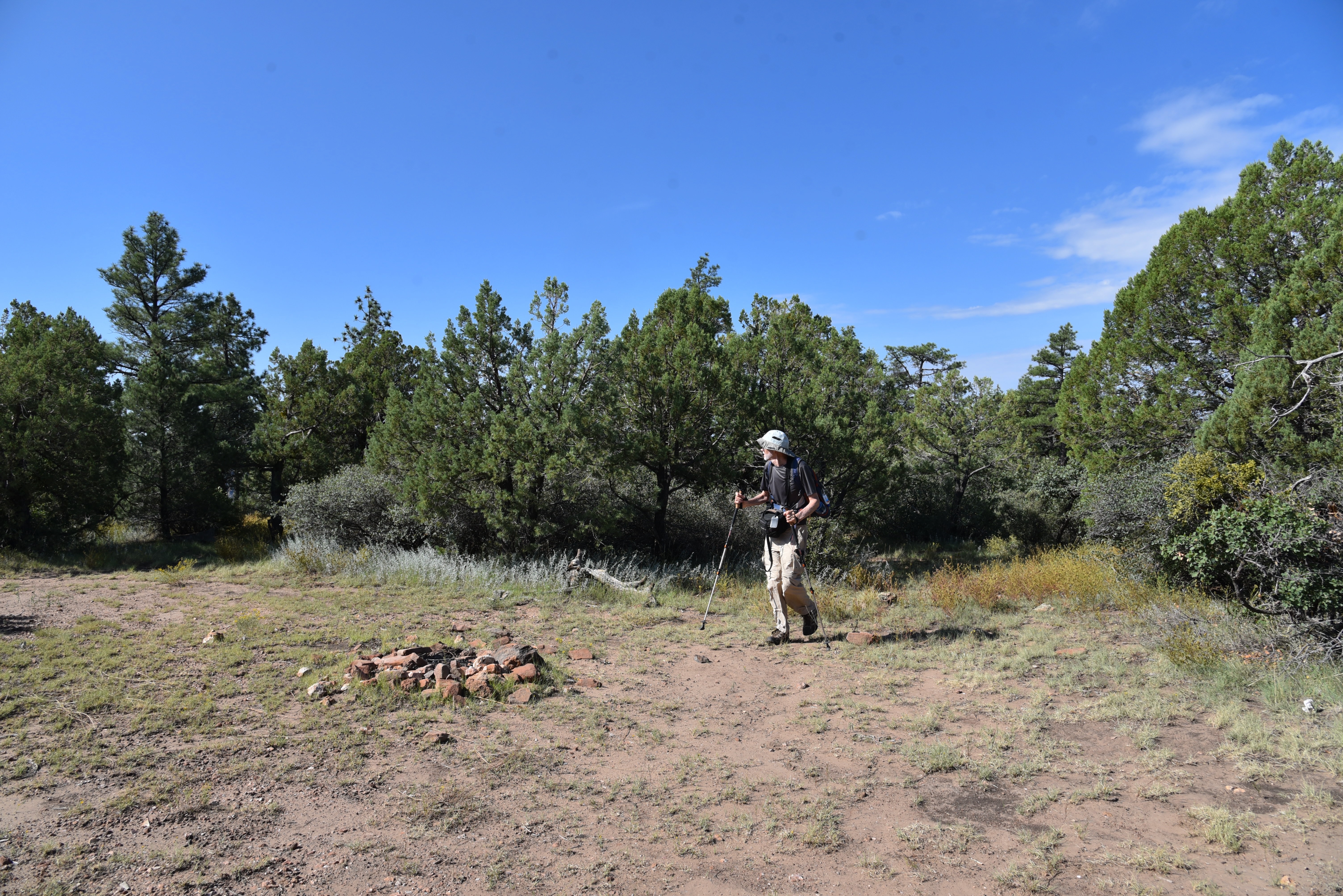
A major road fork at the 1.6-mile point is marked by a small water hole and the junction with FR9361Q.  The route heads right to again stay on FR9361A.  The final 0.8-mile leg of the hike passes through an enchanting green tunnel--bound to turn gold in autumn-- of Gambel oaks replete with Arizona Sister activity.  The lightly travelled dirt road narrows as it makes a moderate descent to its terminus at a non-descript circular campsite that belies the spectacle located just a few yards beyond. 
Mountain vistas from a sunny meadow

Faint game paths wind through a maze of agave, cacti and ancient Alligator junipers landing hikers at an overlook above Fossil Springs Wilderness.  Sandstone ledges protrude over a gorge that plunges 1,000 feet to the wilderness floor that’s home to Fossil Creek, one of Arizona’s most popular water-centric recreation areas. 
There are 3 gates on the hike. Close them behind you!

Broken agaves at the overlook

Free of the (permit-required) traffic and visitors splashing in the waterfalls, the view from above gives a seldom seen overview of the scope and magnitude of the 11,550-acre wilderness below.
Ponderosa pines shade the route


LENGTH:  4.8 miles roundtrip

RATING: easy

ELEVATION:  6,375 – 6,149 feet

GETTING THERE:

From Interstate 17 in Camp Verde, go 27 miles east (toward Payson) on State Route 260 to Forest Road 142 located past milepost 245 on the left.  Immediately past the cattle guard, turn left into a dirt parking area.  A high clearance vehicle is recommended.

The dirt parking area also serves as an access point for the General Crook Trail No. 130.