


Munds Park Trail System
 |
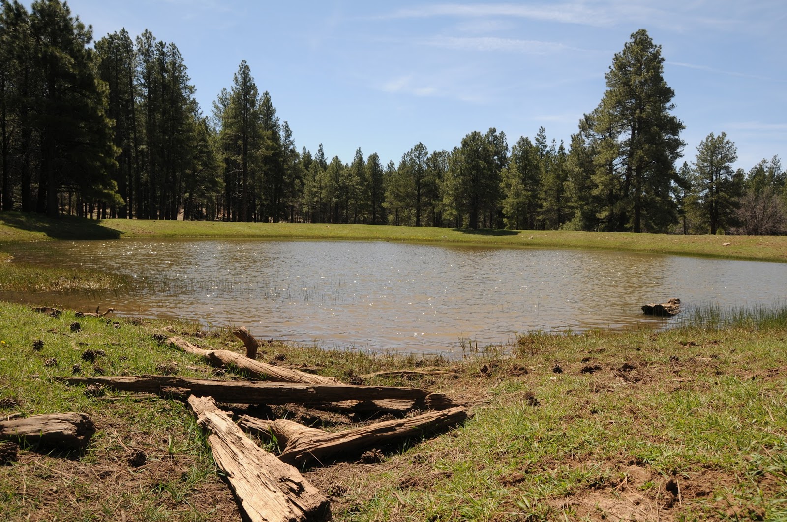
| Mud Tank |
 |
| Typical scene on the Mud Tank Trail |
The Iron Springs Trailhead serves as the system’s nerve
center with a map kiosk showing an overview of the entire matrix as well as
providing a launch point for the Mud Tank Trail, Brad’s Trail and Frog Tank Loop.
A good way to get warmed up before exploring the system’s
longer routes is to step out on the Mud Tank Trail. This effortless walk among Ponderosa pines is
open to hikers, bikers and equestrians and culminates at a stock pond. The watering hole is a quiet, pretty place surrounded by oak trees and a muddy fringe of animal footprints. A stroll along its perimeter
reveals the signatures of elk, deer, raccoons, birds and the familiar impressions
of dog paws. You’ll want to hang out for a while to absorb the songs of
Mountain bluebirds and Stellar’s jays riding on pine-infused breezes before
heading back to the trailhead to pick up Brad’s Trail. Named for forest service
volunteer Brad Bunsell (1958-2011) who, according to a tribute at the kiosk,
never met a rock he couldn’t move, the path serves as a non-motorized connector
to the Frog Tank Loop.
The mile-long trail is also the main artery for paths that access private communities. Look for directional signage tacked to
trees to stay on course. The Frog Tank Loop junction marks the beginning of a
delightfully irregular, 3.1-mile trip through thick, coniferous forests, sunny
meadows and scenic water features. Heading right from the junction, the route
descends on a rugged shared-use road to meet the distressed channel of an
intermittent stream.
Keep an eye out for motorized traffic while ogling the
eroded banks, reflecting pools and trickling rivulets. The loop connects to a
maze of forest roads that can cause confusion if you’re not paying attention. Just
look for the Frog Tank Loop signs at each intersection and you’ll be fine. As
the trail swings westward, it emerges into a moist, green pasture that drains
into Frog Tank. Only foot traffic is allowed around the pool’s sensitive berms,
so travel lightly or better yet, take a break beneath one of the massive trees
on the perimeter and try to spot some of the animals that come there to drink
and swim.
Beyond the tank, the trail crosses a canyon-bound waterway cluttered
with high-country wildflowers like Pine Thermopsis and wild roses before heading
uphill to a point just above the steep-walled passage. Once at the top of the
climb, look for a couple of spur paths leading to the lip of the gorge.
Carefully peer over the edge for dizzying glimpses of vertical basalt walls and
a log-jammed creek. Around the next bend, community paths and cabin rooftops
signal the end of the loop where you'll backtrack on Brad’s Trail to the start
point.
 |
| Frog Tank |
 |
| Meadow on the Frog Tank Loop |
 |
| Pine Thermopsis bloom April through July |
 |
| Intermittent stream on Frog Tank Loop |
LENGTH:
Mud Tank Trail: 1.6 miles roundtrip
Brad’s Trail: 2 miles roundtrip
Frog Tank Loop: 3.1 miles
RATING: easy-moderate
ELEVATION: 6500’ – 6700’
 |
| Sign on Brad's Trail |
GETTING THERE:
Iron Springs Trailhead:
From Interstate 17 in Munds Park, take the Pinewood Blvd
(Forest Road 240) exit 322 and continue 0.8 miles to Crestline Road. Turn left
and go 0.8 miles (road will turn into Oak Dr.) to Iron Springs Road, turn right
and go 0.2 mile to the trailhead gate. Park along the street, pass through the
gate and hike 0.3 mile to the big trailhead kiosk.
INFO: