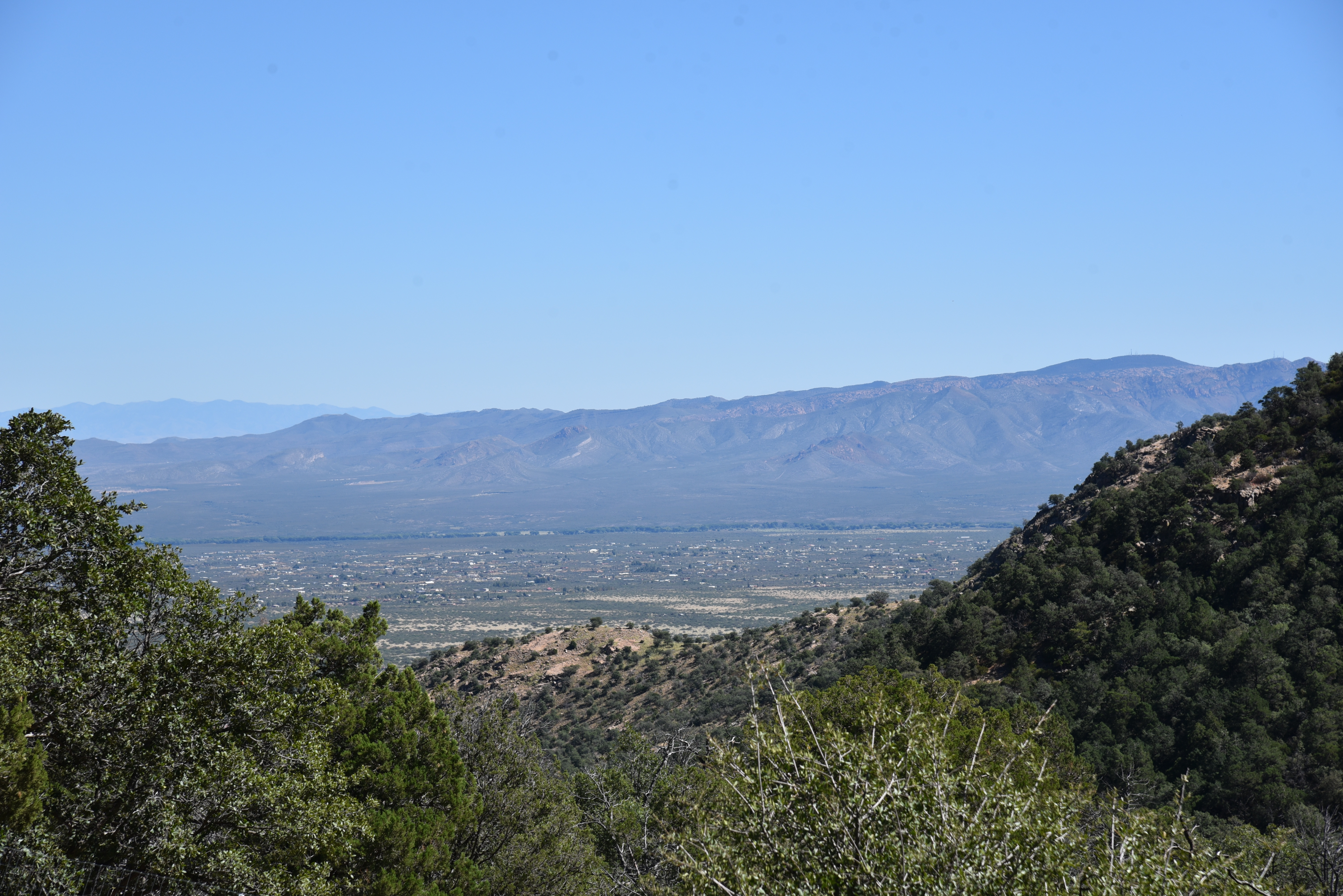
Find A Trail. Start Your Search Here:

Showing posts with label Coronado NF. Show all posts

Tuesday, April 11, 2023

Amerind Trails

NEW TRAILS COMING TO DRAGOON

Newly constructed trails at the Amerind Museum

Right around the turn of the century, I took a break at the Texas Canyon rest stop during a road trip from Willcox to Phoenix, looked out over the gorge below and thought, “Cool rocks. I wonder if there are any hiking trails in there.” 

Granite formations in Texas Canyon

Turns out, that particular slice of Chihuahuan Desert along Interstate 10 an hour east of Tucson where restaurants and roadside services are sparse, was on private property with no way for curious hikers to explore the wonderland of weathered igneous stone.
Trail designer Sirena Rana in Texas Canyon

That’s about to change, though.

Cottonwoods surround a pond on the Amerind Trails

 
This October, a 5.7-mile trail system is set to open in Texas Canyon on the Amerind Museum property in the community of Dragoon.

“Texas Canyon is so amazing,” says Sirena Rana founder of Trails Inspire and designer of the Amerind Trails. “ There’s so much interesting geology and a lot of people have wondered what it looks like inside.  Up until now, there were no public trails.”

Sirena Rana on the trail to whale rock

The stony parcel of Texas Canyon sits in the shadow of the Dragoon Mountains between the towns of Benson and Willcox. Nearby attractions like the Chiricahua National Monument, Cochise Stronghold, Willcox Playa Wildlife Area, Tombstone, Southern Arizona wineries and acres of Coronado National Forest are big draws for tourists and locals alike.

The tafoni rock in Texas Canyon

But Dragoon and the Amerind Museum remain comparatively under the radar.  The Amerind Museum is a sort of hybrid museum, art gallery and research facility dedicated to archeology, Indigenous cultures and Western art that’s been around since 1937.
Whale rock is a highlight of the Amerind Trails

Seeking to extend its reach, enrich visitor experience, and build interest in the area, museum officials contacted Rana after seeing her presentation on how trails can benefit communities to explore adding hiking trails to their property in Texas Canyon.

“When designing trails, the first thing I do is find the people who know about the land. Locals, neighbors, hikers and experts who know what’s special about the terrain,” Rana says.  “To me, the most important thing is to make trails accessible to all. I like a series of stacked loops that allow for a lot of options and are customizable for all levels of difficulty and lengths.”

Routing the 5.7 miles of trails through the dramatic, boulder-strewn terrain was tricky, but extensive site scoping and design research paid off.

Windmill with Dragoon Mountains on horizon

The whale trail departs from a picnic area

“We found routes by using the grasslands in between the rocks and natural granite passages while keeping close to interesting control points like cliffs, dramatic rock formations and ponds,” Rana shared. The careful planning has yielded unique pathways into some of the area’s standout geological wonders including a naturally sculpted tafoni rock and the (soon-to-be Instagram darling) whale rock.

Dragoon Mountains seen from Amerind Trails

The stone pillars, balanced rocks, slabs, grottos, spires, and fractured joints within the trail system are the result of millions of years of geological activity and weathering of quartz monzonite (aka granite) that crystalized underground.  As the land surface slowly eroded, the harder granite intrusion was exposed to the elements that would shape them into the bizarre forms seen today.
Golden corydalis color the grasslands Feb - Jun

For trail construction, Rana selected an Arizona company that specializes in building sustainable recreational trails that respect natural landscapes and cultural resources.

“For construction we used Flagline Trails, a Flagstaff-based contractor,” Rana says.  “They are incredibly talented and the crew did an amazing job. They took my design and made it as good as can be. The system has three access points, north and south loops plus an out-and-back trail to whale rock. There will be benches placed along the routes and signage and painted paw prints to mark the trails where they cross bedrock will be installed over the summer. The trails will be open for day use only .  There’s no camping at the site, but there are plenty of places to camp and stay in neighboring towns and in Coronado National Forest.”

Trail construction began on January 3, 2023 and wound up in April. 
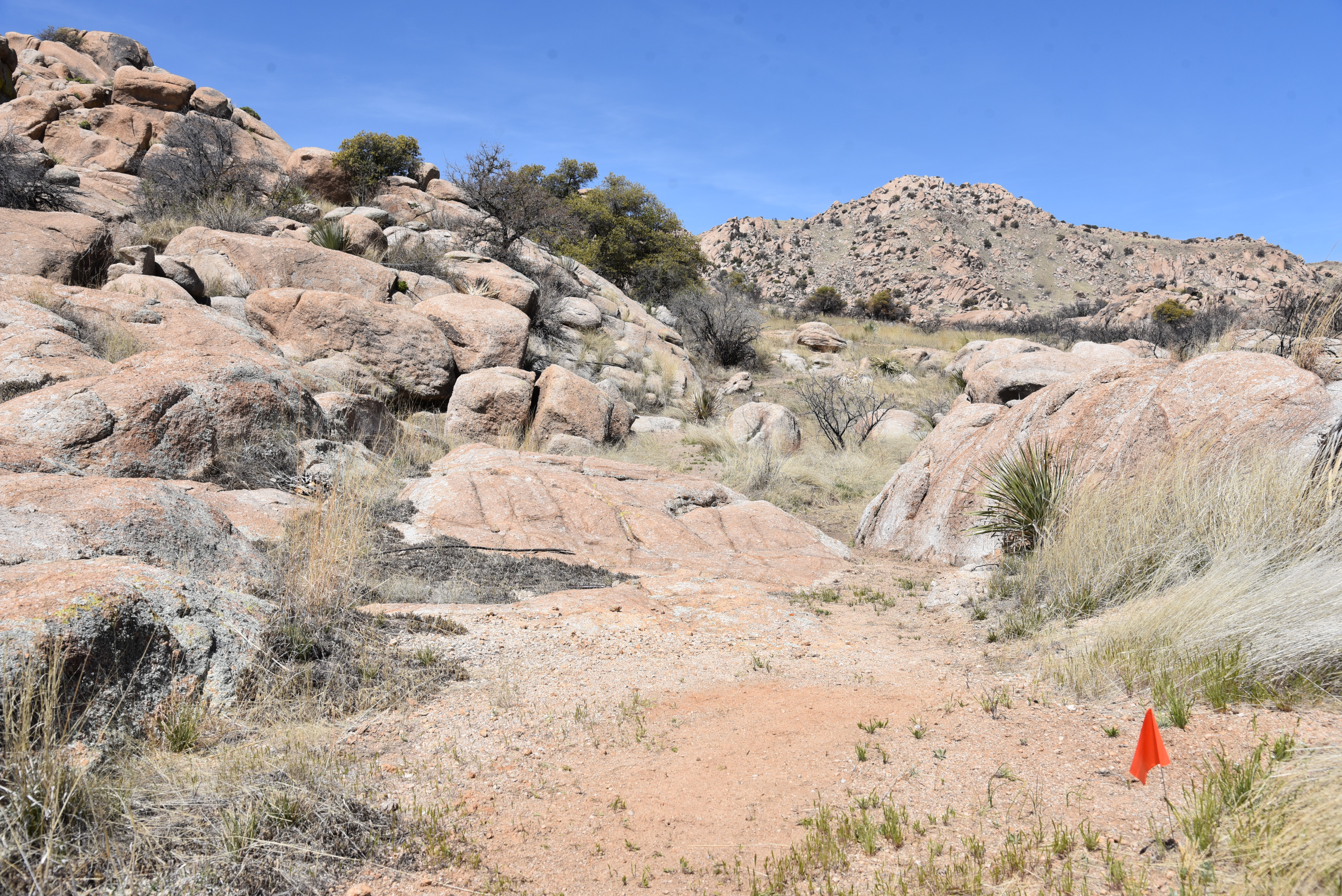
Painted paw prints will mark the trail where it crosses bedrock

Using “Amerind Trails” as a working title, official naming of the trails is in the works. “We handed off the naming of trails, and signage placement with our recommendations to the Amerind Foundation,” Rana says. “I’m thrilled with how the trails turned out and they are sure to be a great contribution to the community.”
Interesting geology dominates the landscape

A grand opening event will be scheduled for October and if all goes as planned, the community of Dragoon is going to need a restaurant.

LENGTH: 5.7 miles

RATING: easy-moderate

ELEVATION: 4,643 - 4,873 feet

GETTING THERE:

Amerind Museum

2100 N. Amerind Rd., Dragoon, AZ.

From Interstate 10 south of Tucson, take the Dragoon Road exit 318 and follow the signs 1 mile south to the Amerind entrance on the left.  

HOURS: The museum is open Tuesday – Sunday 10 a.m. – 4 p.m.. Closed on major holidays. Trails will be open for day use only.

There’s no camping on the property, but there are nearby campgrounds and lodging.

FEE: $10 - 12

FACILITIES: picnic tables, restrooms, museum exhibits and events

INFO:

TRAILS WILL OPEN OCTOBER 7, 2023.

Amerind Museum

amerind.org

Trails Inspire LLC

trailsinspire.com

Flagline Trails LLC

flaglinetrails.com


Monday, October 11, 2021

Miller Canyon

MILLER CANYON

Miller (L) and Carr (R) Peaks seen from Miller Canyon

Arizona’s isolated mountain ranges known as “sky islands” are like no other places on earth.  Whether explored by car, like a drive up the Swift Trail to Mount Graham in the Pinaleno Mountains near Safford or a by foot in the Santa Catalina range in Tucson, the vertical journeys take travelers from sweltering desert valleys to cool alpine climes over just a few, very steep miles.

Oaks arch over the lower end of Miller Canyon

Some of the most interesting sky island destinations are in the Huachuca Mountains located near Sierra Vista in the Coronado National Forest in southeastern Arizona. 

Aspens glow in autumn gold below Miller Peak

Rich in both biodiversity and human history, the chain of ragged peaks and crests that jut abruptly from the desert floor are laced with dozens of hiking trails that wind through breezy grasslands, streambeds, canyons, mineral-imbued escarpments and exposed pinnacles for myriad exploratory opportunities.
Hike is in the Miller Peak Wilderness area

One of the easiest to get to is the Miller Canyon Trail No. 106.

Massive boulders line the trail in Miller Canyon


The 3.5-mile route begins by circumventing a slice of private property before heading out on a former mining road.  Within a few yards from the trailhead, views of the San Pedro Valley and the Mule Mountains around the town of Bisbee peek out from a fringe of oak trees and high desert scrub and cacti.

View of the San Pedro Valley from the trail

Pines and Douglas fir trees shade the upper trail

 This little tease of vistas is the last glimpse offered before the route enters the Miller Peak Wilderness area and slips into a riparian zone at the head of the canyon. 
Trail climbs from desert scrub to alpine aspens

Shaded by gigantic sycamore and walnut trees, the green oasis is fed by an intermittent stream that flows from springs and runoff originating high in the hills above.  The path gradually leaves the high desert vegetation zone and moves into a wetter, canyon-bound corridor of big-tooth maples and soaring canopies of arching oaks. 
The area has dozens of connecting trails

The trail crosses the streambed several times as it works its way uphill, hugging the edge of the sliver-thin canyon cluttered with flood debris and boulders. 
Bigtooth maples clutter a drainage

Some of the crossings expose rusty 19-century pipes that were once used to funnel water to nearby towns.  As the trail gains elevation and contracts from wide dirt road to thin footpath, pine and Douglas fir trees dominate the forest, keeping the trail nice and shady for a good part of the way.
Desert and forest biozones collide in Miller Canyon

The climbing is steady but not too difficult until around the 1.5-mile point where the first set of switchbacks herald the start of the serious lung workout ahead.  This is about where relics from defunct mining operations begin showing up in oxidized heaps off the trail. 
The trail crosses several drainages

Look for gears, a boiler and miscellaneous parts disintegrating among abandoned digs. 
Climbing gets steep on the switchbacks

A second set of switchbacks make a final, more aggressive ascent, passing by distinctive Bathtub Spring to meet the Crest Trail No. 103 on an aspen-dotted ridge between Carr and Miller Peaks.
Defunct mining equipment decorates the trail

Now clear of the thick tree cover and confines of the canyon, hikers get a second shot at gorgeous mountain and valley vistas. 
Looking into Mexico from Miller Peak summit

The Crest Trail marks the end of the Miller Canyon Trail, however, it also provides access to the spur trails that ascend both peaks.  
Sycamore trees shade the lower trail

From the junction, it’s another 1.3 miles to 9,230-foot Carr Peak or 2.3 miles to 9,466-foot Miller Peak. Miller Peak, which is located just 4 miles from the Mexico border, holds the distinction of being the southernmost high peak in the United States and is a must-do for mountain-obsessed Arizona hikers.

LENGTH: 7 miles round trip

With Miller Peak: 11.4 miles round trip

With Carr Peak: 9.4 miles round trip

RATING: difficult

ELEVATION: 5,750 – 8,525 feet, Miller Canyon Trail only.

5,750 – 9,466 feet with Miller peak

5,750 – 9,230 feet with Carr Peak

GETTING THERE:

In Sierra Vista, go 9 miles south on State Route 92 to Miller Canyon Road (Forest Road 56) on the right.  Continue 2.5 miles on FR 56 to the Miller Canyon trailhead at the end of the road.  Forest Road 56 is a narrow dirt road with some rough spots.  While carefully driven sedans can get through, a high-clearance vehicle is recommended.  Hike begins near the stop sign.

INFO:

Coronado National Forest

https://www.fs.usda.gov/recarea/coronado/recarea/?recid=25496

Learn more about sky islands:

https://skyislandalliance.org/the-sky-islands/

Monday, October 26, 2015

JOE'S CANYON-YAQUI RIDGE

PASSAGE 1
Arizona National Scenic Trail
Start of the Arizona Trail at the U.S.-Mexico border

If you're reading this, you might be a hiker who has been motivated to take a good long trek by recent movies like Wild and A Walk in the Woods . While these inspiring films romanticize long distance hiking, it's important to do your homework and manage your expectations before hitting the trail.
Here in the Southwest, the obvious draw for a marathon hike is the 817-mile Arizona Trail.
Like many people with a day job whose long-term plans include hiking the entire route from Mexico to Utah, I've been chipping away at the miles in opportunistic grabs and passage-long chunks.
Turns out, this bit-by-bit style is the way most hikers approach the Arizona Trail. Sirena Dufault, AZT Gateway Community Liaison says," You don't have to hike the entire AZT to enjoy it. It's a "choose your own adventure", where you decide how much of a challenge is comfortable for you. Hikers who have completed the trail range from age 19 to folks in their 70s. Some have done it in 21 days while others section hike it for a decade or more." Shawn Redfield, AZT Trail Director concurs. "A through- hike is nothing more than a bunch of section hikes done in series with resupply breaks in between. Preparation is critical, though. There is a small portion of hikers who are not prepared and as the popularity of long distance hiking grows, fueled by recent movies based on it, this translates into hikers who become a danger to themselves and the people who will come to help them."
Redfield adds that research and conditioning for a though-hike can take months and that it's vital to understand the AZT's special challenges of water scarcity, heat, elevation change and remote terrain where rescue is not an option. (Become a member of the of AZT Association to get access to tons of current trail information, water data and opportunities to speak with others who have conquered the route: http://www.aztrail.org/membership/join.html).

On October 24th, I stood at the U.S.-Mexico border where a simple sign denotes the beginning of the AZT. It took me 12 years to get there. Having hiked parts of Passage 1 from Montezuma Pass, through Miller Peak Wilderness (with a side trip to the 9,466' peak) and on to Parker Canyon Lake, this last mile was one of several blaring holes on my progress map. Prior attempts had been rained out, burned out or thwarted by schedule conflicts, so I vowed to bite the bullet and hike rain-or-shine to bridge this gap by the end of 2015. Rather than starting at the traditional Montezuma Pass trailhead, I chose to approach from the Coronado National Monument Visitor Center by hiking 2.4 miles on the Joe's Canyon Trail then 1-mile south on Yaqui Ridge Trail (AZT) to the border. This exceptional trek begins with a 1,400 foot ascent up a rugged drainage to Smuggler's Ridge, a knife-edge saddle with see-forever views overlooking the Mexican State of Sonora. The final mile makes a 600 foot decent to a border monument that marks the beginning (or end) of Arizona's most epic journey. Next up in my gap-plugging adventure: the Mazatzal Divide.
LENGTH: 6.8 miles roundtrip
RATING: moderate
ELEVATION: 5,006' - 6,493'
GETTING THERE:
From Tucson, travel south on Interstate 10 to State Route 90 Exit 302 and go 25 miles south to Sierra Vista. Connect with State Route 92 and continue 16 miles to S. Coronado Memorial Drive and follow it 4.7 miles (road becomes E. Montezuma Canyon Road) to the Coronado National Memorial Visitor Center (open 8 a.m. to 4 p.m. daily. Closed Thanksgiving and Christmas). Trail begins a few yards up the road beyond the center. Parking is free. Restrooms.
INFO:
Coronado National Memorial:
MORE PHOTOS:

Tuesday, September 29, 2015

FOOTHILLS & GUINDANI TRAILS

ABOVE GROUND HIKING AT KARTCHNER CAVERNS STATE PARK
Hikers on the Foothills Loop Trail

When massive blocks of Mississippian Escabrosa Limestone get jostled around by eons of geological turbulence, the results can be both transformative and magical. The Whetstone Mountains south of Benson are a good example of earth's dynamic forces at work. The range began when sediments at the bottom of an ancient inland sea solidified into layers of soft rock. Multiple episodes of faulting and uplifting formed the skyline of peaks that soar to over 7,000' and a chunk of limestone that slipped off the range's eastern flank that became the incubator of a celebrated natural wonder. From the outside, this slipped block appears as an unspectacular, ocotillo-studded hill. But inside, are the water-sculpted wonders of Kartchner Caverns State Park. Within the living wet caves, mineral deposits built over hundreds of thousands of years are still growing. It's like walking through a stadium-size geode.
Cave tours must be scheduled in advance. The half-mile excursions are naturally lit (no amusement park theatric here) and set to a soothing soundtrack. Guides tell the story of the cave's discovery and describe the science behind the bizarre formations that hang like melted wax, pulled taffy and flowing sheets of "liquid" stone. After the tour, you'll want to check out two above-ground hiking trails that explore the Chihuahuan semi-desert grasslands and oak-juniper forests that surround the property. The Foothills Loop Trail winds though a riparian area, savannah-like pastures and sandy washes with breathtaking mountain views. This hike is augmented with numbered posts that correspond with a free trail guide available at the Discovery Center. For a more challenging trek, the Guindani Trail #398 leaves the Foothills Trail, crosses into Coronado National Forest and makes a 1,000' climb to a scenic saddle where the peaks of the Huachuca Mountains near Sierra Vista hover over Arizona's border with Mexico.
LENGTH:
Foothills Loop: 2.5 miles
Guindani Trail # 398: 4.2 mile loop
RATING:
Foothills: moderate
Guindani: difficult
ELEVATION: 4,750' - 5,620'
GATE HOURS: 7 a.m. - 10 p.m.
GETTING THERE:
From Tucson, take Interstate 10 east to exit 302 for State Route 90 (Sierra Vista/Fort Huachuca). Go 9 miles south on SR 90 to the park entrance on the right.
Cave Tour Reservations:
520-586-2283

Tuesday, March 27, 2012

Springtime hike in the Santa Catalina Mountains

ASPEN-MARSHALL GULCH LOOP
Pusch Ridge Wilderness

Half blaze-ravaged moonscape, half creek side woodland, this famously crowded loop hike makes for an interesting first-hand look at the cycle of wildfire forest destruction and subsequent regeneration.
Willowy, white-barked aspens--the quintessential trees of mountain climes--depend on fire for their survival. This species needs lots of sunlight to grow and reproduce, and their natural lifecycle includes succumbing to the shade and crowding brought on by encroaching conifers. When wildfires clear the trees and open the forest floor to sunlight, aspens shoot up rapidly, and right now, they’re having a heyday on the slopes of Mt. Lemmon.
A hike on the Aspen-Marshall Gulch loop showcases this miracle of nature in progress. The tour begins on Aspen Trail #93, progressing uphill through a patchwork of burned areas, fir woodlands and clusters of aspens. Soon, the path enters a dell of slender white-trunk sprouts with vivid green leaves that rustle and sway in a graveyard of charred pine stumps. Beyond this point the route ducks in and out of scorched tracts and intact woodlands before emerging on a sooty, snag-cluttered saddle. Here, the dramatic effects of recent blazes draw visceral reactions. It’s a charred and barren scab of a place. The trail gets a bit sketchy in this area, so watch for cairns leading up to the junction with Marshall Gulch Trail #3. Here, the route leaves the ashen badlands passing through a labyrinth of stone before heading downhill and into another world replete with creek side maples, ferns and alders rounding out the dichotomous flavor of this hike.
View from Aspen Trail

LENGTH: 5.1-mile loop
ELEVATION: 7,410 – 8,400 feet
RATING: difficult
DISTANCE FROM PHOENIX: 158 miles one-way
GETTING THERE:
Aspen sapplings
From I10 in Tucson, take the Grant Road exit 256 and go 8.7 miles east to Tanque Verde Road. Turn left and continue 3.4 miles to Catalina Highway go left and drive uphill 27 miles through Summerhaven to the end of the road at the Marshall Gulch picnic area. Roads are 100% paved.

FEE: $5 Catalina Highway daily fee per vehicle
FACILITIES: restrooms, picnic area,
INFO: Santa Catalina Ranger District, Coronado National Forest, (520) 749-8700

Monday, August 29, 2011

BUTTERFLY TRAIL

BUTTERFLY TRAIL
Santa Catalina Mountains

Five thousand feet below the Butterfly Trail #16, the San Pedro River drifts in placid meanders through a hazy desert basin separating southeastern Arizona’s Santa Catalina and Galiuro Mountain ranges. In addition to vertigo-inducing views, this trail offers a lot of variety in terms of bio diversity and interesting side trips. From the upper trailhead, the hike begins as a pleasant stroll in the woods. For those looking for an easy outing, it’s best to start at this end and turn around before the trail begins its 2,000-foot dip down the mountain. Over its pitchy course, the trail passes through a medley of fir-pine, juniper, yucca, moist seep areas and fire damaged segments where charred stumps cling to sheer slopes. Near the midway point, the dribbling water of Novio Spring fosters an oasis of flowering shrubs, nodding columbines and the butterflies for which the trail is named. Below the spring, Novio Falls spews an intermittent veil of water over bare rock. There’s also an informal path (usually marked with red trail tape) leading to the wreckage of a 1957 F-86 plane crash located a half mile past the spring. Two trailheads access this route, so it can be hiked either as an out-and-back or in two-car exchange style.

LENGTH: 5.7 miles one-way
ELEVATION: 6,500 – 8,500 feet
RATING: moderate-difficult
DOG RATING: fair
KID FRIENDLY:  somewhat
DISTANCE FROM PHOENIX: 153 miles  one way
GETTING THERE:
UPPER BUTTERFLY TRAILHEAD:
From I10 in Tucson, take the Grant Road exit 256 and go 8.7 miles east to Tanque Verde Road. Turn left and continue 3.4 miles to Catalina Highway go left and drive uphill 22.5 miles to the trailhead on the right. Roads are 100% paved.
FACILITIES: restrooms

LOWER BIGELOW TRAILHEAD:
From I10 in Tucson, take the Grant Road exit 256 and go 8.7 miles east to Tanque Verde Road. Turn left and continue 3.4 miles to Catalina Highway go left and drive uphill 19.5 miles to the Lower Bigelow trailhead on the right. Roads are 100% paved. FACILITIES: restrooms, water


FEE: $5 Catalina Highway daily fee per vehicle
INFO: Santa Catalina Ranger District, Coronado National Forest, (520) 749-8700

Saturday, August 20, 2011

WEBB PEAK-ASH CREEK LOOP

WEBB PEAK-ASH CREEK LOOP.
Ash Creek Falls

UPDATE: This area was heavily impacted by the June 2017 Frye Fire. Closures may be in effect. Check before going. https://inciweb.nwcg.gov/incident/5221/
Brushing the clouds at nearly 10,000 feet in elevation, Webb Peak hovers above the Gila Valley where, in summer, triple digit heat hangs in a stifling haze. 
Getting into the refreshing climate of the Pinaleno range involves a scenic drive up the Swift Trail, which rises 6,400 feet over 29 miles. Temperatures drop as the road passes through desert scrub, juniper chaparral and oak woodlands before entering thick coniferous forests where it’s typically 20 degrees cooler than at the base of the mountain. From a distance, the summit looks formidable.
In reality though, hiking to the top of this peak is only moderately challenging and when combined with a side trip to nearby Ash Creek Falls, makes for a memorable journey.
Rushing water, alpine meadows, a fire tower, mountain slopes fleeced in spruce and fir, far-reaching summit views and dozens of hiking trails make this southeastern Arizona “sky island” (isolated peaks surrounded by arid environments) a popular summer destination. 
HIKE DIRECTIONS: From the Columbine trailhead, hike 0.5 mile north on Ash Creek Trail #307 to the Webb Peak Trail #345 junction.  Veer right here and continue on #307 to the 1.7-mile point where the trail splits.  Take the right stem and go 0.7 mile to the falls.  From here, backtrack to the Webb Peak junction and head uphill. The route crosses the summit and loops back to the Columbine trailhead.

LENGTH:  8.1 miles roundtrip
ELEVATION: 9,120’- 9,960’
RATING:  moderate
DOG RATING:  moderate
KID FRIENDLY: just okay--steep climb on the way out
DISTANCE FROM PHOENIX:  204 miles one-way
GETTING THERE:
From Safford, go 8 miles south on US 191 to 1st Ave (signed “Willcox”) and turn right.  Follow this road, which will become Swift Trail (AZ 366) 29 miles to the Columbine corrals and trailhead on the right just past the information center. Road is paved for 22 miles, then turns to maintained dirt suitable for passenger cars.  There are restrooms at the trailhead.

INFO: Safford Ranger District, Coronado National Forest
(928) 428-4150
MORE PHOTOS:

Friday, July 15, 2011

ROSE CANYON LAKE

ROSE CANYON LAKE
Santa Catalina Ranger District, Coronado National Forest
With its pleasantly cool, canyon location on Mt. Lemmon, nearby camping, and convenient access to restrooms, drinking water and even a snack shack, Rose Canyon Lake draws the crowds on hot summer days. A 0.4-mile paved trail on the west side of the lake stays close to the water and is suitable for strollers, wheelchairs and walkers while a dirt trail on the opposite bank climbs to scenic rocky perches. Both trails are complemented by seating and plenty of shade making for effortless exploring around this tiny high altitude lake.


LENGTH: 0.7 mile total
ELEVATION: 7,000’
RATING: easy, partially barrier free
DOG RATING: dogs must be on leash and stay out of the water
KID FRIENDLY? absolutely
DISTANCE FROM PHOENIX: 150 miles one-way
GETTING THERE:
From I10 in Tucson, take the Grant Road exit 256 and go 8.7 miles east to Tanque Verde Road. Turn left and continue 3.4 miles to Catalina Highway, go left and drive uphill 17 miles to the turn off for Rose Canyon Lake (FR 9) between mileposts 17 and 18 on the left. Follow the access road to the end. Roads are 100% paved.
FEES: There’s a $5 Catalina Highway daily fee per vehicle and an $8 day use fee per vehicle at the lake.
FACILITIES: restrooms, supply store, camping, picnic area, drinking water
PROGRAMS: interpretive programs, fishing, no swimming or boating
INFO: Santa Catalina Ranger District, Coronado National Forest, (520) 749-8700

Monday, August 10, 2009

ROMERO POOLS

“THE POOLS” Catalina State Park, Tucson Hemmed in by the stony slopes of Tucson’s Santa Catalina Mountains, Romero Canyon Trail #8 switchbacks uphill through classic high-desert terrain, revealing amazing views at every turn. At roughly the three-mile point, the ocotillo, creosote and Palo verde-studded hillsides give way to an oasis of waterfalls and swimming holes scoured out of Precambrian rock imbedded with streaks of glimmering quartz. Here, the perennial waters of the Romero Pools foster a green zone of riparian plant life. A tangle of moisture-loving plants including cattails, cottonwood and velvet ash flourish in the canyon’s drainage providing a cool and shady respite from the surrounding desert heat. It’s smart to hike this one early in the day to avoid brutal afternoon heat. HIGHLIGHTS: Unlikely pockets of cool water and riparian vegetation in the middle of the high desert. LENGTH: 6 miles roundtrip RATING: moderate ELEVATION RANGE: 2,700 – 3,600 feet NOTE: dogs are not allowed DRIVING DISTANCE FROM PHOENIX: 130 miles one-way GETTING THERE: From Phoenix, travel south on I-10 to exit 240 (Tangerine Road). Continue 13.5 miles to stoplight at Oracle Road (Highway 77), go right (south) and follow the signs to the park entrance near milepost 81. Once inside the park, follow the main road 1.5 miles to the Romero Canyon trailhead. FEES: $7 day use fee per vehicle.
INFORMATION: Catalina State Park, 520-628-5798,   http://azstateparks.com/

Monday, March 9, 2009

MAVERICK SPRING

MAVERICK SPRING Coronado National Forest This secondary path is a pleasant and shady detour to a secluded seep area. To find this hidden gem, start out on the Green Mountain trail and hike for roughly 1.5 miles to the sign for “Maverick Spring” (ignore the negative graffiti that’s scrawled onto the metal post) and continue downhill to a cozy enclave where canyon grapes and wild raspberries thrive in the damp soil. LENGTH: 0.8-mile side trip RATING: easy ELEVATION: 6000'-7300' GETTING THERE: see Green Mountain entry

GREEN MOUNTAIN

GREEN MOUNTAIN Coronado National Forest Clinging to the slopes along scenic Catalina Highway in Tucson, the Green Mountain trail winds through a wilderness of wind-sculpted granite boulders. The steep, rugged route rambles among bizarre stone outcroppings--never straying far from the edge of the mountain and views of the yawning San Pedro River Valley below. Recent wildfires in the area (Ignore my personal snark: “there is no global warming, there is no global warming” ) have destroyed large portions of the forests that formerly shaded the trail. However, the spectacular vistas that have opened up as a result, make up for the loss. To really appreciate this trail, be sure to explore the spur paths that lead to lookout points on the cliffs where dizzying views of the surrounding mountain ranges fill the horizon. Even though this trail hovers between 6,000 and 7,300 feet in elevation, it still gets very warm in the summer months so, it’s best to plan an early start. LENGTH: 7.2 miles round-trip RATING: difficult ELEVATION: 6000' - 7300' FEE: $5 daily fee per vehicle. Exact change is required at the self-serve pay station. GETTING THERE: From Phoenix, take Interstate 10 to Tucson. In Tuscon, exit I-10 at Grant Road (exit 256). Go left on Grant Road and continue to Tanque Verde Road. Go left on Tanque Verde and continue to the turn off for Catalina Highway. Follow Catalina Highway for about 22 miles to the Upper Green Mountain trailhead (just before the San Pedro Vista Lookout area). INFORMATION: fs.fed.us/r3/Coronado (520) 388-8300