


HORSE CROSSING TRAIL
 |
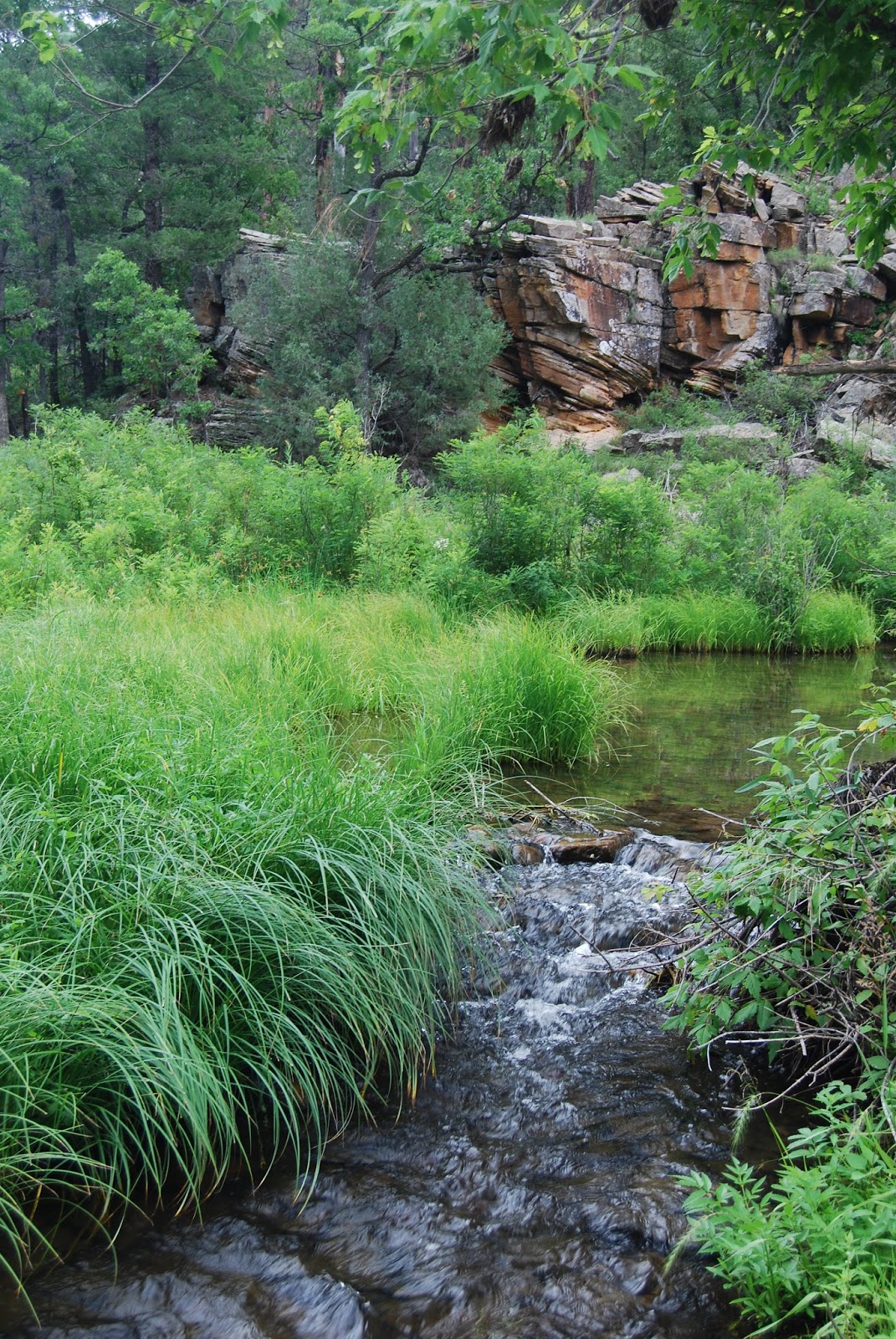
| East Clear Creek |
A leisurely amble through the pristine
and complex canyon system of upper East Clear Creek reveals wonders
that even the most well traveled Arizona hikers will find astounding.
There’s the epic views from the coniferous forest rim, a scenic
drop into the canyon along a fossil-encrusted limestone trail, and an
emerald-green riparian environment along the water.

Sandwiched between two reservoirs, East
Clear Creek slices into soft sedimentary pediments leaving behind a
meandering sheer-walled canyon. This 50-mile-long ribbon of
life-giving water flows northeast from Blue Ridge Reservoir to Clear
Creek Reservoir near Winslow where it merges with the Little Colorado
River. sandstone walls that
look like dunes tilted on their sides in layer-cake formation. Tens
of millions of years ago, the landscape surrounding East Clear Creek
was part of a vast ocean and the fossilized remains of sea-dwelling
algae, coral and brachiopods are strewn about like scattered bones.
Like all of the “crossing” trails on the Mogollon Rim, this one
continues up the opposite side of the canyon. Although traversing the entire length of this gorge would involve
technical climbing skills, swimming and rafting, all that’s needed to
hike the Horse Crossing trail #20 is a pair of boots, water and a day pack.
Exploring the mid-section of the creek, Horse Crossing is hemmed in by vertical rock escarpments. At the bottom of the canyon, running
water sculpts sandstone walls that look like dunes tilted on their sides
in layer-cake formation. Tens of millions of years ago, the landscape
surrounding East Clear Creek was part of a vast ocean and the fossilized
remains of sea-dwelling algae, coral and brachiopods are strewn about
like scattered bones. Like all of the “crossing” trails on the Mogollon
Rim, this one continues up the opposite side of the canyon. However,
it’s more fun to follow fisherman paths and for several miles up or downstream
where clouds reflected in mirror-like pools give
the impression of walking on the sky. 2018 UPDATE: Fire damage in the area, travel with caution.
LENGTH: 3 miles round-trip
RATING: moderate
ELEVATION: 6,900’ – 6,400’
GETTING THERE:
From Payson, travel north on State Route 87 Forest Road 95 between mileposts 299 and 300, located 9.4 miles past Clint's Well.
Turn right (east) on FR 95 and drive 4 miles to Forest Road 513B. Go
left (east) on FR 513B and continue 2 miles to the trailhead. A
high-clearance vehicle is required on FR 513B.
INFO: Coconino National Forest
http://www.fs.usda.gov/recarea/coconino/recreation/hiking/recarea/?recid=54988&actid=50
http://www.fs.usda.gov/recarea/coconino/recreation/hiking/recarea/?recid=54988&actid=50