Find A Trail. Start Your Search Here:

Showing posts with label Lynx Creek. Show all posts

Tuesday, September 14, 2021

Seven Mile Gulch Trail

SEVEN MILE GULCH TRAIL

It's a steep climb up Seven Mile Gulch trail

It’s a scare hikers don’t soon forget.  Low growling, rustling sounds coming from trailside shrubs that hint at something ominous or predatory abruptly morph into the dull pounding cadence of a roused beast before the makers burst from their cover.  This is what it sounds like when doves fly.  

Beautiful scrubland on the trail's exposed ridges

While the startling wildlife encounter is a familiar one in Arizona’s brushlands, it never loses its fright factor. 
Feathery seeds of Alderleaf mountain mahogany

Still, the experience dovetails nicely with hikes that challenge physical stamina as well as mental fortitude.  
A "rest spot" on the trail showcases great views

Hikers can test their mettle, and maybe rouse some doves, on Prescott’s Seven Mile Gulch Trail No. 9854.   
A monsoon storm brews over Seven Mile Gulch

Located in the Lynx Lake Recreation Area in Prescott National Forest just a couple miles south of State Route 69, the shared-use route offers a strenuous climb, diverse eco-zones, wildlife viewing opportunities and sweet mountain vistas.

The trail knocks off its nearly 1,300-foot ascent in a series of insanely vertical hauls with short breather segments and dips into woodsy enclaves. 

The hike begins in pine woodlands

The hike starts out as an easy, half-mile stroll

through pine woodlands before exiting the tree cover and heading uphill on the first of many sheer inclines. 

Brilliant scarlet creeper blooms May - October

Where the route begins its direct assault on the ridgelines and hills west of Lynx Lake the trail is surrounded by scrub oaks, manzanita shrubs, random juniper trees and acres of grasslands. 

Open to hikers, equestrians, bikes and small motorized vehicles, the trail follows a wide road of scaley, torn up metamorphic stone shelves and loose rocks. It’s difficult to imagine getting a bike, horse or ATV up this puppy.  If a dove jolt didn’t wake you up, this will.

Lush forest near Seven Mile Tank

 
At the 1.3-mile point, the trail begins a drop back into pine forests, where it bottoms out at Seven Mile Tank, a shallow water catchment where canyon grape vines and moisture-loving plants and wildflowers thrive in a sun-dappled pocket of greenery. 
Trail moves between scrublands and pine woodlands

The shaded hollow attracts deer, swarms of pollinators and the domestic cattle that roam in this historic livestock grazing area.
Slimleaf lima bean blooms May - October

The brief respite from exposed ridges soon ends and the climbing resumes with more slippery, vertical segments that reveal ever-expanding views of Prescott Valley, Spruce Mountain, the granite dells near Watson Lake, the vivid green course of Lynx Creek and Flagstaff’s San Francisco peaks on the distant horizon.  

Orange globemallow mingles with western yarrow

From sunny landings on the way up, acres of alderleaf mountain mahogany bushes that sprout long, feathery seeds in summer thru early fall blanket the surrounding slopes like winter frost.  
Birchleaf buckthorn berries ripen in fall

After 2.3 miles of unrelenting up, the route meets Ranch Trail No. 62 before gradually ducking back into pine forests for the final walk to where the trail ends at the junction with Watershed Trail No. 299 in the shadow of 7,631-foot Bigelow Peak. 
Beware of rogue wildlife bursting from scrub

There aren’t any good loop options using the connecting routes, unless roads are used, which is why most hikers make the junction their turnaround point.
Prairie clover attracts pollinators

LENGTH:  6.2 miles up-and-back

RATING:  difficult

ELEVATION: 5,506 – 6,767 feet

GETTING THERE:

From State Route 69 in Prescott, go 2 miles south on Walker Road to the trailhead on the right just past the Highlands Center.

INFO: Prescott National Forest

https://www.fs.usda.gov/recarea/prescott/recreation/recarea/?recid=67659&actid=50

Monday, August 12, 2019

Fain Park Trails

FAIN PARK TRAILS
Shoreline Trail traces the edge of Fain Lake
A grotto on Lynx Creek
There's much to see and do at Fain Park.
A Great blue heron wades in Fain Lake
Juniper and scrub oaks shade the hillside trails
Observation deck above the dam has great views
Huge cottonwood trees thrive around the water
Tucked into a ravine between industrial parks and subdivisions five miles downstream from Lynx Lake in Prescott Valley, Fain Lake offers a diverse menu of outdoor recreation opportunities. 
Lynx Creek Loop is a core route in the 6-trail system.
The lake is the center piece of a 100-acre park that’s named for the Fain family—one of the original settlers in the area—who donated the land to the Town of Prescott Valley in 1997. The tiny oasis located less than a mile off busy State Route 69 provides easy access to fishing, gold panning, picnicking and hiking while embracing its multi-faceted heritage and natural resources with educational components.  The mineral-rich, creek-side property has been explored, hunted, mined and homesteaded since prehistoric times. 
Silverleaf nightshade blooms along the trails
The discovery of gold in the nearby Bradshaw Mountains in the mid 1800s brought on a boom of mining activity and several historic artifacts and buildings from this profitable era are preserved in and around the park. 
A restored stamp mill in the park's mining artifact display 
Noteworthy among the many points of interest is a collection of defunct mining equipment on display along the Lynx Creek Loop Trail.
Old fence on the Calvary Trl frames views of Glassford Hill 
Relics including rusty gears, cogs, jacks and a magnificently-restored stamp mill---a kind of crushing machine used in the processing of ore— are outfitted with signs that explain their function in the laborious pursuit of extracting gold from rock and water. The hills above the 3-acre lake are outfitted with a convoluted system of loopy trails.  Two primary routes—the Lynx Creek Loop and the Cavalry Trail combine for a 1.6-mile circumference tour while the Canyon, Chapel, Overlook and Shoreline trails provide scenic detours.
A bridge spans a finger cove on Fain Lake.
Although there are no official mileages given for the secondary trails, my GPS recorded 3.6 miles for the entire system. 
A sacred datura plant on the Lynx Lake Loop trail
The trails wind among scrubby highlands, slender canyons, leafy backwaters behind the lake’s dam, calm shorelines, a created waterfall and stony grottos along Lynx Creek.  Although the trails are well-marked, seasonal flooding and washouts can make certain areas inaccessible, but the system’s interconnected layout makes it easy to circumvent the sporadic obstacles. 
Lush riparian habitats along the Calvary Trail
The popular community fishing lake is stocked regularly with rainbow trout (except in July and August) by Arizona Game and Fish Department. A fishing dock, bridge, dam observation platform, picnic ramadas, restrooms and a barrier-free lakeside path round out the family-friendly amenities of this compact gem.
View from the Overlook Trail in Fain Park
LENGTH: 3.6 miles
RATING: easy - moderate
ELEVATION: 4954 - 5133 feet
GETTING THERE:
2215 N. 5th Street, Prescott Valley.
From State Route 69 in Prescott Valley, go 0.1-mile south on Prescott East Highway to 2nd Street.  Turn left and go 0.1-mile to 5th Street, turn right and continue 0.4 mile downhill to the park. Park hours are 7 a.m. to 10 p.m. October – March and 5 a.m. to 10 p.m. April – September.
INFO: Prescott Valley Parks and Recreation Dept.
-->

Monday, August 1, 2016

JOHNS TANK TRAIL

JOHNS TANK TRAIL #94
Prescott National Forest
View of Lynx Lake from Johns Tank Trail
The eagle has not landed. Sadly, the bald eagles that nest near Prescott's Lynx Lake did not produce offspring this year. Since they first appeared in the winter of 2002, breeding pairs of the quintessential American raptors have commandeered lakeside osprey nests to raise their chicks. In years when the eagles are on the nest, Johns Tank Trail #94-- the hiking trail that traverses their breeding territory-- is closed to human travel from February through June to give the hatchlings their best chance to thrive. The trail explores a bird friendly environment of Ponderosa pine forests swaying over trout-rich waters while tethering two loop routes in the foothills of the Bradshaw Mountains.
Ponderosa pines on Johns Tank Trail
There's no dedicated trailhead for Johns Tank, so it must be accessed by either Lakeshore Trail #311 to its west or Salida Gulch Trail #95 to the north. To take the lake access option, hike 0.1 mile west on Trail #311 to the Trail #94 junction. This mile-long segment passes through deep woods and resinous air as it ascends the hills above the water. After climbing 300 feet, the trail arrives at a juniper shaded highpoint with nice views of Spruce and Granite Mountains that precede a dip into Salida Gulch. Turn right at the Trail #95 junction and hike less than a tenth of a mile to a sign that point to the right. To the left, a rudimentary side path leads to Johns Tank, a sometimes moist but mostly muddy wildlife watering hole. Trail #95, dives farther into the gulch by way of hairpin turns pinched tight by vertical granite walls. About halfway through the loop, look for faint petroglyphs pecked into a stony grotto.
Lakeshore Trail
The route bottoms out on a bank above Lynx Creek, then swings south and uphill again to reconnect with Trail #94. Retrace your steps back to lake and head left to circle the water on Trail #311. This 2.3-mile walk stays close to shore making it a convenient corridor for anglers looking for a secluded spot to reel in dinner. Mind the tackle boxes and coolers. Tracing numerous finger coves, the route is draped in willows, cottonwoods and trunk snuggling cattails. You'll pass a boat launch where dozens of people shove off on paddle boards, fishing boats and kayaks before you arrive back at the start point.
Salida Gulch
LENGTH:
Double loop (as described here): 8.5 miles
Lakeshore-Johns Tank loop: 4.3 miles
Salida Gulch-Johns Tank loop: 6.2 miles
RATING: moderate
ELEVATION: 5,050' - 5,790'
Spruce Mountain view near Trail #94 high point
GETTING THERE:
Lynx Lake access:
From State Route 69 in Prescott, go 2.1 miles south on Walker Road (milpost 293) and turn left onto Lynx Lake North Shore (Forest Road 611). Continue 0.2 mile to the parking area. Hike down the paved walkway at the southeast end of the parking area to Lakeshore Trail #311 and follow it along the spillway to Trail #94. Roads are 100% paved. There's a $5 daily fee per vehicle. Bring exact amount for the self-serve pay station. Trailhead has restrooms, picnic tables, nearby store and a site host.
Salida Gulch access:
From State Route 69 in Prescott, go 1.2 miles south on Walker Road to Lynx Creek Road (Forest Road 9401, signed Lynx Creek Ruins/Salida Gulch), turn left and continue 1 mile to the trailhead at the forest boundary sign. Begin hiking on trail 9263, hop the creek and look for the trail 95 junction in about 0.1 mile. No fees. Vault toilet.
INFO: Prescott National Forest
Lynx Lake Recreation Area Brochure

Sunday, September 14, 2014

HIGHLANDS CENTER FOR NATURAL HISTORY


HIGHLANDS CENTER FOR NATURAL HISTORY
Prescott
Lynx Creek

Located adjacent to the Lynx Lake recreation site a few miles south of downtown Prescott, the trails of the Highland Center for Natural History blend hiking with education. Two easy trail loops are laid out to highlight the unique geology, plant life, conservation concerns and watershed resources of the Central Arizona Highlands. Accompanying field guides available at the trailhead correspond with numbered points of interest along the collective 3-miles of nature trails. These short paths also connect with longer forest trails for those who want more of a challenge. In addition to being a model of sustainable building practices and fire-wise landscaping, the center offers a plethora of guided field hikes, youth learning opportunities and naturalist certification programs. But the keynote event is the annual "Take A Hike" Hiking Spree. Participants in the popular self-paced event hike a list of designated trails within the Prescott National Forest and City of Prescott systems between September and December. Hikers who complete the program may purchase a specially designed commemorative medallion and also are entered into a prize drawing.  The 2014 Spree kicked off on Sept 6th and this year's trail selection includes perennial classics like Juniper Mesa as well as newly opened Granite Gardens trails. Click the link below to get started.
LENGTH: 3 miles
RATING: easy, partially barrier free
ELEVATION: 5300’ – 5590’
FEE: none, but donations are appreciated
HOURS: variable, but generally 8 a.m. - 6 p.m.
GETTING THERE:
1375 S. Walker Road, Prescott. 
From Phoenix, go north on I17 to Cordes Junction, connect with  SR69 and go 30 miles west to Walker Road at milepost 293. Turn left and continue 1.8 miles to the center on the left.
INFO:
Take A Hike Hiking Spree
MORE PHOTOS:

Thursday, May 2, 2013

Liquid gold of the backwoods


LYNX CREEK GOLD PAN DAY USE AREA
Prescott

In the grand scheme of things, gold may be precious, but here in Arizona, water is like gold.  Although we have our fair share of creeks, lakes and rivers, it's not like say, Seattle where it’s so damp, moisture is taken for granted. Our water is as rare and beloved as any gem that ever  adorned Elizabeth Taylor. This relative scarcity of surface wetness means that water hikes are an especially big deal here in the Grand Canyon State.  And, with the annual onslaught of dreaded triple-digit heat now smothering the Valley, more of us will be craving luscious creek side escapes in the coming months.  Of course, some of the best water-themed hikes require navigating miserable roads and planning meticulously timed arduous treks into the backwoods of the Mogollon Rim and beyond.  However, there are a few places where water flows just yards from maintained beaten paths.  One good place to try is the gold-panning area north of Prescott's Lynx Lake.  Here, footpaths and two short trails thread among creek side willows, fragrant pines, dredge tailings from former gold mining operations and trickling rivulets heading toward the Lynx Lake dam. The water here is shallow and flow varies with snowmelt and rain but the area's nice shade, easy access and proximity to myriad recreations opportunities make this a sweet kick off spot for a day of exploring. 

LENGTH:
Trail 444:  0.5 mile one-way
Highlands Trail 442: 1.2 miles one-way
ELEVATION: 5425' - 5656'
RATING: easy, exploratory
FACILITIES: vault toilet at site
HOURS: day use only
GETTING THERE:
From Phoenix, go north on I17 to the Cordes Junction interchange for AZ69.  Head west toward Prescott on AZ69 to the stoplight at Walker Road which is just past the Costco and milepost 293. Turn left and follow Walker Rd 1.2 miles to Lynx Creek Road (FR9401, signed Lynx Creek Ruins/Salida Gulch), turn left and continue 0.4 mile to the "gold panning" trailhead on the right.  
INFO:
Bradshaw Ranger District, Prescott National Forest

MORE PHOTOS:

Monday, April 29, 2013

Hike a "gold country" gulch


SALIDA GULCH LOOP TRAIL
Prescott
Lynx Creek

When it comes to historic gold ore hot spots in Arizona's hills, the mountains around Prescott held the mother lode.  Defunct mining operations have pretty much depleted the area’s precious metal deposits, leaving behind dredge tailing and pipe dreams for prospectors. Lynx Creek flows through the heart of this gold country and is a popular spot for recreational treasure hunters panning for dust and nuggets.  The Salida Gulch trail #95 begins at a section of the creek that is undergoing restoration from the effects of decades of mining.  It's a beautiful   riparian strip with crisp water tumbling over a pebbly waterway that hikers must cross to pick up the trail. Roughly 0.1 mile beyond the creek, pass a gate and then look for the turn off for trail #95 on the right.  The loop begins within a few yards---go left for the shady "gulch" leg or right for the sunny "ridge" side-- it all circles back.  I began with the gulch leg---a 1.6-mile trek through a narrow, stone-entrenched canyon.  Views are sparse on this east side of the loop but intermittent streams and runoff channels foster a cooling canopy of pine-oak woodlands and blooming shrubs.  At about the half-mile point, a prominent prehistoric rock art gallery of decorative coils, intricately sketched game animals and mystifying human forms are incised into massive grey boulders to the left of the trail.  There's another panel farther up the path, but it's not so easy to spot.
Woodlands on the gulch side of the loop

A mile beyond the petroglyphs, the trail makes a sharp turn and begins climbing to the ridge above the gulch.  This 2.4-mile leg leaves the forests and enters a scrubland of junipers, yucca and manzanita with views of Prescott's famous Granite Mountain and the towers on Spruce Mountain.  At one point, you can look down on the gulch leg of the loop winding below off to the right.  For a trail located just about a mile south of a busy Costco shopping center and adjacent to popular Lynx Lake Recreation Area, this easy-on-the-feet hike is surprisingly quiet and enjoyable.

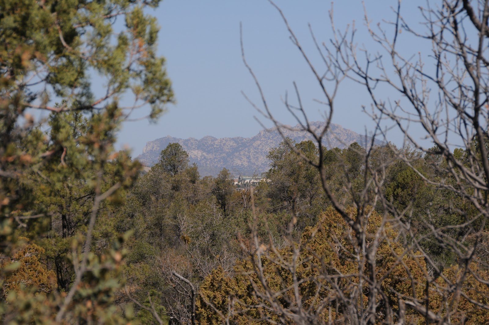
View of Granite Mtn from the ridge 

LENGTH:  4.5-mile loop (includes access trail 9263)
RATING: easy
ELEVATION:  5050' - 5742'
FEES: none at this site
FACILITIES: none, but there's a vault toilet at the gold panning site
GETTING THERE:
From Phoenix, go north on I17 to the Cordes Junction interchange for AZ69.  Head west toward Prescott on AZ69 to the stoplight at Walker Road which is just past the Costco and milepost 293. Turn left and follow Walker Rd 1.2 miles to Lynx Creek Road (FR9401, signed Lynx Creek Ruins/Salida Gulch), turn left and continue 1 mile to the trailhead at the forest boundary sign.  Begin hiking on trail 9263, hop the creek and look for the trail 95 junction in about 0.1 mile.

INFO: Bradshaw Ranger District, Prescott National Forest
MORE PHOTOS: