Find A Trail. Start Your Search Here:

Showing posts with label Paloma Regional Preserve. Show all posts

Tuesday, May 28, 2024

Ridgeline Circuit

SPECKLED RATTLER-CRANKSET-RIDGELINE CIRCUIT

View from the Ridgeline Trail

Summer hiking is Arizona is an endeavor that takes extra effort.  While making long drives to the high country to escape the Valley heat is an ideal solution, road trips to pine-shaded hiking trails are not always feasible. 

View of Golden Cliffs Trail from MUP-A

But hikers got to hike.  By applying a large dose of common sense and doubling down on safety precautions, summer hiking in the desert is doable. 
Trails are well-marked in Paloma Regional Preserve

Of the many safeguards needed to stay alive in summer heat, three are of paramount importance:  timing,  sun protection and, water, water, water.  First, plan to hit the trails early and be done by 8 a.m. or before the dangerous heat kicks in.  
Ridgeline spur to overlook

Many local parks and preserve open at sunrise, so plan accordingly.  One of the most misunderstood elements of desert hiking involves proper attire. 
Knoll with spur trail overlooking the park

An investment in a brimmed hat, long sleeve shirts and long pants made of sun-protective technical fabrics will pay off big time.  These fabrics not only shield against sunburn and insects, but they also act like evaporative coolers to keep moisture on your skin. Yup, you’ll feel cooler in long sleeves than a tank top. Then there’s water.
Paloma Community Park from Ridgeline trail

Bring plenty, more than you think you’ll need. I personally carry nearly a gallon for a 3-hour desert hike.  This includes two 16-ounce bottles that I almost always end up giving away to heat stressed hikers. Dogs will get my extra water first.  
Speckled Rattler Trail junction

And, speaking of dogs—leave then at home. Heat is brutal on canines. Our furry friends suffer burnt paws, heat exhaustion and even death on local trails every year.
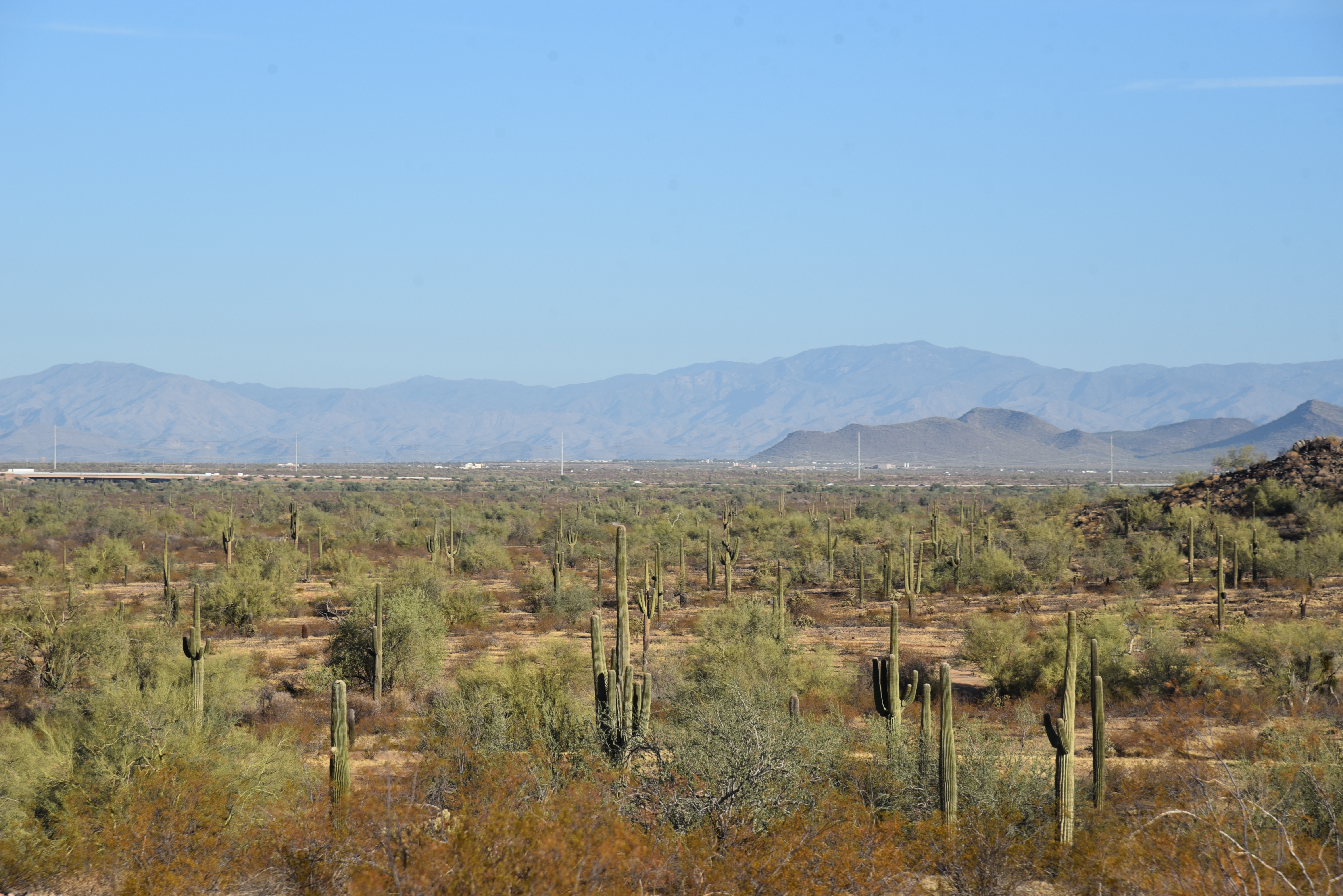
Saguaros on the Ridgeline Trail


With the objective of being up-and-out by 8 a.m., hikers can maximize the effort by choosing trails with easy access, some moderate challenge, bail out options and fantastic views.  The trails of the Paloma Regional Preserve in Peoria exceed these criteria.  A good early morning summer circuit uses the Multi-Use Path-A, Speckled Rattler, Crankset and Ridgeline trails. 

Tight bend on Ridgeline Trail

From the trailhead, the route follows MUP-A for 0.4-mile to Speckled Rattler and then connects to Crankset. This first 1.57-mile leg is flat, tracing the base of West Wing Mountain with the cut of the Golden Cliffs trail visible on the slopes. 
Valley vistas from Ridgeline Trail

A large map kiosk marks the junction with the Ridgeline trail, where the route begins its climb.  At the top of the first of several sets of switchbacks, the trail splits.  The left arm heads up a craggy knoll for a short trek to an overlook above Paloma Community Park, a nice little diversion.
Green corridor of New River below Ridgeline

 
View from Ridgeline overlook spur

The route then traverses a saguaro dotted ridge, swooping uphill in flowing curves and tight turns engineered to make the going almost effortless.  Views grow larger and more varied as the trail ascends to its highest point.  The green swath of New River fills the valley below while a ring of mountain ranges surrounds the horizon.
Long switchbacks mitigate the climb

The trail then spirals down to its end point at marker 90,the turnaround point for this trip.  To build a loop or shorten the hike, download the preserve trail map and keep an eye on the time, your water supply and how you feel.  The goal is always to get back to the trailhead alive.


LENGTH: 5.7 miles (out-and-back, as described here)

RATING: moderate

ELEVATION: 1,393 – 1,850 feet

GETTING THERE:

297799 N. Lake Pleasant Parkway, Peoria.

From Interstate 17 in Phoenix, take the Loop 303 exit 221 and continue west to Lake Pleasant Parkway.  Turn left and go 1 mile to the Paloma Community Park entrance on the left.  Follow the signs to the trailhead parking area.  There are restrooms near the trailhead. No Fees.

HOURS: sunrise to sunset daily

INFO & MAPS:
City of Peoria

peoriaaz.gov/government/departments/parks-recreation-and-community-facilities/parks-and-trails/hiking-trails

Tuesday, October 31, 2023

Granite-Keefer Hill Circuit

GRANITE-KEEFER HILL CIRCUIT

Paloma Regional Preserve

Saguaros frame mountain views on the Granite Trail

The landscape of Paloma Regional Preserve is defined by a massive, flat drainage basin punctuated with a few minor knolls of volcanic rock.

Volcanic outcroppings in Paloma Regional Preserve

New River, when it runs, spills right down the middle of it in untamed rivulets, muddy channels, and occasional torrents. 
Crested saguaro in the Keefer Hill Trail

Bounded by a crescent of desert hills, terra cotta rooftops and the Westwing and Eastwing Mountain Preserves, the large water scoured expanse interfaces seamlessly with its suburban Peoria location. Trail users may walk in from several adjacent parks and neighborhood access points where family-friendly facilities and cul-de-sacs melt easily into acres of protected Sonoran Desert.
Westwing Mountain viewed from Granite Trail

Paloma Regional Preserve’s trail offerings diverge from those of its climb-centric sister preserves. Instead of abrupt stacked loops that culminate on desert mountain summits, the sprawling flatlands are outfitted with a slew of serpentine routes that take their time rolling out the goodies.

New River basin seen from the Granite Trail

  While the preserve’s Compass Rose Trail does ascend to a minor peak, it's an anomaly in an otherwise level field.  
Granite boulders on the eponymous trail

All preserve trails are linked and connect with Eastwing and Westwing parks, so customizing loops and long treks is easy. 
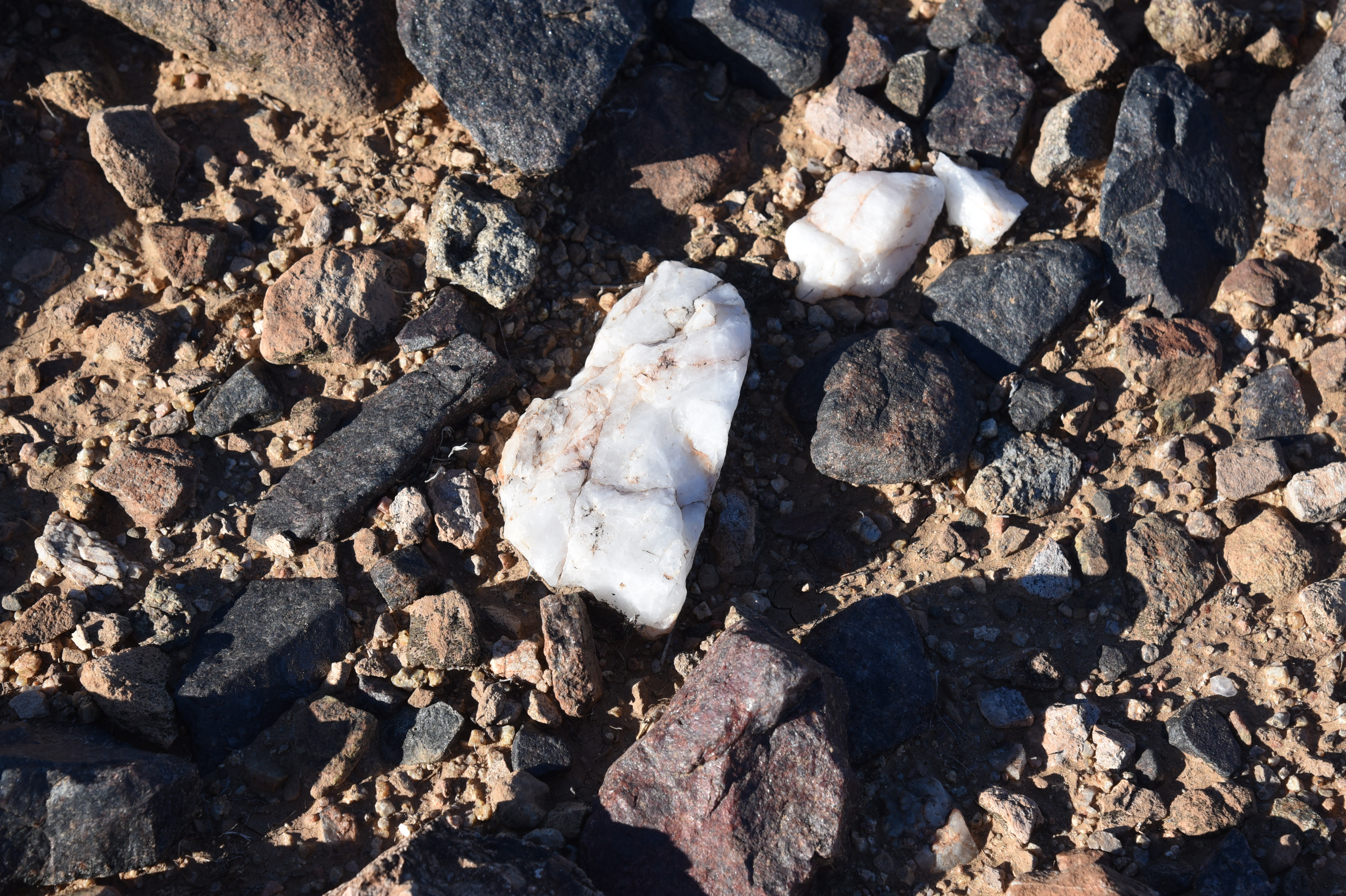
"Salt & Pepper" basalt and quartz line the trails

A good way to start is to make a lollipop loop using the Multi-Use Path A, Granite, New River, and Keefer Hill trails. The hike begins at the 10-acre Sonoran Mountain Ranch Park at the preserve’s east end.
New River Dam seen from Keefer Hill Trail

The trails are accessed from the park’s paved perimeter path where a trailhead with benches and a map kiosk mark the start point.  A 0.3-mile walk on Multi-Use Path A leads to the junction with the 1.7-mile Granite Trail.  The twisty singletrack makes a mild ascent through volcanic boulders, topping out on a rocky mound overlooking the course of New River.  The mesquite-cluttered intermittent waterway appears as a ribbon of green below the ridgeline of Westwing Mountain. 
Tonto National Forest mountains seen from New River Trail

The trail then winds down passing through creosote-dominated terrain strewn with a salt-and-pepper mix of black basalt and white quartz chips.  To the north, the Cave Creek Mountains and peaks and mesas of Tonto National Forest stand out on a hazy horizon.  The circuit follows the New River Trail a few yards to the Keefer Hill Trail junction. The 0.62-mile path traces the base of a 1,650-foot isolated butte. 
View from the high point on Granite Trail

A few feet in, a crested saguaro hovers above a clutter of Palo Verde trees, its elaborate crown splayed into a contorted, spiny bouquet.
Start point for the hike

Beyond the end of the Keefer Hill Trail that rounds crumbling flanks and boulder passages, the Flood Control District of Maricopa County managed New River Dam tames the tendrils of the freeform desert waterway, intercepting its deluge of the manicured subdivisions below.

Preserve trails are well signed

LENGTH: 5.24 miles round trip

RATING: moderate

ELEVATION:  1,412 – 1,515 feet (604 feet of accumulated elevation change)

GETTING THERE:

Sonoran Mountain Ranch Park, 7098 W. Miner Trail, Peoria.

From Phoenix, go north on I-17 to Happy Valley Road exit 218. Go 5 miles west on Happy Valley Road to 67th Avenue, turn right and drive 2.8 miles (road becomes Pyramid Peak Pkwy.) to Sonoran Mountain Ranch Road.  Veer left and go 0.5-mile to Chalfen Blvd., turn left, continue 0.1-mile to Miner Trail and follow the signs to Sonoran Mountain Ranch Park. Turn left into the parking area signed for Eastwing Mountain Trail. Hike begins at the far west end of the park’s paved perimeter trail.

HOURS: sunrise to sunset daily

FACILITIES: restrooms, picnic ramadas, playground, basketball courts. No fees.

INFO: City of Peoria

https://www.peoriaaz.gov/trails

Tuesday, November 1, 2022

Paloma Regional Preserve

PALOMA REGIONAL PRESERVE

An ironwood tree frames views on Compass Rose Trail

Bounded by two desert waterways, a CAP canal, freeways, isolated mountains and the geometric grid of cul-de-sac communities, Paloma Regional Preserve is an island of natural outdoor space. 

Mountain vistas on Multi-Use Path A

The ephemeral character of desert rivers creates seasonal shows of monsoon surges that fade into trickling rivulets and residual pools, all along, feeding swaths of lush greenery in otherwise dry, prickly places. A walkable tour of this critical cycle is on display on the trails of the preserve.
Mesquite trees on the New River Trail

The mostly-flat block of open space straddles the floodplain of New River,  in Peoria, east if the Agua Fria River.

New River Dam bolsters the south end of the preserve

The preserve is anchored by Paloma Community Park which opened in 2020. The amenity-rich site has playgrounds, a dog park, restrooms, sports fields and picnic ramadas. Access to the preserve hiking trails begins at a gate near the dog park where Multi-Use Path A heads east away from the barking commotion.

Speckled Rattler trail leads into Westwing preserve

Wide and sunny, the path serves as a gateway to the preserve’s 12+ miles of trails that also link with the Westwing and Eastwing Mountain Preserves as well as Sonoran Mountain Ranch Park. 
Interesting geology on the New River Trail

With a backdrop of mountain vistas and acres of saguaros, the path soon enters the floodplain of New River.  Mudflats, sandy drainages and water-scoured channels fringed with mesquite and palo verde trees clinging to embankments speak to the power of running water. At the 1.1-mile point, Multi-Use Path A encounters its first major junction where it meets the New River Trail-- a multi-use pathway that runs from Bethany Home Road in Glendale to Pinnacle Peak Road in north Phoenix and serves as a main artery running north-south through the preserve.  
Friendly advise at the trailhead gate.

Park maps available online and well-signed junctions with QR codes and emergency help locator decals, make getting around and staying safe a cinch. While each trail offers excellent hiking, the not-to-miss route on the menu is the Compass Rose Trail. 
View from Multi-Use Path A

The 1.42, moderate-rated path ascends a knoll overlooking the New River Dam for sweet views of the river’s course through the landscape. 
View of New River Mesa & Skull Mesa from Compass Rose

The extra height also opens up views of the Cave Creek Mountains to the northeast and the Sierra Estrella Mountains to the south. From the high point, the brilliant connectivity of the preserve trail system is obvious. The grid of trails below hint at the dozens of options for completing short loop hikes or long distance treks in and around this distinctly desert-water-centric environment.
New River floodplain bisects the preserve

LENGTH:  12+ miles of interconnected trails

RATING: easy - difficult

ELEVATION:  1,369 – 1,550 feet

TRAIL HOURS: sunrise to sunset daily

PARK HOURS: 6 a.m. – 10:30 p,m. daily
FEE: none

GETTING THERE:

Paloma Community Park Trailhead
29799 N Lake Pleasant Pkwy, Peoria.

From Interstate 17, take the Loop 303 exit 221 and continue west to Lake Pleasant Pkwy.

Turn left (south) and go 1 mile to the park entrance on the left.

Trailhead is at the gate at the end of the road near the dog park.

HIGHWAY CONSTRUCTION NOTE:

As of this writing, the Loop 303 exit was closed. Use State Route 74 (Carefree Highway) as an alternative. Take the SR74 exit 223B and head 6 miles west to Lake Pleasant Pkwy. Turn left and go 3.5 miles south to the park entrance on the left.

INFO & MAPS:

City of Peoria

https://www.peoriaaz.gov/home/showpublisheddocument/26718/637774189542300000