SANDROCK CANYON
 |
| An Arizona Sister alights on Gambel oak |
Arizona Sisters are hard to ignore. Adorned with distinctive white markings and orange wing tips the eye-catching butterflies are familiar sights in oak woodlands.
 |
| FR9361A crosses Sandrock Canyon |
Native to Central America and the American Southwest, Adelpha eulalia are easy to spot flitting among oak canopies from late spring through fall.
 |
| Fossil Springs overlook at end of FR9361A |
Unlike many other butterflies, this colorful species with a wingspan of 3 to 5 inches does not normally feed on flowers.
 |
| Sandstone ledges over Fossil Springs Wilderness |
Oak trees are their host plants and primary food source, but they can also be observed perching around mud puddles and water holes.
 |
| Arizona Sisters stand out in oak forests |
The pine-oak woodlands and riparian canyons of Arizona’s Mogollon Rim provides ideal habitat. They have a knack for finding beautiful places to live and produce three or more broods per year between March and December. Hikers can take a step into their terrain by seeking out quiet trails and backroads located between 4,000 and 8,000 feet in elevation where several species of native oaks thrive.
 |
| Amazing views from above Fossil Springs |
Forest Road 9361A in Coconino National Forest departs from a who-knew trailhead 27 miles east of Camp Verde on State Route 260.
 |
| Agaves grow on the rim over Fossil Springs |
The dirt two-track leads into prime butterfly territory with a jaw-dropping beautiful payoff at the end.
From the trailhead, the FR9361A heads through a barbed wire gate and a concrete tunnel under SR260.
 |
| Sandrock Draw Tank on FR9361A |
There are three wire gates along the route. Be sure to close each gate behind you. At the 0.3-mile point, the road is signed as FR9361D, but maps show it as FR9361A, either way, it goes to the same destination.
 |
| Sandrock Draw Tank is a wildlife magnet |
A short walk past the sign, pine-shaded Sandrock Draw Tank, a created waterhole, attracts a host of wildlife.
 |
| Water hole near the FR9361Q junction |
Birds, dragonflies and Arizona Sisters twitching along its muddy fringe are common sightings. Sandrock Draw gradually widens becoming a canyon that feeds into Fossil Springs Wilderness.
 |
| Tunnel under SR260 at the trailhead |
Just beyond the tank, the route heads left at a fork and continues to the 0.9-mile point where the route veers right at the FR9361H junction to stay on FR9361A. Here, the road traces the Sandrock Canyon dipping and climbing through juniper meadows and Ponderosa pines with occasional mountain vistas peeking through dense tree cover.
 |
| FR9361A ends just yards from the overlook |
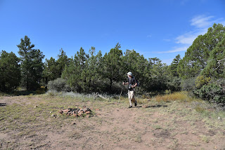
A major road fork at the 1.6-mile point is marked by a small water hole and the junction with FR9361Q. The route heads right to again stay on FR9361A. The final 0.8-mile leg of the hike passes through an enchanting green tunnel--bound to turn gold in autumn-- of Gambel oaks replete with Arizona Sister activity. The lightly travelled dirt road narrows as it makes a moderate descent to its terminus at a non-descript circular campsite that belies the spectacle located just a few yards beyond.
 |
| Mountain vistas from a sunny meadow |
Faint game paths wind through a maze of agave, cacti and ancient Alligator junipers landing hikers at an overlook above Fossil Springs Wilderness. Sandstone ledges protrude over a gorge that plunges 1,000 feet to the wilderness floor that’s home to Fossil Creek, one of Arizona’s most popular water-centric recreation areas.
 |
| There are 3 gates on the hike. Close them behind you! |
 |
| Broken agaves at the overlook |
Free of the (permit-required) traffic and visitors splashing in the waterfalls, the view from above gives a seldom seen overview of the scope and magnitude of the 11,550-acre wilderness below.
 |
| Ponderosa pines shade the route |
LENGTH: 4.8 miles roundtrip
RATING: easy
ELEVATION: 6,375 – 6,149 feet
GETTING THERE:
From Interstate 17 in Camp Verde, go 27 miles east (toward Payson) on State Route 260 to Forest Road 142 located past milepost 245 on the left. Immediately past the cattle guard, turn left into a dirt parking area. A high clearance vehicle is recommended.
The dirt parking area also serves as an access point for the General Crook Trail No. 130.


