Find A Trail. Start Your Search Here:

Showing posts with label Goldfield Mountains. Show all posts

Monday, November 22, 2021

Pass Mountain Trail

PASS MOUNTAIN TRAIL

Goldfield Mtns & Four Peaks seen from Pass Mtn

In terms of sensory overload, the Pass Mountain Trail works sort of like an old-style 5-disk CD changer to deliver a cycle of ever-changing delights that once engaged, just keeps on spinning.

Approaching the east flanks of Pass Mountain

The 7.5-mile route that loops through both Usery Mountain Regional Park in Mesa and the urban-wildland interface of Tonto National Forest, packs in the hiking equivalents of mellow slow dance vibes, sultry tangos and pounding hip-hop rhythms. 

Mountain and valley vistas abound on Pass Mtn

An edgy section of the Pass Mtn Trail

Accessible by way of convenient trailheads in the park, the rocky single track blends low desert strolls, a carousel of vistas and just enough raw mountain exposure to serve up one of the most diverse, close-to-town hikes in the Metro Phoenix area.
A close-to-town hike with wilderness vistas
  Park rangers recommend taking on the loop from either the Wind Cave or Horse Staging trailhead in a clockwise rotation (begin by going left) for a longer but milder ascent to the hike’s scenic saddle.  For those who just want to get to the high point vista and then double back, that’s the ticket, however full-loop hikers should consider a counterclockwise (go right) approach.
Tangles of Sonoran Desert vegetation on Pass Mtn

It’s harder that way, but it gets the difficult climbing over quicker and eliminates the chore of negotiating a steep, slippery down climb on tired legs.

Pass Mtn viewed from the park side of the trail

  Heading right from the Wind Cave trailhead, the trail almost immediately exits the park boundary and enters Tonto National Forest. 
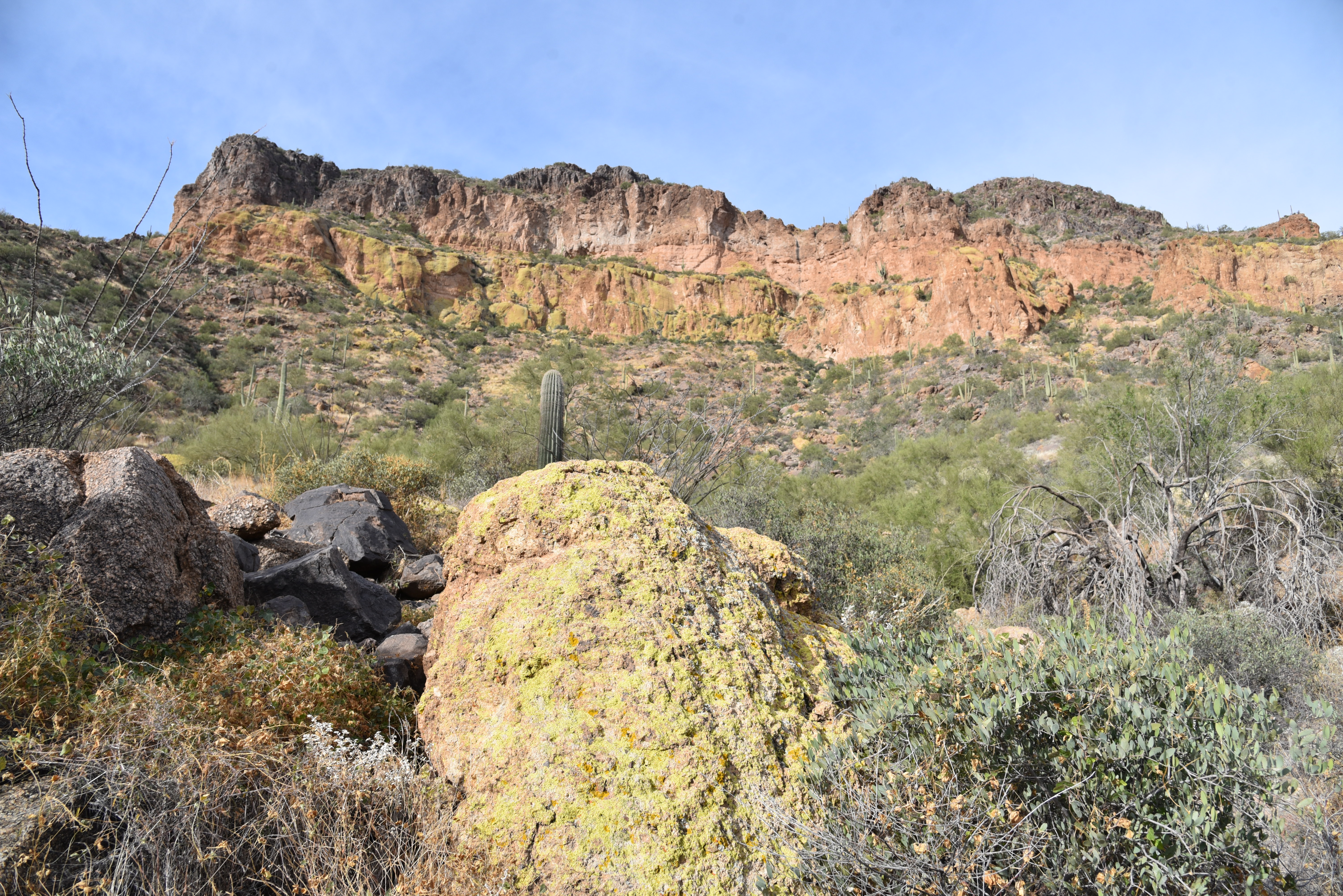
Lichens color the cliffs of Pass Mountain

The first relatively flat half-mile runs through classic desert vegetation and ruffled washes in the shadow of the pyramid-shaped Cat Peaks.  
A slickrock passage leads to a scenic saddle

Over the next mile-and-a-half, views of the Superstition Mountains rising above the town of Apache Junction command the eastern horizon as the trail makes a northward bend and a barely noticeable ascent toward on the mountain’s east face. 
Approaching the U-shaped saddle on Pass Mtn

Residual glimpses of rooftops and roads are soon swallowed up in the folds and drainage cuts of the mountain’s wild side. 
Stunning views from the Pass Mtn saddle


A valley flush with saguaros sits below the destination—a U-shaped pass visible on the north ridgeline.  The climb to get there isn’t too difficult until about a half-mile from the top where the route hangs on precipitous edges and a slickrock ledge for an appetizer of adrenaline before the trail emerges on the prize. 
The trail heads north from the saddle

Bam!  The wind-in-your-face jolt of stepping onto the 2,593-foot saddle is a jaw-dropping experience.  With a single bend in the trail, the vistas make an explosive transition from saguaros and suburbs to layers of mountains and river valleys.
A saguaro-cluttered valley precedes a steep climb

Mesquite and Palo verde trees shade the lower trail

 
In the foreground, the blocky, colorfully-layered Goldfield Mountains rise above a scoured divide.  Behind them, are the iconic Four Peaks and rows of wilderness peaks stand over the Salt River Valley.  
Another view of the saddle approach

View of the saddle on the right ridgeline

Save for some minor drainage crosses and exposure the remainder of the trail is just a moderate trudge that hugs the mountain’s eastern flanks, unspooling views of the Usery Mountains and hazy peeks at the McDowell range near Scottsdale before it swings south and descends to the base of Pass Mountain for the final 2-mile walk back to the trailhead.
Superstition Mountain views


LENGTH: 7.5-mile loop

RATING: difficult

ELEVATION: 1,866 – 2,598 feet

GETTING THERE:

Usery Mountain Regional Park,

3939 N. Usery Pass Rd., Mesa.

From U.S. 60 in Mesa, take the Ellsworth Road exit 191. Go 6.7 miles north on Ellsworth (which will turn into Usery Pass Road) to the Usery Mountain Regional Park entrance on the right.  The tail may be accessed from the Wind Cave and Horse Staging Area trailheads.  There are restrooms at both trailheads.

FEE: There’s a $7 daily fee per vehicle payable at the park entrance. 

INFO: https://www.maricopacountyparks.net/usery-mountain-regional-park-um/


Monday, December 2, 2019

GOLDFIELD MOUNTAIN VIEWPOINT

GOLDFIELD MOUNTAIN VIEWPOINT
Snow-covered Superstition Mtns seen from Bulldog Canyon

Brittlebush bloom along the roads
 Tucked into a rumpled space at the fringe of suburbia, the Goldfield Mountains north of Apache Junction are rife with exploratory hiking opportunities. 
Destination (center on ridge) visible from the trailhead
This rugged slice of the Tonto National Forest located south of Saguaro Lake and the Salt River is hemmed in by State Route 88, the Superstition Wilderness, Four Peaks Wilderness, Usery Mountain Recreation Area and the Fort McDowell Yavapai Nation Reservation.  It’s a strangely beautiful place of mostly volcanic origins.
Magnificent rock formations in Bulldog Canyon
Wildly contorted buffs, welded ash pillars, eroded hills and natural arches hover over jumbled washes and acres of gorgeous Sonoran Desert vegetation.
Although there are few designated hiking trails in the area, old roads cut by defunct mining operations and ranches serve just as well.  Venturing within the Goldfields is not for inexperienced or directionally-challenged visitors.  But within the heavily-used Bulldog Canyon section, finding your way around isn’t too difficult.
Snow on Four Peaks and Sierra Ancha Mountains 11-30-19
One simple starter hike in the Bulldog Canyon area leads to a small peak at the end of a ridge with panoramic vistas that provide a tempting  overview of the lay of the land. The tour begins at the Dome Mountain Trailhead where a gate marks the entrance to the Bulldog Canyon OHV recreation area. The destination, marked by FAA communication towers, teeters on a high crest the to the west.  Start hiking north on the dirt road (Forest Road 10) which is open to motorized traffic, equestrians, bikers and hikers. Follow the cholla-lined track to the 0.3-mile point where Forest Road 1356 head off to the right. For this trip, veer left and stay on FR 10. Ahead, magnificent views of Dome Mountain (3,381 feet), the highest point in the Goldfields soars above the hilly terrain while the hulking form of the Flatiron and Superstition Ridgeline loom to the southeast.  At just under a mile, where two sign posts mark where FR 10 swerves east (right), make note of an unsigned road heading downhill on the left. This is the optional return route. As the road makes a gradual ascent, views of the Four Peaks and Sierra Ancha Mountains begin to peek out over ridges and mesas to the east.
A short, steep climb leads to high point vistas
Flatiron is a commanding presence on the hike
To reach the peak, continue another 0.1-mile straight ahead, veer left at a 3-way junction and pass a white road gate. Here’s where the route begins a moderate climb on long switchbacks. Soon, gaps in the volcanic terrain frame views of the Salt River Valley and distant Mount Ord to the north.  After few more bends in the road, the peaks of the Superstition Wilderness can be seen to the east.
Horses and ATVs climb the summit ridge
 At the top of the road, an FAA station built into the base the ridgeline’s southern promontory, marks the beginning a short, steep climb to a highpoint with wind-sculpted shallow caves and 360-degree views of the Valley and beyond. On clear days, you can see as far away as the mountains near Tucson and the Mogollon Rim. 


Rich Sonoran Desert plants grow in Bulldog Canyon
North views extend to Mt Ord and the Mogollon Rim
When done ogling the landscape, head back down the hill to the double-signed FR 10 junction. For an optional, more difficult return route, take the road going downhill to the right which roughly follows the overhead powerlines. This option has more ups-and-downs and is steeper than FR 10. Otherwise, just retrace your steps on FR 10 back to the trailhead. Both options are nearly the same length.

An FAA site sits below the hike high point.
LENGTH:  3.6 miles roundtrip
RATING: moderate
ELEVATION: 2,011 – 2,490 feet       
GETTING THERE:
Dome Mountain Trailhead
From U.S. 60 in Apache Junction, take the Idaho Road exit 196 and go 4.4 miles north to McKellips Road.
Turn right (east) on McKellips and continue 0.4-mile to Wolverine Pass Road, turn left (north) and go 0.8 miles to Tonto Street  where the pavement ends.  Turn right and go 0.2-mile to Cactus Road, turn left and continue 0.2-mile to the parking area. 
INFO:
Arizona Geological Survey
-->

Friday, September 19, 2008

HAT TOP HILL

HAT TOP HILL Goldfield Mountains Often overshadowed by their famous neighbors--the Superstition Mountains--the equally interesting Goldfield Mountains also offer outstanding hiking opportunities. That is, of course, if you can manage to find your way around on the confusing maze of old roads and faint paths that provide access to the area. Without a good map and sound route finding skills, it's virtually impossible to stay on track in the Goldfields. In March of 2008, I was fortunate enough to participate in a Sierra Club outing led by Ted Tenny, author of Goldfield Mountain Hikes (Gem Guides, 2006). It was a memorable adventure and a highly recommended destination. However, due to the complexity of the route, I will defer to Ted's book and website for maps and route information. Visit Ted at mile240.us/Goldfields/index.html