Find A Trail. Start Your Search Here:

Showing posts with label Carefree. Show all posts

Tuesday, February 19, 2019

Badger Brawl-Cliff-Walk-Esplanade Loop

Badger Brawl-Cliff-Walk-Esplanade Loop

Phoenix Sonoran Preserve
Mountain views on the Esplanade Trail
If the human brain has a “dangerous things archive”, an image of a roaring desert wash ought to be seared into it. 
This hike exposes the power of running water.
For Arizonans especially, the fear of running water should rank right up there with snakes and heights.  Although storm water raging through usually-dry channels solicits choirs of oohs and ahhs, the flows are definitely not something to mess with.
Creosote smells wonderful after rains.
They can go from trickle to torrent in minutes.  Driving, riding or hiking through them is extremely risky and potentially deadly. Need more evidence? Next time you’re hiking by a creek or wash, look up into the trees. Those wads of debris dangling high above mark where the water was.
Wash and creek bed crossings are key features of the hike.
That’s why it’s always smart to steer clear of trails that cross waterways until the swells subside. It only takes a day or two for the trails and crossings to dry out enough to pass through safely. Also, not using trails when they are wet and soggy helps prevent the kind of damage that ruins drainage systems, creates dangerous conditions and encourages the blazing of “work around” paths that destroy native vegetation.  
Skull Mesa framed by greenery around Apache Wash
A good place to observe the force of water in a desert landscape is in the north sector of the Phoenix Sonoran Preserve. Hedged between the Carefree Highway and Sonoran Desert Drive east of Interstate 17 in north Phoenix, the chunk of pristine desert holds many surprises.
The trails here offer a diverse menu of options including moderate ridgeline rambles, barrier-free strolls and easy explorations of the wily water alleys that permeate the area. 
A healthy saguaro on Badger Brawl Trail.
A hike on the easy-rated Badger Brawl-Cliff Walk-Esplanade loop on the preserve’s far east end is one of the best ways to explore the transformative powers of water.
Using trails when they are wet causes damage like this.
The circuit begins with a short walk on the Apache Wash Trail which traces a ragged drainage fringed with greenery.  Soon, the trail dips into the first of several wash crossings where signs warn not to attempt when water is running. 
Ironwood trees dot the desert plains.
The circuit is flat and easy.
Above the washes, sunny stretches of classic desert are dotted with saguaros, cholla and isolated patches of mesquite and Palo Verde trees that throw bits of shade on a flatland littered with basalt lava blobs and milky quartz.
Filaree or Stork's Bill grows along the trails.
Where the route wanders through open desert, mountain views--dominated by Skull Mesa and Black Mountain to the north--bolster the horizons.  
Heed this warning.
The  2.9-mile Cliff Walk Trail tethers the three legs of the loop with a traverse of the banks above the Cave Creek river channel. Scattered boulders, plant dregs and frazzled edges of the waterway document the ferocity of flash floods.
Phoenix Sonoran Preserve Trails are well-signed.
The return leg of the trip follows the level grade of the Esplanade Trail--an unfettered space of quiet beauty safe from the sporadic deluges of creeks and washes.
Black Mountain (right) seen from Apache Wash Trail.
LENGTH:  8.56 miles
RATING: easy
ELEVATION: 1720 - 1910 feet
GETTING THERE:
Apache Wash Trailhead, 1600 E. Sonoran Desert Drive, Phoenix.
From Loop 101 in north Phoenix, take Cave Creek Road exit 28 and go 4.5 miles north to Sonoran Desert Drive. Turn left (west) and continue 3.5 miles to the trailhead on the right. The preserve is open daily from sunrise to sunset. There are restrooms but no water at the trailhead.
HIKE DIRECTIONS:
From the trailhead, follow Apache Wash Trail (AW) 0.5-mile to Badger Brawl Trail (BB). Continue 1.55 miles on BB to Cliff Walk (CW) and hike it 2.9 miles to where you’ll swing back on the Esplanade Trail (E).  There’s a shortcut roughly halfway up CW that cuts 2.25 miles off the big loop. Follow Esplanade 3.4 miles back to AW, veer left and hike 0.73 mile back to the trailhead.
INFO & MAPS:

-->

Monday, April 9, 2018

RESTORATION OF MARICOPA TRAIL SEGMENT 20 COMPLETE

RESTORATION OF MARICOPA TRAIL SEGMENT 20 COMPLETE
Tree burned in the 2005 Cave Creek Complex Fire
Wildfires can be as confusing and they are devastating.  Sometimes they roar through a forest in take-no-hostages fury while in other situations, they hopscotch over the land creating a random patchwork of destruction and untouched swaths. 
Strawberry Hedgehog cacti bloom March-April
The 2005 Cave Creek Complex Fire that swept through Tonto National Forest north of the Valley resulted in a combination of heartbreaking ruin and pockets of unscathed life.  One fluke is the survival of a stand of junipers along Cottonwood Creek, an intermittent stream below Quien Sabe Peak. A point of pride of the restoration efforts of the nearly 14 miles of fire damaged trails that connect the Bronco Trailhead at Seven Springs Road with Spur Cross Ranch Conservation Area is the mending of the route that passes by the  mile-long juniper haven that escaped the blaze.
Corrals at the Bronco Trailhead
 Heavy brush and debris was cleared away from the evergreen passage, enabling hikers to admire the trees instead of battling through scrappy thickets.
Stock Tank on Trail 245
Precious junipers
Sign showing partners in the trail restoration efforts
The reclamation work has been a years-long endeavor with numerous organizations and volunteers contributing time and materials. A major push that wound up this year put the finishing touches on the project.  From January through February crews from Maricopa County, Tonto National Forest and the American Conservation Experience completed four week-long hitches to repair Segment 20 of the Maricopa Trail which incorporates forest routes Bronco Trail #245 and Cottonwood Creek Trail # 247.
Sugar sumac
Crews camped and worked to clear brush, locate and restore historic cairns, repair tread and place trail markers at half-mile intervals along the route. Flagstaff-based American Conservation Experience is a non-profit organization for young adults ages 18-25 who are considering careers in land management, conservation or other outdoor fields.
False Toadflax blooms April -August
Participants serve 3-to-12 month terms under the tutelage of industry professionals. In addition to performing needed work, associates gain valuable knowledge and hands-on experience.  During the two-month Maricopa Trail restoration undertaking, crews repaired or built 170 drainages, fixed 10 water bars and built or fixed 23 cairns while clearing the trail of rocks and hazards.  Crews were assisted by The Backcountry Horseman Association of the East Valley which hauled in tools and food taking some of the load off the sweaty work.
A fire survivor grows strong
Thirteen years after the fire, the classic trails that run beneath desert mesas and peaks
are revitalized and gaining traction as must-do hiking destinations. The land surrounding the route is healing slowly but steadily.
Blooming barberry along the Maricopa Trail 
Dead trees bearing black scars of the blaze stand among emergent sprouts and spotty islands of survivor mesquite, sugar sumac, scrub oak, yuccas and blooming cacti.  Part of the joy of hiking this section of the Maricopa Trail is seeing how, with a little help from McLeod tools, rakes and human effort, the forest is bouncing back. 
Patches of junipers survived the Cave Creek Complex Fire
Although there may be fewer junipers, those that remain are cherished finds and reminders of the whims of Nature and our role in preserving irreplaceable resources.
The stock tank makes for a good day hike destination
A Crucifixion thorn tree frames mountain vistas
With major work in the in the rear-view mirror, the Maricopa Trail continues to grow and evolve into a world-class recreational hub. 
Scene on the Maricopa Trail
There’s still plenty to do and anticipate.
Major goals for the 300+-mile Valley-circumnavigating route include linking county parks, metropolitan areas, municipal trails and communities with a non-motorized, open space corridor that will protect natural and cultural resources from development.
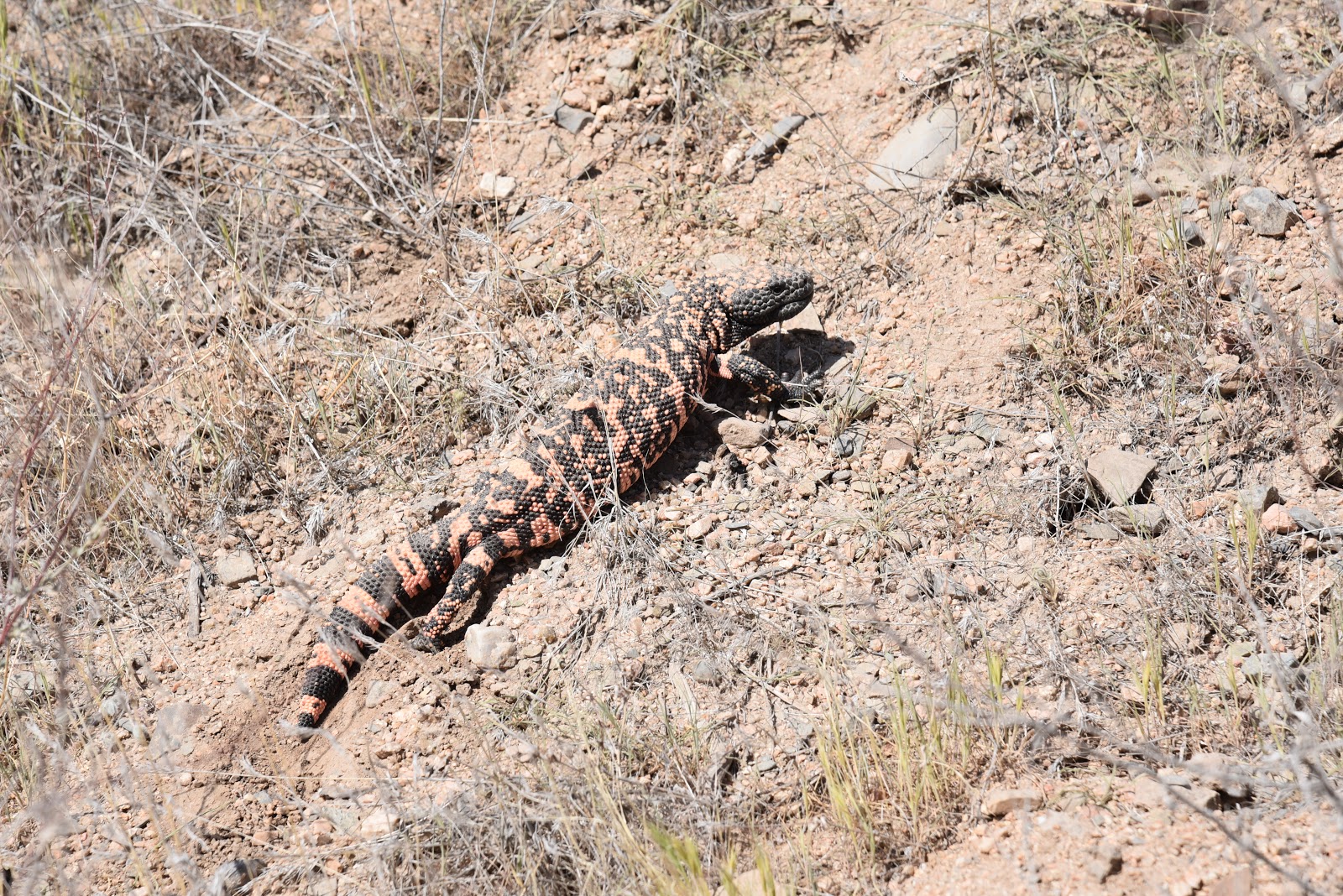
This Gila Monster was not interested in posing for a photo
Per Dwana Taylor, Maricopa County Parks and Recreation Public Information Officer, trail users can look forward to greater connectivity, new trailheads and spurs to the Hassayampa River Preserve and future Vulture Mountain Recreation Area in Wickenburg. 
Hikers on the Bronco-Spur Cross segment of the MT
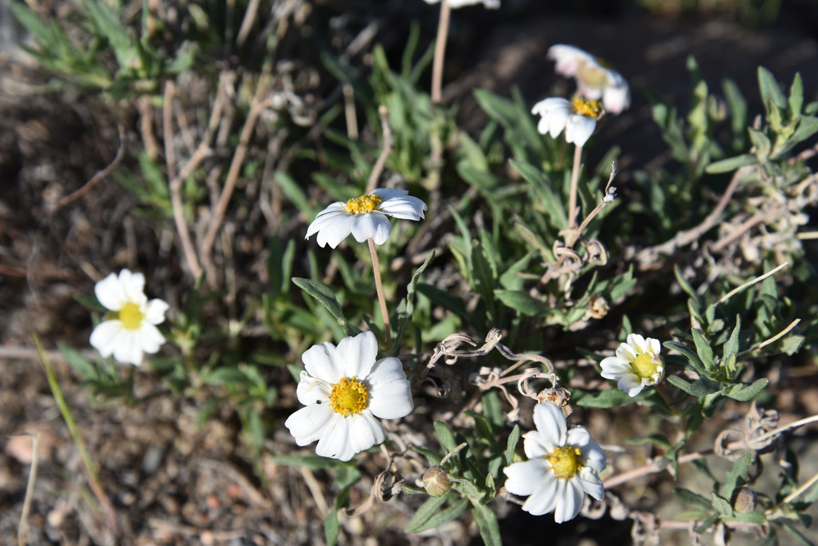
Even in dry years, Blackfoot daisies find a way to bloom
LENGTH: 13.6 miles one way (Bronco Trailhead to Spur Cross)
DAY HIKE OPTION:
Hike 2.6 miles on Trail 245 to the stock tank at the east fork of Bronco Creek. for a 5.2-mile round trip with an elevation range of 3,700 - 4,234 feet.
RATING: moderate
ELEVATION: 2,400- 4,224 feet
GETTING THERE:
Bronco Trailhead:
From the intersection of Cave Creek Road and Pima Road in Carefree, continue 11.6 miles north on Cave Creek Road which turns into Seven Springs Road/Forest Road 24 to the Bronco Trailhead on the left.  The last 3 miles of FR 24 is an all-weather gravel road suitable for passenger cars.  
INFO & MAP
American Conservation Experience

Monday, February 10, 2014

BLUE WASH-CAMP CREEK


BLUE WASH-CAMP CREEK
Tonto National Forest, north of Carefree

Sycamores along Camp Creek

The sandy, canyon-bound courses of Blue Wash and Camp Creek provide an interesting twist on desert hiking. During rainstorms, turbulent sheets of water pummeling off of the Cave Creek Mountains rush through these natural funnels that channel moisture into the Verde River. But, on most days, the rocky corridors are hikable mazes of boulders and rock jams settled in a soft-floored, multi-armed gorge that supports a community of willows, sycamores and bamboo plugged into precious groundwater. There's no "official trail" but well-worn footpaths ambling among house-high blocks of granite are reasonably easy to pick out in this quiet section of Tonto National Forest between Cave Creek Road and Bartlett Dam Road that's off limits to motorized traffic.  From the Cave Creek Road trailhead, the hike begins with a passage through "boulder alley" where there are three tricky spots that require some minor scrambling. At the 1.1-mile point, Blue Wash intersects with Camp Creek at a wide "T" junction. Turn left (northeast) here and hike 0.28 mile to visit Camp Creek Falls---a box canyon grotto with spring-fed water cascades and drop pools. Once done exploring the falls, return to the "T" and hike south down the wash another 3 miles to the turnaround point at Bartlett Dam Road. Actual mileage may vary slightly because there are multiple paths through the canyon.
"boulder alley"


LENGTH: 8 miles roundtrip
RATING: moderate
ELEVATION: 2640' - 3200'

GETTING THERE:
NORTH (Cave Creek Road) TRAILHEAD:
From Loop 101 in Scottsdale, take the Princess/Pima exit 36 and go 13 miles north on  
Camp Creek Falls
Pima to Cave Creek Road (a.k.a. Seven Springs Road and FR24). Follow Cave Creek Road 6.5 miles to the gravel lot on the left just past the "Blue Wash #1" sign. Trail begins near the cottonwood trees across from the parking place.
SOUTH (Bartlett Dam Road) TRAILHEAD:
From Loop 101 in Scottsdale, take the Princess/Pima exit 36 and go 13 miles north on Pima to Cave Creek Road (a.k.a. Seven Springs Road and FR24). Follow Cave Creek Road 4.1 miles to Bartlett Dam Road, turn right and continue 2.8 miles to the trailhead on the left.

MORE PHOTOS:
https://www.facebook.com/media/set/?set=a.10200447108459000.1073741917.1795269672&type=1&l=647804239f

Friday, November 23, 2012

Under the radar canyon hike


MASHAKATTEE CANYON
Tonto National Forest, Seven Springs Area

The seeds for this exploratory trek in the Seven Springs area north of Carefree were sown last year when we viewed the rambling course of Mashakattee Canyon from the summit of Humboldt Mountain--the prominent peak with the  big white "golf ball"  FAA radar station on top . From above, the sinuous juniper-lined sliver was a beautiful sight, and I vowed to someday get down into it.
Visualizing the route from our mountaintop vantage point, it appeared to be straightforward ---more or less, just follow the drainage, which cuts a downhill gash to merge with Seven Springs Wash.  And, we could see that the canyon bisected Cave Creek Road (FR24), so theoretically, access would be easy.   However, as with any off-trail trek, even the best-laid plans can be thwarted by unexpected kinks.
We showed up at the "trailhead" with my GPS loaded with NatGeo topos.  Turns out, we were the only ones in the area armed with such innocuous technology.  Everybody else had guns.  Kink number one.  As we knew that the area is popular with target shooters and hunters, we wore bright colors and planned our hike time frame to miss the prime dawn/dusk stalking hours. (I'm writing this, so, we survived).  Kink number two:  never underestimate the slowing down power of an off trail hike.  The entire length of the canyon is a major drainage full of boulders and slick rock.  The advantage of this is that the stone keeps scratchy shrubs mostly at bay, but also makes for a constant game of finding stable footing—taxing your stair-climbing muscles.  Kink number three: obstacles.  Toppled trees, boulder jams, cliff scrambles and a fence we had to crawl under, added elements of fun, but also slowed the pace considerably.  The canyon grows narrower and more cluttered as it approaches its terminus below Humboldt Mountain.  So, just know your limits and turn back when you've had enough. Still, for an under the radar station  kind of hike, Mashakattee Canyon is easy to follow, has great views, seasonal water and interesting geology.  

LENGTH:  2.35 miles one way
RATING:  moderate--100% on rocks with  obstacles. Sturdy footwear and hiking stick required.
ELEVATION:  3,517' - 4,256'
GETTING THERE:
From Loop 101 in North Scottsdale, take the Pima/Princess Road exit 36 and go 13 miles north on Pima Road to Cave Creek Road.  Turn right (east) and continue on Cave Creek Road (a.k.a. FR 24, Seven Springs Road) to FR 254 located just past MCDOT mile marker 10 on the right (0.6 mile past Humboldt Mtn Rd. FR 562).  If you have a high clearance vehicle, turn onto FR 254 cross the wash and continue 0.2 mile to a turnout on the right with a fire ring.  Park here and make an easy scramble into the canyon veer left and hike the gorge northeast toward Humboldt Mountain.  Alternately, you can enter the canyon where FR 254 crosses a wash at about 0.15 mile from FR24.  Those without high clearance should park along FR24 and make the short hike up the road.
MORE PHOTOS:

Friday, November 25, 2011

HUMBOLDT MOUNTAIN

HUMBOLDT   MOUNTAIN
Tonto National Forest
Looking East Over the Verde River Valley
UPDATE: 9-26-20 The Sears Fire is burning in this area. https://inciweb.nwcg.gov/incident/7218/
View from the Summit
Sometimes I just feel like a brainless hike up a hill with no route finding, treacherous terrain or precarious precipices. Just. Up.  Thankfully, Humboldt Mountain meets this criteria and it's not too far from downtown Phoenix.  You've probably seen this hill and wondered about it ---there's a huge, white “golf ball” (as it’s commonly called) on the summit that’s visible from the back roads north of Cave Creek and Carefree. The white ball, which is an FAA radar station used for air traffic control, shares the summit with a fire tower and a hardware jungle of tech equipment.  The hike involves walking up a narrow road of crumbling asphalt via a series of gentle switchbacks and a combination of flat and fairly steep segments.  The 2005 Cave Creek Complex Fire took a toll on the area's vegetation, but recovery is underway and desert shrubs are popping up everywhere.  With every few feet of elevation gain, the views get bigger and better.  Much of the lower road winds through cactus-studded grasslands with Cave Creek Mountains, Pinnacle Peak and New River Mesa on the horizon.  Higher up, the road winds around to the eastern slope of the mountain where there the sprawling Verde River Valley and Horseshoe Lake come into view. Just below the summit, the one and only hairpin turn in the road kisses the edge of a scenic saddle.  Here, sycamore-and-cottonwood cluttered drainages appear as  twisted meanders nearly 2,000 feet below.  From this saddle, the final uphill slog to the summit rewards with more excellent views and the revelation that “golf ball” is hardly an accurate description of the FAA tower. It is most indubitably, a soccer ball.

LENGTH:  7.8 miles roundtrip
RATING:  moderate
ELEVATION: 3,570' – 5,204'
BEST SEASON: October - April
Saddle View

GETTING THERE:
From Loop 101 in North Scottsdale, take the Pima/Princess Road exit and go 13 miles north on Pima Road to Cave Creek Road.  Turn right (east) and continue on Cave Creek Road (a.k.a. FR 24, Seven Springs Road) to FR 562 (Humboldt Mountain road) located between MCDOT mile markers 9 and 10.  The turnoff is easy to miss—it’s on the right, paved and there’s a “562” sign about 100 feet up the road.  Park in the turnouts along FR24 and FR562 and hike up FR562 to the summit. 
HINT: If you get to Seven Springs Recreation Area, you have gone roughly 2 miles too far.
INFO:  Cave Creek Ranger District, Tonto National Forest, (480) 595-3300

MORE PHOTOS: