PYRITE TRAIL
 |
| The Pyrite trail traverses several ridges & high passes. |
One of the most
striking features of Skyline Regional Park’s Pyrite Trail is its quiet atmosphere. The fresh-cut route is one of the newest
trails in the 8700-acre park located 2 miles north of Interstate 10 in Buckeye.
 |
| Sierra Estrella Mountains on the far horizon. |
The moderate-rated path begins 1.4 miles from
the trailhead and can be harnessed into several loop hike options. Exploring the park’s western edge, the trail spins
off the heavily-travelled Granite Falls-Chuckwalla-Turnbuckle circuit and heads into a cloistered
wilderness of sound-stifling mountain peaks and scoured washes.
 |
| Creosote bloom along the park trails. |
 |
| View from a high pass on Pyrite Trail. |
The muffled sounds of wind, wings and
scampering critters dovetail nicely with the desert solitude.
 |
| Washes and mountains muffle noise. |
Like a great
actor in an even better play, the silence here is the character that anchors
the storyline without disrupting the plot. The “plot” of this adventure is how the trail
mitigates a 700-foot climb to a climatic summit by way of deceptively
intimidating switchbacks.
 |
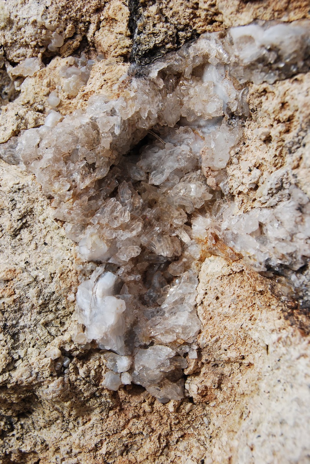
| Milky quartz spills from fractured cliffs. |
Just under a
mile into the trail, a set of climb-calming zig-zags take on a ragged ridgeline
of mineral-stained volcanic and metamorphic rocks. Although the switchbacks look imposing from a
distance, the climbing is only a moderate slog.
 |
| The final set of switchbacks visible below a peak. |
On the way up the ridge, chunks of milky quartz that somestimes occurs
with pyrite-- an iron sulfide mineral commonly known as "fools gold"--cascade down the escarpments settling in shiny heaps
at the bases of barrel cacti and cholla. As the trail gains elevation, views to
the south feature the peaks of the Sierra Estrella Mountains and the sprawling Gila
River drainage basin. After roughly a quarter-mile, the trail comes to a pass
where the foothills and valleys of the southern White Tank Mountains roll out
to the north. Ahead, another set of switchbacks creep up a steeper ridge with several
sheer drop offs and scenic vista points.
 |
| Chuckwalla Trail return route visible in the valley below. |
 |
| Pyrite Trail ascends the ridgeline in the center of photo. |
The slightly more vertical and precipitous segment culminates at an airy
gap overlooking the park’s trail-rich midsection (those squiggly lines below
are the return routes), green farmlands to the southwest and a glimpse of the remainder
of the trail as is snakes up a bluff on a scary-looking edge to the trail’s
highpoint. Again, it’s not as bad as it
looks.
 |
| Switchbacks appear more difficult than they are. |
 |
| Desert lavender grows in washes along the trail. |
At the top, the
optional 0.6-mile roundtrip Pyrite Summit spur trail wanders out onto a queasy
lookout point for rewarding 360-degree vistas. From the highpoint, the trail then makes a
0.4-mile descent to connect with the Chuckwalla Trail where heavier foot
traffic and swooping bikes mark the end of the nature-insulated hush. For a 6.7-mile
roundtrip hike, go right at the junction and follow the signs back to the
trailhead or use the park maps to build a longer trek.
 |
| Trailhead in distance seen from Pyrite Trail. |
LENGTH: 6.7-mile
loop (as described here)
RATING: moderate
ELEVATION: 1500
– 2200 feet
GETTING THERE:
Skyline Regional
Park, 2600 N. Watson Road, Buckeye.
From Interstate 10 in Buckeye, take
the Watson Road exit 117 and go 2 miles north to the park. Roads are paved.
 |
| Pyrite Trail spins off busier park trails. |
There are restrooms, campsites and picnic areas at the trailhead. No day use
fees. Camping is by reservation only.
HOURS: Trails
open daily from sunrise to sunset. Gates close at 10 p.m.
INFO & MAPS: